Little Langford
Little Langford is a Village in the county of Wiltshire.
Little Langford postcode: SP3 4NU
There are great places to visit near Little Langford including some great historic monuments, ancient sites, historic buildings, country parks, lakes, parks and villages.
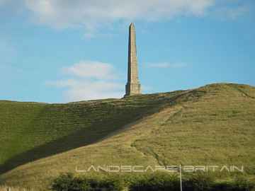
Little Langford has some unmissable historic monuments nearby like Lansdowne Monument, Cherhill White Horse, and Avebury.
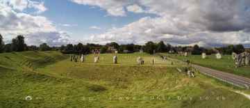
Avebury, West Kennet Long Barrow, The Sanctuary, Silbury Hill, and Barbury Castle are great places to visit near Little Langford if you like ancient sites.
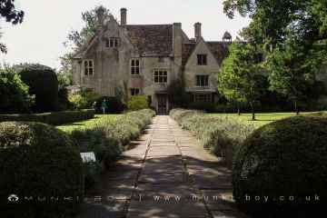
Avebury Manor is one of Little Langford's best, nearby historic buildings to visit in Little Langford.
Country Parks to visit near Little Langford include Coate Water Country Park, Barbury Castle Country Park, and Lydiard Park.
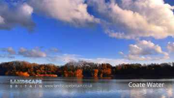
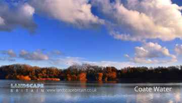
Coate Water is one of Little Langford's best, nearby lakes to visit in Little Langford.
Places near Little Langford feature a number of interesting parks including Lydiard Park.
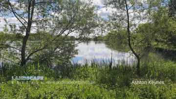
The area around Little Langford's best villages can be found at Ashton Keynes.
Little Langford History
There are some historic monuments around Little Langford:
- Bowl barrow south of The Cursus in Fargo Plantation forming part of The Cursus round barrow cemetery
- Bowl barrow 1020m north west of White Farm
- Earthwork W of Woodford Clump
- Disc barrow and pond barrow 350m NNW of Greenland Farm
- Bowl barrow 100m south east of the southern edge of The Diamond south of the A303
- Ditch, 343yds (310m) ENE of East Farm Cottages to 800yds (730m) NW of St Martin's Chapel
- Bowl barrow 400m south of A344 on Winterbourne Stoke Down
- Bowl barrow 200m west of Durrington Down Plantation
- Long barrow east of Netheravon Bake
- Barrow SSW of Melsome's Field barn
- Bowl barrow 350m north west of Greenland Farm
- Packhorse bridge
- Field system on Chitterne Down
- Bowl barrow 120m south of Normanton Down round barrow cemetery
- Two bowl barrows on Durrington Down, 150m south of The Packway
- Two bowl barrows on Stoke Down 650m south west of Foxhole Cottage
- Bowl barrow 500m south east of Greenland Farm, forming part of a linear round barrow cemetery west of the Lesser Cursus
- Bowl Barrow, part of the round barrow cemetery south of Codford Down
- Chitterne Down barrow
- Bowl barrow 350m south west of Normanton Gorse
- Round barrow south of Robin Hood Ball Clump
- Eighteen round barrows forming the greater part of the Winterbourne Stoke crossroads round barrow cemetery
- Field system on Stoke Down
- Long barrow on Wilsford Down 300m north of The Diamond
- Bowl barrow 250m north of Greenland Farm
- Disc barrow 400m north of A344, south east of Greenland Farm
- Bowl barrow 430m north west of Northdown Barn
- Bowl barrow 250m south of Fargo Road
- Two bowl barrows situated south of The Cursus and east of Fargo Plantation forming part of The Cursus round barrow cemetery
- Churchyard cross
- Six bowl barrows and two disc barrows forming the majority of a round barrow cemetery 300m north west of Fargo Road ammunition compound
- Round barrow N of Yarnbury Castle
- Bowl barrow 160m south of the west end of The Cursus
- Pond barrow south of the A303 and 400m west of Normanton Gorse containing the 'Wilsford Shaft'
- Bowl barrow 540m south east of Druid's Head Farm
- Bell barrow situated south of The Cursus and east of Fargo Plantation forming part of The Cursus round barrow cemetery
- Bell barrow north east of Westfield Farm and 150m south of Wilsford round barrow cemetery
- Bowl barrow in Robin Hood Ball Clump
- Parsonage Down Camp earthwork enclosure and associated field system.
- Linear boundary within Normanton Gorse
- Village cross
- Bilbury Rings
- Newton Barrow
- Enclosure east of Robin Hood's Ball
- Robin Hood's Ball, causewayed enclosure
- Henge monument 300m south of Longbarrow Cross Roads, east of A360
- Bowl barrow 300m north west of Airman's Corner
- Bell barrow 400m south of Greenland Farm, forming part of a linear round barrow cemetery west of the Lesser Cursus
- Two bowl barrows 200m SSW of Rollestone Camp
- Chiselbury Camp hillfort, cross dykes and site of turnpike toll house
- Bowl barrow 400m west of Normanton Gorse
- Roman site in Upper Holt, Teffont Magna
- Five bowl barrows and two saucer barrows forming a round barrow cemetery on Winterbourne Stoke Down
- Milestone SE of Yarnbury Castle
- Bronze Age enclosure and bowl barrow 100m west of Longbarrow Cross Roads on Winterbourne Stoke Down
- Round barrow 230yds (210m) NW of New Field Plantation
- Bowl barrow 450m south of the A344 on Stonehenge Down
- Saucer barrow forming part of a round barrow cemetery 300m north west of Fargo Road ammunition compound
- Heale Hill round barrows and earthworks
- Barrow N of 'The Spectacles'
- Bell barrow 450m south east of Greenland Farm, forming part of a linear round barrow cemetery west of the Lesser Cursus
- Bell barrow known as the Monarch of the Plain on the western edge of Fargo Plantation and south of The Cursus: part of The Cursus round barrow cemetery
- Enclosure on Maddington Down
- Bowl barrow 450m south of Greenland Farm
- Hamshill ditches and field system
- Winterbourne Stoke East round barrow cemetery and earthwork enclosure on Fore Down
- Two bowl barrows 100m west of Durrington Down Plantation
- Cross-ridge dyke on Buxbury Hill
- Long barrow and Old Ditch linear earthwork, on Tilshead Down
- Bowl barrow 830m south west of Greenlands Bungalow, east of Shrewton
- Pond barrow 700m south of A344 on Winterbourne Stoke Down
- Bowl barrow 550m south of Airman's Corner on Winterbourne Stoke Down
- Bowl barrow 400m south east of Greenland Farm, forming part of a linear round barrow cemetery west of the Lesser Cursus
- Bowl barrow 400m SSE of Greenland Farm, forming part of a linear round barrow cemetery west of the Lesser Cursus
- Three bowl barrows 300m ESE of Middle Farm
- Neale's Barrow, round barrow
- Bowl barrow 400m south of Normanton Gorse
- Hydon Hill round barrows
- Bowl barrow south of the A303 and north west of Normanton Gorse
- Bowl barrow 800m west of Airman's Corner on Winterbourne Stoke Down
- Long barrow north of Robin Hood Ball Clump
- Bowl barrow 600m south of A344 on Winterbourne Stoke Down
- Bowl barrow located south of The Cursus and east of Fargo Plantation forming part of The Cursus round barrow cemetery
- Bowl barrow 120m south west of the west end of The Cursus
- Bowl barrow south of The Cursus in Fargo Plantation forming part of The Cursus round barrow cemetery
- Bowl barrow 600m south west of Airman's Corner on Winterbourne Stoke Down
- Two bell barrows, two bowl barrows and a disc barrow which form the greater part of Rollestone Field linear round barrow cemetery
- Grovely Castle and earthworks N of Grovely Wood
- Bowl barrow and a disc barrow in Normanton Gorse, forming part of the Normanton Down round barrow cemetery
- Yarnbury camp (Yarnbury Castle)
- Chalk map of Australia 925m south west of Upper Hurdcott Farm
- Group of barrows W of Hooklands Plantation
- Bowl barrow 430m south of A344 on Winterbourne Stoke Down
- Two bowl barrows and a saucer barrow 280m south of The Packway
- Bell barrow situated 50m north of Normanton Gorse and 170m south of the A303
- Two bowl barrows 300m north of The Packway
- Hut Bottom round barrow
- Bowl barrow and section of linear boundary earthwork on Winterbourne Stoke Down
- Buxbury round barrow, Buxbury Hill
- Punch Bowl round barrow
- Bowl barrow east of the A360 forming part of the Winterbourne Stoke crossroads round barrow cemetery
- Two barrows W of Stoke Down
- Bowl barrow 450m SSW of Airman's Corner on Winterbourne Stoke Down
- Disc barrow on Fargo Road
- Bowl barrow 400m south east of Longbarrow Cross Roads, east of A360
- Three bowl barrows immediately north of the A303 on Stonehenge Down
- Barrow 230yds (210m) W of Sutton Ivers, on Sutton Down
- Hoop Side round barrows
- A bowl barrow and three bell barrows forming part of The Cursus round barrow cemetery
- Ancient cultivation terraces
- East Castle
- Pond barrow on the western margin of Durrington Down Plantation
- Bowl barrow 470m south east of Druid's Head Farm
- Barrow on Fifield Down 700yds (640m) ESE of North Barn
- Disc barrow 200m north of The Packway and south of the westernmost of Alanbrooke's Plantations
- Three bowl barrows forming part of Rollestone Field linear round barrow cemetery
- Long barrow south of Horse Down
- Seven bowl barrows and a pond barrow forming a round barrow cemetery 200m north of The Diamond on Wilsford Down
- Bowl barrow 200m south east of Middle Farm
- Linear boundary from south east of Winterbourne Stoke crossroads to south west of The Diamond on Wilsford Down
- Romano-British settlement on Winterbourne Stoke Down
- Bowl barrow in Normanton Gorse, forming part of the Normanton Down round barrow cemetery
- Wick Ball camp, the Common
- Bowl barrow south of The Cursus on the eastern edge of Fargo Plantation forming part of The Cursus round barrow cemetery
- Faulston pigeon house
- Round barrow south-south-east of Greenland Camp
- Bowl barrow immediately east of the A360 forming part of the Winterbourne Stoke crossroads round barrow cemetery
- Field system on Wylye Down
- Bowl barrow: one of three bowl barrows south-east of Warren Plantation
- Three bowl barrows 150m south of Normanton Down round barrow cemetery
- Hanging Langford camp and Church-end Ring
- Bowl barrow 450m east of The Diamond south of the A303
- Stapleford Castle
- The Bake and Wylye Down milestones
- Bowl barrow 300m north of A344, south west of the Lesser Cursus
- Long barrow on Winterbourne Stoke Down
- Long barrow 350m south west of the Normanton Down round barrow cemetery
- Long barrow 250m north of Normanton Gorse
- Round barrow south of Robin Hood's Ball
- Bowl barrow 150m WSW of Robin Hood's Ball
- Hare Warren Control Station
- Round barrow east-north-east of Wood's Butt
- Bowl barrow known as `Bush Barrow' and two disc barrows south east of Normanton Gorse forming part of Normanton Down round barrow cemetery
- Two bowl barrows forming part of Rollestone Field linear round barrow cemetery
- Heath Wood earthwork
- Bowl barrow 340m south of The Packway, north of the Lesser Cursus
- Long barrow north east of Winterbourne Stoke crossroads
- White Barrow, a long barrow
- Bell barrow 450m south of A344 on Winterbourne Stoke Down
- Ten round barrows forming the Lake Down round barrow cemetery and a section of linear boundary crossing Lake Down
- Barford Down milestone
- Winterbourne Stoke West round barrow cemetery, The Coniger enclosure and section of linear boundary earthwork
- Saucer barrow and bowl barrow 250m north of A344, south of the Lesser Cursus
- Chalk military badges on Fovant Down
- Little Langford round barrow, N of Upper Farm Down
- Round barrows S of Hare Warren
- Bowl barrow south of Normanton Gorse on the southern edge of Normanton Down
- Long barrow north of Netheravon Bake
- Codford Circle hilltop enclosure
- Bowl barrow 240m east of The Penning
- Barrow in Wilton Park
- Round barrow SE of Cowdown Farm
- Four bowl barrows 140m north of the A303 on Stonehenge Down
- Silver Barrow, Orcheston Down
- The Lesser Cursus and a triple bowl barrow forming part of a linear round barrow cemetery south east of Greenland Farm on Winterbourne Stoke Down
- Hengi-form monument in Fargo Plantation south of The Cursus
- Bowl barrow 250m south west of Longbarrow Cross Roads, west of A360
- Two of three bowl barrows south-east of Warren Plantation
- Part of a prehistoric field system on Codford Down
- Round barrow north-west of Goods Clump
- Long barrow east/south-east of Robin Hood's Ball
- Disc barrow near the southern edge of Fargo Plantation forming part of The Cursus round barrow cemetery
- Bowl barrow on Tilshead Down, 950m north west of Copehill Plantation
- Deptford Down round barrow
- Two boundary features to the north/north-east and west of Silver Barrow
- Bowl barrow 300m north of White Farm
- Two bowl barrows 300m south west of Rollestone Camp
- Two bowl barrows forming part of the Winterbourne Stoke crossroads round barrow cemetery
- A bell barrow and three disc barrows west of Fargo Road ammunition compound
- Grovely Ditch
- Lake Barrow Group, North Kite earthwork enclosure, four sections of linear boundary, and a bowl barrow within the North Kite
- Pond barrow 50m north of A344 west of The Cursus
- Ruined church of SS Mary and Nicholas
- Bowl barrow on Berril Down
- Group of barrows near Field Barn
- Bowl barrow 250m south of Westfield Farm buildings
- Two chalk military badges 380m and 550m west of Sheep Well


