


Manningham is a Village in the county of West Yorkshire.
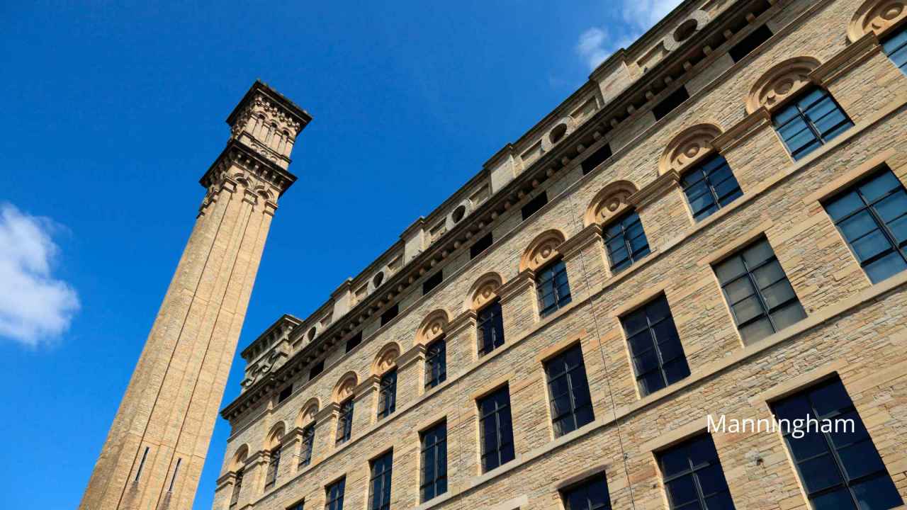
Manningham, located in Bradford, West Yorkshire, is an area rich in industrial heritage and cultural diversity. Historically a key player in the Industrial Revolution, Manningham’s landscape was once dominated by large mills and factories, reflective of Bradford’s prominence as a global center for wool and textile manufacturing. Among its most notable landmarks is Lister Mills, a stunning example of Victorian architectural grandeur. Once one of the largest silk factories in the world, this grand mill symbolized the economic prosperity of the era and the innovation within the textile industry.
Today, Manningham stands as a testament to both its industrial past and its evolving future. While the chimneys and machinery have largely fallen silent, the impressive structures like Lister Mills have found new life, repurposed into vibrant residential and commercial spaces, blending historical charm with modern living. The area around Manningham retains a bustling, urban feel, with a diverse community adding to the rich tapestry of cultures, cuisines, and traditions.
The streets of Manningham are lively, reflecting the myriad of communities that have made the area their home, each contributing to the unique urban tapestry with a variety of shops, eateries, and cultural venues. This diversity is celebrated in numerous community events and festivals, contributing to Bradford’s reputation as a city of rich cultural diversity. Despite the urban development, Manningham also offers pockets of greenery and parks, providing a tranquil escape from the city hustle and a nod to Yorkshire’s wider reputation for scenic landscapes. In this way, Manningham captures the essence of a post-industrial Northern English community — one foot in its majestic industrial past and another stepping forward into a dynamic and inclusive future.
Manningham postcode: BD8 8
There are great places to visit near Manningham including some great cities, villages, woodlands, parks, historic buildings, museums, gardens, country parks, hiking areas, towns, lakes, historic monuments, hills, ancient sites, geological features, nature reserves, shopping centres, airports, bluebell woods, ruins, rivers and streams, castles, waterfalls and boroughs.
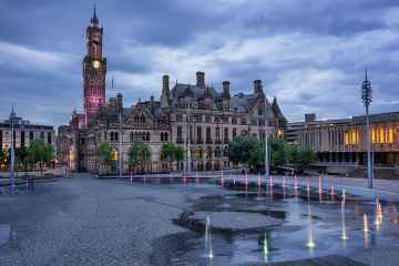
There are a several good cities in the Manningham area like Bradford, Leeds, and Wakefield.
Don't miss Wyke, Haworth, Oxenhope, Thornton, Manningham, Saltaire, and Ripponden's villages if visiting the area around Manningham.
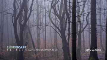
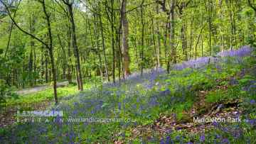
Judy Woods, Chevin Forest Park, Calverley Wood, Middleton Park, and Hardcastle Crags are some of Manningham best woodlands to visit near Manningham.
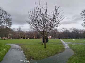
The area around Manningham features a number of interesting parks including Lister Park, Cartwright Hall Gardens, Peel Park, Shibden Park, Roundhay Park, Middleton Park, and Park Square.
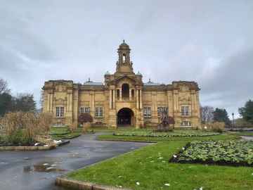
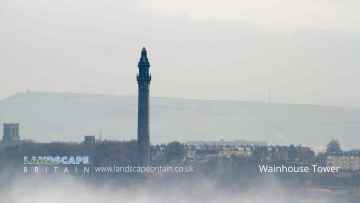
Cartwright Hall, Ilkley Manor House, Hewenden Viaduct, Halifax Town Hall, North Bridge - Halifax, Halifax Minister, and Wainhouse Tower are some of Manningham best historic buildings to visit near Manningham.
Don't miss Cartwright Hall, and Yorkshire Sculpture Park's museums if visiting the area around Manningham.
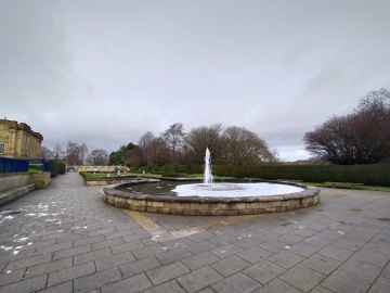
The area around Manningham's best gardens can be found at Cartwright Hall Gardens.
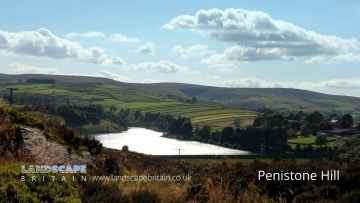
There are a number of country parks near Manningham including Penistone Hill Country Park, Ogden Water Country Park, Shibden Country Park, Chevin Forest Park, Golden Acre Park, Bretton Country Park, and Yorkshire Sculpture Park.
Penistone Hill Country Park, Colden, The Bridestones on Bridestones Moor, The Chevin, Hardcastle Crags, and Withens Clough are great places to visit near Manningham if you like hiking areas.
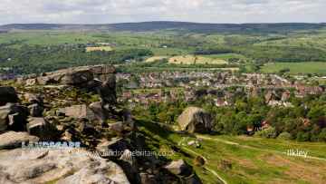
The area around Manningham boasts some of the best towns including Ilkley, Sowerby Bridge, Halifax, Todmorden, Huddersfield, Bradley, and Otley.
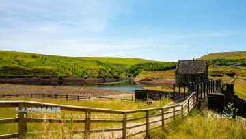
Lakes to visit near Manningham include Chellow Dean Reservoirs, Boothwood Reservoir, Ogden Water Country Park, Ogden Water, Shibden Park, Light Hazzles Reservoir, and Warland Reservoir.
Don't miss Wainhouse Tower, and Centre Hill Beacon Site's historic monuments if visiting the area around Manningham.
There are a several good hills in the Manningham area like Centre Hill, Stoodley Pike, and The Chevin.
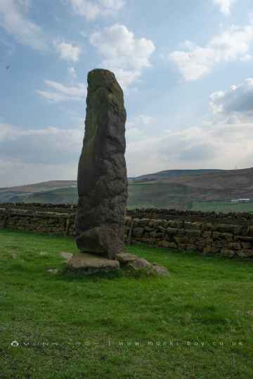
Ancient Sites to visit near Manningham include Stones Lane Standing Stones, Centre Hill Beacon Site, and The Bridestones on Bridestones Moor.
Manningham is near some unmissable geological features like The Bridestones on Bridestones Moor,
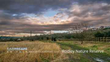
Nature Reserves to visit near Manningham include Rodley Nature Reserve, RSPB St Aidan's, RSPB Fairburn Ings, and Yorkshire Sculpture Park.
Don't miss Trinity Leeds, White Rose Shopping Centre, The Merrion Centre, County Arcade, and Leeds Kirkgate Market's shopping centres if visiting the area around Manningham.
Don't miss Leeds Bradford Airport's airports if visiting the area around Manningham.
The area around Manningham's best bluebell woods can be found at Middleton Park.
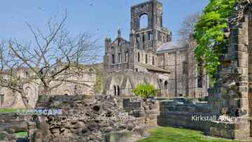
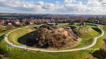
Kirkstall Abbey, and Sandal Castle are some of Manningham best ruins to visit near Manningham.
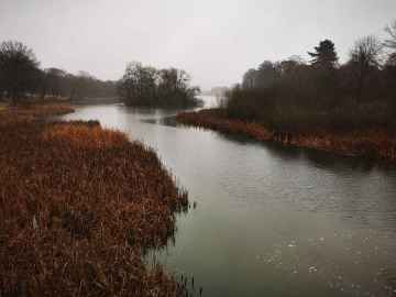
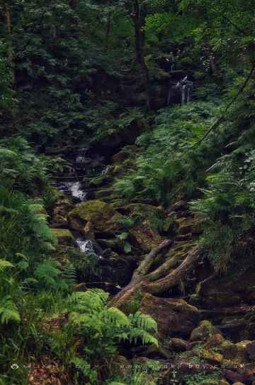
River Dearne at Bretton, Hebden Water, and Hebden Beck are great places to visit near Manningham if you like rivers and streams.
Sandal Castle is one of Manningham's best, nearby castles to visit in Manningham.
Greenwood Lee Clough Waterfall, and Lumb Falls are great places to visit near Manningham if you like waterfalls.
The area close to Manningham boasts some of the best boroughs including Kirklees.
Manningham History
There are some historic monuments around Manningham:
Places to see near Manningham


Lakes near Manningham
Canals near Manningham
Rivers near Manningham
Shopping in Manningham
Manningham Lane Retail Park Manningham, Bradford
Manningham Lane Retail Park retail park
Tesco Valley Road, Manningham
Tesco supermarket
Freshco 43, Oak Lane
Freshco supermarket


