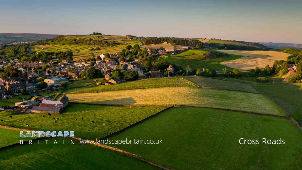
Cross Roads is a Village in the county of West Yorkshire.
Cross Roads is a small village situated near Keighley, in the heart of West Yorkshire, England. Nestled amidst the rolling hills and verdant landscapes of the Brontë country, this charming locale is known for its rich history and tight-knit community. Keighley itself has been a significant market town since the Middle Ages, and the nearby hamlets, including Cross Roads, have benefited from this prominence.
The name “Cross Roads” is quite descriptive, as the village historically served as a convergence point for various routes through the countryside. Over the years, it has witnessed countless travelers, merchants, and settlers passing through, each leaving their unique imprint on the village’s tapestry. Architecturally, Cross Roads boasts a delightful mix of traditional stone-built houses and more modern constructions, reflecting its evolution over centuries. The village, while retaining its tranquil and bucolic charm, has always managed to keep pace with the changing times, making it a unique blend of the old and the new. A walk through its meandering lanes offers a glimpse into a bygone era, while also showcasing the dynamism of a community looking towards the future.
Cross Roads postcode: BD22 9DH
Retail in Cross Roads
There are great places to visit near Cross Roads including some great cities, villages, woodlands, parks, historic buildings, museums, gardens, country parks, hiking areas, towns, lakes, historic monuments, hills, ancient sites, geological features, nature reserves, shopping centres, airports, bluebell woods, ruins, rivers and streams, castles, waterfalls and boroughs.
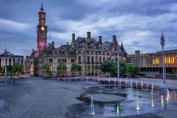
There are a number of cities near Cross Roads including Bradford, Leeds, and Wakefield.
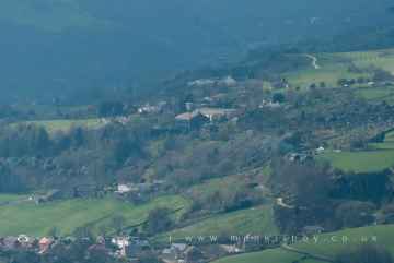
The area around Cross Roads features a number of interesting villages including Wyke, Haworth, Oxenhope, Thornton, Manningham, Saltaire, and Ripponden.
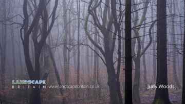
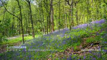
The area around Cross Roads boasts some of the best woodlands including Judy Woods, Chevin Forest Park, Calverley Wood, Middleton Park, and Hardcastle Crags.
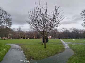
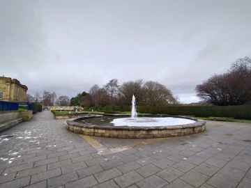
There are a several good parks in the Cross Roads area like Lister Park, Cartwright Hall Gardens, Peel Park, Shibden Park, Roundhay Park, Middleton Park, and Park Square.
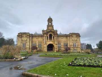
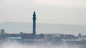
There are a several good historic buildings in the Cross Roads area like Cartwright Hall, Ilkley Manor House, Hewenden Viaduct, Halifax Town Hall, North Bridge - Halifax, Halifax Minister, and Wainhouse Tower.
Cross Roads's best nearby museums can be found at Cartwright Hall, and Yorkshire Sculpture Park.
There are a several good gardens in the area around Cross Roads like Cartwright Hall Gardens.
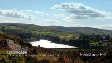
Penistone Hill Country Park, Ogden Water Country Park, Shibden Country Park, Chevin Forest Park, Golden Acre Park, Bretton Country Park, and Yorkshire Sculpture Park are some of Cross Roads best country parks to visit near Cross Roads.
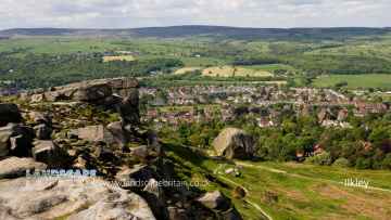
The area around Cross Roads features a number of interesting hiking areas including Penistone Hill Country Park, Colden, The Bridestones on Bridestones Moor, The Chevin, Hardcastle Crags, and Withens Clough.
Cross Roads has some unmissable towns nearby like Ilkley, Sowerby Bridge, Halifax, Todmorden, Huddersfield, Bradley, and Otley.
Cross Roads's best nearby lakes can be found at Chellow Dean Reservoirs, Boothwood Reservoir, Ogden Water Country Park, Ogden Water, Shibden Park, Light Hazzles Reservoir, and Warland Reservoir.
Cross Roads's best nearby historic monuments can be found at Wainhouse Tower, and Centre Hill Beacon Site.
There are a several good hills in the Cross Roads area like Centre Hill, Stoodley Pike, and The Chevin.
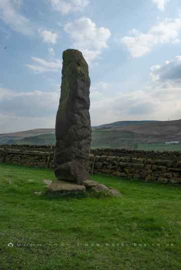
Stones Lane Standing Stones, Centre Hill Beacon Site, and The Bridestones on Bridestones Moor are some of Cross Roads best ancient sites to visit near Cross Roads.
The Bridestones on Bridestones Moor is a great place to visit close to Cross Roads if you like geological features.
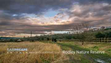
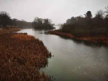
The area around Cross Roads features a number of interesting nature reserves including Rodley Nature Reserve, RSPB St Aidan's, RSPB Fairburn Ings, and Yorkshire Sculpture Park.
Cross Roads's best nearby shopping centres can be found at Trinity Leeds, White Rose Shopping Centre, The Merrion Centre, County Arcade, and Leeds Kirkgate Market.
Cross Roads is near some unmissable airports like Leeds Bradford Airport,
There are a several good bluebell woods in the area around Cross Roads like Middleton Park.
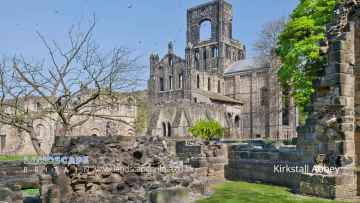
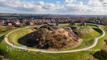
The area around Cross Roads features a number of interesting ruins including Kirkstall Abbey, and Sandal Castle.
There are a several good rivers and streams in the Cross Roads area like River Dearne at Bretton, Hebden Water, and Hebden Beck.
Sandal Castle is a great place to visit close to Cross Roads if you like castles.
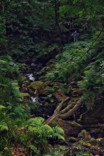
Don't miss Greenwood Lee Clough Waterfall, and Lumb Falls's waterfalls if visiting the area around Cross Roads.
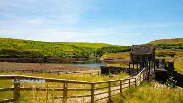
Boroughs to visit near Cross Roads include Kirklees.
Cross Roads History
There are some historic monuments around Cross Roads:
- Cup marked boundary stone known as Churn Milk Joan on Crow Hill, Midgley Moor, 580m north of Foster Clough Bridge
- Rock in Panorama Woods with single cup and ring carving
- Cup marked rock in forestry furrow on Rivock
- Six carved rocks in field west of Riddlesden Golf Course
- Kildwick Bridge
- Flat carved rock 150m south west of Silver Well Cottage
- Cup and ring marked rock between Keighley Gate and Silver Well Cottage
- Cup and ring marked rock 42m east of Rivock Edge triangulation pillar
- Wayside cross known as Abel Cross
- Two prominent cup marked rock outcrops known as Doubler Stones
- Cup and ring marked rock 350m SSW of Panorama Reservoir
- Cup and ring marked rock on moor east of Gawk Stones
- Cup marked rock near wall below Rivock Edge
- Rock with single cup near track north of Drake Hill
- Large carved rock in the wall between grouse moor and forestry plantation on Rivock
- Cairn 330m north of Woodhead on Harden Moor
- Cup and ring marked rock known as Piper Crag Stone
- Prominent cup and ring marked rock on Coarse Stone Edge
- Recumbent gatepost with cup and ring carving 57m west of the Swastika Stone
- Enclosed Bronze Age urnfield 160m west of Overgreen Royd Farm, Mixenden
- Rock with dense concentration of cup marks on Stanbury Hill
- Cup marked rock east of entrance to Silver Well Cottage
- Carved rock on bank of How Beck, east of path from West Morton to Riddlesden and 440m south west of Barn House Farm
- Cup and ring marked rock next to wall NNW of Black Pots
- Carved rock south east of entrance to Silver Well Cottage
- Carved rock in wall of grounds of Overdale Nursing Home
- Carved rock known as the Swastika Stone
- Late prehistoric enclosed settlement known as Castle Stead Ring
- Cup and ring marked rock between Spicey Gill and the Ilkley-Keighley road
- Ring cairn on Midgley Moor, 360m north east of Upper Han Royd
- Ore hearth smeltmill and wood drying kiln in Lumb Clough Wood, 350m south east of Bank Foot
- Cup and ring-marked rock north east of a wall junction on the southern flank of Rivock
- Late prehistoric enclosed settlement known as Catstones Ring on Catstones Hill
- Cup marked rock between Doubler Stones and Gawk Stones
- Cup, ring and groove marked rock at the base of a wall between East Morton and West Morton
- Cup marked rock just within afforested area north east of wall on Rivock
- Cup and ring marked rock 12.5m from drainage cut NNE of Black Pots
- Late prehistoric enclosed settlement 500m north west of Goose Clough on Ovenden Moor
- Cup marked rock 39m south east of entrance to Silver Well Cottage
- Cairn on Midgley Moor, 400m north east of Upper Han Royd
- Late prehistoric enclosed settlement 350m south west of Goose Clough at Hunter Hill, Ovenden
- Two cup and ring marked rocks in conifer plantation on Rivock
- Cairn with an oval bank on Midgley Moor, 430m north east of Upper Han Royd
- Cairn known as Millers Grave on Midgley Moor
- Two carved rocks near Neb Stone
- Enclosed Bronze Age urnfield 440m north west of Rough Bottom on Midgeley Moor
- Cup and groove marked rock between East Morton and West Morton
- Group of four carved rocks in Panorama Woods
- Cairn 290m north of Woodhead on Harden Moor
- Cup marked rock 14m from the wall on the unforested plateau at Rivock
- Long barrow and superimposed round cairn on Black Hill
- Rock with three cup marks 150m south west of Black Beck Hole
- Low rock with one cup on unforested plateau at Rivock
- Black Hill round cairn
- Carved rock known as the Anvil Rock
- Rock with at least six cups 170m north west of Grey Stones Farm
- Five carved rocks in Cottingley Woods, 600m NNE of Lee Farm
- Wayside cross known as Tinker Cross
- Cup and ring marked rock 370m SSW of Panorama Reservoir
- Group of five carved rocks on the western ridge of Stanbury Hill
- Cup and ring marked rock overlooking bend in Ilkley-Keighley road, 185m south east of Neb Stone
- Cup marked rock 47m south east of Rivock Edge triangulation pillar
- Carved rock near wall in pasture below Addingham Crag 290m south of Cragg House
- Large carved rock at hill top, north east of line of stone grouse butts on Rivock
- Large cup and ring marked rock in forestry furrows on Rivock
- Split and hewn cup-marked rock north of a wall junction on Rivock
- The old bridge over the Hebden Water at Hebden Bridge
- Cup marked rock in enclosed pasture NNE of Black Pots
- Cup and ring marked rock below Addingham Crag
- Brow Pit mine shaft, gin circle, spoil heap and tramway, 270m south west of Catherine Slack Farm
- Cup marked rock 1m from wall on unforested plateau at Rivock
- Cup and groove-marked rock north of Drake Hill
- Cup and ring marked rock known as the Sepulchre Stone, Addingham Moorside
- Old Church of St Thomas Becket, 210m north east of Daisy Field Farm
- Five carved rocks near the edge of Rivock outcrop
- Rock with shallow cup and ring-markings at the western end of the ridge on Stanbury Hill
- Cup marked rock on north side of barn, 100m north west of the Grey Stones Farm
- Carved rock next to the drive of Overdale Nursing Home
- Carved rock 80m NNE of Badger Stone
- Carved rock known as the Badger Stone
- Late prehistoric enclosed settlement 150m north of Shaygate Farm, Wilsden
- Cup and ring marked rock below Brunthwaite Crag
- Rock with single cup mark in forestry SSE of Black Pots
- Cup marked rock 19m above forestry track in Rivock conifer plantation
- Carved rock 100m north east of eastern Grainings Head Quarry
- Cup and groove-marked rock on Rivock, west of a deep channel
- Carved rock incorporated in and extending beyond outbuilding at Hardwick House Farm
- Ring cairn 310m north of Woodhead on Harden Moor
- Cup marked rock adjacent to wall near road from East Morton to West Morton