Madehurst
Madehurst is a Village in the county of West Sussex.
There are great places to visit near Madehurst including some great towns, country parks, woodlands and airports.
There are a several good towns in the Madehurst area like Chichester, and Crawley.
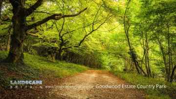
Don't miss Goodwood Country Park, and Buchan Country Park's country parks if visiting the area around Madehurst.
Goodwood Country Park is one of Madehurst's best, nearby woodlands to visit in Madehurst.
Don't miss Gatwick Airport, Shoreham Airport, and Chichester/Goodwood Airport's airports if visiting the area around Madehurst.
Madehurst History
There are some historic monuments around Madehurst: