Keymer
Keymer is a Village in the county of West Sussex.
Keymer postcode: BN6 8RA
There are great places to visit near Keymer including some great towns, country parks, woodlands and airports.
Keymer has some unmissable towns nearby like Chichester, and Crawley.
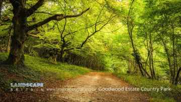
Keymer's best nearby country parks can be found at Goodwood Country Park, and Buchan Country Park.
There are a number of woodlands near to Keymer including Goodwood Country Park.
The area around Keymer features a number of interesting airports including Gatwick Airport, Shoreham Airport, and Chichester/Goodwood Airport.
Keymer History
There are some historic monuments around Keymer:
- Part of Western Brow round barrow cemetery and an Anglo-Saxon barrow field 690m south of Westmeston Farm
- Deserted medieval settlement and associated cultivation terraces on Perching Hill
- Round barrows W of Ditchling Beacon
- Bowl barrow 300m north west of Mount Harry
- Earthwork near Horseshoe Plantation, Stamer
- Bowl barrow 530m south east of Ditchling Cross: part of Plumpton Plain round barrow cemetery
- Anglo-Saxon barrow field 650m south west of Wick Farm
- A group of three bowl barrows and an Anglo-Saxon barrow field on The Bostle
- Earthworks and lynchets on Buckland Bank and Buckland Hole
- Bowl barrow 780m south east of Westmeston Farm, forming part of Western Brow round barrow cemetery
- A saucer barrow and three bowl barrows on Tegdown Hill
- Motte and bailey castle 240m east of Dean's Mill
- Whitehawk Camp causewayed enclosure
- Bronze Age and Anglo-Saxon barrow cemeteries south of Juggs Road
- Medieval earthworks at Balmer
- Two bowl barrows north-east of Streathill Farm
- Prehistoric linear boundary and Bronze Age bowl barrow in Pudding Bag Wood, 350m south of Upper Lodges
- A cross-ridge dyke and part of an adjoining cross-ridge dyke meeting at Juggs Road near Falmer Bottom
- Cross dyke 730m south east of Ditchling Cross
- Bowl barrow south west of The Beeches: part of Plumpton Plain round barrow cemetery
- Romano-British villa at Randolph's Farm
- Bowl barrow on North Hill
- Bowl barrow north west of Warningore Bostall: part of Plumpton Plain round barrow cemetery
- Saucer barrow 170m SW of Ditchling Cross, Plumpton Plain
- Bowl barrow south of The Beeches: part of Plumpton Plain round barrow cemetery
- Bowl barrow 700m south east of Ditchling Cross: part of Plumpton Plain round barrow cemetery
- Section of Port's Road and barrow on Round Hill, Hangleton
- Part of Western Brow round barrow cemetery and an Anglo-Saxon barrow field 700m south of Westmeston Farm
- Part of Plumpton Plain round barrow cemetery and an Anglo-Saxon barrow field south east of Warningore Bostall
- Hillfort, a beacon and dewpond on Ditchling Beacon
- Round barrow S of Ditchling Beacon
- Wolstonbury Camp: a Ram's Hill type enclosure on Wolstonbury Hill and associated later remains
- Bowl barrow 670m south west of Saxondown Farm: part of a round barrow cemetery
- Two bowl barrows 190m south east of Blackcap
- Plumpton Plain earthworks
- Faulkner's Bottom entrenchment
- Romano-British farmstead 480m north west of Devil's Dyke Cottages
- Earthworks and lynchets near Eastwick Barn, Patcham
- Bowl barrow 200m east of Plumpton Bostall (top end)
- Bowl barrow 750m south east of Westmeston Farm, forming part of Western Brow round barrow cemetery
- Three bowl barrows 770m south east of Westmeston Farm, forming part of Western Brow round barrow cemetery
- Bowl barrow on Fulking Hill
- Medieval enclosure W of Newmarket Plantation
- Oval barrow 775m south of Plumpton Place on Plumpton Plain
- Platform barrow 300m south of Wolstonbury Camp
- Devil's Dyke hillfort
- Bowl barrow 550m south east of Ditchling Cross: part of Plumpton Plain round barrow cemetery
- Roman road and 18th century coaching road N of Pyecombe church
- Post-medieval stock enclosure at Devil's Dyke
- Hillfort, the possible remains of a Romano-Celtic temple and a group of three bowl barrows at Hollingbury
- Cross dyke and bowl barrow 310m south east of Wolstonbury Camp
- Bowl barrow on Scabes Castle
- Cross dyke in Great Wood, 500m south west of Stanmer House
- Bowl barrow in Great Wood
- Romano-British farmstead, field system and trackway on Wolstonbury Hill
- Linear earthwork S of village
- Ewe Bottom entrenchment, Patcham
- Three bowl barrows 820m south east of Westmeston Farm, forming part of Western Brow round barrow cemetery
- Pair of bowl barrows 720m SSE of Westmeston Farm forming part of Western Brow round barrow cemetery
- Medieval settlement at Stanmer
- Cross dyke on Newtimber Hill
- Two bowl barrows 600m south east of Ditchling Cross: part of Plumpton Plain round barrow cemetery
- Moated site in Ragget's Wood
- Castle Hill earthwork
- Group of three bowl barrows and an Anglo-Saxon mixed cemetery on Summer Down
- Bowl barrow on Streat Hill 430m NNW of Streathill Farm, forming part of Western Brow round barrow cemetery
- Middle Brow earthwork
- Hlaew 430m ENE of Keymer Post
- Platform barrow and saucer barrow 350m ESE of Blackcap
- Old manor house (remains of), Portslade-By-Sea
- Bowl barrow on Streat Hill 400m NNW of Streathill Farm, forming part of Western Brow round barrow cemetery
- Dovecote at Patcham Court Farm, 80m north west of All Saints Church
- Bowl barrow south of Newmarket Bottom
- Cross dyke and adjacent saucer barrow 850m south east of Ditchling Cross: part of Plumpton Plain round barrow cemetery
- Three bowl barrows 750m south east of Westmeston Farm, forming part of Western Brow round barrow cemetery