Newbigging
Newbigging is a Village in the county of South Lanarkshire.
Newbigging postcode: ML11 8NH
There are great places to visit near Newbigging including some great towns and shopping centres.
East Kilbride is one of Newbigging's best, nearby towns to visit in Newbigging.
There are a several good shopping centres in the area around Newbigging like EK - East Kilbride.
Newbigging History
There are some historic monuments around Newbigging:
- Newbigging market cross Crosses and carved stones: market cross SM2307
- Greenaton Farm, enclosed settlement 250m WNW of Prehistoric domestic and defensive: enclosure (domestic or defensive) SM11214
- Kersewell Mains, cairn 450m NE of Prehistoric ritual and funerary: cairn (type uncertain) SM11201
- Calla Doone, hut-circle 500m ESE of Prehistoric domestic and defensive: hut circle, roundhouse SM11280
- Windygates, hut-circle 385m NNW of Prehistoric domestic and defensive: hut circle, roundhouse SM11203
- Thankerton,fort 1500m SW of Prehistoric domestic and defensive: fort (includes hill and promontory fort) SM2610
- Wester Yardhouses, hut-circles and cairns 270m SSW of Prehistoric domestic and defensive: hut circle, roundhouse; Prehistoric ritual and funerary: cairn (type uncertain) SM11236
- Burngrange,long cairn 800m N of Prehistoric ritual and funerary: long cairn SM4295
- Bamflatt,settlement 870m SSW of Prehistoric domestic and defensive: settlement SM2782
- Tashieburn, horse engine platform 50m NE of Industrial: coal SM9700
- Hillhead,earthwork 1220m NNW of Prehistoric domestic and defensive: enclosure (domestic or defensive) SM2652
- Calla,broch 650m S of Prehistoric domestic and defensive: broch SM4540
- Crosswood, cairn 750m SE of Prehistoric ritual and funerary: cairn (type uncertain) SM11245
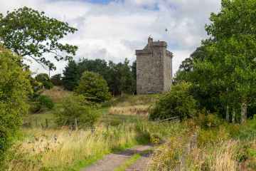
- High House of Edmonston,tower house Secular: castle SM5277
- Richard's Knowe Strip,settlement 150m WNW of St John's Kirk Prehistoric domestic and defensive: settlement SM2624
- Covington,castle & dovecot Secular: castle SM2599
- Cornhill,Roman camp N of Roman: camp SM5278
- Hillhead,earthwork 930m N of homestead moat Secular: homestead moat SM2653
- Quothquan Law, fort Prehistoric domestic and defensive: fort (includes hill and promontory fort) SM2601
- Greens Moor,long cairn,cairns and field system NW of Kersewell Mains Prehistoric domestic and defensive: field or field system; Prehistoric ritual and funerary: cairn (type uncertain) SM4212
- Burghmuir Farm,enclosures 550m S of Prehistoric domestic and defensive: enclosure (domestic or defensive) SM5492
- Wester Yardhouses, cairn 630m S of Prehistoric ritual and funerary: cairn (type uncertain) SM11231
- Blackhouse Burn,enclosures Prehistoric ritual and funerary: enclosure (ritual or funerary) SM4063
- Heavyside,two enclosures 1000m E of Prehistoric domestic and defensive: enclosure (domestic or defensive) SM4107
- Haywood, deserted mining village Industrial: coal SM9684
- Dunsyre Hill,field systems Prehistoric domestic and defensive: field or field system SM3371
- Hare Law, cairn 730m SSE of Wester Yardhouses Prehistoric ritual and funerary: cairn (type uncertain) SM11230
- Castle Hill,fort 550m WSW of Candybank Prehistoric domestic and defensive: fort (includes hill and promontory fort) SM2668
- Waulkmill, cairn 310m SE of Prehistoric ritual and funerary: cairn (type uncertain) SM11284
- Wester Yardhouses, hut-circle 470m SSE of Prehistoric domestic and defensive: hut circle, roundhouse SM11233
- Carnwath Golf Course,motte Secular: motte SM1145
- Chester Hill,fort Prehistoric domestic and defensive: fort (includes hill and promontory fort) SM2598
- Wester Yardhouses, souterrain 180m WNW of Prehistoric domestic and defensive: souterrain, earth-house SM2615
- Whitewellbrae Wood, henge 60m E of NE corner Prehistoric ritual and funerary: henge SM3369
- Boghall,earthwork 460m S of Prehistoric domestic and defensive: enclosure (domestic or defensive) SM2618
- Boghall Castle,Biggar Secular: castle SM5265
- Park Knowe,enclosure 1500m SSW of Thankerton Prehistoric domestic and defensive: enclosure (domestic or defensive) SM2603
- St John's Kirk,fort 360m WNW of Prehistoric domestic and defensive: fort (includes hill and promontory fort) SM2634
- Coulter Motte,motte,Wolfclyde Secular: motte SM90082
- Kersewell Mains,cairn 1400m ENE of Prehistoric ritual and funerary: cairn (type uncertain) SM4662
- Kersewell Mains,cairn 1400m E of Prehistoric ritual and funerary: cairn (type uncertain) SM4663
- Skirling Mains,enclosure 320m WSW of Prehistoric domestic and defensive: enclosure (domestic or defensive) SM3265
- Craigiehall, hut-circle 630m ESE of Prehistoric domestic and defensive: hut circle, roundhouse SM11232
- Ewe Hill,barrows 750m NE of Biggarshiels Farm Prehistoric ritual and funerary: barrow SM4645
- Bizzyberry Hill,fort & Wallace's Well Prehistoric domestic and defensive: fort (includes hill and promontory fort); Secular: well SM2607
- Dunsyre Hill,cairn Prehistoric ritual and funerary: cairn (type uncertain) SM3370
- Gillespie Moat,motte,Parkmanse Garden Secular: motte SM2643
- Easter Toftcombs,fort 820m NW of Prehistoric domestic and defensive: fort (includes hill and promontory fort) SM2611
- Meadowflatt,enclosure 900m NW of Prehistoric domestic and defensive: enclosure (domestic or defensive) SM4068
- Kilbucho House,cairn 1010m NW of Prehistoric ritual and funerary: cairn (type uncertain) SM2913
- Couthally Castle,Carnwath Secular: castle SM3909