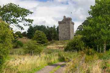
Elvanfoot
Elvanfoot is a Village in the county of South Lanarkshire.
Elvanfoot postcode: ML12 6TF
There are great places to visit near Elvanfoot including some great towns and shopping centres.
Places near Elvanfoot feature a number of interesting towns including East Kilbride.
EK - East Kilbride is a great place to visit close to Elvanfoot if you like shopping centres.
Elvanfoot History
There are some historic monuments around Elvanfoot:
- Air Cleuch,cairns 1300m S of Glengeith Prehistoric domestic and defensive: field clearance cairn, cairnfield; Prehistoric ritual and funerary: cairn (type uncertain) SM4641
- Netherton,cairn 800m SW of Prehistoric ritual and funerary: cairn (type uncertain) SM4513
- Glenochar Burn,bastle house,post-medieval settlement & field system Secular: settlement, including deserted, depopulated and townships SM5385
- Arbory Hill,fort Prehistoric domestic and defensive: fort (includes hill and promontory fort) SM264
- Devonshaw Hill,fort 500m NE of Woodend Farm Prehistoric domestic and defensive: fort (includes hill and promontory fort) SM2502
- March Burn to Little Clyde,Roman road Roman: road SM3348
- Glengeith, settlement, bastle house and field system Prehistoric domestic and defensive: homestead; Secular: settlement, including deserted, depopulated and townships SM4798
- Stoneyburn,platform settlement and field system 700m WSW of Prehistoric domestic and defensive: field or field system SM4486
- Berries Burn,cairn 800m NNW of Castle Crawford Farm Prehistoric ritual and funerary: cairn (type uncertain) SM4487
- Glencaple,burnt mound 980m WNW of Prehistoric domestic and defensive: burnt mound SM5267
- Normangill Rig,platform settlement E of Midlock Prehistoric domestic and defensive: platform settlement SM4756
- Cold Chapel,settlement 500m NE of Prehistoric domestic and defensive: settlement SM4530
- Nap Hill, Roman signal station 900m SE of Little Clyde Roman: signal station SM102
- Crookedstane,platform settlement 1300m W of Prehistoric domestic and defensive: platform settlement SM4646
- Whelphill, unenclosed platform settlement 390m W of Prehistoric domestic and defensive: platform settlement SM4531
- North Shortcleugh,platform settlement 1500m E of Prehistoric domestic and defensive: platform settlement SM4296
- Glencaple,platform settlement 600m NW of Prehistoric domestic and defensive: platform settlement SM4249
- Fall Hill,enclosed cremation cemetery 650m NE of Midlock Prehistoric ritual and funerary: enclosed cremation cemetery SM4766
- Abington,motte & bailey 1600m N of Secular: bailey SM2609
- Crooked Stone, standing stone 160m N of Crookedstane Prehistoric ritual and funerary: standing stone SM4238
- Lettershaws,platform settlement 1000m NE of Prehistoric domestic and defensive: platform settlement SM4332
- Normangill Rig,cairn 1000m S of Normangill Prehistoric ritual and funerary: cairn (type uncertain) SM4526
- Crookedstane,platform settlement 200m E of Prehistoric domestic and defensive: platform settlement SM4647
- Bodsberry Hill to Little Clyde,Roman road Roman: road SM3941
- Fagyad Hill,cairn Prehistoric ritual and funerary: cairn (type uncertain) SM4254
- Camps Knowe Wood,fort Prehistoric domestic and defensive: fort (includes hill and promontory fort) SM2437
- Wintercleugh,bastle house 1000m S of Tomont Hill Secular: bastle SM5279
- Castle Crawford Farm,fort 500m NW of Prehistoric domestic and defensive: fort (includes hill and promontory fort) SM2616
- Smithwood, bastle house 900m SW of Daerside Secular: bastle SM5647
- Hillend,enclosures 250m ENE of Prehistoric domestic and defensive: enclosure (domestic or defensive); Prehistoric ritual and funerary: henge SM5451
- Little Clyde,Roman camp Roman: camp SM2745
- Midlock,cairn 640m NE of Prehistoric ritual and funerary: cairn (type uncertain) SM4256
- Windgate House,bastle house and associated structures Secular: enclosure SM5257
- Kirkton,settlement 1280m ENE of Prehistoric domestic and defensive: settlement SM2617
- Campshead,unenclosed platform settlement 800m WNW of Prehistoric domestic and defensive: platform settlement SM4735
- Kirkton,fort 1155m ENE of Prehistoric domestic and defensive: fort (includes hill and promontory fort) SM2822
- Normangill,henge Prehistoric ritual and funerary: henge SM3292
- Bodsberry Hill,fort Prehistoric domestic and defensive: fort (includes hill and promontory fort) SM2605
- Stoneyburn,cairns 800m SW of Prehistoric ritual and funerary: cairn (type uncertain) SM4515
- Midlock,platform settlement 1000m ESE of Prehistoric domestic and defensive: platform settlement SM4757
- Historic gold workings, Leadhills, South Lanarkshire Industrial: mines, quarries SM13677
- Wildshaw Hill,cairn 500m WSW of summit Prehistoric ritual and funerary: cairn (type uncertain) SM4511
- Kirkton,fort 860m NNE of Prehistoric domestic and defensive: fort (includes hill and promontory fort) SM2614
- Crawford Castle or Lindsay Tower Secular: castle SM2633
- Boghead,platform settlement 500m SW of Prehistoric domestic and defensive: platform settlement SM4603
- Black Hill,fort 650m NW of Craighead Prehistoric domestic and defensive: fort (includes hill and promontory fort) SM2606
- Castle Crawford Farm,enclosure 585m NNW of Prehistoric domestic and defensive: enclosure (domestic or defensive) SM2631
- North Shortcleuch,platform settlement 1000m E of Prehistoric domestic and defensive: platform settlement SM4516
- Collins Burn,enclosure 750m NW of Elvanfoot Bridge Prehistoric domestic and defensive: enclosure (domestic or defensive) SM4527
- Craighead, platform settlement 1200m WNW of Prehistoric domestic and defensive: platform settlement SM4485
- Crawford,Roman fort Roman: fort SM2632
- Wandel,Roman fortlet and camp 460m SW of Roman: fortlet SM2835
- Craighead, barrow and cairn 820m NW of Prehistoric ritual and funerary: barrow SM4517
- Watermeetings,platform settlement 450m W of Prehistoric domestic and defensive: platform settlement SM4644
- Fall Kneesend, enclosed cremation cemetery Prehistoric ritual and funerary: enclosed cremation cemetery SM3947


