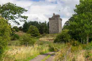
Dolphinton
Dolphinton is a Village in the county of South Lanarkshire.
Dolphinton postcode: EH46 7HF
There are great places to visit near Dolphinton including some great towns and shopping centres.
East Kilbride is one of Dolphinton's best, nearby towns to visit in Dolphinton.
The area close to Dolphinton boasts some of the best shopping centres including EK - East Kilbride.
Dolphinton History
There are some historic monuments around Dolphinton:
- Langlaw Hill,fort,enclosure & barrows Prehistoric domestic and defensive: enclosure (domestic or defensive); Prehistoric ritual and funerary: barrow SM3033
- Bamflatt,settlement 870m SSW of Prehistoric domestic and defensive: settlement SM2782
- Henderland Hill,fort Prehistoric domestic and defensive: fort (includes hill and promontory fort) SM2840
- Skirling Mains,enclosure 320m WSW of Prehistoric domestic and defensive: enclosure (domestic or defensive) SM3265
- Lochurd Hills, enclosures 485m and 435m W of and 245m and 465m WSW of Woolshears Hi Prehistoric ritual and funerary: enclosure (ritual or funerary) SM2998
- West Mains,enclosure 200m NE of Prehistoric domestic and defensive: enclosure (domestic or defensive) SM3256
- Bizzyberry Hill,fort & Wallace's Well Prehistoric domestic and defensive: fort (includes hill and promontory fort); Secular: well SM2607
- Broughton Church Ecclesiastical: church SM2779
- Penveny,settlement & scooped homestead NW of Prehistoric domestic and defensive: scooped homestead SM3218
- Ratchill,platform settlement and ring enclosure 460m NE of Prehistoric domestic and defensive: platform settlement; Prehistoric ritual and funerary: enclosure (ritual or funerary) SM2828
- Cock Rig to Linton Muir,Roman road Roman: road SM3247
- Dunsyre Hill,field systems Prehistoric domestic and defensive: field or field system SM3371
- Blyth Hill,fort Prehistoric domestic and defensive: fort (includes hill and promontory fort) SM2990
- Kirkurd,church SE of Castlecraig Ecclesiastical: church SM3106
- Heavyside,two enclosures 1000m E of Prehistoric domestic and defensive: enclosure (domestic or defensive) SM4107
- Broughton Knowe,ring enclosures Prehistoric ritual and funerary: enclosure (ritual or funerary) SM3152
- Castle Hill,fort 550m WSW of Candybank Prehistoric domestic and defensive: fort (includes hill and promontory fort) SM2668
- Newlands Church and graveyard, 50m SW of Newlands House Crosses and carved stones: cross-incised stone; Ecclesiastical: church SM3071
- Newmill,enclosures SW of Prehistoric domestic and defensive: enclosure (domestic or defensive) SM3069
- Drochil Castle,fort & enclosure 1190m NNW of Prehistoric domestic and defensive: enclosure (domestic or defensive) SM2956
- High House of Edmonston,tower house Secular: castle SM5277
- Muirburn Castle,fort & scooped settlement Prehistoric domestic and defensive: fort (includes hill and promontory fort) SM3142
- Burghmuir Farm,enclosures 550m S of Prehistoric domestic and defensive: enclosure (domestic or defensive) SM5492
- Broughtonknowe,three barrows 230m SE of Prehistoric ritual and funerary: barrow SM2922
- Stirkfield,barrow and enclosed cremation cemetery 1120m ESE of Prehistoric ritual and funerary: barrow SM3150
- Bordland Rings,fort,Bordlands Hill Prehistoric domestic and defensive: fort (includes hill and promontory fort) SM3010
- Drochil Castle Secular: castle SM1495
- North Muir,Nether Cairn Prehistoric ritual and funerary: cairn (type uncertain) SM2708
- North Muir,cairns Prehistoric ritual and funerary: cairn (type uncertain) SM3544
- Blyth,cairn 1050m NNW of Prehistoric ritual and funerary: cairn (type uncertain) SM2905
- North Muir,Upper Cairn Prehistoric ritual and funerary: cairn (type uncertain) SM2709
- Hardgatehead,Roman road and turnpike road 600m SW of Roman: road; Secular: road SM3263
- Ratchill,platform settlement 550m N of Prehistoric domestic and defensive: platform settlement SM2946
- Shaw Hill,cairn Prehistoric ritual and funerary: cairn (type uncertain) SM3236
- Brownsbank,enclosure 300m SE of Stirkfield Farm Prehistoric domestic and defensive: enclosure (domestic or defensive) SM4109
- Dunsyre Hill,cairn Prehistoric ritual and funerary: cairn (type uncertain) SM3370
- Bryland,fort 640m SE of Prehistoric domestic and defensive: fort (includes hill and promontory fort) SM3007
- Lochurd Farm,ring enclosures & mound 1550m S of Prehistoric ritual and funerary: enclosure (ritual or funerary) SM3006
- Stirkfield Rig,ring enclosures Prehistoric ritual and funerary: enclosure (ritual or funerary) SM3151
- Ewe Hill,barrows 750m NE of Biggarshiels Farm Prehistoric ritual and funerary: barrow SM4645
- Callands House,earthwork S of Prehistoric domestic and defensive: enclosure (domestic or defensive) SM3074
- Terrace Wood,cultivation terraces Prehistoric domestic and defensive: cultivation terraces SM2393
- Clashpock Rig,homestead Prehistoric domestic and defensive: homestead SM3217
- Crosswood, cairn 750m SE of Prehistoric ritual and funerary: cairn (type uncertain) SM11245
- Huskie Rig,mounds Prehistoric ritual and funerary: mound (ritual or funerary) SM2778
- Stirkfield,settlements and cultivation remains 1300m ESE of Prehistoric domestic and defensive: settlement SM2939
- Wester Happrew,fort 360m NW of Prehistoric domestic and defensive: fort (includes hill and promontory fort) SM2944
- Hammer Knowe,fort & settlement Prehistoric domestic and defensive: fort (includes hill and promontory fort) SM3094
- Easter Toftcombs,fort 820m NW of Prehistoric domestic and defensive: fort (includes hill and promontory fort) SM2611
- Whiteside Hill,fort & enclosure Prehistoric domestic and defensive: enclosure (domestic or defensive) SM2955
- Broughtonknowe, ring enclosures & barrow 420m NE of Prehistoric ritual and funerary: barrow SM2923
- South Slipperfield,barrows 1850m SSW and 1620m S of Prehistoric ritual and funerary: barrow SM5742
- Slipperfield Mount,cairn S of Prehistoric ritual and funerary: cairn (type uncertain) SM3698
- Pyked Stane,cairn,Pyked Stane Hill Prehistoric ritual and funerary: cairn (type uncertain) SM2938
- Old Harestanes,stone circle 180m NE of Prehistoric ritual and funerary: stone circle or ring SM2697


