Llanyre
Llanyre is a Village in the county of Powys.
Llanyre postcode: LD1 6DY
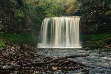
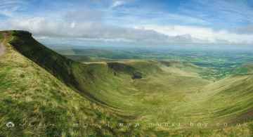
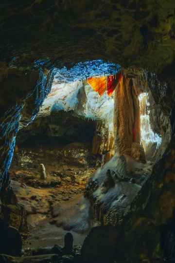
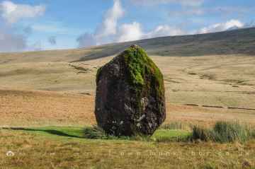
There are great places to visit near Llanyre including some great waterfalls, mountains, caves and ancient sites.
Llanyre's best nearby waterfalls can be found at Sgwd Yr Eira, Dan Yr Ogof Waterfalls, Sgwd Isaf Clun Gwyn, and Sgwd Y Pannwr.
Mountains to visit near Llanyre include Corn Du, and Pen y Fan.
The area close to Llanyre boasts some of the best caves including Dan Yr Ogof.
The area around Llanyre's best ancient sites can be found at Maen Llia Standing Stone.
Llanyre History
There are some historic monuments around Llanyre:
- Llandrindod Common Roman Practice Camps
- Carneddau round cairns
- Caer Einon Camp
- Cefn Ty-Mawr
- Upper House round cairns
- Little Hill Round Barrows
- Carneddau, round cairn on N end of
- Castle Bank Hillfort
- Roman Fortlet (revealed by aerial photography), Disserth
- Castell Cae-Maerdy Castle Mound
- Tower Hill Round Barrow
- Llyn Gwyn Earthwork
- Court stone row
- Ffrwd standing stone
- Llandrindod Wells Roman road
- Carneddau Round Cairn
- Garnfawr Deserted Rural Settlement
- St Harmon Roman road
- Bryntwppa stone row
- Cwmblaenerw House Platforms
- Caer Du
- Two Cooking Mounds 350m W of Llwynceubren, Howey
- Dol-y-Fan Round Cairn
- Roman Earthworks S of Llandrindod Wells
- Crugyn Tumulus
- Pant y Rhiw Medieval Settlement
- Roman Marching Camp (revealed by aerial photography) 500m SSE of Glan-yr-Afon
- Banc Ystrad-wen cairn cemetery
- Bongam Bank Round Barrows
- Llwyn-Ceubren Round Barrow
- Cwm standing stone
- Cwm Berwyn Camp
- Pen-y-bont Standing Stone
- Earthwork 100m N of Caer Du, Howey
- Cilberllan ring cairn
- Gwernfach round cairn
- Llyn Dwr Cairn
- Carneddau, standing stone to SSW of
- Cefnllys Medieval Settlement and Field Systems
- Ringwork near Coed Ty-Mawr
- Beili-Bedw Earthworks
- Upper House Platform House
- Cwrt Llechryd moated site
- Creggin Round Barrow
- Llyn Dwr Standing Stone
- Pant Purlas Round Barrow
- Gelli Hill Round Barrow
- Abbey Cwmhir Great Park Shed
- Cwm-berwyn round cairn
- Colwyn Castle
- Cefnllys Castle
- The Gaer hillfort
- Gilwern Hill, round cairn on NE of
- Carn Wen cairn
- Broomy Hill, standing stone on N
- Broomy Hill, standing stone on S
- Court standing stone
- Old Castle Mound
- Broomy Hill standing stone
- Gelli Hill Stone Circle
- Doldowlod Pillbox
- Round Barrow NE of Cefn-Ceido Hall
- Cwmbrith Round Cairn
- Caer Fawr Medieval Settlement
- Gilwern Hill round cairn
- Fforest Wood Mound & Bailey Castle
- Corn Drying Kiln 340m S of Cryn-Fryn
- Round Cairn 130m E of Cryn-Fryn
- Ffynnon Mary Burnt Mound 300m SE of Carn Wen
- Carreg-Wiber Bank Earthwork
- Cwmblaenerw Enclosed Long Hut
- Pen-llys Earthwork
- Garth cairn cemetery
- Standing Stone, Llanwrthwl Churchyard
- Pawl Hir Ring Cairn
- Tomen Bedd Ugre Mound & Bailey Castle
- Carneddau, cairn on N end of
- Standing Stone SSE of Dol-y-Felin
- Castell Collen
- Bank House Medieval Settlement
- Castle Bank ring cairn
- Llethyr Waun-lwyd ring cairn
- Ty-Lettice Round Barrow
- Cwmhir Abbey
- Ty Lettice Roman road


