


Mindrum
Mindrum is a Village in the county of Northumberland.
Mindrum postcode: TD12 4QN
There are great places to visit near Mindrum including some great villages, ancient sites, beaches, hiking areas, geological features, castles, ruins, islands, towns, roman sites and historic monuments.
Mindrum's best nearby villages can be found at Milfield, Craster, and Bamburgh.
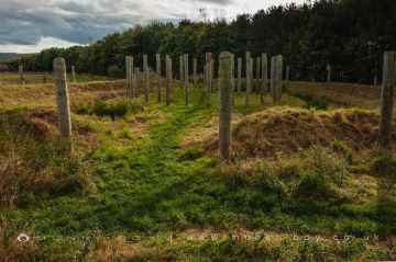
There are a several good ancient sites in the area around Mindrum like Milfield North Henge.
There are a number of beaches near Mindrum including Embleton Bay, and Bamburgh Beach.
The area around Mindrum boasts some of the best hiking areas including Dunstanburgh, Sycamore Gap, and Hadrian's Wall near Hexham.
Gull Crag and the Rumble Churn, Greymare Rock, and Sycamore Gap are some of Mindrum best geological features to visit near Mindrum.
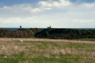
The area around Mindrum's best castles can be found at Dunstanburgh Castle.
There are a several good ruins in the Mindrum area like Dunstanburgh Castle, WWII Sandbag Pillbox, and Old Limekiln at Dunstanburgh.
Don't miss Farne Islands's islands if visiting the area around Mindrum.
Hexham, and Berwick-upon-Tweed are some of Mindrum best towns to visit near Mindrum.
Don't miss Hadrian's Wall near Hexham, and Chesters Roman Fort's roman sites if visiting the area around Mindrum.
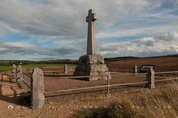
Don't miss Flodden's historic monuments if visiting the area around Mindrum.
Mindrum History
There are some historic monuments around Mindrum:
- Enclosed settlement, 620m south east of Cornhill Castle
- Shieling at Southernknowe, 530m SSE of Whitehall
- Settlement at the south end of The Bell
- Enclosed native settlements, cultivation terraces and cairn field south west of Mounthooly
- Homebank,enclosure 1100m ENE of Prehistoric domestic and defensive: enclosure (domestic or defensive) SM5190
- Old Halterburnhead,settlements 100m SW of and 200m SE of Prehistoric domestic and defensive: settlement SM4665
- Roman period native enclosed settlement 480m north of Sutherland Bridge
- Shoulder Hill,homestead Prehistoric domestic and defensive: house SM4999
- Enclosed settlement 920m south east of Whitehall
- Settlement WSW of Ell's Knowe
- Twizel medieval tower house and village, post-medieval folly and garden
- Kip Knowe,settlement Prehistoric domestic and defensive: settlement SM5171
- Roman period native enclosed settlement 700m south of Ring Chesters defended settlement
- Burnt Humbleton,fort Prehistoric domestic and defensive: fort (includes hill and promontory fort) SM4668
- Burnhead,homestead 500m SE of Prehistoric domestic and defensive: homestead SM4667
- Northern ring cairn on Coldsmouth Hill
- Hethpool tower house
- Roman period native enclosed settlement 600m north east of Elsdonburn Shank
- Castle Hill camp
- Settlement SW of Mid Hill
- Little Hetha defended settlement
- Elsdonburn Roman period native settlements and medieval shieling
- Five shielings 620m NNE of Elsdonburn Shank
- Mid Hill enclosed settlement, Westnewton
- North Black Hagg defended settlement
- The Mount, motte-and-bailey castle Secular: motte SM386
- Settlement on the east slope of The Bell
- Southernknowe Roman period native enclosed settlement and clearance cairns, 280m north of Sutherland Bridge
- Stob Stones,standing stones Prehistoric ritual and funerary: standing stone SM1689
- Butter Sike,enclosure 900m ENE of Attonburn Prehistoric domestic and defensive: scooped settlement SM5188
- Twizel Bridge
- Cornhill Castle
- Downham camp
- Settlement north west of Ell's Knowe
- Roman period native enclosed farmstead 320m north west of Southernknowe
- Green Humbleton,fort Prehistoric domestic and defensive: fort (includes hill and promontory fort) SM1694
- Hut circle settlements and field systems at Hetha Burn Head
- Bronze Age cairnfield, prehistoric enclosure, Romano-British settlement and medieval shielings 500m south of Mounthooly
- Countridge Knowe,cultivation terraces Prehistoric domestic and defensive: cultivation terraces SM2161
- Roman period native enclosed settlement and medieval sheiling 165m north east of Dunsdale
- Roman period native settlement 200m SSE of Staw Hill defended settlement
- Elliesheugh,farmstead and field system Secular: farmstead SM6002
- Roman period native enclosed settlement 460m north of Sutherland Bridge
- Unenclosed settlement, part of a field system, Romano-British aggregate village and group of shielings, 470m south east of Whitehall
- Hut circle, cultivation terraces and farmstead of later prehistoric date, and medieval settlement and field system 800m and 740m south of Elsdonburn Shank
- Roman period native farmstead 550m SW of Trowupburn Farm
- Trowupburn Roman period native enclosed settlement, 120m north of Trowupburn Farm
- Settlement at Scaldhill Shank
- Hethpool stone circles
- Roman period native settlement 250m west of Elsdonburn Shank
- Hetha Burn defended settlement, Roman period native enclosed settlement and associated trackways
- Sourhope,unenclosed platform settlement and field system 1900m N of Prehistoric domestic and defensive: platform settlement SM4833
- Settlements and cairn east of Laddies Knowe
- Burnhead,scooped settlement and house 300m NE of Prehistoric domestic and defensive: scooped settlement; Secular: house SM4680
- Enclosed settlement and subsidiary enclosures 160m N of Ring Chesters defended settlement
- Romano-British farmstead 760m north of Whitehall
- Madam Law Cairn
- St Giles's medieval chapel and burial ground, Wark on Tweed
- Halterburn,farmsteads 400m ESE of Secular: enclosure SM4666
- Romano-British settlement 810m south east of Whitehall
- Roman period native farmstead 320m north east of Longknowe
- Steer Rig,palisaded settlement 820m ENE of Old Halterburnhead Prehistoric domestic and defensive: palisaded enclosure SM4558
- Ell's Knowe defended settlement and earlier palisaded site
- Birgham Haugh,fort and enclosures 800m SW of Prehistoric domestic and defensive: fort (includes hill and promontory fort) SM5017
- Great Hetha defended settlement
- Defended settlement, 507m north west of Pawston Lake
- Roman period native enclosed settlement 270m ESE of Fleehope
- Enclosed settlement west of Mid Hill
- Southern ring cairn on Coldsmouth Hill
- Roman period native enclosed farmstead, 470m ESE of Fleehope
- Belchester,fort 200m W of Prehistoric domestic and defensive: fort (includes hill and promontory fort) SM4547
- Hirsel Law, fort Prehistoric domestic and defensive: fort (includes hill and promontory fort) SM12349
- Redden,fort and enclosure 750m E of Prehistoric domestic and defensive: fort (includes hill and promontory fort) SM5601
- Sinkside Hill defended settlement
- Wark Castle motte and bailey castle and artillery fort
- Round cairn 550m NNW of Southernknowe
- The King's Stone NW of Crookham Westfield Farm
- Round cairn 540m NNW of Southernknowe
- Howtel tower house
- Ring Chesters defended settlement
- Roman period native settlement on east slope of Mid Hill, 520m south of Staw Hill Camp
- Wildgoose Hill, fort 610m SW of Burnhead Prehistoric domestic and defensive: fort (includes hill and promontory fort) SM1706
- Farmstead and cultivation terraces, ENE of Stawhouse
- House platform north west of Laddie's Knowe settlement
- Fawcett Shank defended settlement, 620m SSE of Fleehope
- Littlehaugh Shiel, fort 400m WSW of Prehistoric domestic and defensive: fort (includes hill and promontory fort) SM12401
- Moneylaws Castle Hill camp
- Homebank,ring-ditch 1500m E of Prehistoric domestic and defensive: enclosure (domestic or defensive); Prehistoric ritual and funerary: enclosure (ritual or funerary) SM5016
- East Moneylaws camp
- Halterburn,farmstead 700m E of Secular: enclosure SM4670
- The Hirsel,settlements & ecclesiastical remains S of Ecclesiastical: burial ground, cemetery, graveyard; Prehistoric domestic and defensive: settlement SM4522
- Cliftoncote,cultivation terraces Prehistoric domestic and defensive: cultivation terraces SM5009
- Two round cairns south west of Tuppie's Grave
- Roman period aggregate village on Coldsmouth Hill, 650m south east of St Ethelrede's Chapel
- Old Halterburnhead,homestead 600m NE of Prehistoric domestic and defensive: homestead SM4669
- Settlement north of Coldburn
- Staw Hill defended settlement
- Roman period native enclosed settlement 370m WNW of Great Hetha defended settlement
- Cottage Hospital, settlement 250m SW of Prehistoric domestic and defensive: settlement SM12356
- Bowmont Hill camp
- Trowupburn cairn group
- Roman period native enclosed farmstead 370m WNW of Southernknowe
Places to see near Mindrum


Lakes near Mindrum
Rivers near Mindrum
- Otter Burn Catchment (trib of Rede)
- Rede from Source to Cottonshope Burn
- Sills Burn Catchment (trib of Rede)
- Cottonshope Burn Catchment (trib of Rede)
- Durtrees Burn Catchment (trib of Rede)
- Wind Burn Catchment (trib of Rede)
- Rede from Bellshiel Burn to N Tyne
- Rede from Cottonshope Burn to Bellshiel Burn
- Elsdon Burn Upper Catchment East
- Lisles Burn Catchment (trib of Rede)
- Elsdon Burn Upper Catchment West
- Dargues Burn Catchment (trib of Rede)
- Blakehope Burn Catchment (trib of Rede)
- Miller Burn Catchment (trib of Rede)
- Elsdon Burn lower catchment (Trib of Rede)
- West Allen from Source to Wellhope Burn
- Allen from West Allen to South Tyne
- West Allen from Wellhope Burn to Allen
- Carr's Burn Catchment (Trib of West Allen)
- Wellhope Burn Catchment (Trib of West Allen)
- Allen from Source to West Allen
- Chevington Burn/Steads Burn from Source to Tidal Limit
- Lyne from Source to Tidal Limit
- Coquet from Usway Burn to Holystone Burn
- Black Burn Catchment (trib of Wreigh Burn)
- Holystone Burn Catchment (trib of Coquet)
- Usway Burn from Source to Coquet
- Foxton Burn Catchment (trib of Wreigh Burn)
- Coquet from Source to Usway Burn
- Alwin Catchment (trib of Coquet)
- Netherton Burn Catch (trib of Wreigh Burn)
- Wreigh Burn from Netherton Burn to Coquet
- Ridlees Burn from Source to Coquet
- Wreigh Burn from Source to Netherton Burn
- Grasslees Burn
- Barrow Burn Catchment (trib of Coquet)
- Edlingham Burn from Source to Aln
- Aln from Edlingham Burn to Tidal Limit
- Aln from Source to Callaly Burn
- Cawledge Burn Catchment (trib of Aln)
- Callaly Burn Catchment (trib of Aln)
- Aln and Shawdon Burn from Coe Burn to Edlingham Burn
- Shipley Burn from Source to Aln
- Eglingham Burn from Source to Shipley Burn
- Coe Burn Catchment (trib of Aln)
- Aln from Callaly Burn to Coe Burn
- Pont from Fenwick Burn to Med Burn
- Fenwick Burn from Source to Pont
- Pont from Small Burn to Blyth
- Blyth from How Burn to Pont
- Ponteland to Dinnington Catchment Area
- Blyth from Source to How Burn
- Coldcoats Burn Catchment (trib of Pont)
- Pont from Med Burn to Small Burn
- Pont from Source to Fenwick Burn
- Med Burn from Source to Pont
- How Burn from Source to Blyth
- Ogle Burn Catchment (trib of Blyth)
- Hart Burn from Source to Delf Burn
- Delf Burn Catchment (trib of Hart Burn)
- Wansbeck from Ray Burn to Hart Burn
- Wansbeck from Bothal Burn to North Sea
- Hart Burn from Delf Burn to Wansbeck
- Wansbeck from Source to Ray Burn
- Bothal Burn Catchment (trib of Wansbeck)
- Wansbeck from Font to Bothal Burn
- Ray Burn Catchment (trib of Wansbeck)
- Wansbeck from Hart Burn to Font
- Font from Source to Wansbeck
- Todd Burn Catchment (trib of Coquet)
- Hazon Burn Catchment (trib of Coquet)
- Coquet from Forest Burn to Tidal Limit
- Forest Burn Catchment (trib of Coquet)
- Coquet from Holystone Burn to Forest Burn
- Black Burn Catchment (trib of Coquet)
- Tyelaw Burn Catchment (trib of Coquet)
- Longdike Burn Catchment (trib of Coquet)
- Swarland Burn Catchment (trib of Coquet)
- Blyth from Pont to Tidal Limit
- Duddo Burn from Source to Blyth
- Seaton Burn from Source to Tidal Limit
- Sleek Burn / Hepscott Burn Source to Tidal Limit
- South Low from Haggerston Bridge to N Sea
- Waren Burn from Source to N Sea
- North Low from Source to Berrington Burn
- Annstead Burn from Source to N Sea
- Rennington Burn from Source to N Sea
- Embleton Burn form Source to N Sea
- Brunton burn from Source to N Sea
- Newlands Burn Catchment (trib of Waren Burn)
- South Low from Source to Haggerston Bridge
- Berrington Burn from Source to North Low
- Elwick Burn from Source to Ross Low
- Ross Low from Source to Eldwick Burn
- Fenham Burn Catchment (to N Sea)
- Belford Burn from Source to Ross Low
- Long Nanny from Source to N Sea
- North Low from Berrington Burn to N Sea
- Newbiggin Dean Catch (trib of Tweed)
- Horncliffe Mill Burn
- Willow Burn Catchment (Trib of Tweed)
- Till from Roddam Burn to Glen
- Glen from Source to College Burn
- Till from Linhope Burn to Roddam Burn
- Till from Glen to River Tweed
- Glen from College Burn to Till
- College Burn from Lambden Burn to Glen
- Harthope Burn
- Till (Nthumb)
- Pallins Burn Catch (trib of Till)
- Lambden Burn from Source to College Burn
- Lilburn Burn
- College Burn from Source to Lambden Burn
- Wooler Water from Harthope Burn to Till
- Wooler Water from Source to Harthope Burn
- Linhope Burn from Source to Till
- Roddam Burn
- Till from Source to Linhope Burn
- Hetton Burn


