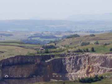
Snainton
Snainton is a Village in the county of North Yorkshire.
There are great places to visit near Snainton including some great waterfalls, ruins, historic monuments, hiking areas, villages, rivers and streams, towns, caves, limestone pavements, geological features, mountains, cities, historic buildings, hills, castles, country parks, parks, gardens and ancient sites.
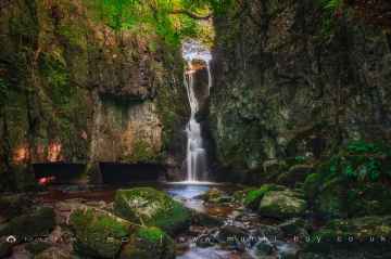
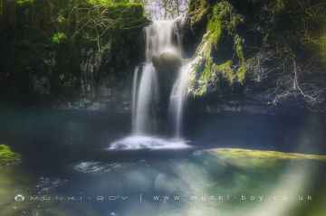
There are a several good waterfalls in the Snainton area like Catrigg Force, Lockin Garth Force, Whitfield Gill Force, Slape Wath Waterfall, Mill Gill Force, Cotter Force, and Aysgill Force.
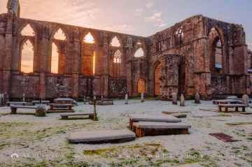
Bolton Abbey, Byland Abbey, Easby Abbey (ruin), Fountains Abbey and Studley Royal Water Garden, Fountains Abbey (ruin), Trig Point on Warrendale Knotts, and Old Limekiln at Blua Crags are great places to visit near Snainton if you like ruins.
Snainton's best nearby historic monuments can be found at Bolton Abbey, Culloden Tower, and Robin Hood's Well (Fountains).
Deepdale, Cotterdale, Southerscales, Ingleton Waterfalls Trail, Swilla Glen, Baxenghyll Gorge, and Raven Ray are great places to visit near Snainton if you like hiking areas.
There are a several good villages in the Snainton area like Pool-in-Wharfedale, Askrigg, Hardraw, Malham, West Burton, Bainbridge, and Aysgarth.
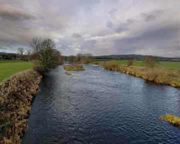
Whitfield Beck, Mill Gill, Hardraw Beck, River Wharfe, and Walden Beck at West Burton are great places to visit near Snainton if you like rivers and streams.
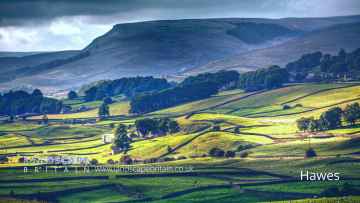
Hawes, Skipton, Grassington, Richmond, Middlesbrough, Harrogate, and Settle are some of Snainton best towns to visit near Snainton.
The area around Snainton features a number of interesting caves including Great Douk Cave, White Scar Cave, Yordas Cave, Janet's Cave, Gaping Gill, Horseshoe Cave, and Jubilee Cave.
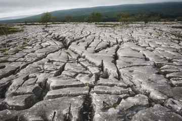
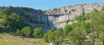
Snainton's best nearby limestone pavements can be found at Southerscales, Malham Cove, and Warrendale Knotts Limestone Pavement.
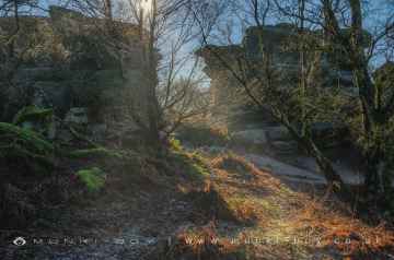
Snainton has some unmissable geological features nearby like Malham Cove, and Brimham Rocks.
Mountains to visit near Snainton include Ingleborough.
Cities to visit near Snainton include York, and Ripon.
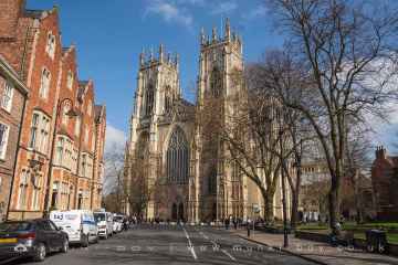
Historic Buildings to visit near Snainton include York Minster, Culloden Tower, and Beggar’s Bridge.
Snainton's best nearby hills can be found at Addlebrough, Warrendale Knotts, Giggleswick Scar, Blua Crags, Sugar Loaf Hill, and Attermire Scar.
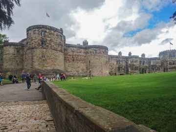
Castles to visit near Snainton include Skipton Castle, Richmond Castle, and Bolton Castle.
There are a number of country parks near to Snainton including Brimham Rocks.
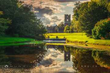
Snainton's best nearby parks can be found at Fountains Abbey and Studley Royal Water Garden, Fountains Abbey (ruin), and Studley Royal Water Garden.
The area around Snainton's best gardens can be found at Fountains Abbey and Studley Royal Water Garden.
There are a several good ancient sites in the Snainton area like Schoolboys Tower, Jubilee Cave, and Victoria Cave.
Snainton History
There are some historic monuments around Snainton:
- Two long barrows 630m and 690m north east of Scamridge Farm
- Round barrow on Long Hill 430m west of Highdales
- Round barrow in Wykeham Forest, 850m south west of Coomb Slack Farm
- Two square barrows on Coomb Hill, 530m west of Coomb Slack Farm
- Round barrow immediately south of California Belt, 190m east of Fox Head
- Embanked pit alignment 130m south and 310m SSE of Jingleby House
- Round barrow in Broxa Forest 800m south west of Highdales
- Warrening enclosure on Shortgate Hill, 480m south west of Coomb Slack Farm
- Two round barrows on Newclose Rigg, 810m north east of High Rigg Farm
- Part of a warrening enclosure 470m south east of High Rigg Farm
- Square barrow 480m north east of Cockmoor Hall
- Square barrow on West Ayton Moor, 810m south west of Cockrah House
- Two Iron Age round barrows and a Bronze Age round barrow, 340m north east of a triangulation pillar, on Highwood Brow
- Round barrow in Wykeham Forest, 330m south east of the Three Tremblers
- Round barrow 570m south east of Warren House
- Prehistoric field system and seven round barrows on West Ayton Moor
- Round barrow on Coomb Hill, 530m west of Coomb Slack Farm
- Round barrow on Flockrake Noddle, 550m SSW of Silpho Brow Farm
- Square barrow on West Ayton Moor, 700m south west of Cockrah House
- Square barrow on Highwood Brow, 400m south east of Mount Misery
- Prehistoric linear boundary in Craddlegrip Wood, 900m north west of High Yedmandale
- Round barrow 395m north west of the Adder Stone
- Round barrow on East Moor, 640m north of East Moor Farm
- Square barrow in Broxa Forest, 580m south east of Whisperdales
- Two intersecting linear boundaries in Dalby Forest, immediately west of Jingleby Tower
- Round barrow in Wykeham Forest, 800m east of Jenny Thrush Spring
- Round barrow at Blanket Head, 350m north west of Broad Head Farm
- Round barrow in California Belt, 140m east of Fox Head
- Heslerton Brow barrow group: three bowl barrows 300m north-east of Wold Barn
- Warrening enclosure 1.07km east of High Rigg Farm
- Cross dyke 900m west of Backleys Farm
- Round barrow on Highwood Brow, 990m north east of Brompton Moor House
- Round barrow on Highwood Brow, 760m north east of Brompton Moor House
- Four square barrows in Wykeham Forest, 660m south of Mount Misery
- Two round barrows on Troutsdale Moor, 900m west of Rock House Farm
- New Bield round barrow and ringwork
- Round barrow W of Newlands Lane
- Round barrow on Troutsdale Brow, 165m south east of Jenny Thrush Spring
- Round cairn in Dalby Forest, 340m south of Jingleby Tower
- Ring cairn on West Ayton Moor, 900m south west of Cockrah House
- Churchyard cross, immediately south of St Mary the Virgin's Church
- Warrening enclosure 1.3km north west of Givendale Head Farm
- Square barrow in Broxa Forest, 720m south west of Surgate Brow Farm
- Square barrow in Wykeham Forest, 610m north east of Loft Howe
- Enclosed cremation cemetery at Willot Head, 510m south west of Loft Howe
- East Heslerton Brow barrow group: a bowl barrow 750m east of Manor Wold Farm
- Three embanked pit alignments and segments of a linear boundary and a medieval hollow way, 300m west of Givendale Head Farm
- Embanked pit alignments, linear earthworks, round barrows and cairns on Ebberston Low Moor
- Round barrow 530m south east of High Scamridge Farm
- Round barrow on Coverdale Moor, 470m south of North Stile Cottage
- Round barrow on Shortgate Hill, 500m south east of Coomb Slack Farm
- Round barrow in Broxa Forest 850m WSW of Highdales
- Long barrow 530m north of Keeper's Cottage
- Castle Hill fortified house
- Round barrow 820m south east of South Moor Farm
- Square barrow on Shortgate Hill, 380m south west of Coomb Slack Farm
- Square barrow in Wykeham Forest, 600m south east of Mount Misery
- A cross dyke on Knapton Wold, 500m west of West Farm
- Three Howes round barrows
- Round barrow in School Belt, 1050m north west of Jenny Spring
- Round barrow in Wykeham Forest, 120m south of a triangulation pillar on Highwood Brow
- Round barrow 920m south west of Silpho Brow Farm
- Square barrow in Wykeham Forest, known as Loft Howe
- Round barrow on Coverdale Moor, 530m south of North Stile Cottage
- Round barrow 600m west of Scamridge Farm
- Prehistoric linear boundary known as Snainton Dikes, 740m east of Ebberston Common House
- Two round barrows 60m south east of the Adder Stone
- Round barrow on Highwood Brow, 420m south east of Mount Misery
- Round barrow on Newclose Rigg, 380m south of Adder Stone
- Round barrow 300m north west of Warren House
- Round barrow on Low Moor, 715m north of South Moor Farm
- Four round barrows 320m east of High Pastures
- Square barrow in Wykeham Forest, 630m north east of Loft Howe
- Rabbit type on Flainsey Rigg, 1.3km east of Dalby Meadow
- Round barrow south east of California Belt, 270m east of Fox Head
- Part of a cross dyke with associated warrening features, 850m south east of High Rigg Farm
- Staple Howe: a palisaded hilltop enclosure in Knapton Plantation
- Three round barrows in Wykeham Forest, known as the Three Tremblers
- Round barrow 520m north of Ebberston Common House
- Round barrow 1/4 mile (400m) NW of Broom House
- Southern of two round barrows in Dalby Forest known as the Brown Howes
- Northern of two round barrows in Dalby Forest known as the Brown Howes
- Round barrow in Dalby Forest, known as Waitcliff Howe
- Round barrow in Wykeham Forest, 845m WNW of Loft Howe
- Round barrow in Springwood Heights Plantation, 220m north west of Springwood Cottage
- Northern of two round barrows known as Row Howes, 640m south east of East Moor Farm
- Allerston lime kilns
- Round barrow on Givendale Rigg, 1.5km south west of Givendale Head Farm
- Round cairn 830m south west of Jingleby Tower
- Round barrow 480m north of Jingleby Thorn
- Round barrow 550m west of South Moor Farm
- Round barrow, 650m south west of Coomb Slack Farm
- Late prehistoric enclosed settlement on Coomb Hill, 540m south west of Coomb Slack Farm
- The Moor Dikes and Craddlegrip Dike prehistoric linear boundaries and other prehistoric remains in Wykeham Forest
- Thompson's Rigg cairnfield, including a platform cairn, round burial cairns, hollow ways, a standing stone, associated round barrows and a ring cairn
- Round barrow 390m south of Mount Misery
- Regular aggregate field system on Troutsdale Moor, 470m north west of Rock House Farm
- Wykeham Cistercian priory, All Saints parish church and churchyard cross
- Round barrow on Newclose Rigg, 500m south west of Adder Stone
- Northern section of prehistoric linear boundary with intersecting hollow ways, known as Rise Dikes, in Wykeham Forest
- Round barrow 700yds (640m) NE of Brompton Wold Farm
- Round barrow 250m south east of the Adder Stone
- Round barrow at Wester Gill, 390m north west of East Moor Farm
- Fox Howe round barrow
- Medieval manor site
- Warrening enclosure on Flainsey Rigg, 1.45km east of Upper Dalby Wood
- Round barrow 440m north of Jingleby Thorn
- Round barrow on Givendale Rigg, 1.6km south west of Givendale Head Farm
- Round barrow in Broxa Forest 740m south west of Highdales
- Square barrow on Coomb Hill, 420m west of Coomb Slack Farm
- Round barrow on Newclose Rigg, 690m south west of Adder Stone
- Iron Age barrow cemetery, East Field
- Square barrow in Wykeham Forest, 660m south east of the Three Tremblers
- Round barrow 250m north of Givendale Head Farm
- Round barrow on Ebberston Low Moor, 200m north west of Ebberston Common House
- Round barrow 420m north west of Jingleby Thorn
- Round barrow on Silpho Brow, 740m west of Silpho Brow Farm
- Round barrow in Wykeham Forest, 850m WNW of Loft Howe
- Prehistoric linear boundary on Stonygate Moor, 550m west of Warren House Farm
- Round barrow in Wykeham Forest, 920m east of Jenny Thrush Spring
- Southern section of prehistoric linear boundary known as Rise Dikes, in Wykeham Forest
- Round barrow in Wykeham Forest, 870m east of Jenny Thrush Spring
- Round barrow in SE corner of Scardale Plantation
- Round barrow NE of Lawson's Wold Barn
- Round barrow in Dalby Forest, 70m south of Waitcliff Howe
- Round barrow 780m north west of Cockmoor Hall
- Round barrow on Shortgate Noddle, 330m south east of Coomb Slack Farm
- Round barrow in Wykeham Forest, 360m south east of the Three Tremblers
- Square barrow on West Ayton Moor, 1100m south west of Cockrah House
- Round barrow at North Moor, 120m south east of Forest Lodge
- Regular aggregate field system on Troutsdale Moor, 950m south west of Rock House Farm
- Round barrow 470m north of Keeper's Cottage
- Warrening enclosure 1.08km north east of High Paper Mill Farm
- East Heslerton Brow barrow group: a bowl barrow 1.1km east of Manor Wold Farm
- Warrening enclosure on Flainsey Rigg, 1.5km east of Low Dalby
- Round barrow 400m north east of Low Pasture Farm
- Long barrow 630m north west of Scamridge Farm
- Round barrow in Wykeham Forest, 440m east of Jenny Thrush Spring
- Round barrow in Dalby Forest, 30m west of Broad Head Farm
- Round barrow 330yds (300m) NNW of Ladyhills
- Square barrow at Mutton Gill, 670m north west of Wykeham Moor Cottages
- Three round barrows on West Heslerton Wold
- Round barrow 460m north west of the Adder Stone
- Prehistoric linear boundary and associated features centred 500m north east of High Bride Stones
- Round barrow in Dalby Forest, 1190m south west of Jingleby Tower
- Round barrow 740m east of Broad Head Farm
- Round barrow cemetery (including the barrows known as Three Howes) 220m and 360m north west of South Moor Farm
- Oxmoor and Givendale Dikes: prehistoric linear boundaries and associated features
- Round barrow in Wykeham Forest, 550m south east of the Three Tremblers
- Prehistoric linear boundary in Dalby Forest, known as Dargate Dikes
- Round barrow in Wykeham Forest, 860m north east of the Three Tremblers
- Two round barrows 680m south west of Jingleby Tower
- Three round barrows S of Prodham's Wold Farm
- Heslerton Brow barrow group: a bowl barrow 230m north-east of Wold Barn
- Wilton Hall moated site 250m south of Manor Farm
- Square barrow in Wykeham Forest, 560m north east of Loft Howe
- Four square barrows in Wykeham Forest, 520m north west of Loft Howe
- Scamridge Dikes: prehistoric linear boundaries and associated features
- The Thieves' Dikes: prehistoric linear boundaries and associated features
- Medieval settlement immediately south east of Ebberston Hall
- Enclosed cremation cemetery in Wykeham Forest, 230m south of Loft Howe
- Prehistoric linear boundary and associated features including a medieval monastic grange, north, east and south east of Moorsome Farm
- Four square barrows in Wykeham Forest, 330m north of Loft Howe
- Round barrow on Highwood Brow, 950m north east of Brompton Moor House
- Yedingham Priory
- Round barrow on Coomb Hill, 500m west of Coomb Slack Farm
- Rabbit type on Sneverdale Rigg, 875m north east of Low Dalby House
- Round barrow 540m south west of Bridge Farm
- Square barrow on Coomb Hill, 470m west of Coomb Slack Farm
- Two round barrows in Dalby Forest, 70m north of Broad Head Farm
- Round barrow 780m east of Broad Head Farm
- Three square barrows in Wykeham Forest, 590m south east of Mount Misery
- Round barrow 150m north east of a triangulation pillar on Highwood Brow
- Late prehistoric enclosed settlement in Wykeham Forest, 630m south east of Mount Misery
- Square barrow in Wykeham Forest, 680m north east of Loft Howe
- Square barrow on Shortgate Hill, 550m south of Coomb Slack Farm
- Southern of two round barrows known as Row Howes, 680m south east of East Moor Farm
- Basin Howe: a round barrow immediately north of Wellspring Farm
- Round barrow at North Moor, 380m north east of Forest Lodge
- Round cairn on Granny Hill, 420m south east of Loft Howe
- Round barrow,lime kiln and warrening enclosure in Wykeham Forest, 540m east of Jenny Thrush Spring
- Round barrow 200m north west of High Park Farm
- Round barrow in Dalby Forest, 220m north east of Jingleby Tower
- Warrening enclosure at Longdale Howl, 400m west of the Adder Stone
- East Heslerton Brow barrow group: a long barrow 1000m east of Manor Wold Farm
- Mount Misery and Bakers Warren, 18th century rabbit warrens
- Allerston medieval manorial centre, dovecotes and 17th century gunpowder works
- Romano-British settlement
- Six round cairns at Rustif Head, 860m south east of Mount Pleasant Farm
- Heslerton Brow barrow group: a bowl barrow 250m north-west of Wold Barn
- Round barrow in Broxa Forest 820m south west of Highdales
- Round barrow 630m south east of High Scamridge Farm
- Warrening enclosure 975m north east of High Paper Mill Farm
- Round barrow 740m south west of Jingleby Tower
- Round cairn 280m south east of High Scamridge Farm
- Round barrow in Dalby Forest, 1100m south west of Jingleby Tower
- Dovecote at Low Hall
- Round barrow on Low Moor, 565m north east of South Moor Farm
- Round barrow in Dalby Forest, 870m east of Ebberston Common House
- Round barrow 200m north west of the Adder Stone
- Round barrow on Suffield Moor, 750m south of Silpho Brow Farm
- Round barrow on Highwood Brow, 870m north east of Brompton Moor House
- Section of linear boundary in Dalby Forest, 630m north west of Jingleby Tower
- East Heslerton Brow barrow group: a bowl barrow 1.3km east of Manor Wold Farm
- Round barrow on Knapton Brow
Places to see near Snainton
Lakes near Snainton
Canals near Snainton
Rivers near Snainton
- Stainsby Beck Catchment (trib of Tidal Tees)
- Bishopton Beck from Source to Billingham Beck
- North Burn from Source to Claxton Beck
- Billingham Beck from Brierley Beck to Tees Es
- Lustrum Beck Catchment (trib of Tees)
- Tees Estuary (S Bank)
- Neasham Stell Catchment (trib of Tees)
- Billingham Beck from Bishopton Bck to Brierle
- Spa Beck Catchment (trib of Tees)
- Greatham Beck Catchment (trib of Tidal Tees)
- Cowbridge Beck from Source to North Burn
- Claxton Beck from Source to North Burn
- Brierley beck from Source to Billingham Beck
- Billingham Beck from Source to Bishopton Beck
- Tees from Skerne to Tidal Limit
- Marton West Beck Catchment (trib of Tidal Tees)
- Hart Beck from Source to Sea (Hartlepool)
- Saltergill Beck Catchment (trib of Tees)
- Potto Beck Catchment (trib of Leven)
- Tame from Source to Leven
- Grange Beck Catchment (trib of Leven)
- Broughton Beck from Source to River Leven
- Leven from Tame to River Tees
- Leven from Source to Tame
- Kilton Beck from Source to Middle Gill Beck
- Mill Beck from Source to Kilton Beck
- Skelton Beck Catch (Saltburn) trib of North Sea
- Saltburn Gill Catch trib of North Sea
- Middle Gill Beck from Source to Kilton Beck
- Kilton Beck from Middle Gill Beck to North Sea
- Green Field Beck from Source to River Wharfe
- Cowside Beck from Source to River Skirfare
- Park Gill Beck from Source to River Wharfe
- Linton Beck Catchament (Trib of Wharfe)
- Oughtershaw Beck from Source to River Wharfe
- Skirfare from Cowside Beck to River Wharfe
- Skirfare from Source to Heselden Beck
- Wharfe from Park Gill Bk to Barben Beck/River Dibb
- Hesleden Bk from Source to River Skirfare
- Wharfe from Oughtershaw Beck to Park Gill Beck
- Hebden Beck Catchment (trib of Wharfe)
- Barben Beck/River Dibb Catchment (trib of Wharfe)
- Skirfare from Heselden Beck to Cowside Beck
- Wharfe from Hundwith Beck to River Washburn
- Wharfe from Barben Beck/River Dibb to Hundwith Beck
- Hambleton Beck/Ings Bk Catch (trib of Wharfe)
- Wharfe from R Washburn to Collingham Beck
- Washburn Spinksburn Bk (Swinsty Res) to Wharfe
- Kex Beck Catchment (trib of Wharfe)
- Barden Beck Catchment (trib of Wharfe)
- Riffa Beck/West Beck Catch (trib of Wharfe)
- Fir Beck/Blands Beck Catchment (trib of Wharfe)
- Weeton Beck catchment (trib of Wharfe)
- Collingham Bk Catchment (trib of Wharfe)
- Spinksburn Bk Source to Washburn (Swinsty)
- Stank Beck catchment (trib of Wharfe)
- Washburn Source to Spinksburn Bk (Swinsty Res)
- The Fleet/The Foss from Source to R Wharfe
- The Foss Catchment (trib of Wharfe)
- Wharfe from Tadcaster Weir to River Ouse
- Cock Beck Catchment (trib of Wharfe)
- Wharfe from Collingham Beck to Tadcaster Weir
- Dorts Dike Catchment (trib of Wharfe)
- Thorner Beck Catchment (trib of Wharfe)
- Staithes Beck from Source to Newton Beck
- Newton Beck from Source to Staithes Beck
- Sandsend Beck/Mickley Bk from Source to North Sea
- East Row Beck from Source to North Sea
- Esk from Baysdale Beck to Sleddale Beck
- Baysdale Beck from Source to River Esk
- Esk from Source to Baysdale Beck
- Murk Esk from Wheeldale Gill to Eller Beck
- Murk Esk from Source to Wheeldale Gill
- Great Fryup Beck Catchment (trib of Esk)
- Glaisdale Beck catchment (trib of Esk)
- Danby Beck catchement (trib of Esk)
- Murk Esk from Eller Beck to River Esk
- Rigg Mill Bk/Long Mill Bk catch (trib of Esk)
- Little Beck/May Beck catchment (trib of Esk)
- Eller beck from Source to Murk Esk
- Sleddale Beck from Source to River Esk
- Stonegate Beck catchment (trib of Esk)
- Esk from Sleddale Beck to Ruswarp
- Wheeldale Gill from Source to Murk Esk
- Hayburn Beck/Thorny Beck catch (drains to N Sea)
- Swale from Clapgate Beck to Bedale Beck
- Sand Beck from Source to River Swale
- Healam Beck from Burniston Bk to River Swale
- Bedale/Newton/Burton Bk from Rand Bk to R Swale
- Scurf Beck from Source to Bedale Beck
- Scorton Beck from Source to River Swale
- Brompton Bk from Source to Newton Bk
- Ings Goit from Source to Burneston Beck
- Skeeby/Holme/Dalton Bk from Source to River Swale
- Brough Bk/Scotton Bk from Source to River Swale
- Bedale/Newton/Burton Bk from Source to Brompton Bk
- Colburn Beck/Risedale Bk from Source to R Swale
- Old Stell Catchment (trib of Bedale Beck)
- Bedale/Newton/Burton Bk - Brompton Bk to Rand
- The Stell/Rawcar Beck from Source to River Swale
- Swale from Bedale Beck to River Wiske
- Laver from Carlesmoor Beck to Kex Beck
- Ouse from River Ure to River Nidd
- Tutt Catchment (Trib of Ure)
- Holbeck Catchment
- Ure from River Tutt to River Swale
- Burn from Source to Leighton Beck
- Ure from River Skell to River Tutt
- Carlesmoor Beck from Source to River Laver
- Leighton Beck from Source to River Burn
- Laver from Source to Carlexmoor Beck
- Ouse from Source to River Ure
- Kex Beck and the Laver
- Skell from Source to River Laver
- Skell from River Laver to River Ure
- Burn from Leighton Beck to River Ure
- Ure from Thornton Steward Beck to River Skell
- Holgate Beck to Ouse
- Alne Beck from Source to River Kyle
- Hurns Gutterfrom Source to River Ouse
- The Foss
- Huby Burn from Source to New Parks Beck
- Derrings Beck from Source to River Kyle
- New Parks Beck from Huby Burn to River Kyle
- Kyle from Alne Beck to Derrings Beck
- Linton on Ouse Airefield catch (trib of Kyle)
- Kyle from Source to Alne Beck
- New Parks Beck from Source to Huby Burn
- Kyle from New Parks Beck to River Ouse
- Kyle from Derrings Beck to New Parks Beck
- Foss Dike
- Ouse from River Nidd to Stillingfleet Beck
- Beldon Beck catch (trib of Apedale Beck)
- Cotterdale Beck from Source to River Ure
- Walden Beck from Source to Bishopdale Beck
- Ure from Duerley Beck to Mill Beck
- Duerley Beck from Source to River Ure
- Bishopdale Bk from Source to R Ure
- Apedale Beck Catch (trib of River Ure)
- Widdale Beck from Source to Snaizeholme Beck
- Ure from Widdale Beck to Duerley Beck
- Ure from Source to Widdale Beck
- Ure from Mill Beck to Thornton Steward Beck
- Bain/Raydale Beck Catch (trib of Ure)
- Coverdale Catch (Trib of Ure)
- Coghill Beck Catch (trib of Ure)
- Snaizeholme Beck from Source to Widdale Beck
- Widdale Beck from Source to River Ure
- Fossdale Gill from Source to River Ure
- Swale from Muker Beck to Clapgate Beck
- Swale from Stonesdale Bk tp Muker Bk
- Marske Beck from Source to River Swale
- Arkle Beck from Source to River Swale
- Muker Beck Catchment from Source to River Swale
- Stonesdale Bk from Source to River Swale
- Gunnerside Gill from Source to River Swale
- Swale from Whitsundale Bk to Stonesdale Bk
- Barney Bk/Hard Level Gill from Source to R Swale
- Birkdale Beck from Souce to River Swale
- Whitsundale Beck from Source to River Swale
- Swale Birkdale/Gt Sleddale Bks to Whitsundale Bk
- Great Sleddale Beck from Source to River Swale
- Gill Beck/Black Beck from Source to River Swale
- Foss from Farlington Beck to the Syke
- Foss from Source to Farlington Beck
- The Syke from Source to River Foss
- Tang Hall Bk/Old Foss Bk catch, trib of River Foss
- Farlington Beck from Source to River Foss
- Foss from the Syke to the River Ouse
- Willow Beck Catchment (trib of Wiske)
- Otterington Beck catchment (trib of Wiske)
- Trenholme Stell from Source to River Wiske
- Wiske from Source to Trenholme Stell
- Wiske from Trenholme Stell to River Swale
- Sike Stell catch (trib of Wiske)
- Cundall Beck/Soppa Gutter Catch (trib of Swale)
- Swale from Wiske to River Ure
- Willow/Isle/Sutton Bks Catchment (Trib of Cod Bk)
- Cod Beck from Broad Beck to Spital Beck
- Spital Beck from Source to Cod Beck
- Paradise Beck catchment (trib of Cod Beck)
- Birdforth/Green's Bks Catch (trib of Swale)
- Cod Beck from Source to Broad Beck
- Cod Beck from Spital Beck to River Swale
- Broad Beck from Source to Cod Beck
- Borough Beck
- Seven from source to Hartoft Beck
- Little Beck from Source to River Seven
- Rye from River Seven to River Derwent
- White Beck catchment (trib of Rye)
- Rye from River Seph to Holbeck
- Hodge Beck from Source to River Dove
- Raisdale Beck from Source to River Seph
- Walmouth Beck from Source to River Riccal
- Bonfield Gill from Source to River Riccal
- Pickering Beck from Source to Costa Beck
- Redbridge Sewer
- Rye from Source to River Seph
- Hartoft Beck from Source to River Seven
- Costa Beck from Pickering Beck to R Rye/Ackland Beck
- Seph from Source to Ledge Beck
- Levisham Beck from Source to Pickering Beck
- Rye from Holbeck to River Seven
- Seven from Catter Beck to River Rye
- Seven from Hartoft Beck to Little Beck
- Marrs Beck from Source to Holbeck
- Dove from Source to Hodge Beck
- Riccal from Bogmire Gill to R Rye
- Spring Wood Catchment (Trib of Rye)
- Bogmire Gill from Source to River Riccal
- Seven from Little Beck to Catter Beck
- Dove from Hodge Beck to River Rye
- Ledge Beck from Source to River Seph
- Wath Beck from Souce to Holbeck
- Costa Beck from Source to Pickering Beck
- Seph from Ledge Beck to River Rye
- Pickering Beck from Source to Levisham Beck
- Catter Beck/Hutton Beck from source to River Seven
- Gundale Beck
- Sledhill Gill
- Holbeck from Source to Wath Beck
- Settrington Beck catch (trib of Derwent)
- Derwent from Kirkham to Elvington Beck
- Cram Beck catch (trib of Derwent)
- Barlam/Skirpen Beck catch (trib of Derwent)
- Menethorpe Beck catch (trib of Derwent)
- Derwent from River Rye to Kirkham
- Spittle/Bulmer/Ings Becks catch (trib of Derwent)
- Fen Beck
- Kettles Beck
- Austwick beck
- Hindburn
- Wenning - Lower
- Keasden Beck
- Wenning - Upper
- Roeburn
- Clapham Beck