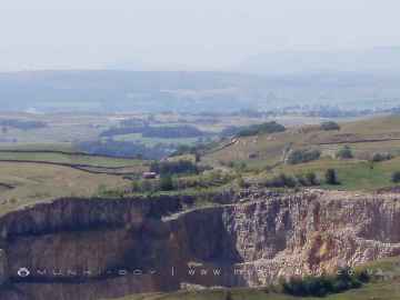
Hazlewood
Hazlewood is a Village in the county of North Yorkshire.
Hazlewood postcode: BD23 6JG
There are great places to visit near Hazlewood including some great waterfalls, ruins, historic monuments, hiking areas, villages, rivers and streams, towns, caves, limestone pavements, mountains, cities, historic buildings, hills, geological features, castles, old mines, country parks, parks, gardens and ancient sites.
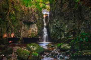
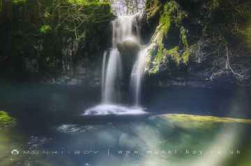
The area around Hazlewood features a number of interesting waterfalls including Catrigg Force, Lockin Garth Force, Whitfield Gill Force, Slape Wath Waterfall, Mill Gill Force, Cotter Force, and Aysgill Force.
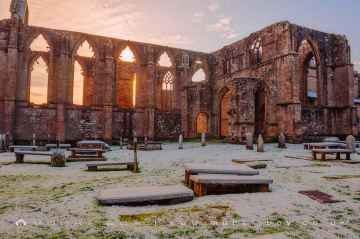
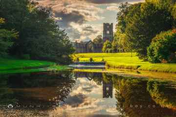
There are a several good ruins in the Hazlewood area like Bolton Abbey, Byland Abbey, Easby Abbey (ruin), Fountains Abbey and Studley Royal Water Garden, Fountains Abbey (ruin), Trig Point on Warrendale Knotts, and Old Limekiln at Blua Crags.
Bolton Abbey, Rylstone Crag and Rylstone Cross, Culloden Tower, and Robin Hood's Well (Fountains) are some of Hazlewood best historic monuments to visit near Hazlewood.
There are a number of hiking areas near Hazlewood including Deepdale, Cotterdale, Southerscales, Ingleton Waterfalls Trail, Swilla Glen, Baxenghyll Gorge, and Raven Ray.
There are a number of villages near Hazlewood including Pool-in-Wharfedale, Askrigg, Hardraw, West Burton, Bainbridge, Aysgarth, and Malham.
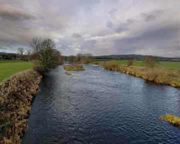
Whitfield Beck, Mill Gill, Hardraw Beck, River Wharfe, and Walden Beck at West Burton are great places to visit near Hazlewood if you like rivers and streams.
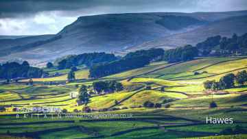
Hazlewood's best nearby towns can be found at Hawes, Skipton, Grassington, Richmond, Middlesbrough, Harrogate, and Settle.
Great Douk Cave, White Scar Cave, Yordas Cave, Gaping Gill, Janet's Cave, Horseshoe Cave, and Jubilee Cave are some of Hazlewood best caves to visit near Hazlewood.
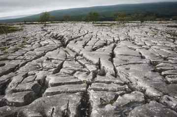
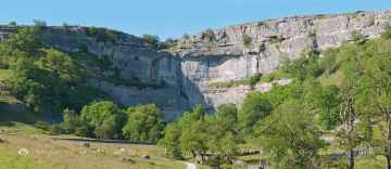
Southerscales, Malham Cove, and Warrendale Knotts Limestone Pavement are some of Hazlewood best limestone pavements to visit near Hazlewood.
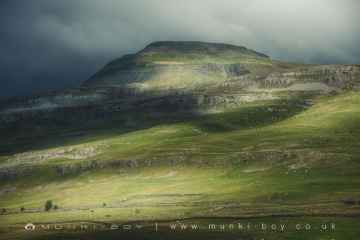
Mountains to visit near Hazlewood include Ingleborough.
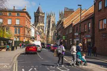
Hazlewood has some unmissable cities nearby like York, and Ripon.
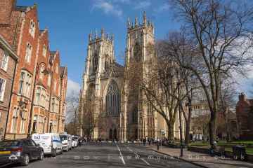
The area around Hazlewood boasts some of the best historic buildings including York Minster, Marton House, Culloden Tower, and Beggar’s Bridge.
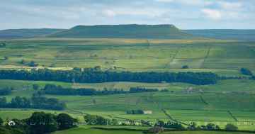
Addlebrough, Embsay Crag, Rylstone Crag and Rylstone Cross, Warrendale Knotts, Giggleswick Scar, Blua Crags, and Sugar Loaf Hill are some of Hazlewood best hills to visit near Hazlewood.
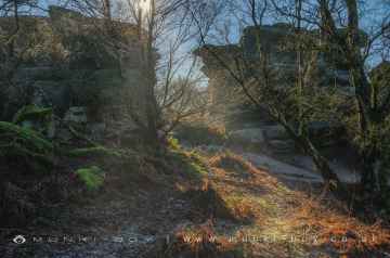
Malham Cove, Grassington Lead Mines, and Brimham Rocks are great places to visit near Hazlewood if you like geological features.
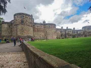
There are a several good castles in the Hazlewood area like Skipton Castle, Richmond Castle, and Bolton Castle.
The area around Hazlewood's best old mines can be found at Grassington Lead Mines.
Country Parks to visit near Hazlewood include Brimham Rocks.
The area around Hazlewood boasts some of the best parks including Fountains Abbey and Studley Royal Water Garden, Fountains Abbey (ruin), and Studley Royal Water Garden.
The area around Hazlewood's best gardens can be found at Fountains Abbey and Studley Royal Water Garden.
The area around Hazlewood boasts some of the best ancient sites including Schoolboys Tower, Jubilee Cave, and Victoria Cave.
Hazlewood History
There are some historic monuments around Hazlewood:
- Rock with at least five cup marks and a sinuous groove mark 615m NNE of Ridge Lathe, Pinder Hawes Hill, Skyreholme
- Rock with at least five cup marks on low ridge north of track on High Green, 220m ESE of Nussey Green Lathe, Skyreholme
- Rock with four cup marks near relict walling north of Dryas Dike 710m ESE of Wards End, Middleton Moor
- Thornhill's lead level, 500m north of Kiplings Cottage
- Two carved rocks on northern slope of ridge at Lanshaw overlooking Woofa Bank
- Cup marked rock on slope south of Green Crag Enclosure
- Round barrow 500ft (150m) NNW of Marchup Plantation in Parson's Lane
- Cup marked rock north of track at east end of Foldshaw Ridge, 470m SSE of the shooting shelter in Middleton Moor Enclosure
- Prominent rock with one cup mark at apex on ridge between Dryas Dike and Delves Beck 830m ESE of Blackhill House, Middleton Moor
- Carved rock with multiple rings in path above the Cow and Calf Hotel, 180m west of Highfield House
- Carved rock known as Pepperpot Rock and adjacent small carved rock west of West Rock and 215m south of White Wells
- Rock with at least 13 cup marks 645m NNE of Ridge Lathe, Pinder Hawes Hill, Skyreholme
- Large rock with single cup mark at point where path through Green Crag Enclosure reaches top of slope
- Rock with at least 30 cup marks, some joined by groove marks, near gate into Larnshaw from Forest Road, 420m north of High Lathe, Skyreholme
- Cup, ring and groove marked rock south of derelict wall on Bradley Moor, 70m south west of Low Edge Farm
- Rock with at least two cup marks at the east end of a group of rocks 40m south of the track from Black Hill Road to New Dam, High Green, Skyreholme
- Round Hill, round barrow 1/2 mile (800m) NNE of Upper Austby Farm
- Cup marked rock in enclosed pasture NNE of Black Pots
- Cup and ring marked rock on moor east of Gawk Stones
- Section of rubble walling east of Grammar School Cairn, on Cranshaw Thorn Hill
- Gatepost with cup marks and grooves 350m SSE of West Moor House, at side of road 500m west of Bow Beck
- Group of five carved rocks on the western ridge of Stanbury Hill
- Cup marked rock and cairn near path 775m ESE of Blackhill House, Middleton Moor
- Cup and groove marked rock 32m south west of wall near Stead Crag
- Carved rock in wall of grounds of Overdale Nursing Home
- Site of Roman Fort, Ilkley.
- Cup and ring marked rock 42m east of Rivock Edge triangulation pillar
- Five carved rocks near the edge of Rivock outcrop
- Three carved rocks near grouse butts on Foldshaw Ridge 870m ESE of Wards End, Middleton Moor
- Carved rock known as the Anvil Rock
- Carved rock near wall in pasture below Addingham Crag 290m south of Cragg House
- Rock with a complex design of small cup marks and shallow grooves south of Foldshaw Ridge, 440m south of the shooting shelter, Middleton Moor
- Recumbent gatepost with cup and ring carving 57m west of the Swastika Stone
- Late prehistoric enclosed settlement with an outlying bank and ditch on Counter Hill, 220m north east of Moorcock Hall
- Two carved rocks near Neb Stone
- Cup and ring marked rock below Brunthwaite Crag
- Cup marked rock 200m west of Cow and Calf Hotel
- Rock with many cup marks on ridge between Dryas Dike and Delves Beck 880m ESE of Blackhill House, Middleton Moor
- Cup and ring marked rock known as Langbar Rock 750m ENE of Wards End, Langbar Moor
- Fancarl Top stone circle
- Cup marked rock on slope, 480m ENE of the shooting shelter in Middleton Moor Enclosure
- Carved rock in a valley on south side of Cranshaw Thorn Hill 460m WSW of Gill Head Reservoir
- Rock with at least 14 cup marks 26m north of track from New Dam to Black Hill Road at east end of group of carved rocks on High Green, Skyreholme
- Cup, ring and groove marked rock west of the path between Black Hill and Loftshaw Gill, 300m NNE of the shooting shelter in Middleton Moor Enclosure
- Group of four carved rocks in Panorama Woods
- Rock in Panorama Woods with single cup and ring carving
- Carved rock at east end of disused rifle range
- Cup and groove marked rock on south slope of High Black Hill, 750m north of March Ghyll Reservoir, Middleton Moor Enclosure
- Carved rock between Backstone Beck and the path to Gillhead 365m south west of Gill Head Reservoir
- Rock with seven to eight cup marks north of Dryas Dike 720m ESE of Wards End, Middleton Moor
- Carved rock incorporated in and extending beyond outbuilding at Hardwick House Farm
- Large carved rock in the wall between grouse moor and forestry plantation on Rivock
- Rock with two deep cup marks north of track along Foldshaw Ridge, 460m south west of the shooting shelter, Middleton Moor
- Cup and groove-marked rock on Rivock, west of a deep channel
- Cup marked rock just within afforested area north east of wall on Rivock
- Cup and groove marked rock, 310m north east of the shooting shelter in Middleton Moor Enclosure
- Cup marked rock 230m south of and above White Wells
- Three carved rocks on Long Ridge 420m south east of Wards End, Middleton Moor
- Cairn at Rombalds Moor triangulation pillar
- Rock with shallow cup and ring-markings at the western end of the ridge on Stanbury Hill
- Five carved rocks grouped between Dryas Dike and Delves Beck 840m ESE of Blackhill House, Middleton Moor
- Large rock with single cup mark 130m south east of and overlooking Green Crag Enclosure
- Rock with cup marks 33m north east of Green Crag Enclosure
- Two carved rocks near wall 760m north east of Ridge Lathe, Burhill Kiln Allotment, Skyreholme
- Ring cairn on Kail Hill 380m north east of High Woodhouse.
- Carved rock on Cranshaw Thorn Hill above Ilkley Crags, 465m west of Gill Head Reservoir
- Cup and ring marked rock between Spicey Gill and the Ilkley-Keighley road
- Carved rock 70m south west of Gill Head Reservoir
- Carved rock 80m NNE of Badger Stone
- Carved rock south east of entrance to Silver Well Cottage
- Carved rock in strip of trees on north side of track from Stead to Burley in Wharfedale
- Cairn west of Craven Hall Hill
- Cup and Ring marked rock known as the Hanging Stone Rock
- Cairnfield with rubble banks and carved rocks above Stead Crag
- Large cup and ring marked rock in forestry furrows on Rivock
- Rock with at least two cup marks 660m north east of Ridge Lathe, Burhill Kiln Allotment, Skyreholme
- Rock with at least eight cups and two long grooves on ridge between Dryas Dike and Delves Beck 870m ESE of Blackhill House, Middleton Moor
- Partially quarried cup and groove marked rock between track and wall at east end of Foldshaw Ridge, 470m south of the shooting shelter, Middleton Moor
- Cup and ring marked rock below Addingham Crag
- Carved rock 110m north east of Badger Stone
- Enclosure with carved rocks and disturbed cairn known as Green Crag Enclosure
- Rock with seven cup marks enclosed by a groove south of Foldshaw Ridge, 490m south of shooting shelter, Middleton Moor
- Rock with single cup mark in forestry SSE of Black Pots
- Lime kiln and associated quarries 330m west of Toft Gate Farm
- Cup and groove marked rock on slope south of Delves Beck 870m east of Moor End Farm, Middleton Moor
- Rock with two cup marks south east of quarry at Cow and Calf Rocks
- Three carved rocks opposite St Margaret's Church
- Rock with at least four large cups and a groove north of Dryas Dike 800m ESE of Wards End, Middleton Moor
- Small cairn north east of large cairn on Hawksworth Moor
- Low Moor round barrow
- Carved rock on Cranshaw Thorn Hill above Ilkley Crags, 560m west of Gill Head Reservoir
- Cup and ring marked rock 90m WSW of Gill Head Reservoir
- Enclosed settlement containing three carved rocks known as Backstone Beck Enclosure
- Carved rock with rounded triangular profile 48m NNW of enclosure on Woofa Bank
- Cup, ring and groove marked rock on south slope of High Black Hill, 350m east of the shooting shelter in Middleton Moor Enclosure
- Ring cairn 430m south west of Wood End
- Cup marked rock near wall below Rivock Edge
- Carved rock known as the Swastika Stone
- Sam O'on Level and Panty O'on Stone, 200m NNE of Low Far Side
- Rock with two cup marks 500m ESE of New Dam, Burhill, Skyreholme
- Rock with single cup near wall at Stead Crag
- Cairn known as the Great Skirtful of Stones
- Cup marked rock 47m south east of Rivock Edge triangulation pillar
- Two cup marked rocks between Dryas Dike and Delves Beck 810m ESE of Blackhill House, Middleton Moor
- Cup marked rock lying 200m south of and above White Wells
- Cup and groove marked rock at west end of a group of carved rocks 30m north of track from New Dam to Black Hill Road, High Green, Skyreholme
- Small rock with four cup marks and a large hewn rock with one cupmark on Foldshaw Ridge 830m ESE of Wards End, Middleton Moor
- Cup, ring and groove marked rock at east end of the low ridge between Dryas Dike and Delves Beck 980m ESE of Wards End, Middleton Moor
- Small cup-marked rock on Stanbury Hill, 40m west of fork in path
- Cup and ring marked rock 370m SSW of Panorama Reservoir
- Rock with cup marks and short groove 740m ESE of Blackhill House, Middleton Moor
- Cup and ring marked rock at Lanshaw; easternmost of Lanshaw group
- Churchyard cross at the Church of St Peter
- Rock with one cup mark in track at east end of Foldshaw Ridge, 480m SSE of the shooting shelter in Middleton Moor Enclosure
- Carved rock and associated prehistoric walling above Backstone Beck, 200 WNW of Gill Head Reservoir
- Cup and ring-marked rock north east of a wall junction on the southern flank of Rivock
- Enclosures, small cairnfield and carved rocks on Pancake Ridge
- Carved rock next to the drive of Overdale Nursing Home
- Two cup marked rocks 220m west of Highfield House
- Stone circle, Mossy Moor Ridge
- Cup and ring marked rock between track and grouse butt north of Dryas Dike, 620m south of the shooting shelter, Middleton Moor
- Rock with at least 24 cup marks, many interconnected by groove marks, 345m north west of High Lathe, Burnetts Ridge, Skyreholme
- Rock with three cupmarks west of West Rock and 225m south of White Wells
- Barden Tower medieval fortified house and medieval garden earthworks
- Two carved rocks at the west corner of Raven Stones Plantation on Rocking Moor, 400m west of Brae
- Enclosure on Woofa Bank with 11 carved rocks and one upright stone
- Cup and ring marked rock 150m west of Low Edge Farm, Bradley Moor
- Rock with a complex pattern of cup, ring and groove marks, 755m NNE of Ridge Lathe, Burhill Kiln Allotment, Skyreholme
- Cairn and carved rock on High Black Hill, 410m ENE of the shooting shelter in Middleton Moor Enclosure
- Large carved rock at hill top, north east of line of stone grouse butts on Rivock
- Six carved rocks in field west of Riddlesden Golf Course
- Cairn known as the Little Skirtful of Stones
- Carved rock and two cairns 180m ESE of the shooting shelter, Middleton Moor Enclosure
- Cup marked rock 39m south east of entrance to Silver Well Cottage
- Large flat rock with single cup mark 20m north west of enclosure on Woofa Bank
- Enclosure 50m north east of Horncliff Slade on Hawksworth Moor
- Carved rock 100m north east of eastern Grainings Head Quarry
- Churchyard cross, Burnsall
- Cup and ring marked rock 10m south of West Rock
- Rock with five cups near Haystack Rock
- Rock with parallel grooves 95m west of flag post on Craven Hall Hill
- Rock with three cup marks 150m south west of Black Beck Hole
- Cup marked rock in field south of Stead Hall Farm
- Cairnfield with linear banks and carved rocks stretching from Woofa Bank to Green Crag
- Two cup and ring marked rocks in conifer plantation on Rivock
- Two adjacent carved rocks and associated rubble bank at top of ridge at Lanshaw overlooking Woofa Bank
- Rock with one cup mark 860m ENE of Wards End, Langbar Moor
- Large cup marked rock west of Green Crag Enclosure
- Split and hewn cup-marked rock north of a wall junction on Rivock
- Cup and ring marked rock between Keighley Gate and Silver Well Cottage
- Two fragments of carved bedrock east of Crocodile Rock, near west end of Hangingstones Quarry
- Cup marked rock in forestry furrow on Rivock
- Rock with two large cup marks on slope west of enclosure on Woofa Bank
- Grooved rock on slope at Lanshaw
- A group of seven carved rocks and four small cairns, south of Eller Edge Nook and 730m ENE of High Lathe, Skyreholme
- Cup and ring marked rock next to wall NNW of Black Pots
- Rock with cup marks and long groove 750m ESE of Blackhill House, Middleton Moor
- Cup marked rock 14m from the wall on the unforested plateau at Rivock
- Cup marked rock east of entrance to Silver Well Cottage
- Carved rock known as the Badger Stone
- Cup marked rock between Doubler Stones and Gawk Stones
- Cup and ring marked rock known as Piper Crag Stone
- Late prehistoric enclosed settlement known as Round Dykes Camp on Addingham Low Moor
- Cup and ring marked rock overlooking bend in Ilkley-Keighley road, 185m south east of Neb Stone
- Cup marked rock with triangular groove 75m east of enclosure on Woofa Bank
- Cup marked rock 1m from wall on unforested plateau at Rivock
- Anglo-Saxon cemetery and medieval manorial centre including fishponds and part of the open field system adjacent to St Peter's Church
- Devil's Apronful cairn
- Two prominent cup marked rock outcrops known as Doubler Stones
- Rock with dense concentration of cup marks on Stanbury Hill
- Cup and ring marked rock 12.5m from drainage cut NNE of Black Pots
- Prominent cup-marked rock east of track, north east of Stanbury Hill
- Cup-marked rock in stone quarry on Stocks Hill
- Large carved boulder on eminence between two streams east of Barmishaw Well
- Rock with many cup marks and one groove between Dryas Dike and Delves Beck 910m ESE of Blackhill House, Middleton Moor
- Rock with cup marks in south east face near grouse butts on Foldshaw Ridge 860m ESE of Wards End, Middleton Moor
- Medieval settlement and part of the open field system immediately south of Myddleton Lodge
- Striated cup marked rock 20m west of enclosure on Woofa Bank
- Grubstones stone circle
- Bolton Priory
- Two cup marked rocks in path south east of quarry at Cow and Calf Rocks
- Twelve Apostles stone circle, Burley Moor
- Rock with one large cup mark on the south slope of High Black Hill, 330m east of the shooting shelter in Middleton Moor Enclosure
- Two carved rocks, one dome-shaped and one ridged, near grouse butts on Foldshaw Ridge 880m ESE of Wards End, Middleton Moor
- Low rock with one cup on unforested plateau at Rivock
- Cup and ring marked rock known as the Sepulchre Stone, Addingham Moorside
- Cup and groove marked rock on flat ground south of Foldshaw Ridge, 510m SSW of the shooting shelter, Middleton Moor
- Cairn on Hawksworth Moor; largest one of a group of cairns
- Rock with 30 to 40 cup marks and some groove marks in the wall at the west side of Black Hill Road, 610m ESE of New Dam, Skyreholme
- Cairnfield, carved rocks and associated curved bank at north west end of Green Crag Slack, east of Gill Head Reservoir
- Cup and groove marked rock near grouse butts on Foldshaw Ridge 905m ESE of Wards End, Middleton Moor
- Prominent cup and ring marked rock on Coarse Stone Edge
- Cup and ring marked rock 300m NNW of Gill Head Reservoir
- Two cup marked rocks 40m north of track from New Dam to Black Hill Road at centre of group of carved rocks at High Green, Skyreholme
- Ring cairn 90m ESE of the Great Skirtful of Stones
- Small cairn and carved rock on ridge at Lanshaw overlooking Woofa Bank
- Cup and ring marked rock 350m SSW of Panorama Reservoir
- Cup, ring and groove marked rock near ford across Whinthorn Ridge Gill in Middleton Moor Enclosure, 430m NNE of March Ghyll Reservoir
- Westernmost of two carved rocks under Green Crag west of gas pipeline
- Large rock with cup marks and cup and ring on Foldshaw Ridge 810m ESE of Wards End, Middleton Moor
- Carved rock 80m east of Green Crag Enclosure
- Cup and ring marked rock 340m east of Badger Stone
- Carved rock known as Planets Rock 180m north east of the Gill Head Reservoir
- Two cup marked rocks forming part of a group of prominent rocks known as Raven Stones on Rocking Moor, 500m WSW of Brae
- Cup marked rock 19m above forestry track in Rivock conifer plantation
- Cairn on west flank of High Black Hill, 210m ENE of the shooting shelter in Middleton Moor Enclosure
- Cup and ring marked rock at Lanshaw; 1km WSW of High Cragg Farm
- Enclosure, fieldwalls and cairnfield, including seven carved rocks and an upright stone.
- Carved rock known as the Barmishaw Stone
- Ring cairn 475m south east of the Great Skirtful of Stones
- Small cup marked rock at eastern edge of a hollow 125m south east of the enclosure on Woofa Bank
- Cup marked rock on low knoll west of and overlooking Cow and Calf Hotel
- Old Bridge
- Flat carved rock 150m south west of Silver Well Cottage
- Grooved rock and cup and ring marked rock 420m east of Badger Stone
- Two cairns on Hawksworth Moor, one with an internal cist
- Cup marked rock and small cairn between Dryas Dike and Foldshaw Ridge 730m ESE of Wards End, Middleton Moor
Places to see near Hazlewood
Lakes near Hazlewood
Canals near Hazlewood
Rivers near Hazlewood
- Stainsby Beck Catchment (trib of Tidal Tees)
- Bishopton Beck from Source to Billingham Beck
- North Burn from Source to Claxton Beck
- Billingham Beck from Brierley Beck to Tees Es
- Lustrum Beck Catchment (trib of Tees)
- Tees Estuary (S Bank)
- Neasham Stell Catchment (trib of Tees)
- Billingham Beck from Bishopton Bck to Brierle
- Spa Beck Catchment (trib of Tees)
- Greatham Beck Catchment (trib of Tidal Tees)
- Cowbridge Beck from Source to North Burn
- Claxton Beck from Source to North Burn
- Brierley beck from Source to Billingham Beck
- Billingham Beck from Source to Bishopton Beck
- Tees from Skerne to Tidal Limit
- Marton West Beck Catchment (trib of Tidal Tees)
- Hart Beck from Source to Sea (Hartlepool)
- Saltergill Beck Catchment (trib of Tees)
- Potto Beck Catchment (trib of Leven)
- Tame from Source to Leven
- Grange Beck Catchment (trib of Leven)
- Broughton Beck from Source to River Leven
- Leven from Tame to River Tees
- Leven from Source to Tame
- Kilton Beck from Source to Middle Gill Beck
- Mill Beck from Source to Kilton Beck
- Skelton Beck Catch (Saltburn) trib of North Sea
- Saltburn Gill Catch trib of North Sea
- Middle Gill Beck from Source to Kilton Beck
- Kilton Beck from Middle Gill Beck to North Sea
- Green Field Beck from Source to River Wharfe
- Cowside Beck from Source to River Skirfare
- Park Gill Beck from Source to River Wharfe
- Linton Beck Catchament (Trib of Wharfe)
- Oughtershaw Beck from Source to River Wharfe
- Skirfare from Cowside Beck to River Wharfe
- Skirfare from Source to Heselden Beck
- Wharfe from Park Gill Bk to Barben Beck/River Dibb
- Hesleden Bk from Source to River Skirfare
- Wharfe from Oughtershaw Beck to Park Gill Beck
- Hebden Beck Catchment (trib of Wharfe)
- Barben Beck/River Dibb Catchment (trib of Wharfe)
- Skirfare from Heselden Beck to Cowside Beck
- Wharfe from Hundwith Beck to River Washburn
- Wharfe from Barben Beck/River Dibb to Hundwith Beck
- Hambleton Beck/Ings Bk Catch (trib of Wharfe)
- Wharfe from R Washburn to Collingham Beck
- Washburn Spinksburn Bk (Swinsty Res) to Wharfe
- Kex Beck Catchment (trib of Wharfe)
- Barden Beck Catchment (trib of Wharfe)
- Riffa Beck/West Beck Catch (trib of Wharfe)
- Fir Beck/Blands Beck Catchment (trib of Wharfe)
- Weeton Beck catchment (trib of Wharfe)
- Collingham Bk Catchment (trib of Wharfe)
- Spinksburn Bk Source to Washburn (Swinsty)
- Stank Beck catchment (trib of Wharfe)
- Washburn Source to Spinksburn Bk (Swinsty Res)
- The Fleet/The Foss from Source to R Wharfe
- The Foss Catchment (trib of Wharfe)
- Wharfe from Tadcaster Weir to River Ouse
- Cock Beck Catchment (trib of Wharfe)
- Wharfe from Collingham Beck to Tadcaster Weir
- Dorts Dike Catchment (trib of Wharfe)
- Thorner Beck Catchment (trib of Wharfe)
- Staithes Beck from Source to Newton Beck
- Newton Beck from Source to Staithes Beck
- Sandsend Beck/Mickley Bk from Source to North Sea
- East Row Beck from Source to North Sea
- Esk from Baysdale Beck to Sleddale Beck
- Baysdale Beck from Source to River Esk
- Esk from Source to Baysdale Beck
- Murk Esk from Wheeldale Gill to Eller Beck
- Murk Esk from Source to Wheeldale Gill
- Great Fryup Beck Catchment (trib of Esk)
- Glaisdale Beck catchment (trib of Esk)
- Danby Beck catchement (trib of Esk)
- Murk Esk from Eller Beck to River Esk
- Rigg Mill Bk/Long Mill Bk catch (trib of Esk)
- Little Beck/May Beck catchment (trib of Esk)
- Little Beck/May Beck catchment (trib of Esk)
- Eller beck from Source to Murk Esk
- Sleddale Beck from Source to River Esk
- Stonegate Beck catchment (trib of Esk)
- Esk from Sleddale Beck to Ruswarp
- Wheeldale Gill from Source to Murk Esk
- Hayburn Beck/Thorny Beck catch (drains to N Sea)
- Swale from Clapgate Beck to Bedale Beck
- Sand Beck from Source to River Swale
- Healam Beck from Burniston Bk to River Swale
- Bedale/Newton/Burton Bk from Rand Bk to R Swale
- Scurf Beck from Source to Bedale Beck
- Scorton Beck from Source to River Swale
- Brompton Bk from Source to Newton Bk
- Ings Goit from Source to Burneston Beck
- Skeeby/Holme/Dalton Bk from Source to River Swale
- Brough Bk/Scotton Bk from Source to River Swale
- Bedale/Newton/Burton Bk from Source to Brompton Bk
- Colburn Beck/Risedale Bk from Source to R Swale
- Old Stell Catchment (trib of Bedale Beck)
- Bedale/Newton/Burton Bk - Brompton Bk to Rand
- The Stell/Rawcar Beck from Source to River Swale
- Swale from Bedale Beck to River Wiske
- Laver from Carlesmoor Beck to Kex Beck
- Ouse from River Ure to River Nidd
- Tutt Catchment (Trib of Ure)
- Holbeck Catchment
- Ure from River Tutt to River Swale
- Burn from Source to Leighton Beck
- Ure from River Skell to River Tutt
- Carlesmoor Beck from Source to River Laver
- Leighton Beck from Source to River Burn
- Laver from Source to Carlexmoor Beck
- Ouse from Source to River Ure
- Kex Beck and the Laver
- Skell from Source to River Laver
- Skell from River Laver to River Ure
- Burn from Leighton Beck to River Ure
- Ure from Thornton Steward Beck to River Skell
- Holgate Beck to Ouse
- Alne Beck from Source to River Kyle
- Hurns Gutterfrom Source to River Ouse
- The Foss
- Huby Burn from Source to New Parks Beck
- Derrings Beck from Source to River Kyle
- New Parks Beck from Huby Burn to River Kyle
- Kyle from Alne Beck to Derrings Beck
- Linton on Ouse Airefield catch (trib of Kyle)
- Kyle from Source to Alne Beck
- New Parks Beck from Source to Huby Burn
- Kyle from New Parks Beck to River Ouse
- Kyle from Derrings Beck to New Parks Beck
- Foss Dike
- Ouse from River Nidd to Stillingfleet Beck
- Beldon Beck catch (trib of Apedale Beck)
- Cotterdale Beck from Source to River Ure
- Walden Beck from Source to Bishopdale Beck
- Ure from Duerley Beck to Mill Beck
- Duerley Beck from Source to River Ure
- Bishopdale Bk from Source to R Ure
- Apedale Beck Catch (trib of River Ure)
- Widdale Beck from Source to Snaizeholme Beck
- Ure from Widdale Beck to Duerley Beck
- Ure from Source to Widdale Beck
- Ure from Mill Beck to Thornton Steward Beck
- Bain/Raydale Beck Catch (trib of Ure)
- Coverdale Catch (Trib of Ure)
- Coghill Beck Catch (trib of Ure)
- Snaizeholme Beck from Source to Widdale Beck
- Widdale Beck from Source to River Ure
- Fossdale Gill from Source to River Ure
- Swale from Muker Beck to Clapgate Beck
- Swale from Stonesdale Bk tp Muker Bk
- Marske Beck from Source to River Swale
- Arkle Beck from Source to River Swale
- Muker Beck Catchment from Source to River Swale
- Stonesdale Bk from Source to River Swale
- Gunnerside Gill from Source to River Swale
- Swale from Whitsundale Bk to Stonesdale Bk
- Barney Bk/Hard Level Gill from Source to R Swale
- Birkdale Beck from Souce to River Swale
- Whitsundale Beck from Source to River Swale
- Swale Birkdale/Gt Sleddale Bks to Whitsundale Bk
- Great Sleddale Beck from Source to River Swale
- Gill Beck/Black Beck from Source to River Swale
- Foss from Farlington Beck to the Syke
- Foss from Source to Farlington Beck
- The Syke from Source to River Foss
- Tang Hall Bk/Old Foss Bk catch, trib of River Foss
- Farlington Beck from Source to River Foss
- Foss from the Syke to the River Ouse
- Willow Beck Catchment (trib of Wiske)
- Otterington Beck catchment (trib of Wiske)
- Trenholme Stell from Source to River Wiske
- Wiske from Source to Trenholme Stell
- Wiske from Trenholme Stell to River Swale
- Sike Stell catch (trib of Wiske)
- Cundall Beck/Soppa Gutter Catch (trib of Swale)
- Swale from Wiske to River Ure
- Willow/Isle/Sutton Bks Catchment (Trib of Cod Bk)
- Cod Beck from Broad Beck to Spital Beck
- Spital Beck from Source to Cod Beck
- Paradise Beck catchment (trib of Cod Beck)
- Birdforth/Green's Bks Catch (trib of Swale)
- Cod Beck from Source to Broad Beck
- Cod Beck from Spital Beck to River Swale
- Broad Beck from Source to Cod Beck
- Borough Beck
- Seven from source to Hartoft Beck
- Little Beck from Source to River Seven
- Rye from River Seven to River Derwent
- White Beck catchment (trib of Rye)
- Rye from River Seph to Holbeck
- Hodge Beck from Source to River Dove
- Raisdale Beck from Source to River Seph
- Walmouth Beck from Source to River Riccal
- Bonfield Gill from Source to River Riccal
- Pickering Beck from Source to Costa Beck
- Redbridge Sewer
- Rye from Source to River Seph
- Hartoft Beck from Source to River Seven
- Costa Beck from Pickering Beck to R Rye/Ackland Beck
- Seph from Source to Ledge Beck
- Levisham Beck from Source to Pickering Beck
- Rye from Holbeck to River Seven
- Seven from Catter Beck to River Rye
- Seven from Hartoft Beck to Little Beck
- Marrs Beck from Source to Holbeck
- Dove from Source to Hodge Beck
- Riccal from Bogmire Gill to R Rye
- Spring Wood Catchment (Trib of Rye)
- Bogmire Gill from Source to River Riccal
- Seven from Little Beck to Catter Beck
- Dove from Hodge Beck to River Rye
- Ledge Beck from Source to River Seph
- Wath Beck from Souce to Holbeck
- Costa Beck from Source to Pickering Beck
- Seph from Ledge Beck to River Rye
- Pickering Beck from Source to Levisham Beck
- Catter Beck/Hutton Beck from source to River Seven
- Gundale Beck
- Sledhill Gill
- Holbeck from Source to Wath Beck
- Settrington Beck catch (trib of Derwent)
- Derwent from Kirkham to Elvington Beck
- Cram Beck catch (trib of Derwent)
- Barlam/Skirpen Beck catch (trib of Derwent)
- Menethorpe Beck catch (trib of Derwent)
- Derwent from River Rye to Kirkham
- Spittle/Bulmer/Ings Becks catch (trib of Derwent)
- Fen Beck
- Kettles Beck
- Austwick beck
- Hindburn
- Wenning - Lower
- Keasden Beck
- Wenning - Upper
- Roeburn
- Clapham Beck


