Inverarnie
Inverarnie is a Village in the county of Highland.
Inverarnie postcode: IV2 6XA
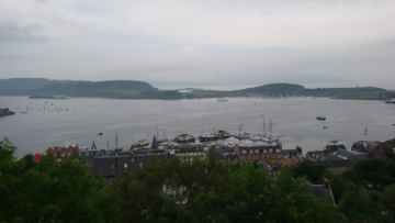
There are great places to visit near Inverarnie including some great towns, mountains and lakes.
Towns to visit near Inverarnie include Fort William.
The area around Inverarnie's best mountains can be found at Ben Nevis (Beinn Nibheis).
Lakes to visit near Inverarnie include Loch Linnhe.
Inverarnie History
There are some historic monuments around Inverarnie:
- Carn Glas, chambered cairns 815m SE of Achvraid Prehistoric ritual and funerary: chambered cairn SM2392
- An Bathach, promontory fort 300m ENE of Prehistoric domestic and defensive: fort (includes hill and promontory fort) SM11879
- Culchunaig, cairn and standing stone 300m SE of Prehistoric ritual and funerary: cairn (type uncertain) SM3070
- Milton of Clava, chapel and standing stone 255m SSW of Ecclesiastical: chapel; Prehistoric ritual and funerary: standing stone SM13652
- Milton of Tordarroch, fort 800m S of Prehistoric domestic and defensive: fort (includes hill and promontory fort); Secular: shieling SM11550
- Baile na Creige, cairns 185m SSW and 175m SSE of Prehistoric ritual and funerary: cairn (type uncertain) SM11552
- Depopulated township, 400m SE of Balloan Secular: settlement, including deserted, depopulated and townships SM11549
- Bogbain Wood, hut circle and field system 400m SSW of Bogbain Farm Prehistoric domestic and defensive: field or field system SM4698
- Milton of Clava, cairn 215m SSW of Prehistoric ritual and funerary: cairn (type uncertain) SM13650
- Daviot Castle Secular: castle SM5486
- Mains of Daviot Farm, ring cairn and stone circle 600m NNE of Prehistoric ritual and funerary: ring cairn SM3085
- Craig Phadrig,fort Prehistoric domestic and defensive: fort (includes hill and promontory fort) SM2892
- Mid Craggie, cairn 90m E of Prehistoric ritual and funerary: kerb cairn SM11417
- Stonehenge House, chambered cairn 20m WNW of Prehistoric ritual and funerary: chambered cairn SM11548
- West Croachy House, cairns 1000m ESE of Prehistoric domestic and defensive: field clearance cairn, cairnfield; Prehistoric ritual and funerary: cairn (type uncertain) SM11433
- Balnafoich, cupmarks 320m SSW of Prehistoric ritual and funerary: cupmarks or cup-and-ring marks and similar rock art SM11557
- Shenval, settlement Secular: settlement, including deserted, depopulated and townships SM11434
- Mains of Gask,ring cairn and standing stones 130m SSW of Prehistoric ritual and funerary: ring cairn SM4651
- Tullich, settlements 760m NNE of Secular: settlement, including deserted, depopulated and townships SM11613
- Midtown, burnt mounds 850m NNE of Prehistoric domestic and defensive: burnt mound SM11553
- Glen Nairn, hut circle 270m ENE of Prehistoric domestic and defensive: hut circle, roundhouse SM11544
- Ashton Farm Cottages, ring ditch 415m SW and pit circles 460m WSW of Prehistoric domestic and defensive: hut circle, roundhouse SM11535
- Dun Davie,fort Prehistoric domestic and defensive: fort (includes hill and promontory fort) SM3301
- Braeval Farm, cupmarks 260m NNW of Prehistoric ritual and funerary: cupmarks or cup-and-ring marks and similar rock art SM11796
- Druid Temple Farm, chambered cairn and stone circle 230m WSW of Prehistoric ritual and funerary: chambered cairn SM2417
- Brin Nursery, barrow cemetery 70m NNW of Prehistoric ritual and funerary: barrow SM11495
- Culdoich, ring cairn 490m NW of Prehistoric ritual and funerary: ring cairn SM3091
- Holme Mains, motte 210m SE of Secular: motte SM3078
- Torbreck, stone circle SW of Prehistoric ritual and funerary: stone circle or ring SM3098
- Clachandruim, three hut circles 540m, 680m and 750m WSW of Prehistoric domestic and defensive: hut circle, roundhouse SM11543
- Torvean,motte 270m N of Torvean Croft Secular: motte SM3806
- Mains of Aberarder, hut circle 1145m ESE of Prehistoric domestic and defensive: hut circle, roundhouse SM11542
- Daltullich House, enclosure 245m NE of Prehistoric domestic and defensive: enclosure (domestic or defensive) SM11533
- Achvraid, hut circles 1030m SSE of Prehistoric domestic and defensive: hut circle, roundhouse SM11561
- Achvraid, hut circles 800m SE of Prehistoric domestic and defensive: hut circle, roundhouse SM11786
- Tordarroch, cupmarks 220m NE of Prehistoric ritual and funerary: cupmarks or cup-and-ring marks and similar rock art SM11558
- Milton of Farr, cupmarks 110m SE of Prehistoric ritual and funerary: cupmarks or cup-and-ring marks and similar rock art SM11556
- Dhuallow, cairn 195m E of Prehistoric ritual and funerary: cairn (type uncertain) SM11468
- Creagan an Tuirc, fort Prehistoric domestic and defensive: fort (includes hill and promontory fort) SM11493
- Craggie Cottage, settlement cairns and field system 600m SW of Prehistoric domestic and defensive: field or field system; Prehistoric ritual and funerary: kerb cairn SM4712
- Loch Ruthven, crannog 490m SSW of Tullich Prehistoric domestic and defensive: crannog SM11490
- Tordarroch, ring cairn 250m E of Prehistoric ritual and funerary: ring cairn SM11559
- Culloden Battlefield, Graves of the Clans, Cairn and Well of the Dead Secular: Culloden monuments SM967
- Inverness, site of Dominican friary and effigy of a knight, Friars' Street Ecclesiastical: friary SM6402
- Lower Slackbuie, unenclosed settlement 90m E of 1 West Heather Road Prehistoric domestic and defensive: settlement SM5218
- Ballaggan, mound 420m WNW of Prehistoric ritual and funerary: cairn (type uncertain) SM11900
- Mid Lairgs, bridge and military road 200m SSE of Secular: bridge SM11525