Hardley
Hardley is a Village in the county of Hampshire.
Hardley postcode: SO45 2QZ
There are great places to visit near Hardley including some great cities, villages, lakes, towns, historic buildings, shopping centres and airports.
Portsmouth, and Winchester are some of Hardley best cities to visit near Hardley.
Hardley has some unmissable villages nearby like Southwick, Milford-on-Sea, and Hambledon.
Southwick Park Lake is a great place to visit close to Hardley if you like lakes.
Towns to visit near Hardley include Aldershot, Lymington, Gosport, Basingstoke, and Southampton.
Historic Buildings to visit near Hardley include Fort Blockhouse.
There are a number of shopping centres near Hardley including The Malls - Basingstoke, and Westquay.
Airports to visit near Hardley include Southampton Airport, and Blackbushe Airport.
Hardley History
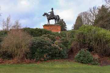
There are some historic monuments around Hardley:
- Castle wall
- Row Down round barrow cemetery
- The 'Undercroft', Simnel Street
- Vault under Head Post Office
- Vaults on the W side of French Street
- Three bowl barrows 420m south-west of Pitts Copse Farm forming part of the Beaulieu Heath round barrow cemetery
- Bowl barrow 220m north-east of Stonyford Pond
- Town wall: the West Gate
- Bowl barrow 630m north of Hardley Bridge
- Conduit head, Commercial Road
- Town wall: the Water Gate, High Street
- Quilter's and adjoining vaults in High Street
- Bowl barrow 280m north-east of Harford House
- Castle (part of)
- Bitterne (Clausentum) Roman station
- Netley Abbey
- Bowl barrow 700m west of Foxhill Farm. Part of Foxhill round barrow cemetery
- Town wall: the Bar Gate
- Castle Gateway, Castle Lane
- Roman piers and revetment in the River Itchen
- St Denys Priory (remains of)
- Bowl barrow and length of field boundary on Peaked Hill, 440m south-west of East Boldre Vicarage
- Seven bowl barrows and a bell barrow 460m south-west of Foxhill Farm. Part of Foxhill round barrow cemetery
- Two bell barrows 820m south of Stonyford Pond
- Town wall: section between Simnal Street and the site of the Bugle Tower excluding the West Gate
- Bowl barrow 250m north-east of Hardley Bridge
- Town wall: section from Bargate E and including Polymond Tower
- Bowl barrow 200m west of Moorgreen House
- Bowl barrow on Peaked Hill, 620m west of East Boldre Vicarage
- Hickley Wood hillfort
- Eastern aqueduct and the water catchment area of a western aqueduct, at Netley Abbey
- Lankasters vault, High Street
- Round barrow cemetery comprising six bowl barrows north-west of King's Hat Inclosure
- Redbridge old bridges
- Vault at corner of St Michael's Square and West Street
- Two bowl barrows at Gurnetfields Furzebrake
- Bowl barrow north of Ferny Crofts
- Five round barrows 460m east of Stonyford Pond: part of the Beaulieu Heath round barrow cemetery
- Bowl barrow 240m north-west of Harford House
- Bowl barrow 740m west of Foxhill Farm. Part of Foxhill round barrow cemetery
- Bowl barrow 540m north of Otterwood Farm
- Western aqueduct near Netley Abbey
- Bowl barrow 400m south of Stonyford Pond
- Bowl barrow 520m north-west of Hatchett Gate
- Bowl barrow 340m east of Harford House
- Well House
- Town wall: section from 75yds (70m) E of Arundel Tower to limit of castle site including Arundel and Catchcold Towers
- Vault SW of Gloucester Square
- Bowl barrow in Fawley Inclosure
- Telegraph Woods beacon, 170m north of Fir Cottage
- Medieval merchant's house and associated deposits at 58 French Street
- Bowl barrow 480m west of Glydia Farm
- Bowl barrow 610m east of Stonyford Pond forming part of the Beaulieu Heath round barrow cemetery
- Bowl barrow 560m ENE of Pottern Ford
- Beaulieu Abbey
- The Tudor House, St Michael's Square
- Cutthorn
- Vault under St Michael's Parish Hall, St Michael's Square
- Barn, remains of, at St Leonards Grange
- Bowl barrow 530m southwest of Foxhill Farm. Part of Foxhill round barrow cemetery
- The Weigh House, French Street
- Bell barrow 360m south-west of Ipers Bridge Farm
- Three bowl barrows 560m north of Otterwood Farm
- St Leonards Chapel (remains of)
- Roman road on eastern edge of Beaulieu Heath, 220m north east of Hardley Bridge Ford
- Promontory defined by an Iron Age linear earthwork, St Andrew's Castle and additional remains on Hamble Common
- Canute's Palace, Porters Lane
- Netley Abbey; precinct wall and moat
- Bowl barrow 250m north-west of Flash Pond
- Site of Norman town house in curtilage of St Michael's House
- Bowl barrow on Yew Tree Heath
- Town wall: remains of E side of town wall S of East Street and N of Gods House Tower
- Town wall: Gods House Gate and Tower
- Bowl barrow on Peaked Hill, 550m west of East Boldre Vicarage
- Bowl barrow 600m west-north-west of Hatchett Gate
- Bowl barrow 100m north-east of Ipley crossroads
- Redbridge old bridges
- Two bell barrows, two bowl barrows and a short length of field boundary south-east of The Noads
- Netley Castle
- 'King John's Palace'
- Bowl barrow 260m north of Stonyford Pond
- Bowl barrow 300m west of Hatchett Gate
- Bowl barrow 600m south-west of Stonyford Pond
- Vault on N side of St Michael's Square
- Vault in High Street opposite Gloucester Square
- Vault under 8 St Michael's Square
- Bowl barrow 620m west of Foxhill Farm. Part of the Foxhill round barrow cemetery
- Bowl barrow 720m south-west of Stonyford Pond
- Bowl barrow 360m west of Pitts Copse farm forming part of Beaulieu Heath round barrow cemetery
- Bowl barrow 560m south-west of Stonyford Pond
- Bowl barrow 660m west of Foxhill Farm. Part of Foxhill round barrow cemetery.
- Bowl barrow 570m west of Foxhill Farm. Part of Foxhill Round barrow cemetery.
- Bowl barrow 220m east of Rowbarrow Pond
- Conduit head, Hill Lane
- Holy Rood Church
- Vault adjoining St Michael's Church
- Bowl barrow 660m south-west of Pitts Copse Farm
- Bowl barrow 980m north-west of Hatchett Gate
- Moated site, fishponds and associated settlement site, 200m west of Holbury Manor
- Two bowl barrows 500m south west of Foxhill Farm. Part of Foxhill round barrow cemetery
- Vault S of junction of High Street and Castle Way
- Bowl barrow 400m north of Hardley Bridge
- Vaults under school playground, French Street
- Town wall: section between Bugle Street and Bugle Tower
- Calshot Castle: a 16th century artillery castle
Places to see near Hardley
Lakes near Hardley
Canals near Hardley
Rivers near Hardley
- Teffont
- Hampshire Avon (Upper) d/s Nine Mile River confl
- Nadder Trib (Swallowcliffe)
- Nadder (Middle)
- Linford Brook
- Hampshire Avon (Upper) u/s Nine Mile River confl
- Ripley Brook
- Ebble (Upper)
- Till (Hampshire Avon)
- Nadder (Headwaters)
- Clockhouse Stream
- Bisterne Stream
- Bourne (Hampshire Avon)
- Sem
- Ashford Water (Allen River)
- Etchilhampton Water
- Nine Mile River
- Wylye (Headwaters)
- Wylye (Middle)
- Wylye Trib (The Were or Swan)
- Ebble
- Ditchend Brook
- Hampshire Avon (West)
- Mude
- Chitterne Brook
- Nadder (Upper)
- Nadder (Lower)
- Sweatfords Water
- Wylye Trib (Heytesbury Stream)
- Hampshire Avon (East) and Woodborough Stream
- Huckles Brook
- Dockens Water
- Sleep Brook
- Hampshire Avon (Lower)
- Fonthill Stream
- Wylye (Lower)
- Hampshire Avon (East) and Deane Water
- Fovant Brook
- Penwood Stream
- Enborne (downstream A34 to Burghclere Brook)
- Lower Enborne
- Middle Kennet (Marlborough to Hungerford)
- Shalbourne (source to Kennet at Hungerford)
- Kingsclere Brook (Source to Enborne)
- Inkpen Stream (source to Kennet)
- Holy Brook
- Earlstone Stream and Burghclere Brook (source to Enborne)
- Winterbourne
- Froxfield Stream
- Clayhill Brook
- Enborne (Burghclere Brook to Kingsclere Brook)
- Upper Dun
- Og
- Kennet (Lambourn confluence to Enborne confluence)
- Kennet and Holy Brook
- Middle Kennet (Hungerford to Newbury)
- Upper Kennet to Marlborough
- Burghfield Brook
- Aldbourne
- Baughurst Brook
- West End Brook (tributary of Foudry Brook)
- Silchester Brook
- Lambourn (Source to Newbury)
- Enborne (Source to downstream A34)
- Foudry Brook (West End Brook to M4)
- Kennet and Avon Canal and Dun above Hungerford
- Ecchinswell Brook (source to Enborne)
- Vyne Stream
- Hart (Elvetham to Hartley Wintney)
- Cove Brook
- Whitewater
- Loddon (Swallowfield to River Thames confluence)
- Barkham Brook
- Loddon (Sherfield on Loddon to Swallowfield)
- Blackwater (Aldershot to Cove Brook confluence at Hawley)
- Blackwater (Bramshill to River Loddon confluence at Swallowfield)
- Emm Brook
- Blackwater (Hawley to Whitewater confluence at Bramshill)
- Fleet Brook
- Lyde
- Hart (Crondall to Elvetham)
- Bow Brook (Bramley to Sherfield Green)
- Twyford Brook
- Loddon (Basingstoke to River Lyde confluence at Hartley Wespall)
- Bow Brook (Pamber End to Bramley)
- Loddon (Hartley Wespall to Sherfield on Loddon)
- Domsey Brook
- Virley Brook
- Blackwater (Combined Essex)
- Pant
- Brain