Calcoed
Calcoed is a Village in the county of Flintshire (Sir y Fflint).
Calcoed postcode: CH8 8LF
There are great places to visit near Calcoed including some great towns, castles, ruins, hills, ancient sites, hiking areas and country parks.
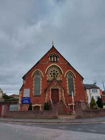
Buckley, and Flint are some of Calcoed best towns to visit near Calcoed.
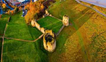
There are a number of castles near to Calcoed including Flint Castle - Castell y Fflint.
The area around Calcoed's best ruins can be found at Flint Castle - Castell y Fflint.
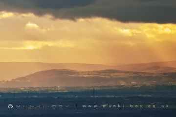
Hills to visit near Calcoed include Clwydian Range, Moel Famau, Moel Llys-y-Coed, Moel Arthur, and Hope Mountain.
Moel Arthur is a great place to visit close to Calcoed if you like ancient sites.
There are a several good hiking areas in the area around Calcoed like Hope Mountain.
Places near Calcoed feature a number of interesting country parks including Waun-Y-Llyn Country Park.
Calcoed History
There are some historic monuments around Calcoed:
- Coed Shepherd Round Barrow
- Round Barrow 135m SE of Lodge Farm
- Maen Achwyfan
- Coed Trefraith Enclosure
- Basingwerk Abbey
- Coed Glyn-Bach Round Barrow
- Round Barrow 350m SW of Glol Farm
- Nook round barrow
- Round Barrow at Naid y March, Holywell Common
- Bryn y Cosyn Round Barrows
- Pen-y-Cloddiau Camp
- Ffrith y Garreg-Wen Round Barrow
- Hafod Wood Moated Site
- Enclosure, Field System & Hollow-ways North of Pant
- Ministry of Supply Valley Site
- St Winefride's Chapel
- Moel y Gaer Camp
- Llanerch-y-mor Lead Smelting Chimney
- Greenfield Valley Mills
- Penbedw Park Stone Circle & Standing Stone
- Round Barrow 180m E of Mwccwd
- Round Barrow 135m NW of Rosehill Farm Gorsedd
- Plas-Yw Round Barrows
- Bwrdd y Rhyfel Camp
- Wat's Dyke: Section SE of Meadow Mills
- Round Barrow 225m SE of Plas Newydd
- Brynbella Mound, and sections of Offas Dyke adjoining it.
- Round Barrow 153m NW of Plas yn Rhos
- Moel Arthur Camp
- Round Barrow 450m South West of Glol Farm
- Bryn Digrif Round Barrows
- Bryn Castell Castle Mound
- Llyfanod round barrow
- Round Barrow 450m E of Penbedw Hall
- Bron Fadog Enclosure
- Offa's Dyke: Tan-y-Graig Section
- Berthen-Gam Round Barrow
- Offa's Dyke:Section N & S of the Circle on Holywell Racecourse, and Circle and Round Barrow
- Barrows 378m E of Berthen-Gam School
- Groes Faen Bach round barrow
- Round Barrow 225m E of Minffordd Cottage
- Round Barrow 180m NW of Groesfaen
- Wat's Dyke: Section in Fron Tydyr
- Round Barrow 400m SE of Smithy Gate
- Rhual-Isaf Round Barrow
- Y Gorseddau Round Barrows
- Two Round Barrows 90m NE of Eosfan
- Llyn Du Round Barrow
- Offa's Dyke: Section from Rhydwen-Fach to Coed Pen-y-Gelli
- Round Barrow 270m NW of Waen Isaf
- Round Barrow 495m SE of Parc y Prysau
- Crown Wood Round Barrow
- Holywell Castle Mound
- Round Barrow WSW of Llyfanod
- Wat's Dyke: Section from Coed Llys to Chester-Holywell Road
- Llys Edwin Medieval Fortified House Site
- Offa's Dyke: Section North West of Tre Abbot-Fawr
- The Bailey Hill, Mold
- Downing Hall Inscribed Stone (now in Whitford Church)
- Coed-y-bryn round barrow
- Round Barrow 270m NW of Traveller's Inn
- Hen Blas Castle Site
- Round Barrow 225m SE of Parc y Prysau
- Hen Caerwys Deserted Village Site
- Gatehouse Farm round barrow
- Groesffordd round barrows
- Wat's Dyke: Section in Wern Sirk Wood
- Round Barrow 450m SSW of Llynfanod
- Round Barrow 270m E of Axton Baptist Chapel
- Pen-y-graig round barrow
- Circle & Two Round Barrows on Southern Portion of Holywell Golf Course
- Hen-y-Fail Round Barrow
- Glol Camp