


Warter
Warter is a Village in the county of East Riding of Yorkshire.
Warter postcode: YO42 1XP
There are great places to visit near Warter including some great towns, villages and hiking areas.
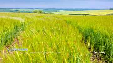
There are a several good towns in the Warter area like Beverley, and Bridlington.
There are a number of villages near to Warter including Bempton.
Don't miss Flamborough Head's hiking areas if visiting the area around Warter.
Warter History
There are some historic monuments around Warter:
- Round barrow 350m south east of Fordham Farm
- Site of Nunburnholme Priory
- Bowl barrow on Huggate Pasture, 500m north of Pasture Dale Plantation
- Bowl barrow on Huggate Wold, 840m ENE of Watermanhole Reservoir
- Bowl barrow 100m north east of High Wold Farm
- Bowl barrow on Huggate Wold, 700m NNW of Watermanhole Reservoir
- Four bowl barrows 450m south east of High Wold Farm
- Round barrow 200m east of farm on Garrowby Hill Top
- Hanging Grimston barrow group: a bowl barrow 650m SSW of Thixendale Grange
- Cross base and shaft and cross base at St Margaret's Church
- Site of Warter Augustinian Priory
- Settlement at Blealands Nook
- Deepdale cross ridge dyke
- Money Hill round barrow
- Round barrow 930m north east of Dalton Gates Farm
- Section of single linear boundary dyke in Great Plantation, Greenwick Dale, 250m east of East Greenwick Farm
- Two bowl barrows 300m south east of Blanch Farm
- Bowl barrow 400m south of High Wold Farm
- Round barrow 100m north west of farm on Garrowby Hill Top
- Hanging Grimston barrow group: three bowl barrows 350m north-east of Wold Farm
- Round barrow south west of Uncleby Wold Barn
- Bowl barrow 1000m north east of Goodmanham Wold Farm
- Bowl barrow 550m north of High Wold Farm
- Round barrow 550m south-west of Hessleskew
- Round barrow 250m south of Callis Wold Farm
- Bowl barrow 700m south west of Enthorpe House
- Round barrow 380m south-west of High Barn Farm
- Sections of linear boundary dyke in Frendal Dale, Tun Dale, and Great Plantation, between Millington and Huggate Wolds
- Round barrow south-east of Cot Nab Farm
- Bowl barrow 560m NNW of Farberry Garth Farm
- Sections of linear boundary dyke in Harper Dale and Holm Dale, north east of Horsedale Plantation
- Hanging Grimston barrow group: a bowl barrow 100m north-east of Wold Farm
- Round barrow 350m west of Cot Nab Farm
- Bowl barrow 610m east of Blanch Farm
- Bowl barrow on Huggate Wold, 580m north west of Horsedale Plantation
- Hanging Grimston barrow group: four bowl barrows and part of a cross dyke 600m SSW of Thixendale Grange
- Round barrow 360m south-west of High Barn Farm
- Park Closes moated lodge, 130m south west of Park Farm
- Round barrows S of Gill's Farm
- Bowl barrow 230m south west of High Barn Farm
- Section of linear boundary dyke in and extending to the north west of Farclose Plantation towards Waterman Hole
- Round barrow south of South Wold Farm
- Round barrow 400m north east of Wold Farm, Bishop Wilton Wold
- Round barrow 100m SW of Cobdale Farm
- Section of single linear boundary dyke in Horse Dale, 550m north west of Glebe Farm
- Bowl barrow 210m south east of Blanch Farm
- Round barrow 300m south west of Callis Wold Farm
- Round barrow 500m south east of Painsthorpe Wold Cottages
- Oval barrow 750m north of Wallis Grange
- Round barrow 350m east of Callis Wold Farm
- Hanging Grimston barrow group: a long barrow 400m east of Wold Farm, incorporating part of a prehistoric linear boundary
- Section of single linear boundary dyke in Stable Plantation, Greenwick Dale, 400m south west of East Greenwick Farm
- Round barrow 730m NNW of Goodmanham Wold Farm
- Bowl barrow on Huggate Pasture, 450m NNE of Pasture Dale Plantation
- Section of double linear boundary dyke west of Far Out Field, Millington Wold
- Bowl barrow on Huggate Wold, 600m west of Horsedale Plantation
- Section of linear boundary dyke 390m west of South Wold Farm
- Bowl barrow 340m south east of Watermanhole Reservoir
- Round barrow 850m north east of Wayrham Farm
- Round barrow SE of Gill's Farm
- Bowl barrow 450m north east of High Wold Farm
- Section of linear boundary dyke between Sylvan Dale and Warren Farm, north west of Coldwold Farm
- Hanging Grimston barrow group: four bowl barrows on Uncleby Stoop
- Bowl barrow 110m east of High Wold Farm
- Bowl barrow 320m north east of High Wold Farm
- Round barrow, north east of Greenwick Lodge
- Section of double linear boundary dyke 300m north east of Millington Grange Farm
- Round barrow 915m north east of Dalton Gates Farm
- Two round barrows 820m north east of Dalton Gates Farm
- Round barrow 850m north of Wold Farm, Bishop Wilton Wold
- Nine round barrows SE of Arras Cottages
- Round barrow 320m south-west of High Barn Farm
- Round barrow on Thirty Acres, Warter
- Barrow W of Bradeham Farm
- Bowl barrow on Huggate Wold, 480m north of Watermanhole Reservoir
- Round barrow 900m north east of Wayrham Farm
- Bowl barrow 290m south east of Blanch Farm
- Round barrows SW of Riggs Farm
- Hanging Grimston barrow group: three bowl barrows 600m south west of Thixendale Grange
- Round barrow 600m north east of Painsthorpe Wold Cottages
- Section of single linear boundary dyke east of York Lane, south east of Farclose Plantation
- Round barrow 520m S of Warren Farm
- Round barrow 240m south-west of High Barn Farm
- Three round barrows 110m east of Coldwold Farm
- Cleaving Hall moated site
- Round barrow 250m north east of Painsthorpe Wold Cottages
- Bowl barrow on Huggate Wold, 700m north west of Horsedale Plantation
- Six bowl barrows 300m north east of High Wold Farm
- Bowl barrow 550m north east of Goodmanham Wold Farm
- Round barrow 400m north west of Callis Wold Farm
- Round barrow 400m north-west of Cobdale Farm
- Bowl barrow 780m north east of Watermanhole Reservoir
- Round barrow 300m north-east of farm on Garrowby Hill Top
- Round barrow 270m south-east of Blanch Farm
- Ousethorpe medieval settlement, moat and mill 310m south of Ousethorpe Farm
- Section of linear boundary dyke in Harper Dale Plantation north east of Northfield Farm
- Bowl barrow on Huggate Wold, 500m NNW of Horsedale Plantation
- Sections of single and multiple linear boundary dykes on Huggate Pasture and Frendal Dale
- Round barrow 450m north east of Blanch Farm
- Bowl barrow on Huggate Wold, 400m NNW of Watermanhole Reservoir
- Section of linear boundary dyke 160m west of High Callis Wold Farm
- Two bowl barrows on Huggate Wold, 600m north west of Horsedale Plantation
- Two bowl barrows 500m north west of Farberry Garth Farm
- Round barrow south-west of Uncleby Wold Barn
- The Queen Dike: part of a cross-dyke 600m east of Wold Farm
- Bowl barrow 720m NNW of Farberry Garth Farm
- Round barrow 330m south east of Painsthorpe Wold Cottages
- Bowl barrow on Huggate Wold, 600m NNW of Horsedale Plantation
- Bowl barrow 760m NNE of Farberry Garth Farm
- Round barrow 300m south west of Cot Nab Farm
- Round barrow 600m west of Newcote Farm
- Bowl barrow 230m south west of Enthorpe House
- Bowl barrow 500m east of Blanch Farm
- Round barrow 390m south-west of High Barn Farm
- Twelve bowl barrows 800m north of Goodmanham Wold Farm
- Bowl barrow on Huggate Wold, 460m WNW of western corner of Horsedale Plantation
- Bowl barrow 450m north of High Wold Farm
- Wood Leys round barrow
- Section of a single and double linear boundary dyke in Horse Dale, and the junctions of Holm Dale and Harper Dale, north west of Northfield Farm
- Bowl barrow 550m south west of Enthorpe House
- Hanging Grimston barrow group: a bowl barrow 450m north-east of Wold Farm
- Hanging Grimston barrow group: a bowl barrow 650m south west of Thixendale Grange
- Round barrow 250m east of Wold Farm, Bishop Wilton Wold
- Bowl barrow 600m ESE of Blanch Farm
- Section of linear boundary dyke south of Middleham Plantation and Harper Dale Plantation
- Barrow near Middle Plantation
- Section of linear boundary dyke on Millington Lings 625m north east of High Callis Wold
- Round barrow south east of South Wold Farm
- Bowl barrow 550m south of High Wold Farm
- Bowl barrow 400m NNW of East Greenwick Farm
- Bowl barrow on Huggate Pasture, 350m north east of Pasture Dale Plantation
- Sections of multiple linear dykes 125m south west of Cot Nab Farm
- Bowl barrow 200m south east of High Wold Farm
- Section of linear boundary dyke on Cow Moor, Millington Dale
- Bowl barrow 620m ESE of Blanch Farm
- Bowl barrow 170m north west of Farberry Garth Farm
- Sections of linear boundary dyke in Cow Dale Plantation, Rabbit Dale and Oxland Plantation
Places to see near Warter


Lakes near Warter
Canals near Warter
Rivers near Warter
- Upper Fox Drain Catchment ds of Sherburn STW
- Ouse from R Wharfe to Upper Humber
- Bishop Dike (Trib of Ouse)
- Stillingfleet Beck Source to Ouse
- Mill Dike from Source to Bishop Dike
- Riccall Dam Catchment (trib of Ouse)
- Selby Dam from Conf. Fox Dike and Carr Dike to Ouse
- Ouse Still/fleet bk - Kelfield and Wharfe d/s Ryther
- Fox Dike/Carr Dike from Source to Selby Dam
- Holmes Dike catchment (trib of Ouse)
- Danes Dyke
- Gypsey Race from Source to North Sea
- Barmston Sea Drain / Skipsea Drain to Conf
- Barmston Sea Drain from Skipsea Drain to N Sea
- Gransmoor Drain (Burton Agnes to Lissett Area)
- Earls Dyke from Source to North Sea
- Auburn Beck from Source to North Sea
- Steam Dyke Hornsea Mere to N Sea
- Oldfleet/Wyton/Sproatley Drain from Source to Humber
- Burton Pidsea Drain Lower Catchment
- Fosse drain / Skeffling Drain
- Ottringham Drain from Ottringham Grange to Humber
- Burstwick Drain from Source to Humber
- Humbleton Beck Catchment
- Sands/Keyingham/Roos Dr from Source to Humber
- Winestead Drain from Source to Humber
- Mill Beck 3 (N Cave to High Humsley Area)
- Mill Beck 4 (N and S Newbald Area)
- Mill Beck 2 (Ellerker Area)
- Foulness from Source to Black Beck (South)
- Foulness from Black Beck to Market Weighton Canal
- Wellsprings Drain/Eastburn Beck/Driffield Trout Stream
- Scurf Dike from Source to River Hull
- Skerne Beck
- Nafferton Beck from Source to to Driffield Canal
- Lowthorpe/Kelk/Foston Bks from Source to Frodingham Beck
- Old Howe/Frodingham Beck to R Hull
- West Beck Lower to River Hull
- Garton Wold / Water Forlorns
- Hull from West Beck to Arram Beck
- West Beck Upper
- Mickley Dike Catchment
- Conistone Ganstead Area
- Fleet Drain
- Ella Dyke
- Fordyke Stream Lower to Holderness Dr
- Hull from Arram Beck to Humber
- High Hunsley to Arram Area
- Lambwath Stream from Source to Foredyke Stream
- Scorborough Beck
- Bryan Mills Beck Source to Bryan Mills Farm
- Middleton on the Wolds and Watton Beck
- Holderness Drain from Fordyke Stream to Humber
- Holderness Drain Source to Fordyke Stream
- High Hunsley to Woodmansey Area
- Foredyke Stream Upper
- Catchwater Drain
- Beverley and Barmston Drain
- Bishop Wilton Beck Catch (trib of Blackfoss Beck)
- Birk Lane Drain Catch (trib of Derwent)
- Bielby Beck from Source to Pocklington Beck
- Gowthorpe Beck Catch (trib of Blackfoss Beck)
- Pocklington Beck from Source to Bielby beck
- Lowmoor Drain Catch (trib of Derwent)
- Blackfoss Bk lower Catch (trib of Pocklington Bk)
- Pocklington Beck from Bielby Bk to River Derwent
- Derwent from Elvington Beck to River Ouse
- Fleet Dike catch (trib of Ouse)
- Eastfield Drain Lower to River Hertford
- Sherburn Beck catchment (trib of Derwent)
- Lowdales Beck Catchment (trib of Derwent)
- Black/Crosscliff/Grain Bk from Source to R Derwent
- Ruston Beck catchment (trib of Derwent)
- The Syme form Source to Thornton/Dalby/Staindale
- Ebberston Beck catchment (trib of Derwent)
- Hertford from Source to River Derwent
- Lownorth Beck from Source to River Derwent
- Derwent from Source to Black Beck
- Seamer Drain from Source to River Hertford
- Thornton/Dalby/Staindale from Source to the Syme
- Brompton Beck catchment (trib of Derwent)
- Troutsdale Beck from Source to River Derwent
- Scampston Beck catchment (trib of Derwent)
- Burniston Beck/Sea Cut/Scalby Beck Catch to N Sea
- Derwent from Black Beck to River Rye


