


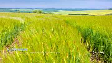
Bugthorpe
Bugthorpe is a Village in the county of East Riding of Yorkshire.
Bugthorpe postcode: YO41 1QJ
There are great places to visit near Bugthorpe including some great towns, villages and hiking areas.
Beverley, and Bridlington are some of Bugthorpe best towns to visit near Bugthorpe.
The area around Bugthorpe's best villages can be found at Bempton.
There are a number of hiking areas near to Bugthorpe including Flamborough Head.
Bugthorpe History
There are some historic monuments around Bugthorpe:
- Hanging Grimston barrow group: a bowl barrow 200m west of Wold Farm
- Kirkham Bridge
- A bowl barrow on Birdsall Wold, 250m south-east of Vessey Pasture Farm
- A bowl barrow on Birdsall Wold, 475m north-west of Vessey Pasture Farm, incorporating part of a linear boundary
- Roman villa
- Aldro earthworks: a bowl barrow on Birdsall Wold, 500m north-west of Brown Moor Farm
- Round barrow south of South Wold Farm
- A bowl barrow on Birdsall Wold, 300m north-east of Vessey Pasture Farm
- Aldro earthworks: a bowl barrow on Birdsall Wold, 1km north-west of Brown Moor Farm
- Aldro earthworks: a bowl barrow and part of a linear boundary on Birdsall Wold, 200m north-east of Aldro Farm
- Aldro earthworks: a bowl barrow on Birdsall Wold, 650m west of Aldro Farm
- Aldro earthworks: a bowl barrow on Birdsall Wold, 380m north-west of Aldro Farm
- Kitty Hill round barrow
- Round barrow south west of Uncleby Wold Barn
- Hanging Grimston barrow group: a bowl barrow 450m north-east of Wold Farm
- Aldro earthworks: a bowl barrow and part of a cross-dyke on Birdsall Wold, north-west of Brown Moor Farm
- The Three Dykes (or Five Riggs)
- Hanging Grimston barrow group: a bowl barrow 400m south-west of Wold Farm
- Cross base and shaft and cross base at St Margaret's Church
- Kirkham Priory Augustinian monastery: monastic precinct, three fishponds, and precinct boundary
- A bowl barrow on Birdsall Wold, 250m north-west of Vessey Pasture Farm
- Hanging Grimston barrow group: a bowl barrow 650m SSW of Thixendale Grange
- Aldro earthworks: a cross-dyke on Hanging Grimston Wold, 350m south-east of Brown Moor Farm
- Acklam Wold barrow group: a bowl barrow 300m south-east of Acklam Wold House
- Mount Ferrant: a motte and bailey castle
- Hanging Grimston barrow group: three bowl barrows 600m south west of Thixendale Grange
- A long barrow 120m north of Westow Grange, incorporating part of a medieval field system
- Wood Leys round barrow
- Moated site at St Lois Farm
- Round barrow 850m north of Wold Farm, Bishop Wilton Wold
- Acklam Wold barrow group: a bowl barrow 180m north-west of Acklam Wold House
- Hanging Grimston barrow group: four bowl barrows and part of a cross dyke 600m SSW of Thixendale Grange
- Round barrow 300m north-east of farm on Garrowby Hill Top
- Giant's Hill motte
- Acklam Wold barrow group: a bowl barrow 300m south west of Acklam Wold House
- Medieval moated site 150m south east of Low Hutton Post Office
- Round barrow 600m north east of Painsthorpe Wold Cottages
- Ousethorpe medieval settlement, moat and mill 310m south of Ousethorpe Farm
- Part of Leppington medieval village, a moated site and site of the former parish church of St Helen
- Aldro earthworks: a cross-dyke on Birdsall Wold, 400m east of Aldro Farm
- Round barrow 250m south of Callis Wold Farm
- Hanging Grimston barrow group: a long barrow 400m east of Wold Farm, incorporating part of a prehistoric linear boundary
- A bowl barrow on Toisland Wold, 200m north-east of Toisland Farm
- Rectilinear enclosures
- Round barrow 500m south east of Painsthorpe Wold Cottages
- Hanging Grimston barrow group: three bowl barrows 350m north-east of Wold Farm
- A bowl barrow on Toisland Wold, 600m east of Toisland Farm
- Two bowl barrows on Birdsall Wold, 850m east of Aldro Farm
- Hanging Grimston barrow group: a bowl barrow 650m south west of Thixendale Grange
- Round barrow 400m north east of Wold Farm, Bishop Wilton Wold
- Aldro earthworks: a linear boundary, two cross-dykes and nine round barrows on Birdsall Wold
- A bowl barrow on Birdsall Wold, 425m east of Aldro Farm
- A bowl barrow on Birdsall Wold, 700m east of Aldro Farm
- Aldro earthworks: a bowl barrow on Birdsall Wold, 450m north-west of Aldro Farm
- Round barrow 100m north west of farm on Garrowby Hill Top
- Section of linear boundary dyke 390m west of South Wold Farm
- Aldro earthworks: a bowl barrow on Birdsall Wold, 500m north-west of Brown Moor Farm
- Round barrow 300m east of Carrmire Gate
- Aldro earthworks: a bowl barrow on Hanging Grimston Wold 50m north-west of Stone Sleights Farm
- A bowl barrow on Birdsall Wold, between Birdsall Dale and Vessey Pasture Dale
- Acklam Wold barrow group: a bowl barrow 450m south-west of Acklam Wold House
- Round barrow south-east of Cot Nab Farm
- A bowl barrow on Birdsall Wold, 580m east of Aldro Farm
- A bowl barrow on Birdsall Wold, 300m east of Aldro Farm
- Hedon Howe tumulus
- Barrow W of Bradeham Farm
- Round barrow 330m south east of Painsthorpe Wold Cottages
- Site of Archbishop's moated palace and fishponds, Hall Garth.
- Aldro earthworks: a bowl barrow, a square barrow and part of a cross-dyke on Leavening Wold
- Section of double linear boundary dyke 300m north east of Millington Grange Farm
- Roman minor town identified as Derventio
- Two bowl barrows on Birdsall Wold, between Birdsall Dale and Vessey Pasture Dale
- Round barrow 250m north east of Painsthorpe Wold Cottages
- Acklam Wold barrow group: a bowl barrow 220m north-west of Acklam Wold House
- A bowl barrow on Birdsall Brow, 600m north-east of Toisland Farm
- A bowl barrow on Birdsall Wold, 750m east of Aldro Farm
- Aldro earthworks: seven bowl barrows and part of a linear boundary on Birdsall Wold, 220m east-north-east of Aldro Farm
- Bolton Old Hall moated site
- Round barrow 250m east of Wold Farm, Bishop Wilton Wold
- A cross-dyke from Birdsall Brow to Vessey Pasture Dale incorporating two bowl barrows and a cross-dyke extending from Water Dale
- Round barrow 350m south east of Fordham Farm
- Acklam Wold barrow group: a bowl barrow 450m south of Acklam Wold House
- A bowl barrow on Birdsall Brow, 100m west of Swinham Wood
- Round barrow 520m S of Warren Farm
- Roman pottery kilns and associated features at Crambeck
- Acklam Wold barrow group: a pair of bell barrows and a bowl barrow 200m south-west of Acklam Wold House
- Round barrow 400m north west of Callis Wold Farm
- A bowl barrow on Birdsall Wold, 600m east of Aldro Farm
- Acklam Wold barrow group: a bowl barrow on Wooing Nab
- Round barrow south east of South Wold Farm
- Round barrow 350m east of Callis Wold Farm
- Aldro earthworks: a bowl barrow on Hanging Grimston Wold 100m west of Stone Sleights Farm
- Greenlands barrow group: five bowl barrows on Toisland Wold, 500m east of Toisland Farm
- Roman site SW of Kennythorpe
- Round barrow 300m south west of Callis Wold Farm
- Old church
- Aldro earthworks: a cross-dyke on Birdsall Wold, 200m west of Brown Moor Farm
- A cross-dyke from Toisland Wold to Vessey Pasture Dale incorporating a bowl barrow
- Moated site, fishponds and associated earthworks at Manor House
- Hanging Grimston medieval settlement adjacent to Mount Pleasant Farm
- Round barrow 200m east of farm on Garrowby Hill Top
- Acklam Wold barrow group: a bowl barrow 150m south-west of Acklam Wold House
- Hanging Grimston barrow group: a bowl barrow 300m east of Stone Sleights Farm
- Hanging Grimston barrow group: four bowl barrows on Uncleby Stoop
- A cross-dyke in Vessey Pasture Dale
- A bowl barrow on Toisland Wold, 180m east of Toisland Farm
- Aldro earthworks: a bowl barrow on Birdsall Wold, 500m west of Aldro Farm
- Round barrow 400m SSW of Low Gaterley Cottages
- A bowl barrow on Birdsall Wold, 530m east of Aldro Farm
- Aldro earthworks: a bowl barrow on Hanging Grimston Wold 400m north-west of Stone Sleights Farm
- A cross-dyke on Birdsall Brow
- Aldro earthworks: a bowl barrow and part of a cross-dyke on Birdsall Wold, 500m north-west of Brown Moor Farm
- Round barrow south-west of Uncleby Wold Barn
- Acklam Wold barrow group: a bowl barrow 300m north-west of Acklam Wold House
- West Wold Farm round barrow
- Round barrow 300m south west of Cot Nab Farm
- Section of linear boundary dyke 160m west of High Callis Wold Farm
- The Queen Dike: part of a cross-dyke 600m east of Wold Farm
- A bowl barrow on Birdsall Wold, between Birdsall Dale and Vessey Pasture Dale
- Three bowl barrows on Birdsall Wold, 400m north-west of Vessey Pasture Farm
- Section of linear boundary dyke on Millington Lings 625m north east of High Callis Wold
- Hanging Grimston barrow group: a bowl barrow 100m north-east of Wold Farm
- Aldro earthworks: a bowl barrow on Birdsall Wold, 80m north-east of Aldro Farm
- A bowl barrow on Toisland Wold, 580m east of Toisland Farm
- Acklam Wold barrow group: two bowl barrows on Wooing Nab
- A bowl barrow on Birdsall Wold, between Birdsall Dale and Vessey Pasture Dale
- Sections of multiple linear dykes 125m south west of Cot Nab Farm
- Round barrow 350m west of Cot Nab Farm
- Bossall Hall: a quadrangular castle
- Aldro earthworks: a bowl barrow on Birdsall Wold, 600m west of Aldro Farm
- Aldro earthworks: two linear boundaries and a bowl barrow on Birdsall Wold, south of Aldro Farm
- Motte and bailey castle south of Scotland
Places to see near Bugthorpe


Lakes near Bugthorpe
Canals near Bugthorpe
Rivers near Bugthorpe
- Upper Fox Drain Catchment ds of Sherburn STW
- Ouse from R Wharfe to Upper Humber
- Bishop Dike (Trib of Ouse)
- Stillingfleet Beck Source to Ouse
- Mill Dike from Source to Bishop Dike
- Riccall Dam Catchment (trib of Ouse)
- Selby Dam from Conf. Fox Dike and Carr Dike to Ouse
- Ouse Still/fleet bk - Kelfield and Wharfe d/s Ryther
- Fox Dike/Carr Dike from Source to Selby Dam
- Holmes Dike catchment (trib of Ouse)
- Danes Dyke
- Gypsey Race from Source to North Sea
- Barmston Sea Drain / Skipsea Drain to Conf
- Barmston Sea Drain from Skipsea Drain to N Sea
- Gransmoor Drain (Burton Agnes to Lissett Area)
- Earls Dyke from Source to North Sea
- Auburn Beck from Source to North Sea
- Steam Dyke Hornsea Mere to N Sea
- Oldfleet/Wyton/Sproatley Drain from Source to Humber
- Burton Pidsea Drain Lower Catchment
- Fosse drain / Skeffling Drain
- Ottringham Drain from Ottringham Grange to Humber
- Burstwick Drain from Source to Humber
- Humbleton Beck Catchment
- Sands/Keyingham/Roos Dr from Source to Humber
- Winestead Drain from Source to Humber
- Mill Beck 3 (N Cave to High Humsley Area)
- Mill Beck 4 (N and S Newbald Area)
- Mill Beck 2 (Ellerker Area)
- Foulness from Source to Black Beck (South)
- Foulness from Black Beck to Market Weighton Canal
- Wellsprings Drain/Eastburn Beck/Driffield Trout Stream
- Scurf Dike from Source to River Hull
- Skerne Beck
- Nafferton Beck from Source to to Driffield Canal
- Lowthorpe/Kelk/Foston Bks from Source to Frodingham Beck
- Old Howe/Frodingham Beck to R Hull
- West Beck Lower to River Hull
- Garton Wold / Water Forlorns
- Hull from West Beck to Arram Beck
- West Beck Upper
- Mickley Dike Catchment
- Conistone Ganstead Area
- Fleet Drain
- Ella Dyke
- Fordyke Stream Lower to Holderness Dr
- Hull from Arram Beck to Humber
- High Hunsley to Arram Area
- Lambwath Stream from Source to Foredyke Stream
- Scorborough Beck
- Bryan Mills Beck Source to Bryan Mills Farm
- Middleton on the Wolds and Watton Beck
- Holderness Drain from Fordyke Stream to Humber
- Holderness Drain Source to Fordyke Stream
- High Hunsley to Woodmansey Area
- Foredyke Stream Upper
- Catchwater Drain
- Beverley and Barmston Drain
- Bishop Wilton Beck Catch (trib of Blackfoss Beck)
- Birk Lane Drain Catch (trib of Derwent)
- Bielby Beck from Source to Pocklington Beck
- Gowthorpe Beck Catch (trib of Blackfoss Beck)
- Pocklington Beck from Source to Bielby beck
- Lowmoor Drain Catch (trib of Derwent)
- Blackfoss Bk lower Catch (trib of Pocklington Bk)
- Pocklington Beck from Bielby Bk to River Derwent
- Derwent from Elvington Beck to River Ouse
- Fleet Dike catch (trib of Ouse)
- Eastfield Drain Lower to River Hertford
- Sherburn Beck catchment (trib of Derwent)
- Lowdales Beck Catchment (trib of Derwent)
- Black/Crosscliff/Grain Bk from Source to R Derwent
- Ruston Beck catchment (trib of Derwent)
- The Syme form Source to Thornton/Dalby/Staindale
- Ebberston Beck catchment (trib of Derwent)
- Hertford from Source to River Derwent
- Lownorth Beck from Source to River Derwent
- Derwent from Source to Black Beck
- Seamer Drain from Source to River Hertford
- Thornton/Dalby/Staindale from Source to the Syme
- Brompton Beck catchment (trib of Derwent)
- Troutsdale Beck from Source to River Derwent
- Scampston Beck catchment (trib of Derwent)
- Burniston Beck/Sea Cut/Scalby Beck Catch to N Sea
- Derwent from Black Beck to River Rye


