


Grenofen
Grenofen is a Village in the county of Devon.
Grenofen postcode: PL19 9NE
There are great places to visit near Grenofen including some great cities, historic buildings, villages, canals, rivers and streams, beaches, geological features, sssis, hiking areas, nature reserves, towns, parks, airports, castles and ruins.
Cities to visit near Grenofen include Exeter.
Exeter Cathedral, St Mary Steps, and St Stephen's Church - Exeter are great places to visit near Grenofen if you like historic buildings.
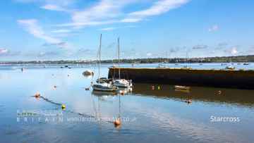
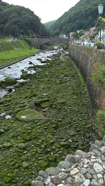
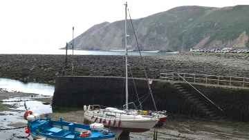
There are a number of villages near Grenofen including Starcross, Lynton and Lynmouth, Littleham, Otterton, Branscombe, Beer, and Hope Cove.
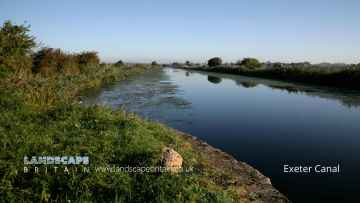
There are a number of canals near Grenofen including Exeter Canal, and Grand Western Canal at Tiverton.
The area close to Grenofen boasts some of the best rivers and streams including East Lyn River.
There are a number of beaches near Grenofen including Blacklands Beach, Branscombe Beach, and Hope Cove.
There are a number of geological features near to Grenofen including Valley of Rocks.
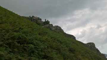
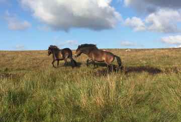
The area close to Grenofen boasts some of the best sssis including Dartmoor.
Don't miss Dartmoor's hiking areas if visiting the area around Grenofen.
Grenofen is near some unmissable nature reserves like Dartmoor,
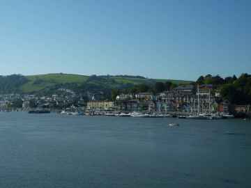
The area around Grenofen boasts some of the best towns including Dartmouth, Tiverton, Crediton, Topsham, Budleigh Salterton, Sidmouth, and Seaton.
Parks to visit near Grenofen include Bicton Park.
Places near Grenofen feature a number of interesting airports including Exeter Airport.
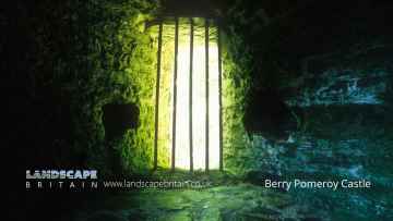
There are a several good castles in the area around Grenofen like Berry Pomeroy Castle.
Don't miss Berry Pomeroy Castle's ruins if visiting the area around Grenofen.
Grenofen History
There are some historic monuments around Grenofen:
- Round cairn 540m north of White Barrow
- Pillow mound 920m north east of Merrivale Bridge, forming part of Merrivale Warren
- Easternmost stone hut circle forming part of the settlement on Langstone Moor
- Enclosure and stone hut circle 450m north of Shillapark Farm
- Two round cairns 120m south-east of Langstone Moor stone circle
- Routrundle Pound
- Part of Eylesbarrow Reave
- Cairn and cist 150m north of Vixen Tor
- Four round barrows on Wigford Down
- Round cairn 560m south east of Little Staple Tor
- Canal, lock, island and salmon keeping pond known collectively as the Tamar Canal
- Round cairn 685m north-east of Sharpitor summit
- Round cairn 340m east of White Tor summit
- Animal pound at The Pound, 620m south of Roborough House
- Enclosure and stone hut circle 700m west of Sharpitor
- Hut circle on Wigford Down
- Enclosed stone hut circle settlement on the south slope of White Tor
- Stone hut circle 660m east of Roos Tor
- Round cairn 1100m ENE of Wedlake Farm
- Enclosed stone hut circle settlement 600m WSW of White Tor
- Southernmost stone hut circle forming part of the settlement on Langstone Moor
- Stone hut circle 390m south west of Yellowmeade Farm
- Cairn and cist 600m north east of Routrundle
- Eleven stone hut circles, a length of boundary wall and a field system forming part of an unenclosed settlement on the north-east slope of Sharpitor
- Round cairn and cist 440m east of White Tor summit
- Tavistock Abbey
- Cairn north-east of Brisworthy Plantation
- One of a group of three cairns on Ringmoor Down
- Two stone alignments and a round cairn 390m NW of Sharpitor
- A length of the Great Western Reave, a prehistoric settlement, three cairns and two field systems on Walkhampton Common
- Prehistoric settlement 610m south west of Cox Tor
- Shaugh Prior village cross: a wayside cross at the road junction 150m east of the parish church
- Round cairn 190m east of Cross Gate
- Wheal Betsy pumping house
- Yennadon Cross: a wayside cross 340m south of Peekhill
- Sixteen stone hut circles forming part of an unenclosed stone hut circle settlement on the north-east slope of Cox Tor
- Stone hut circle 210m south of the Ordnance Survey triangulation pillar on Cox Tor
- Round barrow N of Cadworthy Wood
- One of a group of three cairns on Ringmoor Down
- Three round cairns 310m south of White Tor summit
- Enclosed stone hut circle settlement 200m east of Leeden Tor
- Earthworks on Brent Tor
- Medieval settlement on Peek Hill, 240m and 280m north east of Lowery Tor
- Stone setting (retaining kerb of a cairn) north-east of Brisworthy Plantation
- Upper Merrivale tin blowing and stamping mills, 750m north of Shillapark
- Stone cross SW of church
- Tor cairn forming part of a round cairn cemetery, and a stone hut circle on the summit of Cox Tor
- Two stone hut circles and two clearance cairns forming part of the settlement on Langstone Moor
- Windy Post: a wayside cross on open moorland 1.8km north of Sampford Spiney village
- Enclosure and stone hut circle 80m north of White Tor fort
- Two ring cairns 250m north of the Ordnance Survey triangulation pillar on Cox Tor
- Three pillow mounds and a military training pit 1000m ENE of Merrivale Bridge
- Enclosed stone hut circle settlement 700m south of Leeden Tor
- Two concentric stone circles on Langstone Moor
- Pillow mound 700m north east of Merrivale Bridge, forming part of Merrivale Warren
- Settlement on Wigford Down
- Morwellham Quay: transport infrastructure, part of the water control system and a manganese mill
- Enclosures and hut circles N of White Tor
- Cairnfield and two stone hut circles 490m and 550m south west of Cox Tor
- Prehistoric coaxial field system and cairns, an historic enclosure and part of RAF Sharpitor, situated on and around Peek Hill
- Greenwell Girt socket stone 600m SSW of Lovaton hamlet
- Eight stone hut circles and two enclosures forming part of an unenclosed settlement 580m south of Leeden Tor
- Pillow mound 530m north east of Merrivale Bridge, forming part of Merrivale Warren
- Cairn south-east of Ringmoor Cottage
- Stone hut circle 500m north of Wedlake Farm
- Huckworthy Cross: a wayside cross 1.4km SSW of Sampford Spiney village
- Cairnfield 460m south east of Cox Tor
- Marchant's Cross: a wayside cross 700m south east of Meavy
- Partially enclosed stone hut circle settlement, two cairns and a route marker 325m north west of Yellowmeade Farm
- Round barrow NW of Saddlesborough
- Settlement on Wigford Down S of Durance
- Ring cairn 920m south west of Little Staple Tor
- Cross S of Shaden Plantation
- Pixies' Cross: a wayside cross and associated earthwork enclosure on Whitchurch Down
- An unenclosed stone hut circle settlement, an irregular aggregate field system, a length of reave and an enclosure on the south east slope of Leeden Tor
- Prehistoric enclosures on Dewerstone Hill, 500m south east of Dewerstone Cottage
- Okeltor 19th century arsenic, copper and tin mine
- Stone hut circle 130m east of Leeden Tor forming part of a stone hut circle settlement
- Enclosed stone hut circle settlement and kerbed boulder 300m WNW of White Tor summit
- Two stone hut circles 100m east of Leeden Tor forming part of a stone hut circle settlement
- Stone hut circle 350m north-east of Sharpitor forming part of a stone hut circle settlement
- Tor cairn 170m south of Cox Tor summit forming part of a round cairn cemetery
- Beatland Corner socket stone: a wayside cross 900m south east of Shaugh Prior church
- Hut circles SW of Wedlake
- Stone row NW of Saddlesborough
- Cairn south-east of Ringmoor Cottage
- Stone hut circle 160m east of Sharpitor
- Round barrow cemetery and beacon at Heathfield, 650m west of Moorlands
- A stone circle, standing stone, cairn, recumbent stone and stone alignment on Longash Common
- Eluvial tin streamworks and prehistoric coaxial field system together with other archaeological remains on Whitchurch Common
- Round cairn 25m south of Langstone Moor stone circle
- Unenclosed stone hut circle settlement and tinners' buildings west of Dead Lake
- Three pillow mounds 720m ENE of Merrivale Bridge, forming part of Merrivale Warren
- A ring cairn on Longash Common lying 400m south east of Merrivale Bridge
- Wayside cross 75m south east of Cross Gate
- Round cairn 380m NNW of Sharpitor summit
- Stone hut circle settlement, fields and enclosures 270m south-west of White Tor
- Three hut circles on south part of Wigford Down
- Pillow mound 770m ENE of Merrivale Bridge, forming part of Merrivale Warren
- Four stone hut circles forming part of an unenclosed settlement 580m south of Leeden Tor
- Round cairn 250m south east of Standon Farm
- Stone hut circle and a short length of boundary wall forming part of an unenclosed stone hut circle settlement on the north-east slope of Cox Tor
- Buckland Abbey
- Enclosed settlement 280m south-west of the Ordnance Survey triangulation pillar on Cox Tor
- Prehistoric irregular aggregate field system, stone hut circles and a medieval field on the south-west slope of White Tor
- Two stone hut circles and a length of walling 240m south west of Yellowmeade Farm
- Stone hut circle 500m ENE of Merrivale Bridge, forming part of a partially enclosed stone hut circle settlement
- Round cairn 1060m ENE of Wedlake Farm
- Two pillow mounds 660m ENE of Merrivale Bridge, forming part of Merrivale Warren
- Hilltop enclosure known as Maristow Camp, 240m east of Middle Park House
- Roman's Cross 50m west of the church
- Hut circles W of Saddlesborough
- Enclosure and stone hut circle 320m north-east of Sharpitor forming part of a stone hut circle settlement
- Stone alignment and terminal cairn with a retaining kerb on Ringmoor Down
- Round cairn on Standon Hill
- Irregular aggregate field system, stone hut circles and post-medieval fields on the north-east slope of Cox Tor
- Part of Eylesbarrow Reave
- Round cairn 170m north of the Ordnance Survey triangulation pillar on Cox Tor
- Round cairn 690m north-east of Sharpitor summit
- Long cairn 350m east of White Tor summit
- Stone hut circle 155m east of Sharpitor
- Hut circles W of Wigford Down China Clay Works
- Hut circles SE of Brisworthy
- An enclosure, six stone hut circles, a length of reave and several prospecting pits 170m north-east of Leather Tor
- Stone hut circle 130m south east of the Ordnance Survey triangulation pillar on Cox Tor
- Unenclosed stone hut circle settlement 200m west of Yellowmeade Farm
- Part of Eylesbarrow watershed reave
- Two hut circles S of Catstor Down
- Enclosure north-east of Brisworthy Plantation
- Stone hut circle 315m north-east of Sharpitor forming part of a stone hut circle settlement
- Camp NE of Berra Tor
- White Tor camp, Cudlipptown Down
- A prehistoric and historic archaeological landscape within Merrivale Newtake
- Bowl barrow 570m east of The Firs, forming part of a round barrow cemetery at Heathfield
- Stone hut circle forming part of the settlement on Langstone Moor
- Gawton arsenic mine and flue
- Coaxial field system and prehistoric settlement 410m west of Cox Tor
- Length of reave 290m north of Feather Tor, forming part of a coaxial field system on Whitchurch Common
- Two stone hut circles, a reave, round cairn and shelter south east of Sharpitor
- Four stone hut circles and a cairnfield 400m south-east of Wedlake Farm forming part of the settlement on the north-west slope of Roos Tor
- Two stone hut circles and an enclosure forming part of an unenclosed stone hut circle settlement of the north-east slope of Cox Tor
- Pillow mound on Langstone Moor, 870m south east of White Tor
- Stone hut circle 370m north-east of Sharpitor forming part of a stone hut circle settlement
- Stone alignment and round cairn on Langstone Moor
- A stone hut circle on Longash Common lying 980m ESE of Merrivale Bridge
- The Remains of Longstone Manor House, Wind Strew and associated features
- Cairn and cist on Barn Hill, 840m north east of Moortown Farm
- An enclosure, attached stone hut circle and length of reave 180m north-north-east of Leather Tor
- Round cairn 330m north of the Ordance Survey triangulation pillar on Cox Tor
- Stone hut circle 570m ENE of Merrivale Bridge, forming part of a partially enclosed stone hut circle settlement
- A stone hut circle 650m east of Merrivale Bridge forming part of a partially enclosed stone hut circle settlement
- A partially enclosed stone hut circle settlement, round cairn, post medieval farmstead, millstone and stone cutting pits 580m ESE of Merrivale Bridge
- Enclosure and stone hut circle 770m south of Cox Tor
- Inscribed stones in vicarage garden
- Green Lane Cross: a wayside cross at the north west end of Whitchurch Down
- Blowing mill and vermin trap 350m north east of Merrivale Bridge
- Pound and hut circles N of Hawk's Tor
- One of a group of three cairns on Ringmoor Down
- Three stone alignments, ten cairns, three stone hut circles and a length of the Great Western Reave on Longash Common
- Unenclosed stone hut circle settlement 370m south west of Routrundle
- Seven stone hut circles, a length of field boundary and a clearance cairn forming part of the settlement on Langstone Moor
- An enclosure and three stone hut circles 550m ENE of Merrivale Bridge, forming part of a partially enclosed stone hut circle settlement
- Three hut circles NW of Cadworthy
- Length of reave and three military emplacements 290m south west and 280m south east of Cox Tor
- Walkhampton Church House cross: a wayside cross on the east side of Church House, 650m north east of Walkhampton village
- A stone hut circle on Longash Common lying 870m ESE of Merrivale Bridge
- Stone hut circle 410m south-east of Roos Tor
- Two stone hut circles 570m south-east of Roos Tor
- Four stone hut circles and an enclosure 100m north-east of Sharpitor summit
- Unenclosed stone hut circle settlement, associated fields and a length of the Great Western Reave 500m south of Wedlake Farm
- Barrow near Shaugh Cross
- Willsworthy Pound adjacent to Willsworthy Bridge
- Stone hut circle forming part of an unenclosed stone hut circle settlement on the north-east slope of Cox Tor
- Stone alignment, two round cairns and a length of Walkhampton Common reave lying in a valley between Sharpitor and Leeden Tor
- Prehistoric settlement, field system, cairn and three pillow mounds, 290m north east of Merrivale Bridge
- Cairn 410m south-west of White Tor summit
- Stone hut circle forming part of an unenclosed stone hut circle settlement west of Dead Lake
- Pounds and hut circles N of Saddlesborough
- Wigford Down cross: a wayside cross 230m WNW of Cadover Bridge
- An enclosure containing one stone hut circle 460m west of Cross Gate
- Round cairn 670m north-east of Sharpitor summit
- Stone hut circle 600m south-east of Roos Tor
- Early 20th century arsenic works at the Devon Great Consols Mine
- Two cairns with stone rows E of Collard Tor on Wotter Common
- Enclosures and stone hut circles forming part of a stone hut circle settlement on Langstone Moor
- Bowl barrow 340m east of The Firs, forming part of a round barrow cemetery at Heathfield
- Trendle earthwork NE of Kelly College
- Stone alignment, five cairns, two stone hut circles and a length of reave 600m north east of Horseyeatt
- Two stone hut circles and an enclosure 140m east of the Ordnance Survey triangulation pillar on Cox Tor
- Pillow mound 900m SSW of Little Mis Tor, forming part of Merrivale Warren
- Pillow mound 870m ENE of Merrivale Bridge, forming part of Merrivale Warren
- Cairn 690m south west of White Barrow
- Three stone hut circles forming part of an unenclosed stone hut circle settlement on the north-east slope of Cox Tor
- Four round cairns 340m ENE of Sharpitor
- Two overlapping enclosures on the western edge of the River Walkham
Places to see near Grenofen


Lakes near Grenofen
Rivers near Grenofen
- Broughton Brook (South and West Somerset)
- Tributary of Back Stream (Tone Catchment)
- Hele Bk
- Tone - Wellington to Taunton
- Haywards Water
- Westford Stream
- Sherford Stream
- Tone - Upper
- Back Stream
- Halse WTR
- Allen Brook(Maiden brook)
- Hillfarrance Bk
- West Dart River (Lower)
- West Dart River (Upper)
- East Webburn River
- West Dart River (Blackbrook to Swincombe)
- Wash
- Ashburn
- East Dart River
- Hems - Upper
- West Webburn River
- Swincombe
- Avon (Devon Tidal) and Sth Hams - Blackpool
- Mardle
- Avon (Devon Tidal) and Sth Hams - Slapton
- Cherry Brook
- Hems - Lower
- Dean Burn
- Dart
- Dart (Tidal)
- Am Brook
- Webburn
- Bidwell Brook
- The Gara
- Blackbrook River
- Harbourne River
- Beadon Brook
- Lemon
- South Teign River
- Reedy Brook
- North Teign
- Fingle Brook
- Teign (Upper)
- Ugbrooke Stream
- Wray Brook
- Aller Brook (Teign) - Lower
- Kate Brook
- Scotley Brook
- Aller Brook (Teign) - Upper
- Middle Bovey
- Blackaton Brook
- Liverton Brook
- Aller Brook
- Sowton Brook
- Bramble Brook
- Lower Bovey
- Becka Brook
- Upper Bovey
- Teign (Lower)
- Sheepham Bk
- Ayleston Brook
- Lud Brook
- Lower Erme
- Erme
- Middle Barle
- Dart (Exe)
- Danes Brook
- Lower Batherm
- Upper Barle
- Exe (Haddeo to Barle)
- Burn (Exe)
- Iron Mill Stream
- Upper River Haddeo
- Upper Batherm
- Lowman
- Exe (Barle to Culm)
- North Brook (East Devon)
- Exe (Quarme to Haddeo)
- Calverleigh Stream
- Exe (Source to Quarme)
- Exe (Culm to Creedy)
- Exe (Creedy to Estuary)
- Lower Barle
- Ben Brook
- Ben Brook
- Brockey River
- Quarme
- Lower River Haddeo
- Pulham
- Sherdon Water
- Grindle Brook
- Bolham River
- Weaver
- Aylesbeare Stream
- Polly Brook
- Halberton Stream
- Fulford Water
- Lower Clyst
- Madford River
- Ken Stream
- Middle Culm
- Lower Cranny Brook
- Ford Stream (EXE)
- Spratford Stream
- Upper Clyst
- Sheldon Stream
- Upper Cranny Brook
- Upper Culm
- Lower Culm
- Kenn
- Colebrook
- Holly Water
- Alphin Brook
- Lower Yeo (Creedy)
- Matford Brook
- Ford Brook (EXE)
- Upper Creedy
- Dawlish Water
- Upper Yeo (Creedy)
- Jackmoor Brook
- Shobrooke Lake
- Lower Creedy
- Troney
- Middle Creedy
- Culvery River
- Lim
- Branscombe Stream
- Blackwater River
- Lower Axe
- Kit Brook
- Yarty
- Umborne Brook
- Upper Coly
- Upper Axe
- Offwell Brook
- Lower Coly
- Forton Brook
- Corry Brook
- West Lyn River
- Heddon
- Lower East Lyn River
- Mully Brook
- Rye Stream
- Upper East Lyn River
- Lower River Yeo (Lapford)
- Mole (Taw to Bray)
- Yeo (Molland)
- Venn
- Coney Gut
- Sterridge
- Crooked Oak
- Tributary of River Heddon
- Huntacott Water
- Taw (Source to Bullow Brook)
- Hawkridge Brook
- Newton Tracey Stream
- Taw (River Yeo to Little Dart River)
- Sturcombe River
- Bullow Brook
- Bray (Mole to Hole Water)
- Hollocombe Water
- Upper River Yeo (Barnstaple)
- Upper Caen
- Taw Estuary
- Bradwell Stream
- Upper Little Dart River
- Chelfham Stream
- Hole Water
- Knowl Water
- Badgworthy Water
- Umber
- Farley Water
- Taw (Little Dart River to River Mole)
- Lower River Yeo (Barnstaple)
- Lower Caen
- Mole (Bray to Yeo)
- Lower Little River Dart
- Burcombe Stream
- Taw (River Mole to Estuary)
- Little Silver Stream
- Dalch
- Mole (Yeo to Burcombe Stream)
- Nadrid Water
- Bradiford Water
- Langham Lake
- Bray (Source to Hole Water)
- Mole (Source to Burcombe Stream)
- Taw (Bullow Brook to River Yeo)
- Knighty Brook
- Upper River Yeo (Lapford)
- Dolton Stream
- Lower River Mere
- Kenwith Stream
- Dipple Water
- Horwood Stream
- Little Mere River
- Torridge (Dipple Water to Combe Lake)
- Wagaford Water
- Middle River Lew (Torridge)
- Iddesleigh Stream
- Middle River Okement
- Upper River Yeo (Bideford)
- West Okement
- Upper River Mere
- East Okemont River
- Langtree Lake
- Mussel Brook
- Hole Brook
- Lower River Okement
- Pulworthy Brook
- Waldon
- Torridge (Source to Dipple Water)
- Combe Lake
- Woolleigh Brook
- Whiteleigh Water
- Hookmoor Brook
- Northlew Stream
- Torridge (Lew to Estuary)
- Whitsleigh Down Brook
- Cookbury Stream
- Duntz
- Upper River Lew (Torridge)
- Torridge (Combe Lake to Lew)
- Huntshaw Water
- Lower River Yeo (Bideford)
- Lower River Lew (Torridge)
- Medland Brook
- Welcombe Stream
- Philham Water
- Abbey River
- Tamar (River Lyd to River Inny)
- Tamar (Kelly Brook)
- Lower River Lyd
- Lew (Tamar)
- Quither Brook
- Broadwood Brook
- Thrushel
- Wolf
- Upper River Lyd
- Piall
- Newton Stream
- Upper River Yealm
- Silverbridge Lake
- Lower River Yealm
- Tory Brook
- Meavy
- Lower River Plym
- Upper River Plym
- Walkham
- Burn (Tavy)
- Lumburn
- Upper River Tavy
- Lower River Tavy


