Retail in Kirkcambeck
There are great places to visit near Kirkcambeck including some great hills, hiking areas, villages, ancient sites, ruins, old mines, waterfalls, rivers and streams, lakes, woodlands, towns, mountains, castles, historic buildings, historic monuments, caves, bluebell woods, nature reserves, disused railway lines, airports and islands.
Don't miss Cartmel Fell, White Pike (Seathwaite), The Knott, Broughton Moor, Catbells, Orrest Head, and Haystacks's hills if visiting the area around Kirkcambeck.
Hiking Areas to visit near Kirkcambeck include Cartmel Fell, Coniston Coppermines Valley, Borrowdale, Styhead Tarn, Troutbeck, Orrest Head, and Wild Boar Fell.
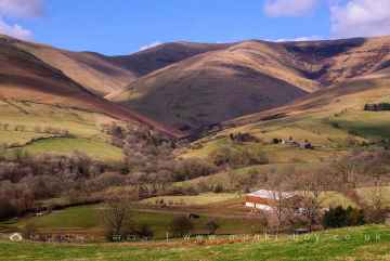
The area around Kirkcambeck boasts some of the best villages including Eskdale, Coniston, Seatoller, Troutbeck, High Borrans, Kentmere, and Brigsteer.
Kirkcambeck's best nearby ancient sites can be found at Hardknott Roman Fort, The Hawk, Sunkenkirk Stone Circle, Castlerigg Stone Circle, High Borrans Romano-British Settlement, Mayburgh Henge, and Gunnerkeld Stone Circle.
Bonsor East Mine Workings, Bonsor Dressing Floors, Penny Rigg Copper Mill, Appletree Worth, Stephenson Ground Limekiln (ruin), Water Yeat Limekiln (ruin), and Hebblethwaite Hall Gill are great places to visit near Kirkcambeck if you like ruins.
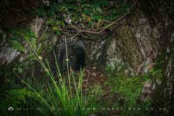
The area around Kirkcambeck boasts some of the best old mines including Penny Rigg Quarry Adit, Three Kings Mine, Tilberthwaite Gill Head Waterfall Level, Horse Crag Quarry, Tilberthwaite Deep Level Adit, Cathedral Quarry, and Parrock Quarry.
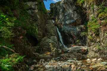
Kirkcambeck's best nearby waterfalls can be found at Tilberthwaite Gill, Rydal Falls, Hebblethwaite Hall Gill, Styhead Gill Waterfalls, Taylorgill Force, Aira Force, and Hell Gill Force.
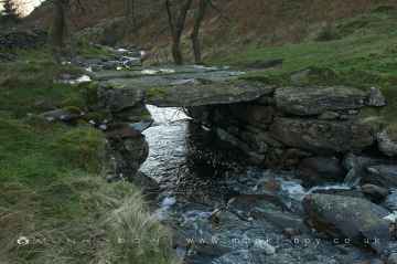
Don't miss River Lickle, Appletree Worth Beck, Styhead Gill, Crowdundle Beck, Aira Beck, Hell Gill, and River Kent at Kentmere's rivers and streams if visiting the area around Kirkcambeck.
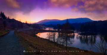
There are a several good lakes in the Kirkcambeck area like Tarn Hows, Thirlmere Reservoir, Derwentwater, Styhead Tarn, Windermere, Wastwater, and Ullswater.
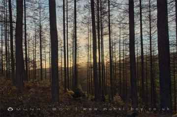
Kirkcambeck's best nearby woodlands can be found at Broughton Moor, Brigsteer Park, Cow Close Wood, Jeffy Knotts Wood, and Grubbins Wood.
The area around Kirkcambeck features a number of interesting towns including Sedbergh, Bowness On Windermere, Ulverston, Penrith, Kendal, Ambleside, and Kirkby Stephen.
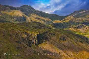
There are a number of mountains near Kirkcambeck including Scafell, Blencathra - Hallsfell Top, Skiddaw, Hartsop Dodd, Stony Cove Pike [Caudale Moor], Place Fell, and Wild Boar Fell.
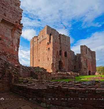
Kirkcambeck has some unmissable castles nearby like Brough Castle, Lowther Castle, Pendragon Castle, Lammerside Castle, Kendal Castle, Sizergh Castle, and Castlesteads (Lowther).
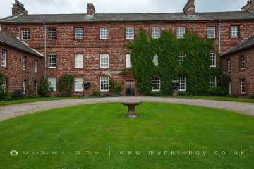
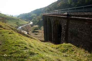
Kirkcambeck has some unmissable historic buildings nearby like Acorn Bank, Acorn Bank Watermill, Church of St Peter Askham, St Michael’s Church at Lowther, Lowther Mausoleum, Askham Hall, and Smardale Gill Viaduct.
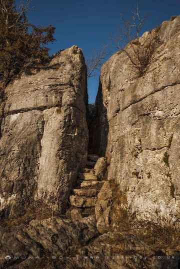
Kirkcambeck is near some unmissable historic monuments like Fairy Steps,
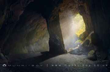
The area around Kirkcambeck boasts some of the best caves including Cathedral Quarry, Fairies Cave, Holy Well Cave, and Buttermere Tunnel.
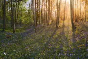
Kirkcambeck's best nearby bluebell woods can be found at Cow Close Wood, and Jeffy Knotts Wood.
Smardale Gill Nature Reserve is one of Kirkcambeck's best, nearby nature reserves to visit in Kirkcambeck.
The area close to Kirkcambeck boasts some of the best disused railway lines including Smardale Gill Nature Reserve.
Kirkcambeck's best nearby airports can be found at Barrow/Walney Island Airport, and Carlisle Lake District Airport.
Piel Island is a great place to visit close to Kirkcambeck if you like islands.
Kirkcambeck History
There are some historic monuments around Kirkcambeck:
- Lanercost Bridge
- Bewcastle Roman fort, high cross shaft in St Cuthbert's churchyard, and Bew Castle medieval shell keep castle
- Bowl barrow 760m SSE of Old Church
- Hadrian's Wall between the road to Garthside and The Centurion Inn, Walton, in wall miles 54 and 55
- Medieval shieling on Espy Bank 35m south of Esby Well
- Medieval shieling 800m east of Woodhead
- Watchclose Roman temporary camp
- Antonstown medieval dispersed settlement 450m south east of Crew Farm
- Prehistoric cup marked stone 380m south of Gillalees
- RAF Spadeadam: Priorlancy Rigg, Engine Test Area
- The Loan medieval bastle and post-medieval cottage
- Eight Roman inscriptions in the Roman quarry in Combcrag Wood, 350m south of Hadrian's Wall
- The Stonehouse bastle, 240m north of Denton Foot
- Motte, immediately south east of Nook Farm
- Boothby Roman fort
- Stone hut circle 740m east of Woodhead
- Barron's Pike bowl barrow
- Tower Tye ringwork
- Foresthead lime kilns, quarry, associated buildings and part of the rail transportation system
- Castle Hill
- Written Rock of Gelt: Roman quarry inscriptions
- Round cairn in Mollen Wood, 640m east of Parkgate Bridge
- Round cairn 610m south east of High Grains
- Crew Castle bastle
- Hadrian's Wall between Eden Vale house and the Cam Beck in wall mile 56
- The vallum between the road to Garthside and the track east of Castlesteads in wall miles 54, 55 and 56
- The vallum between the road to Laversdale at Oldwall and Baron's Dike in wall miles 59 and 60
- Two round cairns in Mollen Wood, 660m east of Parkgate Bridge
- Unenclosed stone hut circle settlement on Grey Hill 930m south east of Ashycroft
- The Hill medieval dispersed settlement and an early post-medieval settlement 400m east of Ashycroft
- Four Romano-British farmsteads 370m south east of Old Church
- Hadrian's Wall and vallum from A6071 to The Cottage in the case of the Wall, and to the road to Oldwall, for the vallum, in wall miles 57, 58 and 59
- Castlesteads Roman fort and the vallum between the track to the east of Castlesteads fort and the Cam Beck in the west
- Low Grains bastle
- Hadrian's Wall between the Cam Beck and Newtown Farm in wall miles 56 and 57
- Bowl barrow 710m south east of Old Church
- Nether Denton Roman fort, associated vicus and length of Stanegate Roman road
- Dollerline medieval dispersed settlement 250m north of Bush Farm
- Towerbrae round cairn
- Hadrian's Wall and vallum between Banks Green Cottage and the road to Lanercost at Banks and the road to Garthside in wall miles 52, 53 and 54
- Early post-medieval dispersed settlement on Mount Hulie
- High Grains medieval pele tower and three shielings 200m west of High Grains Farm
- Romano-British farmstead and post-medieval farmstead at Watch Hill
- Hennel Cleugh bowl barrow, 785m south west of High Grains Farm
- Round cairn 300m south west of Underwood
- Medieval dispersed settlement 210m WNW of Lukes Cottage
- Hadrian's Wall between the road to Laversdale at Oldwall and Baron's Dike in wall miles 59 and 60
- Lanercost Augustinian priory, precinct wall and medieval standing cross base
- Lynestead medieval pele tower, early post-medieval farmstead and an associated corn drying kiln
- Pigeon Clint Written Rock: Roman quarry inscription
- Stone hut circle and round cairn 800m east of Woodhead
- Shiel Knowe round cairn
- Braes Pele medieval tower and shielings 350m east of Borderrigg
- Brampton Old Church Roman fort and the medieval Church of St Martin
- Hadrian's Wall and vallum between the field boundary west of Coombe Crag and Banks Green Cottage and the road to Lanercost at Banks in wall miles 51 and 52
- Enclosure castle known as Triermain Castle
- High Grains bastle and shieling 130m west of High Grains Farm
- Medieval fishponds and moat at Denton Hall
- Prehistoric cultivation terraces immediately south east of Nook
- The Roman bath house to the north east of Castlesteads Roman fort in wall mile 56
- Maiden Way Roman road from B6318 to 450m SW of High House, Gillalees Beacon signal station and Beacon Pasture early post-medieval dispersed settlement
- The Mote Castle mound, medieval motte castle and site of late medieval beacon
- The vallum between the field boundary south east of Heads Wood and the A6071 road in wall mile 57
- Medieval dispersed settlement at Askerton Park 170m WSW of Parkgate Bridge
- Romano-British farmstead and associated enclosure 770m ESE of Old Church
- Hall Hills medieval dispersed settlement 370m WNW of St Cuthbert's Church