Retail in Clifton Dykes
There are great places to visit near Clifton Dykes including some great hills, hiking areas, villages, ancient sites, ruins, old mines, waterfalls, rivers and streams, lakes, woodlands, towns, mountains, castles, historic buildings, historic monuments, caves, bluebell woods, nature reserves, disused railway lines, airports and islands.
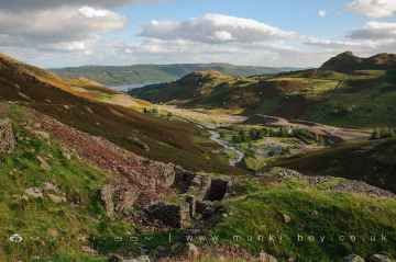
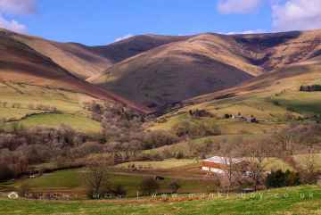
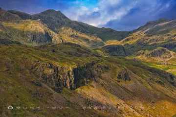
The area around Clifton Dykes boasts some of the best hills including Cartmel Fell, White Pike (Seathwaite), The Knott, Broughton Moor, Catbells, Orrest Head, and Haystacks.
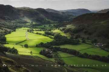
The area around Clifton Dykes boasts some of the best hiking areas including Cartmel Fell, Coniston Coppermines Valley, Borrowdale, Styhead Tarn, Troutbeck, Orrest Head, and Wild Boar Fell.
The area around Clifton Dykes features a number of interesting villages including Eskdale, Coniston, Seatoller, Troutbeck, High Borrans, Kentmere, and Brigsteer.
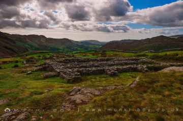
Clifton Dykes has some unmissable ancient sites nearby like Hardknott Roman Fort, The Hawk, Sunkenkirk Stone Circle, Castlerigg Stone Circle, High Borrans Romano-British Settlement, Mayburgh Henge, and Gunnerkeld Stone Circle.
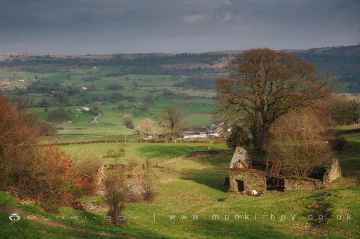
There are a number of ruins near Clifton Dykes including Bonsor East Mine Workings, Bonsor Dressing Floors, Penny Rigg Copper Mill, Appletree Worth, Stephenson Ground Limekiln (ruin), Water Yeat Limekiln (ruin), and Hebblethwaite Hall Gill.
Clifton Dykes's best nearby old mines can be found at Penny Rigg Quarry Adit, Three Kings Mine, Tilberthwaite Gill Head Waterfall Level, Horse Crag Quarry, Tilberthwaite Deep Level Adit, Cathedral Quarry, and Parrock Quarry.
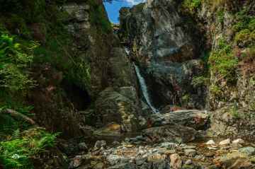
The area around Clifton Dykes features a number of interesting waterfalls including Tilberthwaite Gill, Rydal Falls, Hebblethwaite Hall Gill, Styhead Gill Waterfalls, Taylorgill Force, Aira Force, and Hell Gill Force.
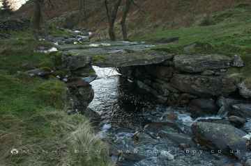
Rivers and Streams to visit near Clifton Dykes include River Lickle, Appletree Worth Beck, Styhead Gill, Crowdundle Beck, Aira Beck, Hell Gill, and River Kent at Kentmere.
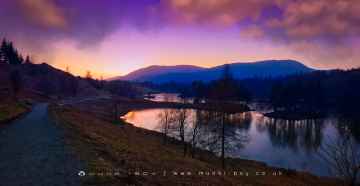
Clifton Dykes's best nearby lakes can be found at Tarn Hows, Thirlmere Reservoir, Derwentwater, Styhead Tarn, Windermere, Wastwater, and Ullswater.
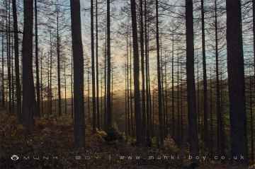
There are a several good woodlands in the Clifton Dykes area like Broughton Moor, Brigsteer Park, Cow Close Wood, Jeffy Knotts Wood, and Grubbins Wood.
Towns to visit near Clifton Dykes include Sedbergh, Bowness On Windermere, Ulverston, Penrith, Kendal, Ambleside, and Kirkby Stephen.
Scafell, Blencathra - Hallsfell Top, Skiddaw, Hartsop Dodd, Stony Cove Pike [Caudale Moor], Place Fell, and Wild Boar Fell are great places to visit near Clifton Dykes if you like mountains.
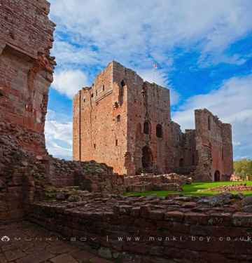
The area around Clifton Dykes boasts some of the best castles including Brough Castle, Lowther Castle, Pendragon Castle, Lammerside Castle, Kendal Castle, Sizergh Castle, and Castlesteads (Lowther).
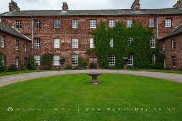
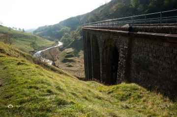
The area around Clifton Dykes features a number of interesting historic buildings including Acorn Bank, Acorn Bank Watermill, Church of St Peter Askham, St Michael’s Church at Lowther, Lowther Mausoleum, Askham Hall, and Smardale Gill Viaduct.
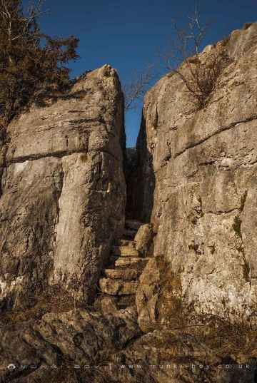
Fairy Steps is a great place to visit close to Clifton Dykes if you like historic monuments.
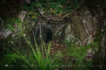
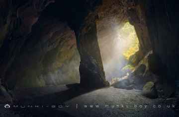
There are a number of caves near Clifton Dykes including Cathedral Quarry, Fairies Cave, Holy Well Cave, and Buttermere Tunnel.
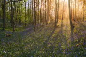
There are a number of bluebell woods near Clifton Dykes including Cow Close Wood, and Jeffy Knotts Wood.
Clifton Dykes is near some unmissable nature reserves like Smardale Gill Nature Reserve,
Smardale Gill Nature Reserve is one of Clifton Dykes's best, nearby disused railway lines to visit in Clifton Dykes.
Airports to visit near Clifton Dykes include Barrow/Walney Island Airport, and Carlisle Lake District Airport.
Piel Island is one of Clifton Dykes's best, nearby islands to visit in Clifton Dykes.
Clifton Dykes History
There are some historic monuments around Clifton Dykes:
- Bowl barrow 850m WSW of Yanwath Woodhouse Farm
- The Giant's Grave - Two Anglian cross-shafts and four hogback stones in St Andrew's churchyard, Penrith
- Two standing stones and a round cairn south of Crooklands
- Roman camp north west of Balmer's Farm
- Castlesteads multivallate prehistoric defended enclosure
- Towtop Kirk early Christian enclosure
- The Giant's Thumb - Anglian high cross in St Andrew's churchyard, Penrith
- Round cairn 280m south-east of The Cockpit stone circle
- Round cairn 490m south east of White Raise round cairn, Askham Fell
- Round cairn 475m south east of White Raise round cairn, Askham Fell
- Little Round Table henge
- Askham Fell stone alignment
- Round cairn west of Riddingleys Top, Askham Fell
- Mayburgh henge
- Long barrow on Trainford Brow
- Settlement 1/3 mile (540m) ENE of Brougham Castle
- Roman marching camp 450yds (410m) NE of Brovacum
- Ring cairn on Askham Fell including The Cop Stone
- Throstle Brow prehistoric enclosure
- Stone circle 800m east of Wetheriggs Pottery
- Round cairn on Burn Banks
- Two standing stones north-west of Four Stones Hill
- Bridge over Heltondale Beck 250yds (230m) SSW of Widewath
- Round cairn 490m ENE of Rough Hill Tarn
- Gunnerkeld concentric stone circle
- Long Meg and Her Daughters stone circle, associated cursus and prehistoric enclosure
- Four funerary cairns and a surrounding cairnfield on Threepow Raise
- White Raise round cairn, Askham Fell
- Settlement 100yds (90m) SE of Sceugh Farm
- Round cairn on Askham Fell, 335m north of the Cop Stone
- Long cairn 370m ESE of Mossthorn Farm
- Edenhall Cross 230m north west of St Cuthbert's Church
- Round cairn 520m north east of The Cockpit, Askham Fell
- Windrigg Hill round cairn, 440m south of High Murber
- Slight univallate hillfort in Scarside Plantation
- Round cairn 285m south east of White Raise round cairn, Askham Fell
- Round cairn on Askham Fell, 270m north of The Cop Stone
- Round cairn north of Four Stones Hill
- Little Meg round cairn
- Round cairn 515m south east of White Raise round cairn, Askham Fell
- Romano-British farmstead at Haweswater
- Brougham Roman fort (Brocavum) and civil settlement and Brougham Castle
- Round barrow 150m east of Scarside Plantation
- King Arthur's Round Table henge
- Romano-British farmstead and a length of Roman road 800m south of Winderwath
- Bowl barrow 350m north east of The Wreay
- Romano-British settlement at Cragside Wood
- Enclosure containing four clearance cairns and a stone bank west of Four Stones Hill
- Eamont Bridge
- Round cairn 580m north east of The Cockpit, Askham Fell
- St Ninian's preconquest monastic site, site of nucleated medieval settlement, St Ninian's Church and churchyard
- Roman fortlet at Salkeld Gate
- Melkinthorpe medieval settlement, part of its associated open field system and the site of Melkinthorpe Hall
- Stone bridge, Cawdale Beck
- The Cockpit stone circle and seven adjacent clearance cairns, Moor Divock
- Dolphenby medieval settlement and part of its associated open field system
- Ring cairn on Knipescar Common
- Clifton Hall tower
- Long cairn 330m east of Mossthorn
- Skirsgill Romano-British enclosed stone hut circle settlement, Romano-British farmstead, and Romano-British regular aggregate field system
- Round cairn 660m north east of The Cockpit, Askham Fell
- Roman road and enclosures SE of Frenchfield
- Sewborrans standing stone 400m south west of Sewborwens
- Moated site and annexe east of Setterahpark Wood
- Bridge over Heltondale Beck 550ft (170m) S of Widewath
- Holme Head standing stone 260m north west of Kitchenhill Bridge
- Ring cairn on Askham Fell and four adjacent stones
- Linear stone bank on Askham Fell
- The Old Kiln, Wetheriggs Pottery
- Ring cairn on Knipescar Common south of Inscar Plantation
- The Countess Pillar
- Strickland's Pele Tower and Penrith Castle
- Round cairn west of enclosure on Four Stones Hill
- Round cairn on Heughscar Hill
- Standing stone 180m NNE of Skirsgill
- Bowl barrow 80m east of Scarside Plantation
- Romano-British settlement and regular aggregate field system north of Yanwath Wood
- Ring cairn east of Threepow Raise
- Two round cairns 415m and 420m NNE of The Cockpit, Moor Divock
- Round cairn 50m north east of White Raise round cairn, Askham Fell
- Round cairn 680m ENE of Dalefoot