Retail in Broad Oak - Cumbria
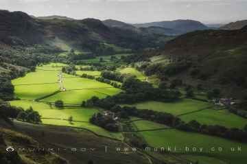
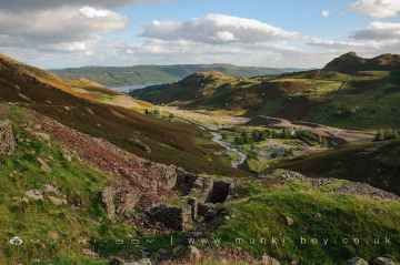
There are great places to visit near Broad Oak - Cumbria including some great hills, hiking areas, villages, ancient sites, ruins, old mines, waterfalls, rivers and streams, lakes, woodlands, towns, mountains, castles, historic buildings, historic monuments, caves, bluebell woods, nature reserves, disused railway lines, airports and islands.
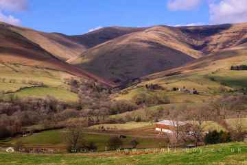
Cartmel Fell, White Pike (Seathwaite), The Knott, Broughton Moor, Catbells, Orrest Head, and Haystacks are some of Broad Oak - Cumbria best hills to visit near Broad Oak - Cumbria.
Broad Oak - Cumbria's best nearby hiking areas can be found at Cartmel Fell, Coniston Coppermines Valley, Borrowdale, Styhead Tarn, Troutbeck, Orrest Head, and Wild Boar Fell.
Eskdale, Coniston, Seatoller, Troutbeck, High Borrans, Kentmere, and Brigsteer are some of Broad Oak - Cumbria best villages to visit near Broad Oak - Cumbria.
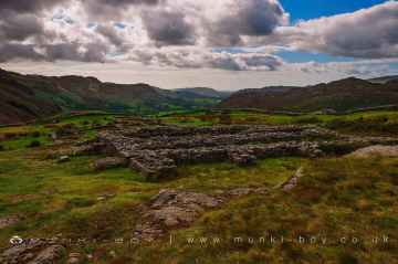
Don't miss Hardknott Roman Fort, The Hawk, Sunkenkirk Stone Circle, Castlerigg Stone Circle, High Borrans Romano-British Settlement, Mayburgh Henge, and Gunnerkeld Stone Circle's ancient sites if visiting the area around Broad Oak - Cumbria.
Ruins to visit near Broad Oak - Cumbria include Bonsor East Mine Workings, Bonsor Dressing Floors, Penny Rigg Copper Mill, Appletree Worth, Stephenson Ground Limekiln (ruin), Water Yeat Limekiln (ruin), and Hebblethwaite Hall Gill.
The area around Broad Oak - Cumbria features a number of interesting old mines including Penny Rigg Quarry Adit, Three Kings Mine, Tilberthwaite Gill Head Waterfall Level, Horse Crag Quarry, Tilberthwaite Deep Level Adit, Cathedral Quarry, and Parrock Quarry.
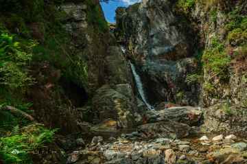
The area around Broad Oak - Cumbria boasts some of the best waterfalls including Tilberthwaite Gill, Rydal Falls, Hebblethwaite Hall Gill, Styhead Gill Waterfalls, Taylorgill Force, Aira Force, and Hell Gill Force.
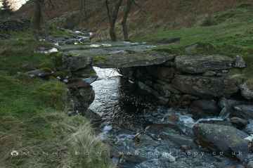
Broad Oak - Cumbria's best nearby rivers and streams can be found at River Lickle, Appletree Worth Beck, Styhead Gill, Crowdundle Beck, Aira Beck, Hell Gill, and River Kent at Kentmere.
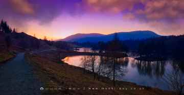
Don't miss Tarn Hows, Thirlmere Reservoir, Derwentwater, Styhead Tarn, Windermere, Wastwater, and Ullswater's lakes if visiting the area around Broad Oak - Cumbria.
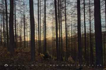
Broughton Moor, Brigsteer Park, Cow Close Wood, Jeffy Knotts Wood, and Grubbins Wood are great places to visit near Broad Oak - Cumbria if you like woodlands.
Don't miss Sedbergh, Bowness On Windermere, Ulverston, Penrith, Kendal, Ambleside, and Kirkby Stephen's towns if visiting the area around Broad Oak - Cumbria.
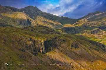
The area around Broad Oak - Cumbria features a number of interesting mountains including Scafell, Blencathra - Hallsfell Top, Skiddaw, Hartsop Dodd, Stony Cove Pike [Caudale Moor], Place Fell, and Wild Boar Fell.
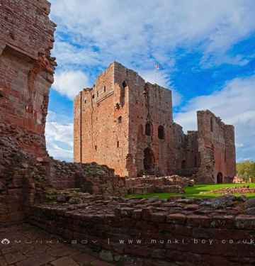
Broad Oak - Cumbria's best nearby castles can be found at Brough Castle, Lowther Castle, Pendragon Castle, Lammerside Castle, Kendal Castle, Sizergh Castle, and Castlesteads (Lowther).
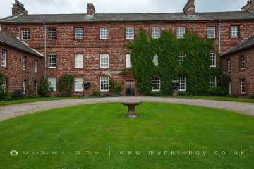
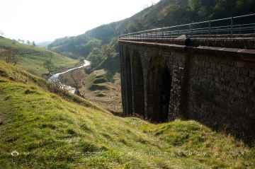
There are a several good historic buildings in the Broad Oak - Cumbria area like Acorn Bank, Acorn Bank Watermill, Church of St Peter Askham, St Michael’s Church at Lowther, Lowther Mausoleum, Askham Hall, and Smardale Gill Viaduct.
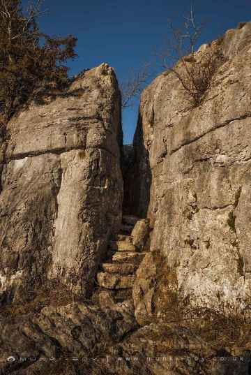
Fairy Steps is one of Broad Oak - Cumbria's best, nearby historic monuments to visit in Broad Oak - Cumbria.
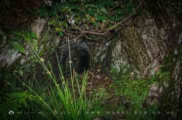
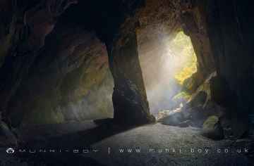
Broad Oak - Cumbria has some unmissable caves nearby like Cathedral Quarry, Fairies Cave, Holy Well Cave, and Buttermere Tunnel.
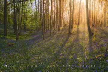
There are a number of bluebell woods near Broad Oak - Cumbria including Cow Close Wood, and Jeffy Knotts Wood.
Smardale Gill Nature Reserve is a great place to visit close to Broad Oak - Cumbria if you like nature reserves.
Smardale Gill Nature Reserve is one of Broad Oak - Cumbria's best, nearby disused railway lines to visit in Broad Oak - Cumbria.
Barrow/Walney Island Airport, and Carlisle Lake District Airport are some of Broad Oak - Cumbria best airports to visit near Broad Oak - Cumbria.
The area around Broad Oak - Cumbria's best islands can be found at Piel Island.
Broad Oak - Cumbria History
There are some historic monuments around Broad Oak - Cumbria:
- Prehistoric cairnfield and associated field system 800m north west and 800m north of Woodend Bridge
- Prehistoric cairnfield and associated field system on Stainton Fell, 330m south of The Knott
- Prehistoric cairnfields, funerary cairns, ring cairns, hut circles, field systems and a medieval enclosed field system on Bootle Fell
- Prehistoric cairnfield on Birkby Fell, 360m south east of Raven Crag
- Prehistoric cairnfield and associated field system north of Pike How, 650m west of High Ground
- Prehistoric cairnfield on Stainton Fell, 660m north of Rowantree Force
- Prehistoric cairnfield and linear boundary on Thwaites Fell immediately north of Hodgewife Well
- Prehistoric cairnfield and two associated hut circles on Corney Fell, 860m north of Buckbarrow Bridge
- Stainton Ling prehistoric hut circle settlement, associated field systems, cairnfields, funerary cairns, and a medieval field system and two shielings
- Prehistoric cairnfield on Stainton Fell, 540m south west of The Knott
- Prehistoric cairnfield and enclosure 750m west of Barnscar settlement
- Prehistoric cairnfield on Stainton Fell, 950m north of Rowantree Force
- Prehistoric cairnfield, field system, two funerary cairns, a Romano-British farmstead, field system and a post-medieval haematite mine at Brantrake Moss
- High cross in St Mary's churchyard
- Prehistoric cairnfield, hut circle settlement, field system, funerary cairn, and a medieval shieling on Birkby Fell west of Devoke Water
- Prehistoric cairnfield, associated field system and hut circle east of Water Crag
- Ravenglass Roman fort bath-house, also known as Walls Castle
- Prehisitoric cairnfield 850m north west of Woodend Bridge
- Roman kilns
- Ravenglass Roman fort
- Mecklin Park cairnfield, 500m north of Ain House
- Prehistoric cairnfield, associated field system and a funerary cairn 520m south of Barnscar settlement
- Prehistoric enclosure containing ten clearance cairns south west of Boat How, Burnmoor
- Pike How prehistoric cairnfield and associated field system 320m south west of High Ground
- Drigg Holme packhorse bridge
- Prehistoric cairnfield and associated field system on Waberthwaite Fell, on the north bank of Charlesground Gill, 880m south east of High Corney
- Prehistoric enclosure south of The Intake, 920m south east of Stainton
- Little Grassoms prehistoric field system, two cairnfields and six funerary cairns on Bootle Fell
- Prehistoric cairnfield on Waberthwaite Fell, 740m south west of Rowantree Force
- Prehistoric cairnfield and associated field system south west of Birkby Fell, 750m north east of The Knott
- Prehistoric cairnfield 420m south east of the triangulation pillar on Rough Crag
- Prehistoric cairnfield and associated field system on Stainton Fell, 760m NNE of Stainton
- Prehistoric cairnfield 660m north east of Barnscar settlement
- Three prehistoric cairnfields and an associated field system on Corney Fell, 1.2km south east of High Corney
- Prehistoric cairnfield 570m south west of Barnscar settlement
- High cross in St Paul's churchyard
- Prehistoric cairnfield on Waberthwaite Fell, 840m north west of Redgill Head
- Prehistoric stone circle, trackway, cairnfields, funerary cairns, hut circles, Romano-British farmstead and a medieval field system, 1.1km SE of Stainton
- Prehistoric enclosure containing three hut circles and eight clearance cairns and an adjacent hut circle and cairnfield north east of Boat How, Burnmoor
- Black Beck North prehistoric cairnfield on Birkby Fell, 950m SSW of the confluence of Linbeck Gill and Black Beck
- Prehistoric cairnfield, ring cairn, hut circle and field system on Thwaites Fell 670m east of Hodgewife Well
- Great Grassoms prehistoric cairnfield, four funerary cairns, two medieval dispersed settlements and associated field systems on Bootle Fell
- Sunkenkirk Stone Circle, 230m south east of Swinside
- Prehistoric cairnfield and associated field system 630m east of the confluence of Hall Beck and Devoke Water
- Prehistoric cairnfield south west of Water Crag, 290m north west of the confluence of Linbeck Gill and Devoke Water
- Prehistoric round cairn on Whitfell
- Prehistoric long cairn on Stainton Fell, 940m north east of Rowantree Force
- Seaton nunnery (site of)
- Prehistoric cairnfield on Corney Fell, 680m north east of Charlesground
- Prehistoric cairnfield and associated field system on Corney Fell, 620m south east of Lambground
- Prehistoric cairnfields, field systems, hut circles and a farmstead on Corney Fell, 440m north west of Buckbarow Bridge
- High cross shaft, high cross head, and high cross base in St Michael and All Angels churchyard
- High cross shaft in St John's churchyard
- Barnscar prehistoric cairnfield, two hut circle settlements, field systems, funerary cairns, and a Romano-British farmstead, trackway and field system
- Cairnfield including a prehistoric enclosure, 5 stone circles, 10 funerary cairns, 6 stone banks, 2 stone walls, a lynchet and a trackway on Burnmoor
- Hare Gill prehistoric cairnfield, hut circle settlement and associated field system 715m SSE of Fisher Gate
- Prehistoric cairnfield and associated field system 350m west of The Knott