Winston
Winston is a Village in the county of County Durham.
There are great places to visit near Winston including some great waterfalls, towns, country parks and airports.
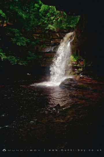
The area around Winston's best waterfalls can be found at Summerhill Force.
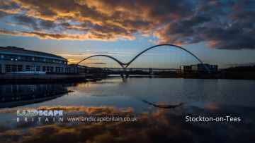
The area around Winston features a number of interesting towns including Stockton-on-Tees, and Middleton-in-Teesdale.
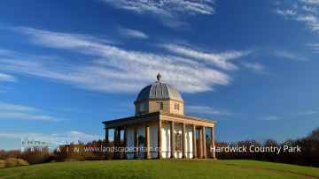
There are a number of country parks near to Winston including Hardwick Country Park.
The area close to Winston boasts some of the best airports including Teesside International Airport.
Winston History
There are some historic monuments around Winston:
- Cup marked stone 565m NNE of the triangulation point on Feldom Rigg
- Cup and ring marked stone 435m south of Jenny's Plantation
- Cup marked stone on Gayles Plantation, 360m east of Shooters Well
- Cairn, 545m ESE of Bragg House, Barningham Moor
- Cup marked stone on Gayles Plantation 370m ESE of Shooters Well
- Whorlton suspension bridge
- Cup and ring marked stone 415m NNW of Folly Plantation
- Two moated sites, the site of a dovecote and further associated features 120m north west and 180m north of The Old Hall
- Barforth Bridge
- Cup and ring marked stone 650m SSE of Jenny's Plantation
- Cup and ring marked stone 520m north east of the triangulation point on Feldom Rigg
- Cup marked stone 620m south of Jenny's Plantation
- Cup marked stone 370m NNW of north corner of Folly Plantation
- Section of Scots Dyke linear boundary 235m south of Stanwick Hall Reservoir
- Cup and ring marked stone 440m NNE of the triangulation point on Feldom Rigg
- Enclosures and industrial workings on Cockfield Fell
- Cup marked stone 525m SSW of Jenny's Plantation
- Medieval settlement remains immediately south east of Hutton Hall
- Cup marked stone on Gayles Plantation, 360m ENE of Shooters Well
- Cup marked stone on Gayles Plantation, 365m east of Shooters Well
- Cup and ring marked stone 350m north west of north corner of Folly Plantation
- Packhorse bridge
- Greta Bridge Roman fort, vicus and section of Roman road
- St Lawrence's Chapel, manorial settlement remains and dovecote
- Section of Scots Dyke linear boundary 250m north of Langdale
- Cup marked stone 495m NNE of the triangulation point on Feldom Rigg
- Cup marked stone 495m south east of Jenny's Plantation
- Section of Scots Dyke linear boundary east of Langdale Rush
- Section of Scots Dyke linear boundary 600m south east of Park House
- Castle Steads slight univallate hillfort and associated outwork
- Cup marked stone on Gayles Plantation 490m ENE of Shooters Well
- Section of Scots Dyke linear boundary in Low Wood, Langdale
- Ravensworth motte and bailey castle, water defence features, park pale and shrunken medieval village
- Ring cairn on Gayles Plantation, 390m ENE of Shooters Well
- Cup marked stone 165m NNE of Folly Plantation
- Cup marked stone 505m south east of Jenny's Plantation
- Roman fort and prehistoric enclosed settlement 400m west of Carkin Moor Farm
- Section of Scots Dyke linear boundary, 650m ENE of Park House
- Summerhouse moated site and associated drainage channels, enclosure and field system
- Section of Scots Dike linear boundary north of Kirklands Farm
- Packhorse bridge across Aldbrough Beck, immediately south west of High Green
- Greta Bridge
- Cup and ring marked stone 465m NNE of the triangulation point on Feldom Rigg
- Cup and ring marked stone on Gayles Plantation 410m north of the triangulation point on Feldom Rigg
- Stanwick Late Iron Age oppidum, Iron Age and medieval settlement, early Christian church and sculpture and post-medieval emparkment
- Cup and ring marked stone 585m SSW of Jenny's Plantation
- Section of Scots Dike linear boundary south of Kirklands Farm
- Penny Hill camp
- Cup marked stone on Gayles Plantation, 370m ENE of Shooters Well
- Cup and ring marked stone 530m NNW of the triangulation point on Feldom Rigg
- Cup marked stone on Gayles Plantation, 440m ENE of Shooters Well
- Remains of St Michael's Church, 50m north west of Dairy Bridge, Rokeby Park
- Cup marked stone 565m north of the triangulation point on Feldom Rigg
- Cup marked stone 490m NNE of the triangulation point on Feldom Rigg
- Cup marked stone 18m south of Stone Man Plantation
- Ring cairn on Gayles Moor
- Section of Scots Dike linear boundary north west of High Merrybent
- Medieval church site and churchyard cross, 10m south and 40m south east of St Michael's Church
Places to see near Winston
Lakes near Winston
Rivers near Winston
- Croxdale Beck from Source to Wear
- Old Durham Beck from Source to Pittington Beck
- Twizell Burn from Source to Cong Burn
- Valley Burn from Source to Wear
- Blackdene Burn to confluence with Wear
- Pittington Beck from Coalford to Old Durham Beck
- Brancepeth Beck from Source to Wear
- South Burn to confluence with Wear
- Hendon Coastal Area
- Cong Burn from Source to Twizell Burn
- Old Durham Beck from Chapman Beck to Wear
- Cong Burn from Twizell Burn to Wear
- Lumley Park Burn from Source to Herrington Burn
- Wear DS of Lumley Park Burn to Tidal Limit
- Lumley Park Burn from Herrington Burn to R Wear
- Wear from Gaunless to Browney
- Wear from Croxdale Beck to Lumley Park Burn
- Herrington Burn from Source to Lumley Park Burn
- Deerness from Source to Hedleyhope Burn
- Browney from Source to Pan Burn
- Smallhope Burn from Source to Browney, Stocke
- Deerness from Hedleyhope Burn to Browney
- Browney from Pan Burn to Smallhope Burn
- Browney from Deerness confl to Wear
- Pan Burn Catchment (Trib of River Browney)
- Hedleyhope Burn from Source to Deerness
- Browney from Smallhope Burn Deerness confl
- Westernhope Burn from Source to Wear
- Ireshope Burn
- Wear from Middlehope Burn to Houselop Beck
- Swinhope Burn from Source to Wear
- Kilhope Burn from Source to Wear
- Burnhope Burn from Source to Wear
- Wear from Wearhead to Middlehope Burn, Iresho
- Stanhope Burn from Source to Wear
- Waskerley Beck from Source to Wear
- Middlehope Burn from Source to Wear
- Rookhope Burn from Source to Wear
- Bollihope Burn from Source to Wear
- Crimdon Beck from Source to Sea
- Hawthorn Burn from Source to North Sea
- Dalton Beck to North Sea
- Castle Eden Burn from Source to North Sea
- Castle Eden Burn from Source to North Sea
- Gaunless from Source to Hummer Beck
- Hummer Beck from Source to Gaunless
- Gaunless from Hummer Beck to Wear
- Wear from Beechburn Beck to Gaunless
- Wear from Houselop Beck to Beechburn Beck
- Bedburn Beck from Source to Euden Beck
- Houselop Beck from Source to Wear
- Beechburn Beck (Trib of Wear)
- Euden Beck Catchment (Trib of Bedburn Beck)
- South Grain Beck from Source to Bedburn Beck
- Linburn Beck from Source to Wear
- Harthorpe Beck (Trib of Bedburn Beck)
- Bedburn Beck from Euden Beck to Wear
- Horsleyhope Burn Catchment (Trib of Derwent)
- Nookton Burn from Source to River Derwent
- Pont Burn Catchment (trib of Derwent)
- Derwent from Nookton Burn to Burnhope Burn
- Derwent from Source to Nookton Burn
- Derwent from Burnhope Burn to River Tyne
- Burnhope Burn from Source to River Derwent
- Don from Source to Tidal Limit
- New Burn (Trib of Tyne)
- Blaydon Burn
- Ouse Burn from Source to Tyne
- Brierdene Burn from Source to North Sea
- Wallsend Burn (Trib of Tyne)
- Team from Source to Tyne
- Devils Water from Rowley Burn to Tyne
- Stocksfield Burn Catchment (trib of Tyne)
- March Burn Catchment (trib of Tyne)
- Red Burn (Trib of Tyne)
- Horsley to Throckley Area (Tyne N Bank)
- Tyne from Watersmeet to Tidal Limit
- Rowley Burn Catchment (Trib of Devils Water)
- Cor Burn Catchment (Trib of Tyne)
- West Dipton Burn from Source to Devil's Water
- Devils Water from Source to Rowley Burn
- Stanley Burn Catchment (trib of Tyne)
- Whittle Burn Catchment (trib of Tyne)
- Woodham Burn from Source to Rushyford beck
- Skerne form Woodham Burn to Demons Beck
- Upper Cocker Beck Catchment (trib of Skerne)
- Skerne from Carrs to Woodham Burn
- Skerne from Demons Beck to Tees
- Woodham Burn from Rushyford Beck to the Skerne
- Skerne from Source to Carrs
- Dene Beck Catchment (trib of Skerne)
- Carrs from Source to Skerne
- Rushyford Beck from Source to Woodham Burn
- Greta from Source to Sleightholme Beck
- Sleightholme Beck from Source to Greta
- Clow Beck from Barton Beck to Tees
- Greta from Sleightholme Beck to Eller Beck
- Tees from Percy Beck to River Greta
- Barton Beck from Source to Clow Beck
- Piercebridge Beck from Source to Tees
- Percy Beck Catchment (Trib of Tees)
- Greta from Eller Beck to Gill Beck
- Sudburn Beck from Source to Langley Beck
- Tees from River Greta to River Skerne
- Greta from Gill Beck to River Tees
- Deepdale Beck from Source to River Tees
- Langley Beck from Source to Sudburn Beck
- Aldbrough Beck from Source to Clow Beck
- Eller Beck from Source to River Greta
- Aldbrough Beck from Forcett Park Catch to Clow Bk
- Langley Bk and Westholme Bk frm Sudburn Bk to Tees
- Mary Wild Beck from Source to Clow Beck
- Gill Beck from Source to Greta
- Nidd from Ashfoldside Beck to Birstwith
- Nidd from Howstean Beck to Ashfoldside Beck
- Howstean Beck from Source to River Nidd
- Nidd from Source to Howstean Beck
- Ashfoldside Beck to River Nidd
- Darley Beck Catchment (Trib of Nidd)
- Fell Beck/Far Beck Catch (Trib of Nidd)
- Nidd from Oak Beck to Low Bridge on Briggate (Knaresborough)
- Crimple Beck from Park Beck to River Nidd
- Nidd from Crimple Beck to River Ouse
- Oak Beck Catchment (Trib of Nidd)
- Nidd from Low Bridge on Briggate (Knaresborough) to Crimple Beck
- Thornton Beck Catch (Trib of Nidd)
- Crimple Beck from Source to Park Beck
- Nidd from Burstwith to Oak Beck
- Gundrifs Beck (trib of Nidd)
- Park Beck Catch (trib of Crimple Beck)


