West Park - Darlington
West Park - Darlington is a Village in the county of County Durham.
Retail in West Park - Darlington
There are great places to visit near West Park - Darlington including some great waterfalls, towns, country parks and airports.
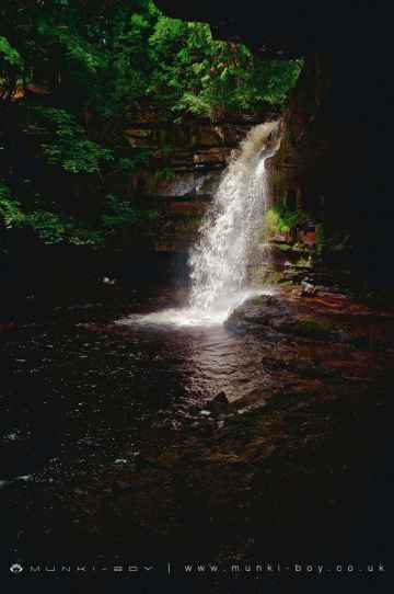
Don't miss Summerhill Force's waterfalls if visiting the area around West Park - Darlington.
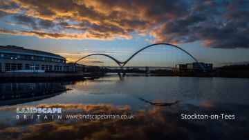
There are a number of towns near West Park - Darlington including Stockton-on-Tees, and Middleton-in-Teesdale.
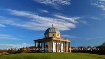
Don't miss Hardwick Country Park's country parks if visiting the area around West Park - Darlington.
The area close to West Park - Darlington boasts some of the best airports including Teesside International Airport.
West Park - Darlington History
There are some historic monuments around West Park - Darlington:
- Burnt mound at Knott Well 370m north east of Stotley Grange
- Late prehistoric ditched, scarp-edge settlement 400m south-south-west of East Mellwaters farmhouse
- Ring cairn on Goldsborough, Cotherstone Moor, 840m south of Pitcher House
- Cup, ring and groove marked rock on Kearton Rigg, 430m south of West Loups's, Cotherstone Moor
- Roman period native settlements and field system, hut circle, bloomeries, lead smelting site and charcoal pits immediately south east of East Force Garth
- Two burnt mounds 350m north east of Stotley Grange
- Burnt mound between Knottwell Sike and Bell Sike, 420m north east of Stotley Grange
- Cup and ring marked rock 130m south west of West Loups's, Cotherstone Moor
- Cup and ring marked rock on Goldsborough Rigg, Cotherstone Moor, 860m south east of Pitcher House
- Roman Fort (Lavatrae)
- Rey Cross Roman temporary camp and signal station, and prehistoric stone circle
- Cairnfield on Ravock, 880m north west of Rovegill House
- Coldberry lead mine and associated hushes
- Roman aqueduct, prehistoric field systems, cairnfield, enclosure and round cairn on Ravock
- Cup and ring marked rock on Cotherstone Moor 520m north west of East Loups's
- A prehistoric carved rock with four cups 620m north of Brier Dykes, Baldersdale
- Four carved rocks on Blake Hill, 520m NNW of Hill Gill Farm, Baldersdale
- Roman period native farmstead at Hind Gate, 140m south of Green House
- Cup marked rock outcrop at the base of a wall 120m east of East Loups's, Cotherstone Moor
- Two burnt mounds south of Blackmea Crag Sike, 590m south west of Castle House
- Cup and groove marked rock on Goldsborough Rigg, Cotherstone Moor, 920m south east of Pitcher House
- Burnt mound on the south bank of Scar Beck, 510m south west of Mizzes House
- Cairn on a prominent knoll and cairnfield to its south east on Ravock, Bowes Moor
- Group of eight shielings and a track on Crossthwaite Scars 675m north west of Park End
- Cup and groove marked rock 450m WNW of Howgill Grange, Baldersdale
- Cup, ring and groove marked rock 170m south west of West Loups's, Cotherstone Moor
- Unenclosed hut circle settlement, two round cairns, medieval transhumance settlement and two pillow mounds, 360m south east of Rey Cross Roman camp
- Roman period native settlement, medieval bloomery, building and track, and a charcoal pit at Keld Smithy Green, Holwick Fell
- Roman period native settlement and a bloomery 160m north west of Bleabeck Force
- Medieval farmstead and two prehistoric carved rocks at West Loup's
- A carved rock with at least 12 cups, 560m north of Brier Dykes, Baldersdale
- Cup marked rock on the summit of the hill, 420m west of Howgill Grange
- Rey Cross, 670m west of Old Spital
- Three prehistoric carved rocks on Goldsborough Rigg, Cotherstone Moor, 860m SSE Pitcher House
- Cup, ring and groove marked rock 310m west of East Loups's, Cotherstone Moor
- Rock with many cup marks on the east bank of How Beck, 450m north west of West Loups's, Cotherstone Moor
- Burnt mound, cairnfield and bloomery at Eel Beck, 480m south of Blackmea Crag, Holwick Fell
- Roman signal station 190m north west of Vale House Farm
- Romano-British settlement 740m WNW of Old Spital
- Cairn on the north side of Ravock, Bowes Moor, 600m west of West Stoney Keld
- Two Romano-British hut circles and three shielings on Holwick Scars 250m south of Hungry Hall
- Prehistoric settlement, two burnt mounds and a burial cairn on the north bank of Blackmea Crag Sike, 570m south west of Middle Farm
- Cairn on a low ridge on the east side of Ravock, Bowes Moor, 860m west south west of West Stoney Keld
- Medieval iron industry and settlement and Bronze Age burial cairns extending from 260m north west of Eel Beck to 140m south east of Wash Beck
- Rock with one cup on Goldsborough Rigg, Cotherstone Moor, 860m north west of West Loups's
- A palisaded hilltop enclosure, a carved rock and a small enclosure, 480m north west of Brier Dykes, Baldersdale
- Bowes Castle
- Pike Law lead hushes and mines
- Romano-British hut circle and enclosing bank and ditch immediately east of High Force Quarry
- Cup and ring marked rock on Goldsborough Rigg, Cotherstone Moor, 870m south south east of Pitcher House
- Roman signal station and camp 270m north east of Bowes Moor Hotel
- Late prehistoric walled settlement 200m south-south-east of East Mellwaters farmhouse
- Burial cairns, burnt mound, Roman native settlement, medieval settlement with field system and iron industry remains, and five shielings on Holwick Fell
- Romano-British and medieval settlement and field systems,leadmines and charcoal pit on Crossthwaite Common, south of Park End Quarry
- Romano-British settlement site to the east and south-east of East Mellwaters farmhouse
- Medieval farmstead 390m south of Lodge Sike Farm
- Roman period native settlement and field system 260m west of Wynch Bridge
- Cup and ring marked rock 80m south of West Loups's, Cotherstone Moor
- Cairnfield on the north east slope of Ravock, Bowes Moor
- Three cairns on Ravock, Bowes Moor, 830m north east of Ravock Castle
- Cup and groove marked rock on the south bank of Scaletree Gill, 560m north west of Park House Farm, Baldersdale
- Cup and groove marked rock 590m north of Brier Dykes, Baldersdale
- Medieval farmstead 330m north west of Water Knott
- A group of six shielings and tracks on Holwick Scars, 280m west of Hungry Hall
- Cairnfield on Ravock, 600m south east of Ravock Castle, Bowes Moor
- Cup ring and groove marked rock outcrop at Toby Wall, 260m north east of West Loups's, Cotherstone Moor
- Cup marked rock 100m north of West Loups's, Cotherstone Moor
- Medieval linear earthwork, enclosures and farmstead and Bronze Age burnt mound 110m and 420m north west of Heatherlea
Places to see near West Park - Darlington
Lakes near West Park - Darlington
Rivers near West Park - Darlington
- Croxdale Beck from Source to Wear
- Old Durham Beck from Source to Pittington Beck
- Twizell Burn from Source to Cong Burn
- Valley Burn from Source to Wear
- Blackdene Burn to confluence with Wear
- Pittington Beck from Coalford to Old Durham Beck
- Brancepeth Beck from Source to Wear
- South Burn to confluence with Wear
- Hendon Coastal Area
- Cong Burn from Source to Twizell Burn
- Old Durham Beck from Chapman Beck to Wear
- Cong Burn from Twizell Burn to Wear
- Lumley Park Burn from Source to Herrington Burn
- Wear DS of Lumley Park Burn to Tidal Limit
- Lumley Park Burn from Herrington Burn to R Wear
- Wear from Gaunless to Browney
- Wear from Croxdale Beck to Lumley Park Burn
- Herrington Burn from Source to Lumley Park Burn
- Deerness from Source to Hedleyhope Burn
- Browney from Source to Pan Burn
- Smallhope Burn from Source to Browney, Stocke
- Deerness from Hedleyhope Burn to Browney
- Browney from Pan Burn to Smallhope Burn
- Browney from Deerness confl to Wear
- Pan Burn Catchment (Trib of River Browney)
- Hedleyhope Burn from Source to Deerness
- Browney from Smallhope Burn Deerness confl
- Westernhope Burn from Source to Wear
- Ireshope Burn
- Wear from Middlehope Burn to Houselop Beck
- Swinhope Burn from Source to Wear
- Kilhope Burn from Source to Wear
- Burnhope Burn from Source to Wear
- Wear from Wearhead to Middlehope Burn, Iresho
- Stanhope Burn from Source to Wear
- Waskerley Beck from Source to Wear
- Middlehope Burn from Source to Wear
- Rookhope Burn from Source to Wear
- Bollihope Burn from Source to Wear
- Crimdon Beck from Source to Sea
- Hawthorn Burn from Source to North Sea
- Dalton Beck to North Sea
- Castle Eden Burn from Source to North Sea
- Castle Eden Burn from Source to North Sea
- Gaunless from Source to Hummer Beck
- Hummer Beck from Source to Gaunless
- Gaunless from Hummer Beck to Wear
- Wear from Beechburn Beck to Gaunless
- Wear from Houselop Beck to Beechburn Beck
- Bedburn Beck from Source to Euden Beck
- Houselop Beck from Source to Wear
- Beechburn Beck (Trib of Wear)
- Euden Beck Catchment (Trib of Bedburn Beck)
- South Grain Beck from Source to Bedburn Beck
- Linburn Beck from Source to Wear
- Harthorpe Beck (Trib of Bedburn Beck)
- Bedburn Beck from Euden Beck to Wear
- Horsleyhope Burn Catchment (Trib of Derwent)
- Nookton Burn from Source to River Derwent
- Pont Burn Catchment (trib of Derwent)
- Derwent from Nookton Burn to Burnhope Burn
- Derwent from Source to Nookton Burn
- Derwent from Burnhope Burn to River Tyne
- Burnhope Burn from Source to River Derwent
- Don from Source to Tidal Limit
- New Burn (Trib of Tyne)
- Blaydon Burn
- Ouse Burn from Source to Tyne
- Brierdene Burn from Source to North Sea
- Wallsend Burn (Trib of Tyne)
- Team from Source to Tyne
- Devils Water from Rowley Burn to Tyne
- Stocksfield Burn Catchment (trib of Tyne)
- March Burn Catchment (trib of Tyne)
- Red Burn (Trib of Tyne)
- Horsley to Throckley Area (Tyne N Bank)
- Tyne from Watersmeet to Tidal Limit
- Rowley Burn Catchment (Trib of Devils Water)
- Cor Burn Catchment (Trib of Tyne)
- West Dipton Burn from Source to Devil's Water
- Devils Water from Source to Rowley Burn
- Stanley Burn Catchment (trib of Tyne)
- Whittle Burn Catchment (trib of Tyne)
- Woodham Burn from Source to Rushyford beck
- Skerne form Woodham Burn to Demons Beck
- Upper Cocker Beck Catchment (trib of Skerne)
- Skerne from Carrs to Woodham Burn
- Skerne from Demons Beck to Tees
- Woodham Burn from Rushyford Beck to the Skerne
- Skerne from Source to Carrs
- Dene Beck Catchment (trib of Skerne)
- Carrs from Source to Skerne
- Rushyford Beck from Source to Woodham Burn
- Greta from Source to Sleightholme Beck
- Sleightholme Beck from Source to Greta
- Clow Beck from Barton Beck to Tees
- Greta from Sleightholme Beck to Eller Beck
- Tees from Percy Beck to River Greta
- Barton Beck from Source to Clow Beck
- Piercebridge Beck from Source to Tees
- Percy Beck Catchment (Trib of Tees)
- Greta from Eller Beck to Gill Beck
- Sudburn Beck from Source to Langley Beck
- Tees from River Greta to River Skerne
- Greta from Gill Beck to River Tees
- Deepdale Beck from Source to River Tees
- Langley Beck from Source to Sudburn Beck
- Aldbrough Beck from Source to Clow Beck
- Eller Beck from Source to River Greta
- Aldbrough Beck from Forcett Park Catch to Clow Bk
- Langley Bk and Westholme Bk frm Sudburn Bk to Tees
- Mary Wild Beck from Source to Clow Beck
- Gill Beck from Source to Greta
- Nidd from Ashfoldside Beck to Birstwith
- Nidd from Howstean Beck to Ashfoldside Beck
- Howstean Beck from Source to River Nidd
- Nidd from Source to Howstean Beck
- Ashfoldside Beck to River Nidd
- Darley Beck Catchment (Trib of Nidd)
- Fell Beck/Far Beck Catch (Trib of Nidd)
- Nidd from Oak Beck to Low Bridge on Briggate (Knaresborough)
- Crimple Beck from Park Beck to River Nidd
- Nidd from Crimple Beck to River Ouse
- Oak Beck Catchment (Trib of Nidd)
- Nidd from Low Bridge on Briggate (Knaresborough) to Crimple Beck
- Thornton Beck Catch (Trib of Nidd)
- Crimple Beck from Source to Park Beck
- Nidd from Burstwith to Oak Beck
- Gundrifs Beck (trib of Nidd)
- Park Beck Catch (trib of Crimple Beck)


