


St Ive Keason
St Ive Keason is a village in the county of Cornwall.
There are great places to visit near St Ive Keason including some great hiking areas, country parks, towns, hills, villages, historic buildings and airports.
There are a several good hiking areas in the area around St Ive Keason like Tehidy.
Country Parks to visit near St Ive Keason include Tehidy Country Park, Kit Hill Country Park, and Mount Edgcumbe House and Country Park.
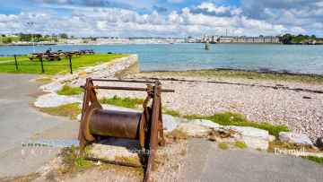
There are a number of towns near St Ive Keason including Callington, Polperro, and St Ives.
The area around St Ive Keason's best hills can be found at Kit Hill Country Park.
Don't miss Cremyll, and Botallack's villages if visiting the area around St Ive Keason.
Don't miss Mount Edgcumbe House and Country Park's historic buildings if visiting the area around St Ive Keason.
St Ive Keason has some unmissable airports nearby like Cornwall Airport Newquay, and Land's End Airport.
St Ive Keason History
There are some historic monuments around St Ive Keason:
- Stone hut circle 812m WSW of East Castick Farm
- Prehistoric standing stone 1.375km WNW of Blackcoombe Farm
- Prehistoric enclosure with three adjacent hut circles 700m NNE of Minions
- Prehistoric regular and irregular aggregate field systems incorporating three hut circle settlements, medieval farmhouse and enclosure N of Wardbrook Farm
- Medieval wayside cross in St Ivo's churchyard, 10m ESE of the church
- Two stone hut circles 1.15km WSW of East Castick Farm
- The Hurlers: three stone circles with paired outlying stones
- Round cairn 740m SSW of Caradon Hill summit
- Stone hut circle 1.225km WSW of East Castick Farm
- Banked cairn 125m NNE of Caradon Hill summit
- Round cairn 612m SE of Trewalla Farm
- Round cairn 725m ESE of Trewalla Farm
- New Consols Mine: surface, buried and underground remains, Luckett
- Prehistoric funerary cist 1.275km NW of Wardbrook Farm
- Stone hut circle with concentric annexe 1.4km SW of East Castick Farm
- Round cairn with central cist 970m ENE of Trewortha Farm
- Medieval bridge at Starabridge
- Two stone hut circles 1.035km ENE of Trewortha Farm
- Trethevy Quoit
- Medieval and post-medieval tin and copper mines with medieval field system on the middle and lower northern slopes of Caradon Hill
- Stone hut circle 82m south-east of Wardbrook Farm
- Stone hut circle 987m WSW of East Castick Farm
- Medieval wayside cross in St Ivo's churchyard, 0.3m south of the church
- St Cleer's Well and cross
- Round cairn and shelters 812m SSW of Caradon Hill summit
- Round cairn with peripheral berm 402m SSW of Caradon Hill summit
- Two stone hut circles 937m WSW of East Castick Farm
- Round cairn 525m east of Trewalla Farm
- Round cairn 230m SW of Caradon Hill summit
- Holmbush Mine: Windsor Lane rotative engine house with adjacent boiler house, loadings and platform
- Round cairn 472m SSW of Caradon Hill summit
- Round cairn 1.175km WSW of East Castick Farm
- Two cairns 550m and 587m ENE of Trewalla Farm and two adjacent small clearance cairns
- Tencreek Cross in St Martin's churchyard 3.5m south east of the church
- Stone hut circle 812m NW of Wardbrook Farm
- Multi-span bridge called Berriow Bridge
- Stone hut circle 1.37km SW of East Castick Farm
- The Longstone medieval wayside cross 750m SW of Minions
- St Mellor's Well
- Round cairn with central cist 1.05km east of Trewortha Farm
- Three medieval wayside crosses 70m SW of Trebartha Hall
- Prehistoric cairn 675m SE of Trewalla Farm
- South Caradon 19th century copper mine
- Medieval hall and St Mary Magdalene's Chapel at Trecarrell
- Stone hut circle 1.34km SW of East Castick Farm
- Craddock Moor stone circle and adjacent peat-stack platform 800m NNE of Trewalla Farm
- Round called Rings Camp
- Stone hut circle 1.287km WSW of East Castick Farm
- Two adjacent transhumance huts on Caradon Hill, 450m north of East Caradon Farm
- Early medieval transhumance hut 740m west of Blackcoombe Farm
- Stone hut circle 800m ESE of Trewalla Farm
- Westcott Cross, 480m south east of Westcott Lodge
- Round barrow on Bin Down
- Round cairn with central cist on Bearah Common, 1.106km north of Wardbrook Farm
- Unenclosed hut circle settlement with adjacent enclosure and linear boundary 1.41km SW of East Castick Farm
- Stone hut circle 685m SE of Trewalla Farm
- Wayside cross 60m south of Northcombe Farm
- Tor cairn with adjacent sub-rectangular hut 650m SSW of Caradon Hill summit
- Medieval churchyard cross in Callington churchyard
- Ring cairn 77m E of Caradon Hill summit
- Henge 315m north west of Westcott
- Two adjoining stone hut circles 1.12km WSW of East Castick Farm
- Round cairn 1.162km NW of Wardbrook Farm
- Round cairn 480m SSW of Caradon Hill summit
- Neolithic long cairn, Prehistoric regular and irregular aggregate field systems, linear boundaries and medieval enclosure 625m W of Blackcoombe Farm
- Unenclosed stone hut circle settlement incorporating three enclosures and two cairns 1.06km WSW of East Castick Farm
- Round cairn 840m SE of Trewalla Farm
- Round barrows on Hingston Down
- Prehistoric irregular aggregate field system with incorporated stone hut circle 1.125km SW of East Castick Farm
- Earlier Prehistoric hillfort, two cairns, medieval pound and adjacent Prehistoric field systems, hut circles and transhumance huts on Stowe's Hill
- Embanked platform cairn 47m NW of Caradon Hill summit
- Two stone hut circles and adjacent Prehistoric boundary wall 575m west of West Berriow Farm
- Wayside cross 50m north east of Carracawn Cross
- Prehistoric round cairn on Caradon Hill, 520m north west of Heather House
- Kerbed platform cairn with kerbed central mound and outer bank 600m east of Trewalla Farm
- Embanked platform cairn with internal mound and peripheral berm 1km NNE of Trewalla Farm
- Three stone hut circles 1.055km ENE of Trewortha Farm
- Prehistoric round cairn on the eastern outcrop of Bearah Tor
- Iron Age defended settlement in Dunterue Wood, 570m south of Castle Head
- Prehistoric clearance cairn 962m north-west of Wardbrook Farm
- Holy Well at Rezare
- Two stone hut circles and an adjoining Prehistoric boundary wall 470m east of Trewalla Farm
- Iron Age defended settlement at Padderbury Top
- Medieval churchyard cross in Quethiock churchyard
- Three adjoining Prehistoric linear boundaries on Bearah Tor, 687m SW of Nodmans Bowda Farm
- Slight univallate hillfort called Cadson Bury
- Two cairns, centred 82m and 110m SW of Caradon Hill summit
- Stone hut circle 1.365km SW of East Castick Farm
- Unenclosed hut circle settlement incorporating a small cairn 875m ENE of Trewortha Farm
- Stone hut circle 750m ESE of Trewalla Farm
- The Rillaton Barrow, 500m NNE of The Hurlers stone circles
- Stone hut circle 975m WSW of West Castick Farm
- Culverland Cross in St Martin's churchyard to the north west of the church
- Three round cairns on the summit of Langstone Downs
- Round cairn 527m SSW of Caradon Hill summit
- Prehistoric platform cairn on Caradon Hill, 550m north west of Heather House
- Castle Head promontory fort
- Banked cairn 175m SW of Caradon Hill summit
- Round cairn 557m SSW of Caradon Hill summit
- Hilltop enclosure 330m south of Hardstone Cottage
- Slight univallate hillfort with outworks called Blacketon Rings
- Prehistoric linear boundary with adjacent stone hut circle, two round cairns and cairnfield 1.125km north of Wardbrook Farm
- Round cairn 580m NW of Wardbrook Farm
- Stone hut circle 1.35km SW of East Castick Farm
- Enclosure on Kit Hill
- Prehistoric linear boundary and adjacent round cairn 938m north-west of Wardbrook Farm
- Two stone hut circles 1.03km WSW of East Castick Farm
- Medieval churchyard cross in St Cleer churchyard
- Dupath holy well, 45m NNE of Dupath Farm
- Prehistoric enclosure with adjacent stone hut circle 780m NNE of Minions
- Two round barrows on Viverdon Down
- Round cairn 775m NW of Wardbrook Farm
- Stone hut circle 954m WSW of East Castick Farm
- The South Hill inscribed stone, an early Christian memorial stone in South Hill churchyard, 50m west of St Sampson's Church
- Early post-medieval tin streamwork at Gonamena
- Allabury Camp slight univallate hillfort 425m WNW of West Castick Farm
- Round called Roundabury
- Round called Killabury
- Round cairn 15m SSE of Caradon Hill summit
- Prehistoric round cairn on Caradon Hill, 310m west of Heather House
- Round cairn 750m ENE of Trewortha Farm
- Platform cairn 225m west of Minions
- Holmbush Mine: Hitchen's Shaft complex
- Round cairn 1.14km NW of Wardbrook Farm
- Round cairn with central cist 1km ENE of Trewortha Farm
- Round cairn 812m ESE of Trewalla Farm
Places to see near St Ive Keason


Lakes near St Ive Keason
Rivers near St Ive Keason
- West Looe River
- Polperro River
- East Looe River
- Seaton
- Upper River Ruthern
- Amble
- Camel (De Lank to Stannon)
- Stannon Stream
- Lower River Camel
- St Lawrence Stream
- Issey Brook (Camel)
- Upper River Amble
- De Lank River
- Lower River Ruthern
- Demelza Stream (Ruthern)
- Polmorla Stream
- Upper River Camel
- Amble tributary (Camel)
- Allen
- Lanivet Stream
- Porth Stream
- Gannel (Upper)
- Menalhyl
- Gannel (Lower)
- Harlyn Water
- Benny Stream
- Porthcothan Stream
- Trebant Water
- Lerryn River
- Cardinham Water
- Warleggan River
- Fowey (Upper)
- Fowey (Warleggan to St Neot)
- Pont Pill
- St Neot River
- Lower River Fowey
- Crackington Stream
- Marsland Water
- Lower River Strat
- Lower River Neet
- Upper River Neet
- Jacob Stream
- Valency
- Upper River Strat
- Coombe Valley Stream
- Newlyn River
- Trevaylor Stream
- Penberth Stream
- Marazion River
- Lamorna Stream
- Roseworthy Stream
- Portreath Stream
- Red River (Upper)
- Bolingey Stream
- Red River (Lower)
- Hayle
- Angarrack Stream
- Holywell Stream
- Kestle Stream
- Upper River Allen (Fal)
- Kenwyn
- Kennal
- Zelah Brook
- Brighton Stream
- Hicks Mill Stream
- Gwindra Stream
- Tresillian River (Lower)
- Upper River Fal
- Calenick Stream
- Trevella Stream
- Tresillian River (Upper)
- Lower River Allen (Fal)
- Lower River Fal
- Upper Carnon River
- Lower River Carnon
- Bokiddick Stream
- Crinnis River
- St Austell River
- Caerhays Stream
- Par River (Upper)
- Par River (Lower)
- Tywardreath Stream
- Carminowe Creek
- Gunwalloe Stream
- Cury River
- Helford River
- Manaccan River
- Poltesco River
- Lestraines River
- Lower River Cober
- Porthleven Stream
- Upper River Cober
- Gweek River
- Upper River Inny
- Penpont Water
- Cotehele Stream
- Lowley Brook
- Lower River Inny
- Lower River Tamar
- Upper River Lynher
- Tiddy
- Withey Brook
- Lower River Lynher
- Tala Water
- Canworthy Water
- Carey
- Tamar (River Ottery to River Deer)
- Tamar (Small Brook to River Deer)
- Upper River Ottery
- Kensey
- Tamar (Small Brook to Lamberal Water)
- Small Brook (Tamar)
- Claw
- Tamar (River Ottery to River Lyd)
- Lower River Ottery
- Upper River Tamar
- Caudworthy Water
- Deer
- Lamberal Water
- Bolesbridge Water
- Derril Water
- Middle River Ottery


