


Pantersbridge
Pantersbridge is a Village in the county of Cornwall.
There are great places to visit near Pantersbridge including some great hiking areas, country parks, towns, hills, villages, historic buildings and airports.
Don't miss Tehidy's hiking areas if visiting the area around Pantersbridge.
Pantersbridge has some unmissable country parks nearby like Tehidy Country Park, Kit Hill Country Park, and Mount Edgcumbe House and Country Park.
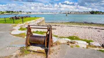
Callington, Polperro, and St Ives are some of Pantersbridge best towns to visit near Pantersbridge.
The area close to Pantersbridge boasts some of the best hills including Kit Hill Country Park.
Pantersbridge's best nearby villages can be found at Cremyll, and Botallack.
The area around Pantersbridge's best historic buildings can be found at Mount Edgcumbe House and Country Park.
Don't miss Cornwall Airport Newquay, and Land's End Airport's airports if visiting the area around Pantersbridge.
Pantersbridge History
There are some historic monuments around Pantersbridge:
- Platform cairn on Goonzion Downs
- One of two round cairns 810m south-west of Tresellern Farm
- Four bowl barrows on Bofarnel Downs forming part of a round barrow cemetery
- Two early Christian memorial stones 195m north of Welltown
- Kerbed platform cairn with central mound and adjacent stone alignment 1.42km NW of Tresellern Farm
- Large regular stone circle 560m north east of Leaze
- Two round cairns 1.38km WSW of Tresellern Farm
- Wayside cross on Druid's Hill, 350m south east of Bodmin Lodge
- Stone hut circle 440m WSW of Tresellern Farm
- Prehistoric hut circles and enclosure, 470m south of Rushyford Gate
- Trezance Holy Well and chapel enclosure
- Blacktor Downs irregular aggregate field system and clearance cairn
- Round cairn 1.58km WNW of Tresellern Farm
- Prehistoric stone alignment 1km SSE of Eastmoorgate
- Round cairn on Browngelly Downs, 625m ESE of Higher Gillhouse Farm
- Stone hut circle 525m WSW of Colquite Farm
- Stone hut circle 325m NNW of Tresibbet Farm
- Churchyard cross immediately north east of the Parish Church
- Treslea Downs Cross 300m west of Mount
- Prehistoric and medieval linear boundary with associated peat stack platform 475m SSW of Eastmoorgate
- Lerryn Bridge
- Part of a medieval boundary dyke 220m east of Golitha House
- Ornamented cross shaft at Glynn
- Round cairn on Browngelly Downs, 825m ESE of Higher Gillhouse Farm
- Three bowl barrows 590m south west of Bedwindle forming part of a round barrow cemetery
- Linear boundary called the Giant's Hedge
- Stone hut circle settlement with incorporating prehistoric irregular aggregate field system 600m SSE of Carkeet Farm
- Wayside cross known as Peverell's Cross
- Cross near Deviock Cottage
- St Bellarmin's Chapel
- Four bowl barrows north of Greymare Farm, forming part of a round barrow cemetery
- Medieval transhumance hut on Draynes Common, 500m south-west of Westerlake Farm
- Kerbed cairn 415m NNW of Candra
- Two small stone circles 530m ESE of King Arthur's Hall
- Two round cairns, three enclosed and two open stone hut circle settlements, a rectangular enclosure and a medieval longhouse to the south of Carburrow Tor
- Ring cairn 295m north west of Candra
- Henge with stone circle called the Stripple Stones and adjacent bowl barrow 415m south east of Hawk's Tor
- Stone hut circle with incorporating prehistoric regular aggregate field system 810m SSE of Carkeet Farm
- Prehistoric platform cairn 365m north of Furswain Farm
- Bosent Cross, 325m ENE of South Bosent Farm
- Round barrow W of Dozmary Pool
- Churchyard cross in Cardinham churchyard, 5m south of the church
- Embanked platform cairn with central mound on Browngelly Downs, 680m ESE of Higher Gillhouse Farm
- Bury Castle
- Prehistoric hut circles, enclosures and cairns 700m south east of Rushyford Gate
- Wayside cross at Polmenna, 730m north east of Ley Green Farm
- Prehistoric settlements and field system with adjacent medieval settlement, field systems, boundaries and tin streamworks on the Brown Gelly Downs
- Roman fortlet 440m south west of Restormel Farm
- Animal pound called Crowpound
- Hut circle 160yds (150m) N of West Northwood Farm
- Prehistoric field systems, enclosure, hut circles and rounds, with adjacent medieval settlement, longhouse and field system on Higher Langdon Farm
- Hut circle village 330yds (300m) W of West Northwood Farm
- Prehistoric round cairn 435m north of Furswain Farm
- St Protus's Cross, 330m east of Blisland church
- Three adjacent stone hut circles 610m north-west of Higher Langdon Farm
- Four Hole Cross, 200m north of Lord's Waste Farm
- Large regular stone circle called the Trippet Stones
- Stone hut circle 520m SSE of Carkeet Farm
- Wayside cross in St Nectan's chapel yard
- Prehistoric and medieval linear boundary 1.34km south of Eastmoorgate
- Medieval tenement boundary between Louden Hill and King Arthur's Downs
- Kerbed round cairn 110m NNE of Carey Tor
- Three stone hut circles with adjacent prehistoric field wall 660m north-west of Higher Langdon Farm
- Round cairn 1.062km south-west of Higher Langdon Farm
- Prehistoric embanked platform cairn and medieval transhumance hut 1.49km NW of Tresellern Farm
- Small multivallate hillfort on Bury Down, 530m north-east of South Park
- Bowl barrow 780m east of Penventon
- Hut circle 440yds (400m) SW of Candra
- Early Christian memorial stone and wayside cross in Cardinham churchyard, 10m east of the church
- Platform cairn with outer bank and central mound 430m WSW of Smallacoombe Tor
- Carminow Cross, south east of Bodmin
- Wayside cross called Killboy Cross
- Medieval wayside cross at Blisland
- Two bowl barrows 70m north west and 50m south east of Tor View at Middle Taphouse
- Two platform cairns centred 485m SW of Colquite Farm
- Prehistoric hut circle settlement on Stanning Hill
- Two bowl barrows 535m ENE of Fairy Cross forming part of a round barrow cemetery
- Wayside cross in St Bartholomew's churchyard
- Largin Castle
- Bowl barrow known as Council Barrow
- King Arthur's Hall
- Tawna Downs round barrows
- Multi-span bridge known as Respryn Bridge
- Lantern cross and grave slab immediately south of St Bartholomew's Church
- Bowl barrow 145m north west of Bodmin Lodge forming part of a round barrow cemetery
- Tredinnick Cross, 450m east of Great Tredinnick
- Medieval wayside cross at Wenmouth Cross, 320m north of Wenmouth
- Platform cairn 460m SW of Colquite Farm
- Bowl barrow 430m south west of Fairy Cross Farm forming part of a round barrow cemetery
- Hut circle group and enclosure NE of Carwen
- Platform cairn on Priddacombe Downs
- Prehistoric round cairn 425m north of Furswain Farm
- Prehistoric hut circle and field system 440m south west of Treswallock Cottage
- Round cairn 1.17km south-west of Higher Langdon Farm
- One of two round cairns 760m south-west of Tresellern Farm
- Two stone hut circles with adjacent prehistoric field wall and incorporated medieval transhumance hut 180m north east of Tresibbet Farm
- Crewel Cross, at No Man's Land
- Barrow group on Greenbarrow Downs
- Medieval wayside cross in Blisland churchyard, 30m east of the church
- Three hut circles 280m south west of Rushyford Gate
- Platform cairn with outer bank and central mound 740m NNE of Goodaver Farm
- Medieval wayside cross at Redgate
- Three bowl barrows 570m north east of Trewindle
- Stone hut circle 50m east of Carey Tor
- Medieval wayside cross in Blisland churchyard, 10m west of the church
- Platform cairn 690m south-east of Carkeet Farm
- Kerbed cairn 500m east of Casehill
- Trewane Cross in St Neot churchyard
- Round cairn on Draynes Common, 950m south-west of Lamelgate Farm
- Prehistoric linear boundary and adjacent subsidiary boundary 1km west of Tresellern Farm
- Churchyard cross and three wayside crosses in St Neot churchyard
- Deserted medieval settlement and part of its associated field system on Redhill Downs
- Unenclosed hut circle settlement, field boundaries, enclosure and cairn on Blacktor Downs
- Bowl barrow 230m south west of Middle Taphouse Farm, forming part of a round barrow cemetery
- Treslea Cross, 750m ENE of Cardinham Church
- Platform cairn with central mound 720m south-east of Carkeet Farm
- Prehistoric irregular field system and hut circle settlement with adjacent medieval regular field system and deserted settlement SE of Tresibbet Farm
- Restormel Castle: motte, bailey and shell keep
- Round cairn on Browngelly Downs, 940m ESE of Higher Gillhouse Farm
- Two wayside crosses in the grounds of Trewardale 34m WSW of the house
- Platform cairn 450m WSW of Colquite Farm
- Prehistoric and medieval settlements with fields and enclosures together with Bronze Age cairns and medieval alluvial streamwork at Garrow Tor
- Temple Old Bridge with adjacent ford and causeway
- Cross on Halvana Moor
- The Goodaver Stone Circle, 610m ESE of Tresibbet Farm
- Cairn 485m WSW of Colquite Farm
- Round cairn 1.1km north-west of Siblyback Farm
- Banked cairn on Browngelly Downs, 880m ESE of Higher Gillhouse Farm
- Prehistoric regular aggregate field system with incorporated enclosure and stone hut circles 550m NNW of Lamelgate Farm
- Banked cairn 950m west of Siblyback Farm
- Medieval churchyard cross 20m south of the Church of St Bruerdus, Churchtown
- Five bowl barrows 550m north of Trewindle forming part of a round barrow cemetery
- Three bowl barrows 215m south east of Beech Lawn, which form part of a larger round barrow cemetery
- Deserted medieval settlement and field system with incorporated prehistoric settlement and field system and post-medieval farmhouse NW of Tresibbet Farm
- Prehistoric to post-medieval field systems, boundaries, settlements and railway at Smallacoombe Parks and north eastern Siblyback Moor
- Prehistoric ritual enclosure 1.7km NW of Tresellern Farm
- Stone hut circle 565m north-west of Higher Langdon Farm
- Prehistoric cairns and field boundary 450m south of the Louden Stone Circle
- Stone hut circle with adjacent prehistoric field walls and incorporated post-medieval peat mound 280m NNE of Tresibbet Farm
- Earlier prehistoric hillfort with outwork and outlying stone hut circle known as Berry Castle
- Hobbs Hill tin mine, openwork and lodeback tinwork 530m east and 160m north east of Chyseger Farm
- Wayside cross 135m north west of The Cockpit in Boconnoc Park
- Stone hut circle 50m south-east of Carey Tor
- Prehistoric to medieval settlements, field systems, enclosures and cairns, with post-medieval boundary and railway on north east Smallacoombe Down
- Kerbed cairn on Alex Tor
- Motte and bailey castle called Cardinham Castle
- Platform cairn with outer bank 825m NNW of Higher Draynes Farm
- Prehistoric cist, cairns and cairnfield on north east Smallacoombe Downs, 570m north west of Smallacoombe Tor
Places to see near Pantersbridge


Lakes near Pantersbridge
Rivers near Pantersbridge
- West Looe River
- Polperro River
- East Looe River
- Seaton
- Upper River Ruthern
- Amble
- Camel (De Lank to Stannon)
- Stannon Stream
- Lower River Camel
- St Lawrence Stream
- Issey Brook (Camel)
- Upper River Amble
- De Lank River
- Lower River Ruthern
- Demelza Stream (Ruthern)
- Polmorla Stream
- Upper River Camel
- Amble tributary (Camel)
- Allen
- Lanivet Stream
- Porth Stream
- Gannel (Upper)
- Menalhyl
- Gannel (Lower)
- Harlyn Water
- Benny Stream
- Porthcothan Stream
- Trebant Water
- Lerryn River
- Cardinham Water
- Warleggan River
- Fowey (Upper)
- Fowey (Warleggan to St Neot)
- Pont Pill
- St Neot River
- Lower River Fowey
- Crackington Stream
- Marsland Water
- Lower River Strat
- Lower River Neet
- Upper River Neet
- Jacob Stream
- Valency
- Upper River Strat
- Coombe Valley Stream
- Newlyn River
- Trevaylor Stream
- Penberth Stream
- Marazion River
- Lamorna Stream
- Roseworthy Stream
- Portreath Stream
- Red River (Upper)
- Bolingey Stream
- Red River (Lower)
- Hayle
- Angarrack Stream
- Holywell Stream
- Kestle Stream
- Upper River Allen (Fal)
- Kenwyn
- Kennal
- Zelah Brook
- Brighton Stream
- Hicks Mill Stream
- Gwindra Stream
- Tresillian River (Lower)
- Upper River Fal
- Calenick Stream
- Trevella Stream
- Tresillian River (Upper)
- Lower River Allen (Fal)
- Lower River Fal
- Upper Carnon River
- Lower River Carnon
- Bokiddick Stream
- Crinnis River
- St Austell River
- Caerhays Stream
- Par River (Upper)
- Par River (Lower)
- Tywardreath Stream
- Carminowe Creek
- Gunwalloe Stream
- Cury River
- Helford River
- Manaccan River
- Poltesco River
- Lestraines River
- Lower River Cober
- Porthleven Stream
- Upper River Cober
- Gweek River
- Upper River Inny
- Penpont Water
- Cotehele Stream
- Lowley Brook
- Lower River Inny
- Lower River Tamar
- Upper River Lynher
- Tiddy
- Withey Brook
- Lower River Lynher
- Tala Water
- Canworthy Water
- Carey
- Tamar (River Ottery to River Deer)
- Tamar (Small Brook to River Deer)
- Upper River Ottery
- Kensey
- Tamar (Small Brook to Lamberal Water)
- Small Brook (Tamar)
- Claw
- Tamar (River Ottery to River Lyd)
- Lower River Ottery
- Upper River Tamar
- Caudworthy Water
- Deer
- Lamberal Water
- Bolesbridge Water
- Derril Water
- Middle River Ottery


