Penmaenmawr
Penmaenmawr is a Town in the county of Conwy.
Penmaenmawr postcode: LL34 6UU
There are great places to visit near Penmaenmawr including some great mountains, lakes, towns and beaches.
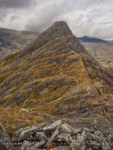
Penmaenmawr's best nearby mountains can be found at Tryfan, Glyder Fach, Glyder Fawr, and Moel Siabod.
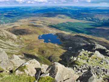
There are a several good lakes in the area around Penmaenmawr like Llyn Foel.
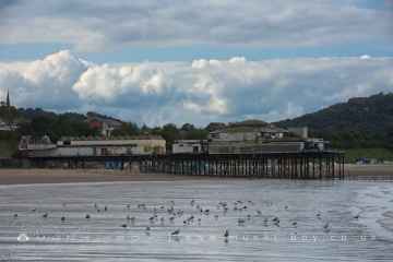
There are a number of towns near to Penmaenmawr including Colwyn Bay.
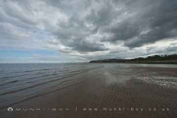
Places near Penmaenmawr feature a number of interesting beaches including Colwyn Bay Beach.
Penmaenmawr History
There are some historic monuments around Penmaenmawr:
- Plas Mawr
- Kendricks Cave & Upper Kendricks Cave
- Hut Circles West of Foel Llwyd
- Barclodiad-y-Gawres Round Cairn
- Llandudno Burial Chamber
- Hut Circles at Clip yr Orsedd
- Maen Crwn standing stone
- Gogarth Grange
- Bwlch y Ddeufaen Standing Stones
- Cefn Maen Amor cairn
- Hut circle East of Afon Rhaeadr Fawr
- Early Fields and Dwellings near Maen-y-Bardd
- Cras Cairn
- Ring Cairn North-West of Llyn y Wrach
- Hut Circles near Wern Newydd
- Penmaenmawr Stone Circle
- Huts & Enclosures in Cwm Caseg
- Hut Circle Settlement at Gwern Engan
- Maen y Bardd Burial Chamber
- Hut Circle, Bryniau Poethion, Great Orme
- Hut Circles North of Afon Anafon
- Dinas Camp
- Enclosed Hut Circle Settlement South-East of Bod Silin
- Hafod y Garreg Deserted Rural Settlement
- Cae Du platform cairn
- Deganwy Castle
- Foel Dduarth Enclosure
- Bryn Castell
- Hut Circle Settlement on Caer Mynydd
- Cae'r Haidd Deserted Rural Settlement
- Carnedd y Saeson & Neighbouring Cairns NW of Foel Dduarth
- Great Orme Copper Mines
- Cerrig Gwynion cairn
- Maes y Gaer Camp (Hillfort)
- Waun Llanfair barrow
- Tyddyn Wilym Deserted Rural Settlement
- Gwern y Plas Ancient Village
- Roman Road N of Llannerch Fedw
- Enclosure & Associated Structures at Pen-y-Bryn
- Medieval Homestead 400m SE of Maes y Gaer
- Kanovium Roman Site
- Pant y Griafolen Huts and Enclosures
- Hafotty Standing Stone
- Pen y Gaer Camp
- Hut Group W of Foel Dduarth
- Hut Circle, Hafnant, Great Orme
- Site of Medieval King's Hall and Wardrobe, Rosehill Street
- Cerrig Pryfaid Stone Circle
- Hwylfa'r Ceirw Stone Alignment
- Clogwyn yr Eryr Deserted Rural Settlement
- Gwern Engan Concentric Enclosed Hut Circle
- Bont-Newydd
- Round Hut 70m S of St Celynin's Church
- Cefn Llechen Stone Circle
- Former Royal Artillery Coast Artillery School
- Ffrith Llwynhwfa Burial Cairn
- Conwy Castle
- Cefn Llechen cairns
- Afon Dulyn ring cairn
- Bryniau Tower
- Pen y Dinas Camp
- Carnedd y Ddelw Cairn
- Foel Dduarth, cairn to NE of
- Hut Group 180m NW of Hafod-y-Gelyn
- Meuryn Isaf Cairn
- Caer Bach
- Foel Lwyd, cairn to N of
- Hut Group 750m SE of Bod Silin
- Early Fields & Dwellings Nr Maen y Bardd
- Yr Orsedd, cairn to NNW of
- Cefn Maen Amor stone circle
- Hut Circle and Rectangular Hut North of Wern Y Pandy
- Maen Penddu
- Foel Lwyd, cairn to NW of
- Cras, ring cairn to N of
- Bryniau Bugeilydd cairns
- Cras, cairn to N of
- Pont y Teiryd Hut Group and Ancient Fields
- Conwy Town Wall
- Castell Caer Lleion
- Aber Castle Mound (Pen-y-Mwd)
- Bryn Derwydd stone circle
- Hut Groups N of Cerrig y Dinas
- Garreg Fawr Hut Groups, Ancient Fields and Cairns