Retail in The Lanes Shopping Centre
There are great places to visit near The Lanes Shopping Centre including some great towns, villages, historic buildings, country parks, nature reserves, sssis, museums, parks, cities, castles, roman sites, ruins, lakes, woodlands, hills, hiking areas, old mines, ancient sites and canals.
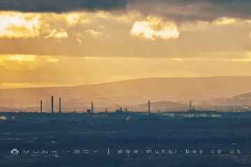
Ellesmere Port, Warrington, Widnes, Knutsford, Blacon, Saltney, and Macclesfield are great places to visit near The Lanes Shopping Centre if you like towns.
There are a number of villages near The Lanes Shopping Centre including Styal, Daresbury, Thelwall, Saughall, Lache, Marton, and Prestbury.
Historic Buildings to visit near The Lanes Shopping Centre include Quarry Bank, Warrington Parish Church Of St Elphin, The Ruskin Rooms, Tatton Park, Chester Racecourse, Chester City Walls, and Bonewaldesthorne Tower.
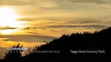
Quarry Bank, Tatton Park, and Teggs Nose Country Park are great places to visit near The Lanes Shopping Centre if you like country parks.
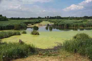
Woolston Eyes, and Tatton Park are some of The Lanes Shopping Centre best nature reserves to visit near The Lanes Shopping Centre.
Places near The Lanes Shopping Centre feature a number of interesting sssis including Woolston Eyes.
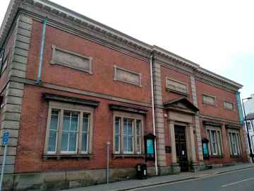
The Lanes Shopping Centre is near some unmissable museums like Warrington Museum and Art Gallery,
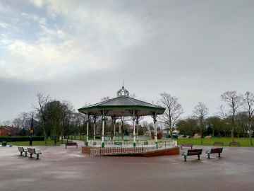
Parks to visit near The Lanes Shopping Centre include Victoria Park - Widnes, Tatton Park, Water Tower Gardens, Westminster Park, and Timbersbrook Picnic Area.
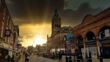
The Lanes Shopping Centre is near some unmissable cities like Chester,
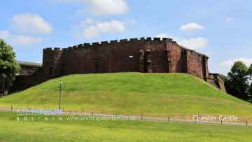
Castles to visit near The Lanes Shopping Centre include Chester Castle.
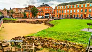
Don't miss Chester Roman Amphitheatre and Roman Walls's roman sites if visiting the area around The Lanes Shopping Centre.
The area around The Lanes Shopping Centre's best ruins can be found at Chester Roman Amphitheatre and Roman Walls.
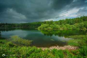
The area around The Lanes Shopping Centre boasts some of the best lakes including Trentabank Reservoir, and Redes Mere.
The area around The Lanes Shopping Centre boasts some of the best woodlands including Trentabank Reservoir, and Macclesfield Forest.
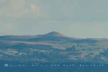
There are a several good hills in the The Lanes Shopping Centre area like Shutlingsloe, and Teggs Nose Country Park.
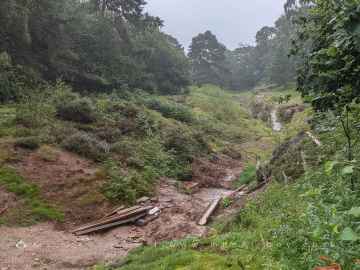
The area around The Lanes Shopping Centre boasts some of the best hiking areas including Teggs Nose Country Park, and Alderley Edge National Trust.
Engine Vein is one of The Lanes Shopping Centre's best, nearby old mines to visit in The Lanes Shopping Centre.
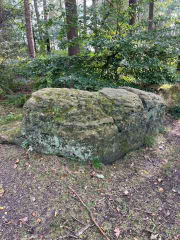
Ancient Sites to visit near The Lanes Shopping Centre include Goldenstone.
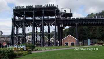
There are a several good canals in the area around The Lanes Shopping Centre like Anderton Boat Lift.
The Lanes Shopping Centre History
There are some historic monuments around The Lanes Shopping Centre:
- Hadrian's Wall and vallum between Baron's Dike and Birky Lane at Walby, in wall miles 60, 61 and 62.
- Roman camp and signal station 600m south-east of Wreay Hall
- Rockcliffe Cross
- Nowtler Hill 1 Roman temporary camp
- Scaleby Castle moated site
- Hadrian's Wall between the east end of Davidson's Banks and road to Grinsdale and vallum between Davidson's Banks and dismantled railway in wall miles 67 and 68
- Hadrian's Wall between Houghton Road and Tarraby in wall mile 64
- Oval enclosure 180m NE of Great Orton
- Hadrian's Wall between Grinsdale and the field boundary south of the site of St Andrew's Church, Kirkandrews on Eden in wall miles 68 and 69
- Moss Side 1 and 2 Roman temporary camps
- Hadrian's Wall vallum between the dismantled railway south of Boomby Gill and the field boundary south east of Mill Beck in wall mile 68
- Hadrian's Wall vallum between the boundaries north of the properties on Whiteclosegate and the field boundary west of Wall Knowe in wall miles 64 and 65
- Hadrian's Wall vallum between the M6 motorway and Drawdykes Castle in wall mile 64
- Bishop's Dyke
- Hadrian's Wall and vallum in wall mile 66, Stanwix Bank to Stainton
- Area of Roman and medieval towns, bounded by Annetwell Street, Abbey Street, Castle Street and Paternoster Row
- Hadrian's Wall vallum between the dismantled railway north of Knockupworth Cottage and the dismantled railway south of Boomby Gill in wall mile 67
- Roman and medieval town area bounded by Heads Lane West Wall and Blackfriars Street
- The Stangate at Crosby Lodge
- Hadrian's Wall and vallum between the field boundary west of Wall Knowe and Scotland Road including the Roman fort at Stanwix in wall mile 65
- Beaumont motte castle and section of Hadrian's Wall in wall mile 70 including turret 70a
- Hadrian's Wall vallum between Mill Beck and the field boundary east of Kirkandrews Farm in wall mile 69
- Park House Roman fort
- Burgh by Sands Roman fort, Beaumont camp, Burgh Castle and Hadrian's Wall from boundary west of churchyard, Beaumont to Burgh Head in wall miles 70 and 71
- Hadrian's Wall between the M6 motorway and the property boundaries to the east of Houghton Road in wall mile 64
- Nowtler Hill 2 Roman temporary camp
- Rectangular enclosures 95yds (85m) N of Sceughmire
- Boomby Lane 1 and 2 Roman temporary camps
- Prehistoric enclosure and associated field system south east of Ivy Cottage
- Carlisle Cathedral precinct
- Carlisle Castle; medieval tower keep castle, two lengths of city wall, a 16th century battery, and part of an earlier Roman fort known as Luguvalium
- Settlement 500yds (460m) SE of Cardew Hill
- Hadrian's Wall vallum between Drawdykes Castle and Whiteclosegate in wall mile 64
- Town wall, section on West Walls
- Scalesceugh Roman kilns
- A night dummy aerodrome control building, part of a World War II bombing decoy, 610m north east of Walby Cottage
- Hadrian's Wall and vallum between Birky Lane at Walby and the east side of the M6 in wall miles 62 and 63
- Hadrian's Wall between the field boundary to the south of the site of St Andrew's Church and Eden Bank at Beaumont in wall miles 69 and 70
- Hadrian's Wall between Tarraby and Beech Grove, Knowefield in wall miles 64 and 65
- City wall, NE side