Aberlemno
Aberlemno is a Village in the county of Angus.
Aberlemno postcode: DD8 3TE
There are great places to visit near Aberlemno including some great towns, ruins, lakes, nature reserves, woodlands and historic monuments.
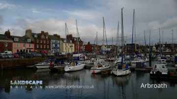
The area around Aberlemno boasts some of the best towns including Arbroath, Kirriemuir, Forfar, Montrose, Monifieth, Carnoustie, and Brechin.
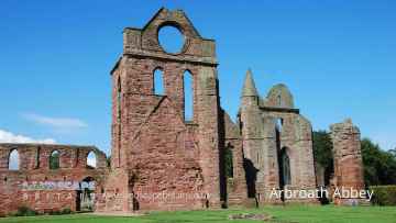
Ruins to visit near Aberlemno include Arbroath Abbey.
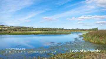
Places near Aberlemno feature a number of interesting lakes including Loch of Kinnordy.
Nature Reserves to visit near Aberlemno include Loch of Kinnordy.
Woodlands to visit near Aberlemno include Loch of Kinnordy.
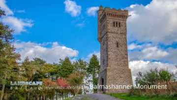
Aberlemno is near some unmissable historic monuments like Balmashanner Monument,
Aberlemno History
There are some historic monuments around Aberlemno:
- Mains of Careston, barrows 100m E of Prehistoric ritual and funerary: barrow SM6391
- Tullo Hill,cairns Prehistoric ritual and funerary: cairn (type uncertain) SM6407
- Balgavies Castle Secular: castle SM5448
- Wellford,enclosure 350m W of Prehistoric domestic and defensive: enclosure (domestic or defensive) SM6390
- Noronbank,timber hall 80m SE of Prehistoric domestic and defensive: hall SM4103
- Belliehill, unenclosed settlement 350m NE of Prehistoric domestic and defensive: settlement SM6514
- East Mains of Whitewell,souterrains 400m NNW of Prehistoric domestic and defensive: souterrain, earth-house SM6371
- The Caterthuns, hillforts Prehistoric domestic and defensive: fort (includes hill and promontory fort) SM90069
- Broomfield,enclosure 200m ESE of Prehistoric domestic and defensive: enclosure (domestic or defensive) SM6365
- Balbinny,enclosure 400m E of Prehistoric domestic and defensive: enclosure (domestic or defensive) SM6357
- Craigend of Careston, enclosure 600m NE of Prehistoric domestic and defensive: enclosure (domestic or defensive) SM6647
- Mill of Balrownie,ring ditch 200m SE of Prehistoric domestic and defensive: house SM6472
- Balhall Lodge, hut circle and field system 1100m NNE of Prehistoric domestic and defensive: hut circle, roundhouse; Secular: enclosure SM8506
- Killievair Stone, standing stone, Barrelwell Smithy Prehistoric ritual and funerary: standing stone SM123
- East Mains of Whitewell,barrow and pits 200m NNW of Prehistoric ritual and funerary: barrow SM6372
- Blackgate Smithy,stone circle Prehistoric ritual and funerary: stone circle or ring SM149
- Aberlemno, cross slab and symbol stones, NE of Village Hall Crosses and carved stones: cross slab SM90004
- Mansworn Rig,house,fields and cairns 450m E of Tullo Hill Prehistoric domestic and defensive: field or field system SM4465
- Shandford,souterrain 700m E of Prehistoric domestic and defensive: souterrain, earth-house SM6408
- Vayne Castle, castle 290m SSW of Vayne Secular: castle SM4015
- Finavon Castle Secular: castle SM2464
- Finavon, fort NE of Hill of Finavon Prehistoric domestic and defensive: fort (includes hill and promontory fort) SM139
- Pitmuies, cross slab 15m WSW of North Lodge Crosses and carved stones: cross slab SM153
- Flemington Tower,Aberlemno Secular: tower SM5447
- Damside Cottages,pit circle and pit alignments 200m SSE of Prehistoric domestic and defensive: posthole setting SM5998
- Meathie church and graveyard, 330m S of Mains of Easter Meathie Ecclesiastical: church SM10090
- Aberlemno churchyard, cross slab Crosses and carved stones: cross slab SM90003
- Law of Windsor,cairn E of Hilton of Fern Prehistoric ritual and funerary: cairn (type uncertain) SM3375
- Pitmuies Cottages,ring ditches SW of Prehistoric domestic and defensive: house SM6087
- Broomknowe,enclosure 200m W of Prehistoric domestic and defensive: enclosure (domestic or defensive) SM6358
- Gallows Hillock,burial mound 350m WNW of Parkhill Prehistoric ritual and funerary: mound (ritual or funerary) SM4755
- Restenneth Priory Ecclesiastical: priory SM90246
- White Caterthun,houses,cairns and fields 800m W of Prehistoric domestic and defensive: field or field system SM4571
- Beattie's Cairn,cairn 1200m WNW of Balhall Lodge Prehistoric ritual and funerary: cairn (type uncertain) SM6360
- Damside Cottages,souterrain 250m E of Prehistoric domestic and defensive: souterrain, earth-house SM6089
- Shandford,souterrains 400m SE of Prehistoric domestic and defensive: souterrain, earth-house SM6409
- Denside Cottage, standing stone 150m E of Prehistoric ritual and funerary: standing stone SM115
- Westerton,standing stone 120m W of Prehistoric ritual and funerary: standing stone SM4585
- Baldoukie,souterrains 250m NE of Prehistoric domestic and defensive: souterrain, earth-house SM6315
- Guthrie Collegiate Aisle, Guthrie parish church Ecclesiastical: collegiate church SM8965
- Balhall, fields and cupmarked stone 800m W of Balhall Lodge Prehistoric domestic and defensive: field or field system; Prehistoric ritual and funerary: cupmarks or cup-and-ring marks and similar rock art SM4459
- Vayne, standing stone Prehistoric ritual and funerary: standing stone SM135
- Shandford,souterrain 700m ESE of Prehistoric domestic and defensive: souterrain, earth-house SM6410
- Myreside,henge,enclosure and barrows NW of Prehistoric domestic and defensive: enclosure (domestic or defensive); Prehistoric ritual and funerary: henge SM5934
- Turin Hill, forts and cup-and-ring marked rock Prehistoric domestic and defensive: fort (includes hill and promontory fort); Prehistoric ritual and funerary: cupmarks or cup-and-ring marks and similar rock art SM142
- Damside Cottages,settlement 400m E of Prehistoric domestic and defensive: settlement SM6090
- Dumbarrow Hill, dun 230m ENE of Hillkirk Prehistoric domestic and defensive: dun SM3076
- East Mains of Pitmuies,ring ditch 250m WNW of Prehistoric domestic and defensive: house SM6088
- Netherton, settlement 400m SSW of Prehistoric domestic and defensive: settlement SM6530
- Barnyards,enclosure 100m NW of Prehistoric domestic and defensive: enclosure (domestic or defensive) SM6355
- Balquharn, souterrains 400m and 600m W of Shandford Prehistoric domestic and defensive: souterrain, earth-house SM6403
- Carse Grey, stone setting 225m WNW of Prehistoric ritual and funerary: stone setting SM4461
- Melgund Cottage,cairn 100m WNW of and enclosure 200m WNW of Prehistoric domestic and defensive: enclosure (domestic or defensive); Prehistoric ritual and funerary: cairn (type uncertain) SM6471
- Netherton, settlement 500m S of Prehistoric domestic and defensive: settlement SM6531
- Guthrie Hill,cairn Prehistoric ritual and funerary: cairn (type uncertain) SM5935
- Rob's Reed, homestead 485m ESE of Home Farm Prehistoric domestic and defensive: homestead SM2869
- Battledykes, Roman camp Prehistoric domestic and defensive: souterrain, earth-house; Roman: camp SM2308
- Hill of Menmuir,fields and cairns 900m ESE of Rome Prehistoric domestic and defensive: field or field system; Secular: field system SM4464
- Law of Baldoukie,barrow 140m E of Baldoukie Farm Prehistoric ritual and funerary: barrow SM6314
- Netherton, enclosure 150m SSE of Prehistoric domestic and defensive: enclosure (domestic or defensive) SM6529
- Carsegownie,cairn 400m SE of Prehistoric ritual and funerary: cairn (type uncertain) SM5947
- Balnamoon, souterrain 300m NNW of Meadowburn Prehistoric domestic and defensive: souterrain, earth-house SM6513