Aspull Sough Waterfall by munki-boy
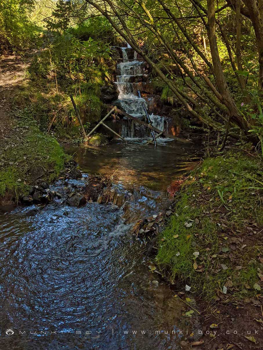
Yellow Brook Aspull Sough Waterfall
A small artificial cascade made to aerate water discharging from the Aspull Sough into Yellow Brook.
Unloved and with various fence and wood debris obscuring the fall. Interesting iron ochre staining just below the foot of the waterfall.
Created: 22 September 2019 Edited: 29 November 2023
Yellow Brook Aspull Sough Waterfall
Yellow Brook Aspull Sough Waterfall LiDAR Map

Contains public sector information licensed under the Open Government Licence v3.0
Local History around Yellow Brook Aspull Sough Waterfall
There are some historic monuments around including:
Market cross in the marketplace to the west of St Wilfrid's Church, StandishCross base on Green Lane 300m north of Strickland House Farm, StandishHeadless Cross, GrimefordThe Moat House moated site 600m WNW of St David's ChurchMabs Cross on Standishgate, 20m west of Mabs Cross School buildingCross base on Standish Wood Lane 700m south east of Standish HallHaigh Sough mine drainage portal, 310m west of Park HouseCross base at the junction of Standish Green Lane, Standish Wood Lane and Beech Walk, 200m NNW of Strickland House Farm, StandishGidlow Hall moated site, Aspull, 560m NNE of Pennington HallMoated site at Arley Hall, Haigh near Wigan.