
Wookey Hole by krzysiek73
Wookey Hole
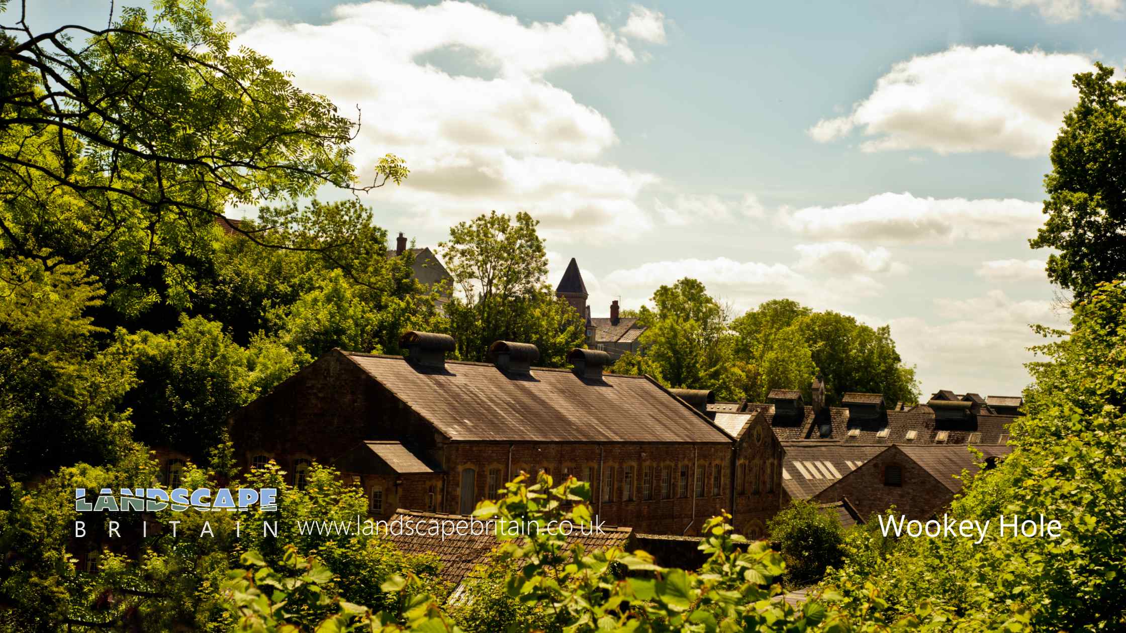
Wookey Hole, nestled in the heart of the Mendip Hills in Somerset, England, is a picturesque village that boasts of both historic charm and natural beauty. While the village itself exudes an old-world allure with its traditional stone-built houses and winding lanes, it’s the stunning landscape that surrounds it that truly captures the heart. Lush green hills, dense woodlands, and the gentle flow of the River Axe provide an idyllic backdrop, making it a favorite among both nature enthusiasts and those looking for a peaceful retreat.
Although Wookey Hole village offers a serene atmosphere, it cannot be mentioned without a nod to its most famous attraction: the Wookey Hole Caves. These magnificent subterranean chambers have fascinated both locals and tourists for centuries, with tales of witches, stunning rock formations, and underground rivers. While the cave system plays a significant role in drawing visitors, it’s important to remember that the village itself, with its unique blend of history and natural beauty, offers its own enchanting experience. Those planning to dive deep into the mysteries of the caves should also ensure they take the time to wander the streets of Wookey Hole and soak in its tranquil ambiance.
Wookey Hole is in Mendip Hills AONB, a designated Area of Outstanding Natural Beauty.
Created: 11 August 2023 Edited: 29 November 2023
Wookey Hole
Local History around Wookey Hole
There are some historic monuments around including:
Round barrows in and near Wright's PieceBowl barrow 330m north of Stoke WoodsGroup of seven round barrows 380m east of East Water Drove (Part of Priddy Nine Barrows Cemetery)Bowl barrow 850m south of Bristol Plain Farm: part of a linear round barrow cemeteryBowl barrow 750m southwest of Dale FarmDisc barrow 610m northeast of Drove CottageBowl barrow 770m south of Townsend FarmSavory's HoleBowl barrow 420m north of Stoke WoodsBracelet CaveBowl barrow 550m south of Bristol Plain Farm: part of a linear round barrow cemeteryBowl barrow 320m east of Lodmore FarmBowl barrow 900m south west of Bristol Plain Farm: part of a group of round barrows south and south west of Bristol Plain FarmLinear barrow cemetery comprising six bowl barrows 510m south west of Townsend FarmBowl barrow 570m south east of Lodmore FarmBowl barrow 590m south-east of Charterhouse Warren FarmBowl barrow 450m north west of Harptree LodgeBowl barrow 490m north west of Pen Hill FarmBowl barrow 365m south west of Ubley Warren FarmBowl barrow 310m southeast of Eastwater FarmDeserted medieval hamlet E of DraycottBowl barrow 340m east of Templedown FarmBowl barrow 450m southwest of Fernhill FarmBowl barrow 70m northeast of King Down FarmBowl barrow 610m northwest of Whitestown FarmBadger Hole, WookeyBowl barrow 800m south of Townsend FarmSt Cuthbert's and Chewton lead mines and Fair Lady WellBowl barrow on Stock Hill: part of the Stock Hill round barrow cemeteryFenny Castle Cross: a medieval wayside cross 20m north west of Castle Farm, CastleBowl barrow 180m west of Ubley Warren FarmCharterhouse lead worksThree of the Priddy Circles and one barrow, 400m west of Castle FarmTwo bowl barrows 850m south east of Brimble Pit Pool: part of a group of round barrows north and east of Foxhills WoodEarly Christian settlement and monastic site at Marchey FarmLong barrow, round barrow and cairn on Pen HillPriddy Circle and barrow cemetery 400m north of Castle of Comfort InnBowl barrow 70m west of Rowberrow FarmRoman building 270m north east of Priddy churchBowl barrow 600m east of Priddy Hill FarmBowl barrow 90m northeast of Hill ViewBowl barrow 870m southwest of Charterhouse Warren FarmBowl barrow 850m south of Townsend FarmBowl barrow 510m south east of Lodmore FarmRound barrows SW of Cleeve's PlantationBowl barrow 300m west of Newlands FarmBowl barrow 380m south east of Southfield FarmBowl barrow 760m southeast of Bristol Plain FarmBowl barrow 450m east of Bristol Plain FarmBishop's tithe barnBishop's palaceBowl barrow 500m north of East WaterBowl barrow 390m northeast of Bristol Plain FarmBowl barrow 400m southwest of Moor ViewTwo round barrows SE of Castle of Comfort InnTwo bowl barrows 350m south of Brimble Pit Pool: part of a group of round barrows north and east of Foxhills WoodBowl barrow 70m northwest of Hill ViewBowl barrow 300m south west of Harptree LodgeBowl barrow 180m southwest of Yoxter FarmBowl barrow 380m south east of BeechbarrowBowl barrow 450m south-east of Red Quar FarmBowl barrow 150m southwest of King Down FarmPair of bowl barrows 405m east of East Water Drove (Part of Priddy Nine Barrows Cemetery)Bowl barrow 400m north of Stoke WoodsBowl barrow 170m south-east of Hunter's Lodge InnBowl barrow 340m north-east of Wellington FarmFenny Castle: a motte and bailey castleRowberrow: a bowl barrow 40m north of Hill ViewBowl barrow 700m south of Bristol Plain Farm: part of a linear round barrow cemeteryKing's Castle enclosures, Iron Age defended settlementBowl barrow 350m north west of Harptree LodgeBowl barrow 650m northeast of Higher Pitts FarmBowl barrow 600m north of Rookham PlantationRound barrow 1435m SE of Miners' Arms InnBowl barrow 460m east of Charterhouse Warren FarmDeserted medieval farmstead and field system NW of Ebbor WoodBrowne's GateBowl barrow 470m south east of Southfield FarmPriddy Glebe Barrow: a bowl barrow 25m north of St. Lawrence's ChurchBowl barrow 410m northeast of Bristol Plain FarmBowl barrow 130m west of St Lawrence's ChurchRhinoceros Hole, WookeyBowl barrow 260m east of Templedown FarmBishop's Palace ruined portions, walls and well houseBowl barrow 570m west of Newlands FarmBowl barrow, 540m west of Brimble Pit PoolBowl barrow 730m southeast of Bristol Plain FarmBowl barrow 400m southeast of Wellington FarmBowl barrow 350m northeast of Cheddar Head FarmBowl barrow 250m northeast of King Down FarmBowl barrow 20m northwest of Whitestown FarmBowl barrow 435m north west of Ivy CottageBowl barrow 520m south-east of Red Quar FarmBowl barrow 570m south east of Southfield FarmBowl barrow 430m southwest of King Down FarmFive bowl barrows 500m north west of Cuckoo Cleeves: part of the Stock Hill round barrow cemeteryLong barrow 370m south-south-east of Castle FarmBowl barrow 550m south east of Southfield FarmBowl barrow 300m southwest of Moor ViewBowl barrow 850m southeast of Bristol Plain FarmStow Barrow : a bowl barrow 700m southwest of Haydon Grange FarmBowl barrow 400m south of RookhamWestbury Beacon, a bell barrow 720m west of Brimble Pit PoolBowl barrow 230m north west of Hunter's Lodge InnBowl barrow on Stock Hill: part of the Stock Hill round barrow cemeteryLong barrow 600m east north east of Brimble Pit PoolThree bowl barrows at Green Ore, two 150m south east and one 420m south west of Newlands FarmGlastonbury lake villageOutlook CaveBowl barrow 420m east of Bristol Plain FarmFour round barrows SE of Miners' Arms Inn, Chewton Rabbit WarrenHenge 370m north east of Drove CottageBowl barrow 430m northwest of King Down FarmBarrow, 350m east of Harptree LodgeRound barrow cemetery 470m and 400m north of Pen Hill FarmBowl barrow 430m north east of Stoke WoodsBowl barrow in the garden of BeechbarrowWestbury Camp, slight univallate hillfort, 750m north of Stokewood CottageBowl barrow 810m southeast of Bristol Plain FarmBowl barrow 870m southwest of Dale FarmGroup of round barrows 750m north west of Ivy CottageWestbury village crossBowl barrow 550m south east of Brimble Pit Pool: one of a group of round barrows north and east of Foxhills WoodBowl barrow 820m south of Bristol Plain Farm: part of a linear round barrow cemeteryThree bowl barrows in Big Plantation, 690m south west of BeechbarrowPair of bowl barrows 640m south of Bristol Plain Farm: part of a linear round barrow cemeteryAshen Hill barrow cemetery: a group of eight round barrows 500m southeast of Harptree LodgeBowl barrow, 455m west of Brimble Pit Pool.


