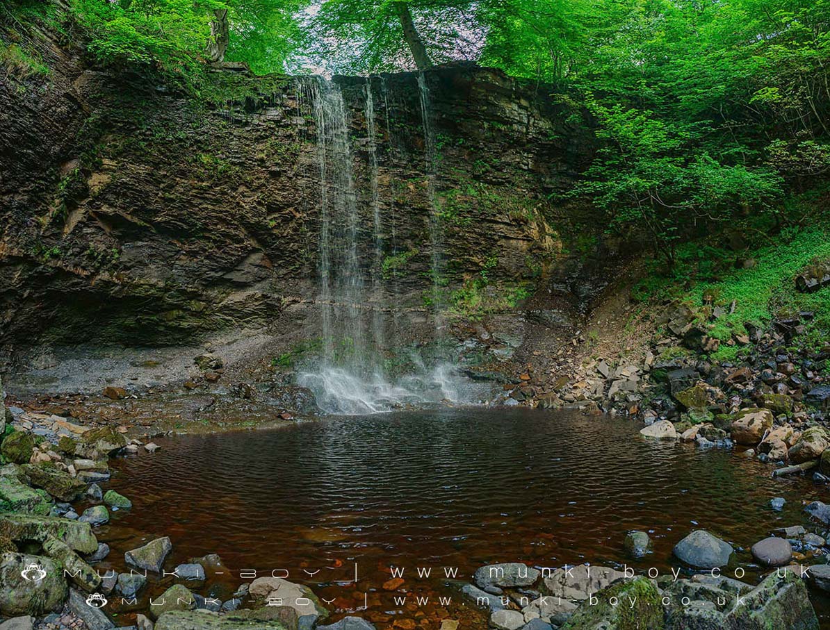
Whitfield Gill Force by munki-boy
Whitfield Gill Force
Whitfield Gill Force is in The Yorkshire Dales National Park in England.
Whitfield Gill Force is a decent enough waterfall on the Whitfield Beck above Askrigg with a couple of footpaths nearby but it’s best viewed from the stream bed, which can be difficult to reach except from further downstream where there is a much smaller waterfall. The waterfall at Whitfield Gill is mostly hidden by trees from the paths on the East side of the river.
Landslips in recent years have caused problems with footpaths above the river around here so a bit of river-walking might be needed.
Created: 28 August 2016 Edited: 29 November 2023
Whitfield Gill Force
Whitfield Gill Force LiDAR Map

Contains public sector information licensed under the Open Government Licence v3.0
Local History around Whitfield Gill Force
There are some historic monuments around including:
Bainbridge slight univallate hillfortRing cairn 580m west of Askrigg churchSir Francis Level ore works, Gunnerside Gill, west of Winterings PasturesRing cairn on Force Ing, west of Whitfield GillCairn on Addlebrough Hill including cup marked boulders.Enclosures on Greenber EdgeSargill ore hearth lead smelt mill, on North Rigg, 340m south east of Sargill Lead MineBow Bridge 90m east of Bowbridge HillStony Raise cairn, Greenber Edge.Bainbridge Roman fort and annexeCairn on Green Scar, 470m SE of New Bridge.