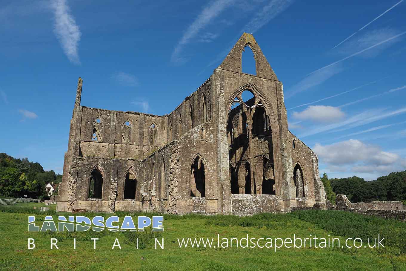
Tintern Abbey
Tintern Abbey / Abaty Tyndryn
Tintern was a Cistercian abbey, a Christian monastery or convent under the government of an Abbot or an Abbess, dating to the medieval period. Founded on the 9th May 1132 by Walter de Clare, Lord of Chepstow.
Tintern Abbey was the second Cistercian foundation in Britain, and the first in Wales. It soon prospered, thanks to endowments of land in Gwent and Gloucestershire, and buildings were added and updated in every century until its dissolution in 1536.
During the 13th century the abbey was rebuilt, works started in around 1220 with the cloisters and domestic ranges, culminating in the great church.
Tintern’s great church, was built between 1269 and 1301 to a simple cruciform plan. Several Lords of Chepstow and their relations are buried in the church, together with William Herbert of Raglan Castle who was buried here after his execution in 1469.
Created: 12 September 2021 Edited: 29 November 2023
Tintern Abbey / Abaty Tyndryn Information
Tintern Abbey / Abaty Tyndryn Address
Tintern Abbey, Tintern
NP16 6SE
Website: https://cadw.gov.wales/visit/places-to-visit/tintern-abbey
Get directionsTintern Abbey / Abaty Tyndryn LiDAR Map
please wait...
Contains public sector information licensed under the Open Government Licence v3.0
Local History around Tintern Abbey / Abaty Tyndryn
There are some historic monuments around including:
Trellech Churchyard CrossOffa's Dyke: section 340m south east of Coxbury FarmTrellech Shrunken Medieval Village The Platform, Piercefield Offa's Dyke: section on Madgett Hill, 380m south east of Brook HouseOffa's Dyke: section on St Briavels Common, immediately west of The FieldsWhitebrook Wireworks Leat Offa's Dyke: section 130m north west of Pennsylvania FarmThree Round Barrows in Lower Hale Wood Offa's Dyke: section on St Briavels Common, immediately south of SittingreenOffa's Dyke: section in Victuals Grove, 230m north of Beaconsfield CottageOffa's Dyke: section 470m west of Wyegate BarnBlackcliff Wood Limekiln The Virtuous Well St Arvan's Church Cross-slabSite of Wireworks at Whitebrook Offa's Dyke: section in Chapelhouse Wood, 240m west of the Recreation GroundMotte Castle 57m south-west of Church of St Mary MagdaleneLancaut deserted villageOffa's Dyke: section in Boatwood Plantation, 320m south west of Chase FarmEarly Iron Furnace in Woolpitch Wood Offa's Dyke: section in Caswell Wood, 280m west of Beeches FarmBishop Barnet's Wood Camp Harold's Stones, Standing StonesOffa's Dyke: section at Birchfield CottageOffa's Dyke: section known as Buttington Tump, 100m west of Buttington LodgeOffa's Dyke: section in Mocking Hazell Wood, 400m south of Lindors FarmOffa's Dyke: section in Shorncliff Wood including the Devil's Pulpit, 790m south west of SheepcotPierce Wood Camps Lancaut promontory fortDovecot at Hygga Farm Tintern Abbey, Precinct Wall Medieval House Sites W of Trellech ChurchChepstow CastleOffa's Dyke: section on Madgett Hill, 290m south east of Brook HouseRound cairn 720m west of Chase FarmSt Briavel's CastleOffa's Dyke: section 65m north of Brook HouseWyndcliff Roman SiteOffa's Dyke: section on St Briavels Common, 230m north of Hudnalls FarmColwell Grove Limekiln and Quarry, Tintern Offa's Dyke: section on St Briavels Common, 190m west of Hudnalls FarmOffa's Dyke: section in Church Grove, 240m south west of Ferney LeazeThe Grotto, Piercefield Offa's Dyke: section on Madgett Hill, 580m west of The Old MillBulwarks CampBlackcliff Wood Camp Offa's Dyke: section in Worgan's Wood, 800m west of Chase FarmOffa's Dyke: section in Wyeseal Wood, 600m north of Gumbers Land BarnOffa's Dyke: section immediately north east of Sedbury sewage worksTintern Abbey, WatergateOffa's Dyke: section 240m north east of Buttington FarmTump Terrett Castle MoundSt Peter's CaveChepstow Town Wall and GateLower or Abbey Wireworks, TinternRoman site 150yds (140m) E of Palace Cottage, BoughspringOffa's Dyke: section in St Margaret's Grove, 170m north east of Gumbers Land BarnOffa's Dyke: section on St Briavels Common, 220m east of Upfield HouseChepstow Park Wood Cairn Broad StoneOffa's Dyke: section on St Briavels Common, 90m north of The CherriesOld Furnace Blast FurnaceChepstow Town Slipway Offa's Dyke: section immediately north west of Coxbury FarmSt. Mary's Churchyard Cross, Penterry The Alcove, Piercefield Offa's Dyke: section in Cutt's Orchard, 230m south east of Brook HouseThe Cold Bath: Piercefield The Giant's Cave, Piercefield Camp NE of StoweTintern Upper Wireworks (New Tongs Mill) Offa's Dyke: section in Lippets Grove, 680m WSW of Beeches FarmTintern Abbey, Inner PrecinctTrellech Cross Cross-Base Offa's Dyke: section on St Briavels Common, 100m south east of Hill FarmOffa's Dyke: section immediately south of Coxbury FarmGaer Hill Camp, Penterry Chepstow Park Wood Moated Site Offa's Dyke: section in Passage Grove, 660m west of SheepcotGaer 594m SW of Trellech Cross Early Iron Furnace at Coed-Ithel Clearwater Paper Mill Offa's Dyke: section on St Briavels Common, 400m east of Yewgreen FarmOffa's Dyke: section in Danehill Wood, 300m west of East Vaga.


