Tilberthwaite Gill Head Waterfall Level by munki-boy
Tilberthwaite Gill Head Waterfall Level
Tilberthwaite Gill Head Waterfall Level is in The Lake District National Park in England.
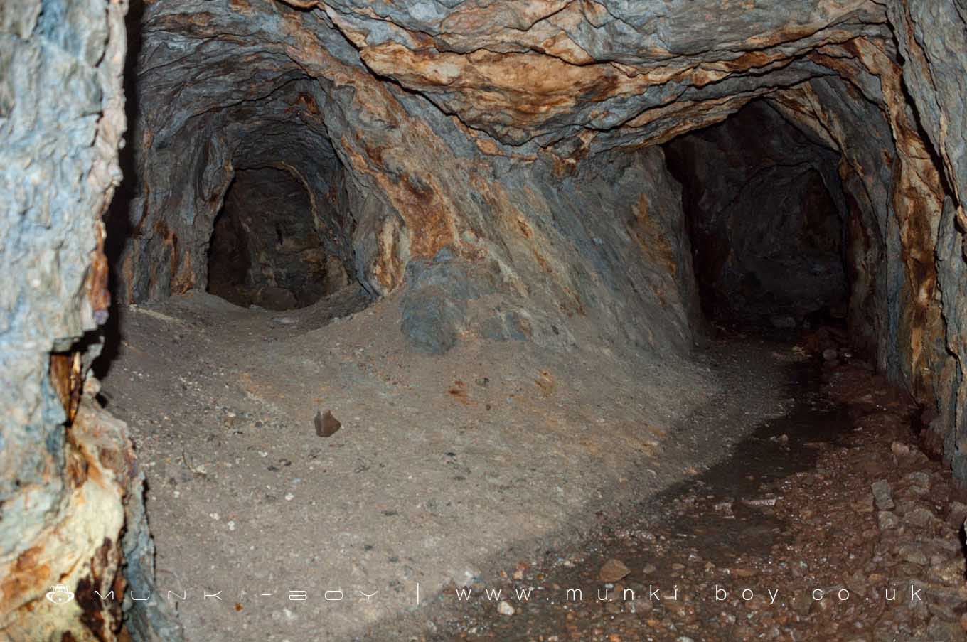
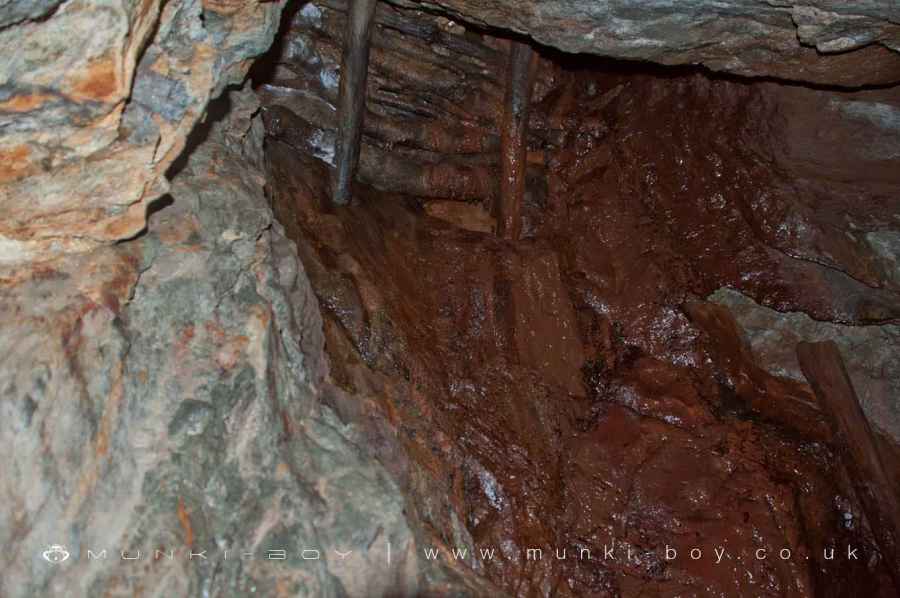
The Tilberthwaite Waterfall Level is an old ‘coffin level’ said to have been started by the German Miners in the 16th Century. The tunnels here were extended in the 19th Century to drain water from the deep Tilberthwaite Mine nearby.
This tunnel is said to be dangerous as the 1930’s timbers here have collapsed in places and the roof has fallen in. There is also a blocked sump down from Benson’s Lode on the hillside above that looks pretty creepy. The small branch in the tunnel nearby is said to be a trial on the lower part of Benson’s South Lode - that is also visible in the hillside above. There is a section of collapsed roof a bit further in and then some distance on the tunnel is completely blocked.
Created: 27 November 2016 Edited: 29 November 2023
Tilberthwaite Gill Head Waterfall Level
Tilberthwaite Gill Head Waterfall Level LiDAR Map

Contains public sector information licensed under the Open Government Licence v3.0
Local History around Tilberthwaite Gill Head Waterfall Level
There are some historic monuments around including:
Coniston copper minesYewdale lime kiln 380m south west of Low YewdaleTwo bloomeries, 340m and 570m NNE of Hoathwaite Landing on Coniston WaterDike, circles and cairns on Bleaberry HawsRifle Range target and Marker's Hut, 150m north west of Blea MossMickleden Beck prehistoric cairnfield and field system, funerary cairn and a medieval dispersed settlement centred 840m south west of Pike of StickleSeven Intakes medieval dispersed settlement 210m south west of Fell FootRoman road up Wrynose PassRoman road in Wrynose BottomCairns and enclosure on The Rigg, BanisheadTwo rifle ranges on Silver HowLong Intakes medieval dispersed settlement and associated kiln 370m south of Fell FootCairns on Foul ScrowRound cairn, 460m south west of Thompson GroundGreenburn copper mines and associated ore processing worksMoot mound at Fell Foot Farm, Little LangdaleThe Langdale Boulders, two prehistoric rock art sites in Great Langdale 250m south of Harry PlaceCastle Howe hillfort, Little Langdale.