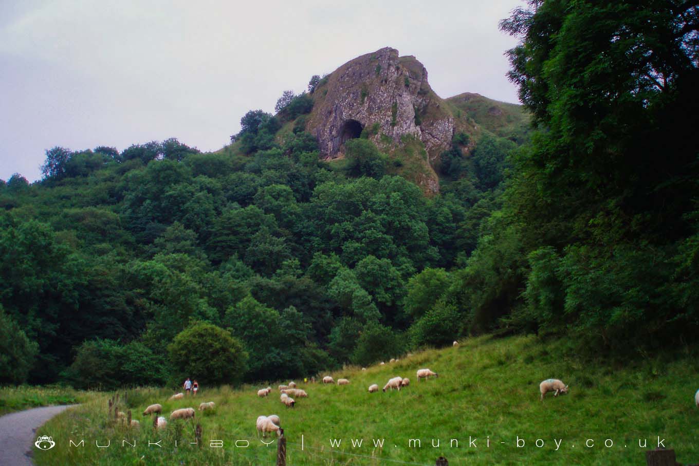
Thors Cave by munki-boy
Thors Cave
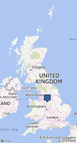
Thors Cave is in The Peak District National Park in England.
Thor’s Cave has been formed over thousands of years by the effects of water and wind. The name may be a corruption of tors (meaning hills), and some people think it comes from Thor, the Norse god of thunder.
The rocks are limestone, formed from layers of dead marine animals between 280 360 million years ago. During this time, stands was south of the equator warm, shallow sea. the area where Thor’s Cave now and was submerged under a The hillside would have been a reef, similar to those found in tropical seas.
Many of the caves in this area have been used by humans and animals for shelter. Bones of Giant Red Deer and Bears have been found in the area, and Thor’s Cave itself was the site of a Bronze Age Burial. Some artefacts are on display in nearby museums.
The pathway which runs through the Manifold Valley is actually the route of the Leek & Manifold Light Railway. There was a station at Thor’s Cave, which was popular for tourists. Local people used the railway to send produce to market further afield. Today the area is popular with Walkers and cyclists
The area around Thor’s Cave is a special place for plants and animals. The woodlands have been a local source of coppiced Hazel. This woodland management allows sunlight to reach the woodland floor, which, in turn, means that wildflowers can grow. Rare butterflies such as Northern Brown Argus (top) and Dark Green Fritillaries find a home here.
Created: 27 November 2016 Edited: 29 November 2023
Thors Cave
Local History around Thors Cave
There are some historic monuments around including:
Lamber Low bowl barrowRye Low bowl barrowPea Low bowl barrowTop Low bowl barrowBowl barrow at north-west end of Gratton HillElderbush CaveThe Lows bowl barrowSt Bertram's Bridge, IlamOssum's CaveStonesteads bowl barrowAnglo-Scandinavian cross, 12m south of the south porch of the Church of the Holy CrossLonglow long barrowGrub Low bowl barrowBowl barrow at north-west end of summit of Gratton HillBowl barrow 400m north-west of BeechenhillBowl barrow 50m west of summit of Musden LowBowl barrow on Hazelton HillWolfscote Hill bowl barrowBowl barrow south of Stanshope PastureBowl barrow 160m north of Lower Green HouseCopper mines on Ecton HillBowl barrow 380m south-west of Blore ChurchHanging Bank bowl barrowBowl barrow 150m south-east of Cliff TopThorswood MinesAnglo-Scandinavian cross fragment, St Peter's churchyardMonastic grange, 40m south west of Musden Grange FarmThe Fishing House of Charles Cotton, Beresford DaleBowl barrow 180m south-east of the Izaak Walton HotelBowl barrow on Mere HillBowl barrow 450m east of StanshopeBowl barrow 200m south-west of Ecton HillBowl barrow 380m north-west of BeechenhillIlamtops Low bowl barrowBowl barrow 230m west of summit of Musden LowBowl barrow 220m north of Dale Abbey FarmBowl barrow 510m north of Latham HallLady Low bowl barrowThrowley Old HallBowl barrow 260m north of DamgateBowl barrow on Marten HillBowl barrow 420m north of BeechenhillBowl barrow on Arbour HillBowl barrow on summit of Musden LowBowl barrow 190m north of Dale Abbey FarmRound Low bowl barrowBowl barrow 50m north-west of Thorswood PlantationBowl barrow 160m south-east of Oldfields FarmBowl barrow 40m north of Rushley BarnBowl barrow east of Bunster HillCart Low bowl barrowBowl barrow at south-eastern end of summit of Gratton HillBowl barrow south of TownendDun Low bowl barrowBowl barrow on Wetton HillViator's BridgeBowl barrow 400m west of DamgateBowl barrow 160m south of summit of Musden LowBowl barrow 120m north-east of Bincliff MinesBowl barrow 440m south east of Throwley CottageWaterfall Low bowl barrowAnglo-Scandinavian cross, 240m south west of Ilam HallAnglo-Scandinavian cross, 7m south of the south transept of the Church of the Holy CrossBrund Low bowl barrowWetton Low bowl barrowViator's Bridge, MilldaleBowl barrow 70m north-east of Bincliff MinesTop of Ecton bowl barrowBowl barrow on Milk HillBrownlow bowl barrowBowl barrow 810m north-west of Rushley BridgeBowl barrow 540m north-east of BeechenhillBowl barrow 450m north of DamgateBowl barrow 400m north of DamgateBowl barrow 300m north of Slade HouseBowl barrow near Highfields Mine, south-west of StanshopeBowl barrow 140m north of Thorswood PlantationBowl barrow on Wetton Hill 650m north-west of Under WettonTown Low bowl barrowBowl barrow 460m north-east of BloreRibden Low bowl barrowBlake Low bowl barrowBowl barrow 120m south-west of Weag's BarnBowl barrow on Narrowdale HillBowl barrow on Archford MoorBowl barrow 350m south-east of Highfields Mine.