The Whispering Knights by munki-boy
The Whispering Knights
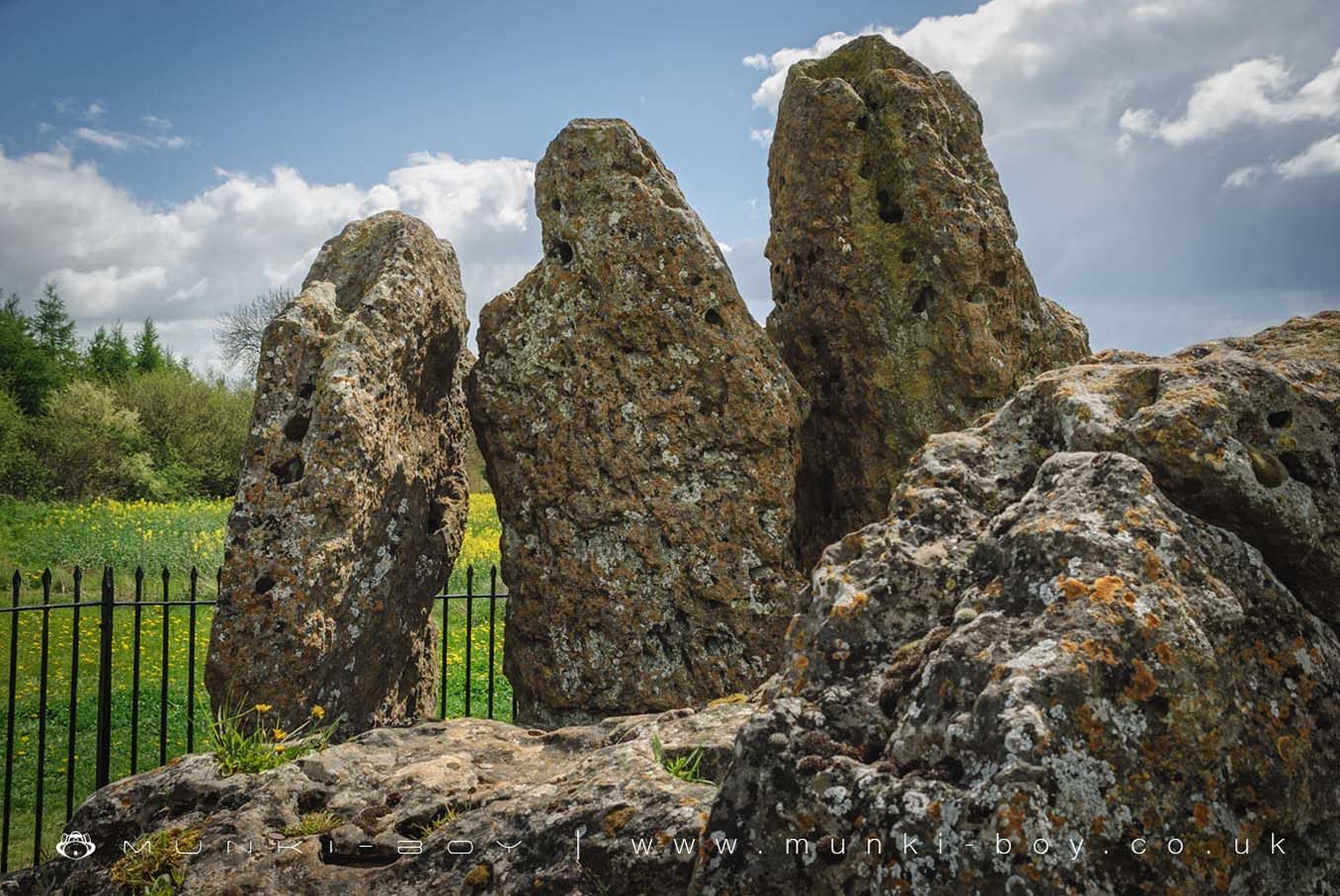
The Whispering Knights is the remains of a portal dolmen-type burial chamber of about 4000 BC. Four stones stand upright, while a fifth, probably the capstone, lies fallen. The stones would never have been covered by a mound; rather they projected out of a low flat-topped platform that surrounded the setting.
The Whispering Knights is part of The Rollright Stones complex.
The Whispering Knights is in Cotswolds AONB, a designated Area of Outstanding Natural Beauty.
Created: 27 November 2016 Edited: 29 November 2023
The Whispering Knights
The Whispering Knights LiDAR Map

Contains public sector information licensed under the Open Government Licence v3.0
Local History around The Whispering Knights
There are some historic monuments around including:
Moated site 300m east of Stourton Methodist ChapelMoated site at Manor FarmGreat house site, garden earthworks and associated remains immediately north, west and south of St Mary's ChurchPortal dolmen 400m south east of Burnt HillNether Chalford medieval settlementThe Rollright StonesHawk Stone standing stone 700m south of Claridges BarnMoated site, 230m west of St Michael's ChurchShrunken medieval village NW of Churchill old churchBesbury Lane bowl barrow, 450m north east of Conduit FarmOver Norton bowl barrow 150m north west of the intersection between the A361 and the A34(T)Squire's Clump Anglo-Saxon burial mound 500m south west of Iron BuildingsLong barrow on Adlestrop HillChipping Norton motte and bailey castle, and fishpondChastleton Barrow camp: a hillfort south of Barrow HouseNeolithic long barrow 400m SSE of Burnt HillThe Mount bell barrow 110m south west of Mount FarmLowland Barn Romano-British farmstead 200m north west of Bury HillIron Age enclosed settlement and part of a trackway 150m north east of the King StoneMoated site.