
The Salt and Pepper Pots by munki-boy
The Salt and Pepper Pots
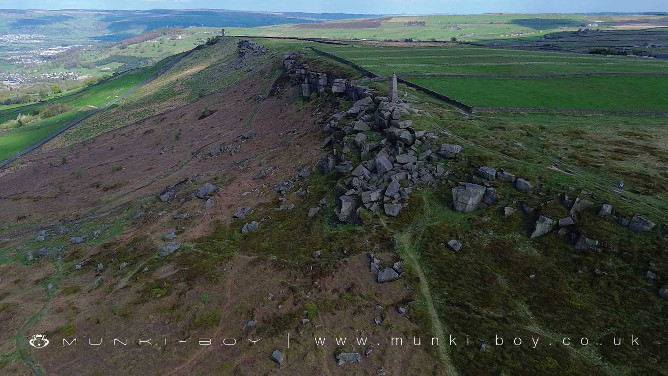
The Salt and Pepper Pots are two famous stone towers standing high on Earl Crag above Cowling. From the crag, the views are breath-taking, stretching across the villages of Cowling, Glusburn, Cross Hills, and Sutton-in-Craven. On a clear day, you can see all the way out to the Rylstone Cross in the distance. The crag itself is a wild, windswept place, with rocky outcrops and open skies, making it a favourite spot for walkers and anyone who loves wide, open landscapes.
Earl Crag has a rugged beauty, with its steep slopes and scattered rocks giving a real sense of height and openness above the villages below. It feels exposed to the elements, with the wind often rushing across the top, and there’s a real feeling of space that is rare so close to settled areas. The two towers, Wainman’s Pinnacle and Lund’s Tower, stand like silent sentinels on the ridge, instantly recognisable from the surrounding countryside and adding to the crag’s dramatic character.
Looking out from the crag, the patchwork of fields and rooftops below gives way to rolling hills in every direction. To the south, you can trace the line of the Aire Valley, while to the north the land rises towards Rylstone Moor, where the distant outline of the Rylstone Cross can just be made out against the sky. It’s a view that captures both the closeness of the villages and the vastness of the surrounding landscape, a place that feels at once part of the world and apart from it.
Created: 26 April 2025 Edited: 26 April 2025
The Salt and Pepper Pots
The Salt and Pepper Pots LiDAR Map

Contains public sector information licensed under the Open Government Licence v3.0
Local History around The Salt and Pepper Pots
There are some historic monuments around including:
Rock with one cup in east end of Great Wood Plantation, 375m NNE of Cawder Hall Farm, Horse Close HillRock with at least one cup mark 310m east of Cawder Hall FarmSubcircular enclosed settlement on Horse Close Hill 250m north of Horse Close FarmLong barrow and superimposed round cairn on Black HillTwo carved rocks in field 130m north east of Cawder Hall Farm, Horse Close HillCarved rock on bank at side of track opposite Garth House, 60m south west of Snaygill FarmCup and ring marked rock 150m west of Low Edge Farm, Bradley MoorCup, ring and groove marked rock south of derelict wall on Bradley Moor, 70m south west of Low Edge FarmRock with one cup at the base of a wall, 250m NNE of Cawder Hall Farm, Horse Close HillBlack Hill round cairnRock with at least 15 cups 240m south of Great Wood Laithe, Horse Close HillOre hearth smeltmill and wood drying kiln in Lumb Clough Wood, 350m south east of Bank FootRock with at least six cups 170m north west of Grey Stones FarmCup and ring marked rock in wall at High Snaygill 80m east of High LaitheRock with one cup in field south east of Great Wood Plantation, 450m north east of Cawder Hall Farm, Horse Close HillHanging Stone or Watersheddles CrossKildwick BridgeCup marked rock on north side of barn, 100m north west of the Grey Stones Farm.


