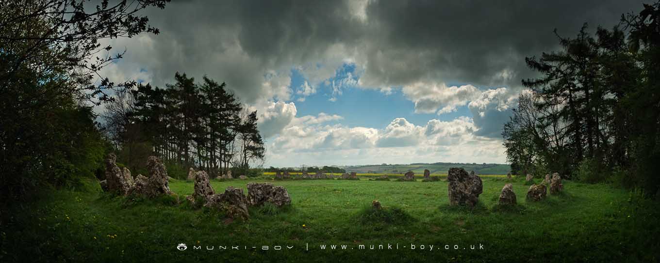
The King's Men stone circle by munki-boy
The Kings Men
The King’s Men is a fine stone circle broadly dating to 2670 bc to 1975 bc. The circle, on a hilltop setting, is nearly perfectly round, with a diameter of 33 m. In 1882 the circle was restored and new stones replaced missing ones. Of the seventy-three stones present today at least one-third were repositioned. Rollright has been seen as some kind of prehistoric astronomical observatory. However, there are very few meaningful alignments represented, a view of the midsummer sunset being the only one that stands out as potentially significant.
The Whispering Knights is part of The Rollright Stones complex.
The Kings Men is in Cotswolds AONB, a designated Area of Outstanding Natural Beauty.
Created: 27 November 2016 Edited: 29 November 2023
The Kings Men
The Kings Men LiDAR Map

Contains public sector information licensed under the Open Government Licence v3.0
Local History around The Kings Men
There are some historic monuments around including:
Shrunken medieval village NW of Churchill old churchNeolithic long barrow 400m SSE of Burnt HillSquire's Clump Anglo-Saxon burial mound 500m south west of Iron BuildingsIron Age enclosed settlement and part of a trackway 150m north east of the King StoneChastleton Barrow camp: a hillfort south of Barrow HouseLong barrow on Adlestrop HillThe Mount bell barrow 110m south west of Mount FarmMoated siteMoated site at Manor FarmChipping Norton motte and bailey castle, and fishpondThe Rollright StonesMoated site 300m east of Stourton Methodist ChapelOver Norton bowl barrow 150m north west of the intersection between the A361 and the A34(T)Great house site, garden earthworks and associated remains immediately north, west and south of St Mary's ChurchBesbury Lane bowl barrow, 450m north east of Conduit FarmLowland Barn Romano-British farmstead 200m north west of Bury HillMoated site, 230m west of St Michael's ChurchPortal dolmen 400m south east of Burnt HillHawk Stone standing stone 700m south of Claridges Barn.