Tehidy Country Park
Tehidy Country Park
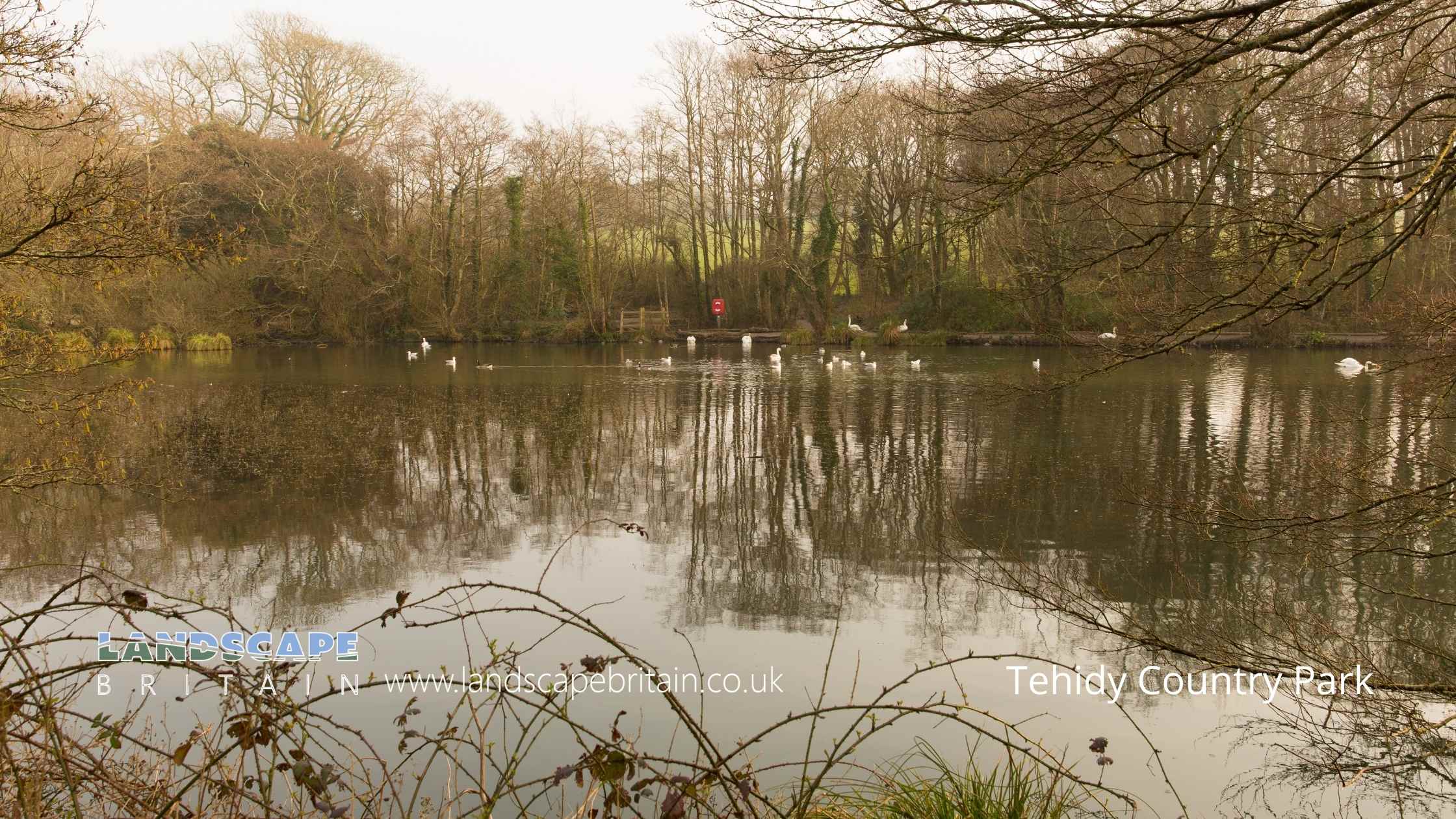
Tehidy is the largest area of woodland in West Cornwall. Now managed as a Country Park, Tehidy has over 9 miles (14.5km) of paths and 250 acres of peaceful woods and lakes to explore, together with a café and a picnic area. There are 5 main access points including North Cliff car park, and South Drive car park.
The Basset family has been linked to Tehidy since the 11th century. You can still see evidence of the Bassets in the prominent 90 foot monument built in memory of Sir Francis Basset in 1836 on top of Carn Brea.
Created: 13 August 2022 Edited: 29 November 2023
Tehidy Country Park Information
Tehidy Country Park Address
Camborne TR14 0EZ, UK
TR14 0EZ
Website: http://www.cornwall.gov.uk/default.aspx?page=13240
Get directionsTehidy Country Park Woodland
Tehidy Country Park is a woodland area in Cornwall, managed by Woodland Welcome.Local History around Tehidy Country Park
There are some historic monuments around including:
Round 680m east of Gwealavellan FarmPart of the mining complex at Wheal Grenville and East Wheal Grenville Mines 210 north west of Newton Moor FarmCliff castle at Tubby's HeadThe remains of the Chapel of St Ia and adjacent cellWayside cross in St John's churchyard, TreslothanThree bowl barrows 245m north west of Gregwartha CottageWayside cross-head in Gwinear churchyard, east of the churchWayside cross in Camborne churchyard, 10m west of the churchPart of the mining complex at South Condurrow and Wheal Grenville Mines, 410m south west of Newton Moor FarmRound in North Cliff Plantation 800yds (730m) NW of Tehidy HospitalWayside cross and cross-base in Camborne churchyard, 10m south west of the churchWayside Cross at Camborne Park Recreation GroundKerbed cairn called Hangman's BarrowCoastguard look-out tower and landmark 240m north of Portreath HarbourCross 140yds (130m) E of Pendarves FarmSmall stone circle known as the 'Nine Maidens' 60m east of Carthew HousePart of a cliff castle called Crane CastlePortal dolmen called The Giant's Quoit at CarwynnenEast Pool MineMedieval chapel and enclosures 570m north west of Wheal FreedomIron Age defended settlement 550m east of Feadon FarmNeolithic hilltop enclosure with later settlement and defensive structures, a prehistoric field system, a medieval castle and deer park and mineral workings on Carn BreaBetty Adit tailings works, 170m south west of Harley FarmRound 275m WNW of Nanterrow FarmPart of the mining complex associated with Marriott's Shaft once part of South Wheal Francis tin and copper mineMinor Romano British villa 100m south east of Magor FarmWayside cross and cross-base immediately north east of the Donald Thomas Daycare Centre, 180m east of St Meriadoc and St Martin's ChurchCross in forecourt of Methodist Chapel, Chapel StreetRoseworthy Arsenic Works, 700m west of Cornhill FarmChurchyard cross in St Illogan churchyardPolmenor Cross in Gwinear churchyard, 12m north of the churchWayside cross in Gwinear churchyard, 5m north of the churchWayside cross on Whitcross Hill, immediately north of Seaview TerraceThe Tolgus arsenic works 80m south east of East Tolgus House.


