
Tehidy
Tehidy
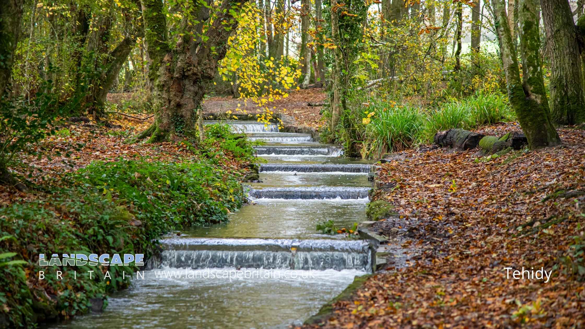
Tehidy is an area of Cornwall near Camborne.
Created: 13 August 2022 Edited: 29 November 2023
Tehidy
Tehidy LiDAR Map
Loading LiDAR
please wait...
please wait...
Contains public sector information licensed under the Open Government Licence v3.0
Local History around Tehidy
There are some historic monuments around including:
Polmenor Cross in Gwinear churchyard, 12m north of the churchRound 680m east of Gwealavellan FarmWayside cross and cross-base immediately north east of the Donald Thomas Daycare Centre, 180m east of St Meriadoc and St Martin's ChurchWayside cross in Gwinear churchyard, 5m north of the churchCross 140yds (130m) E of Pendarves FarmThree bowl barrows 245m north west of Gregwartha CottageSmall stone circle known as the 'Nine Maidens' 60m east of Carthew HousePart of the mining complex at Wheal Grenville and East Wheal Grenville Mines 210 north west of Newton Moor FarmMinor Romano British villa 100m south east of Magor FarmPortal dolmen called The Giant's Quoit at CarwynnenWayside cross-head in Gwinear churchyard, east of the churchWayside cross and cross-base in Camborne churchyard, 10m south west of the churchEast Pool MinePart of a cliff castle called Crane CastleBetty Adit tailings works, 170m south west of Harley FarmMedieval chapel and enclosures 570m north west of Wheal FreedomIron Age defended settlement 550m east of Feadon FarmCoastguard look-out tower and landmark 240m north of Portreath HarbourWayside cross on Whitcross Hill, immediately north of Seaview TerraceCross in forecourt of Methodist Chapel, Chapel StreetRound in North Cliff Plantation 800yds (730m) NW of Tehidy HospitalRoseworthy Arsenic Works, 700m west of Cornhill FarmThe remains of the Chapel of St Ia and adjacent cellCliff castle at Tubby's HeadPart of the mining complex associated with Marriott's Shaft once part of South Wheal Francis tin and copper minePart of the mining complex at South Condurrow and Wheal Grenville Mines, 410m south west of Newton Moor FarmWayside cross in Camborne churchyard, 10m west of the churchChurchyard cross in St Illogan churchyardWayside Cross at Camborne Park Recreation GroundWayside cross in St John's churchyard, TreslothanThe Tolgus arsenic works 80m south east of East Tolgus HouseNeolithic hilltop enclosure with later settlement and defensive structures, a prehistoric field system, a medieval castle and deer park and mineral workings on Carn BreaKerbed cairn called Hangman's Barrow.


