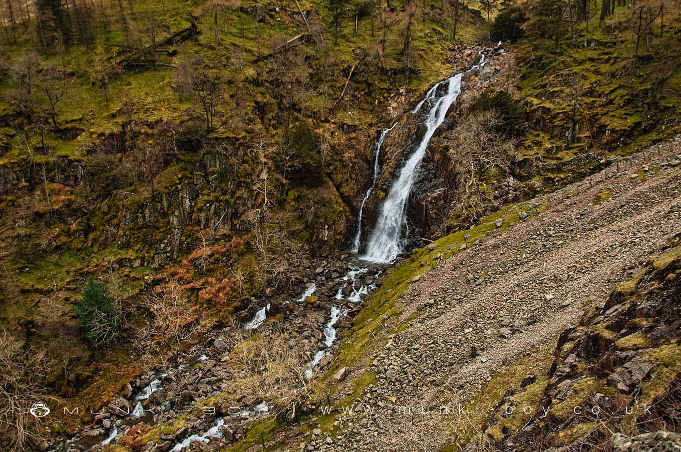
Taylorgill Force by munki-boy
Taylorgill Force
Taylorgill Force is in The Lake District National Park in England.
A massive and impressive waterfall just before the Styhead Gill flows into the River Derwent.
Visible from the easy footpath up to Styhead Tarn on the southern side of the Gill. Best seen from the rocky footpath on the north bank that also leads up to the tarn.
Created: 4 April 2021 Edited: 29 November 2023
Taylorgill Force
Taylorgill Force LiDAR Map

Contains public sector information licensed under the Open Government Licence v3.0
Local History around Taylorgill Force
There are some historic monuments around including:
St Thomas' Work Elizabethan copper mine 320m north west of Grey ButtressDale Head copper mine dressing floors and associated buildings 400m north of Dale HeadReecastle Crag hillfortSlight univallate hillfort on Castle CragGoldscope copper and lead mines and remains of associated dressing floors, stamp mill, dressing mill, reservoir and leatsPrehistoric enclosure, hut circle and adjacent cairnfield east of Whillan Beck, BurnmoorBowl barrow on Brund FellMickleden Beck prehistoric cairnfield and field system, funerary cairn and a medieval dispersed settlement centred 840m south west of Pike of StickleRomano-British farmstead 200m west of Lambing KnottBorrowdale graphite mines and associated grinding mill, 660m north west of SeathwaiteLong Work 16th and 17th century copper mines, 400m north west of Waterfall ButtressDale Head copper mine 300m north east of Dale HeadMaiden Castle round cairn, Burnmoor.


