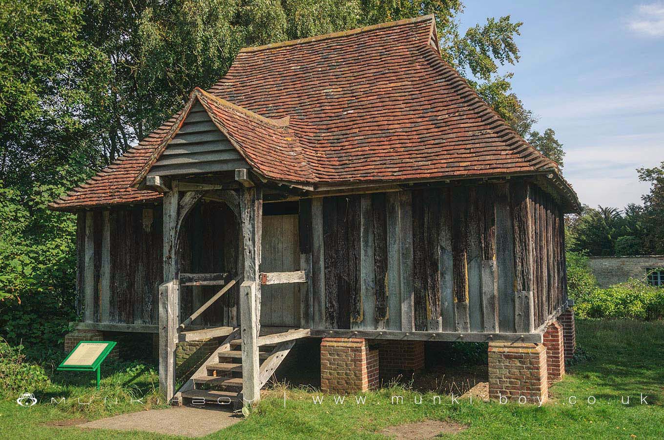
Tadlow Granary by munki-boy
Tadlow Granary
Tadlow Granary was moved here from Tadlow and reconstructed in the 1970’s by the Cambridge Preservation Society, within the central area of Wandlebury Ring ancient fort.
Tree ring dating of the wood used in the granary frame was analysed by Nottingham University and the original date of construction was found to be 1415.
The wood used in the granary was split rather than sawn, an early traditional method.
Created: 27 November 2016 Edited: 29 November 2023
Tadlow Granary
Local History around Tadlow Granary
There are some historic monuments around including:
Bowl barrow on Copley HillCivil War earthworks at the CastleBrent DitchHobson's ConduitFour bowl barrows 920m and 950m south east of Heath Farm, part of a dispersed round barrow cemetery in Charterhouse PlantationCausewayed enclosure 900m west of Great Wilbraham parish churchWormwood Hill tumulusOld Cheddar's Lane pumping stationChapel of the Hospital of St John at Whittlesford BridgeMoated site 130m west of Whittlesford ManorCambridge Castle moundChesterton AbbeyIron Age ritual enclosure containing a Bronze Age barrow, and Roman cemeterySettlement NW of Little ShelfordRoman settlement S of Chronicle HillsHenge 220m ESE of Herring's HouseSettlement site by Caudle Corner FarmSite revealed by aerial photography W of White Hill FarmCausewayed enclosure at Great ShelfordTwo moated sites 150m east of College FarmMoated site at Manor FarmCausewayed enclosure and bowl barrow at Little Trees HillBorough Hill: a large multivallate hillfortBowl barrow 1080m north east of Worsted Lodge Farm, part of a dispersed round barrow cemetery in Charterhouse PlantationLong barrow and enclosure 870m ENE of Copley Hill FarmWandlebury Camp: a multivallate hillfort, earlier univallate hillfort, Iron Age cemetery and 17th century formal garden remainsMoated site SE of St Peter's Church.