Limestone Pavement at Southerscales by munki-boy
Southerscales
Southerscales is in The Yorkshire Dales National Park in England.
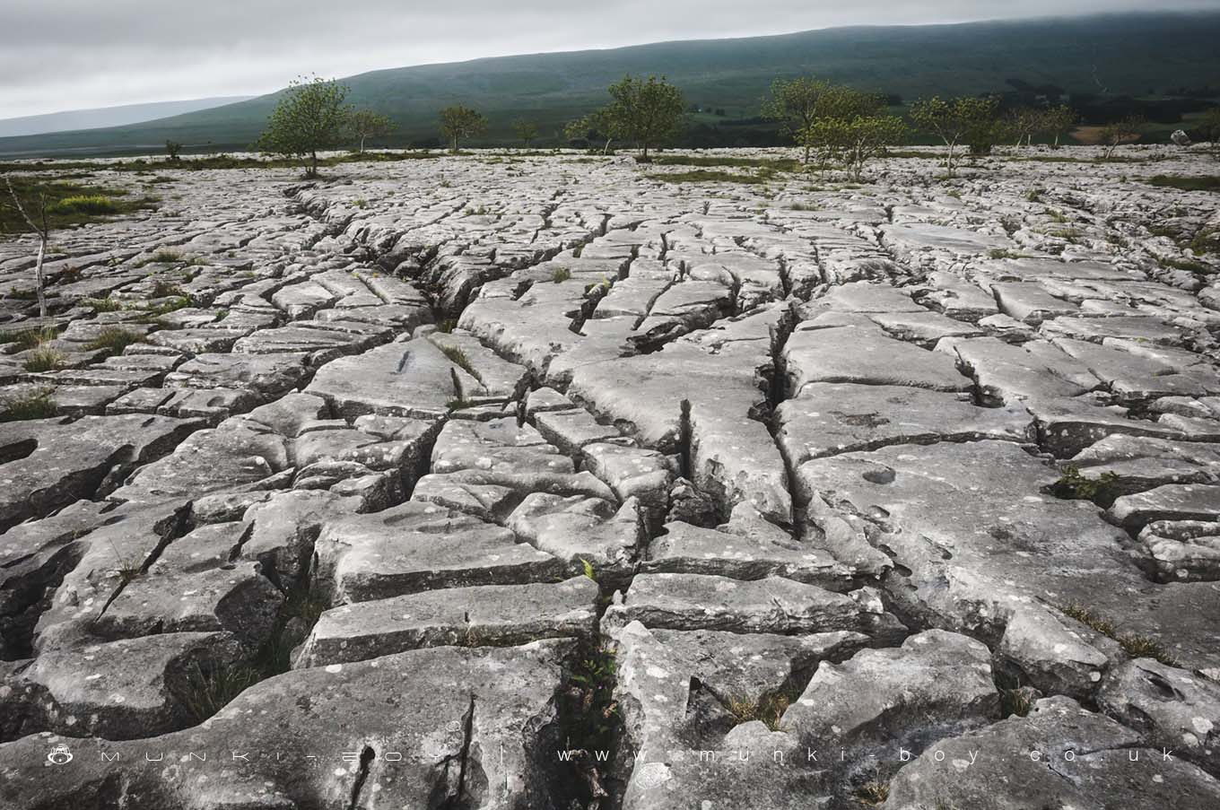
Southerscales is a nature reserve around a spectacular Limestone Pavement below Ingleborough in Yorkshire. The Southerscales nature reserve is managed by The Wildlife Trusts and provides a home for many interesting ferns and other plants including wildflowers, also birds such as the Wheatear and Meadow Pipits. Southerscales features a great example of a limestone pavement, a flat plain of limestone that is weathered over time by water forming small pools which freeze in cold weather, cracking the limestone. Limestone is a porous and permeable rock that water is able to pass through and is also dissolved by water.
The blocks of limestone that form the pavement are known as “Clints” and the large linear cracks that break apart the surface are know as “Grikes”. Some grikes can be rather deep, several feet in places at Southerscales.
Limestone rock often contains large cavities formed by water or streams which create potholes or caves, of which there are many in the Ingleborough area.
Created: 27 November 2016 Edited: 29 November 2023
Southerscales
Southerscales LiDAR Map

Contains public sector information licensed under the Open Government Licence v3.0
Local History around Southerscales
There are some historic monuments around including:
Yarlsber campSettlement on Gauber Cow Pasture RocksMeal Bank Quarry Hoffmann kiln, quarry and lime worksEller Keld settlement siteSettlement 1/3 mile (540m) SE of Chapel le DaleSettlement on Gauber High Pasture RockSettlement in Ashes Shaw Pasture, HortonApron Full of Stones cairnSettlement 440yds (400m) SW of Twistleton HallMarket Cross, ClaphamSettlement in Top Cow Pasture, SelsideSettlement in Ingman Lodge Shaw Pasture, HortonRibblehead railway construction camp and prehistoric field systemRound barrow on Sleights PastureCairn at Force Gill, 80m SSE of Little Dale aqueductLarge univallate hillfort on Ingleborough Hill..