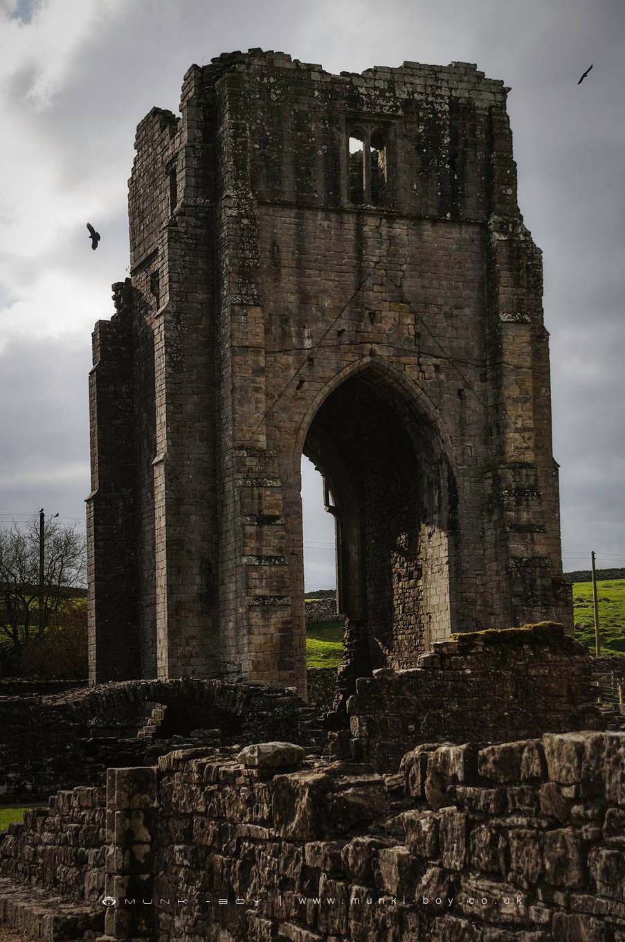
Shap Abbey
Shap Abbey
Shap Abbey is in The Lake District National Park in England.
Created: 27 November 2016 Edited: 29 November 2023
Shap Abbey
Shap Abbey LiDAR Map
Loading LiDAR
please wait...
please wait...
Contains public sector information licensed under the Open Government Licence v3.0
Local History around Shap Abbey
There are some historic monuments around including:
Medieval dyke system and shieling west of Shap AbbeyBuck Park deerpoundRing cairn on Knipescar Common south of Inscar PlantationKeld ChapelSmall stone circle 220m south-east of Castlehowe ScarRound cairn west of White RaiseSlight univallate hillfort in Scarside PlantationGunnerkeld concentric stone circleRomano-British settlement at Cragside WoodSkellaw Hill bowl barrowOddendale concentric stone circleHardendale medieval dispersed settlement and site of medieval monastic grangeBowl barrow 80m east of Scarside PlantationRound barrow 150m east of Scarside PlantationSettlement SW of Naddle BridgeRing cairn on Knipescar CommonShap Stone AlignmentRound cairn on White RaiseWindrigg Hill round cairn, 440m south of High MurberShap large regular stone circleShap Premonstratensian Abbey, including the precinct wall, abbey mill and mill race, and two fishpondsMoated site and annexe east of Setterahpark Wood.