Rylstone Crag and Rylstone Cross by munki-boy
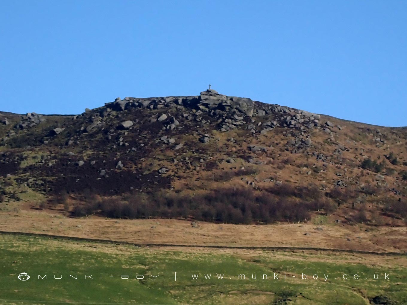
Rylstone Crag and Rylstone Cross
Rylstone Cross stands on the summit of Rylstone Fell, a gritstone ridge above the village of Rylstone in North Yorkshire. The fell reaches a height of about 410 metres and forms part of the southern edge of Barden Moor. The cross is a prominent landmark visible from many points across the surrounding dales and offers wide views over Upper Wharfedale, including towards Skipton and the Aire Valley.
The original monument was a stone pillar erected in 1815 to commemorate the defeat of Napoleon and the signing of the Peace of Paris. In 1887, to mark Queen Victoria’s Golden Jubilee, wooden arms were added to the top of the pillar, forming the cross shape. Over the years, the wooden parts deteriorated and were replaced several times until a new version, made entirely of stone, was installed in 1995. This modern cross was funded by a local farmer and built with a stainless steel core, which includes time capsules containing newspapers from the time of construction.
The walk to Rylstone Cross is popular with hikers and typically starts from Rylstone village or Embsay Reservoir. The route involves a steady climb through open moorland, with rough grass and heather lining the path. The ridge is often windy and exposed but offers rewarding views. It can be extended to include the Cracoe War Memorial, a stone obelisk nearby that honours local men who died in the World Wars.
Rylstone Fell and its surroundings form part of a managed shooting moor, and walkers may notice shooting butts across the landscape. The fell is relatively quiet compared to better-known Dales summits but holds local significance. The nearby village of Rylstone is small and picturesque, and is also known for its connection to the Calendar Girls, a group from the local Women’s Institute who produced a fundraising calendar in the 1990s.
Created: 1 April 2025 Edited: 3 April 2025
Rylstone Crag and Rylstone Cross
Rylstone Crag and Rylstone Cross LiDAR Map

Contains public sector information licensed under the Open Government Licence v3.0
Local History around Rylstone Crag and Rylstone Cross
There are some historic monuments around including:
Multi-period lead mines and processing works and 20th century barytes mill on Grassington MoorRock with one cup in field south east of Great Wood Plantation, 450m north east of Cawder Hall Farm, Horse Close HillSettlement at Chapel House WoodLinton churchyard cross and sundialRedmayne packhorse bridgeCairn in Brazen Gate Woods 260m NNE of Long AshesCup marked rock in wall east of Scarnber Wood, 500m north east of Bark Laithe, WinterburnScale Hill round cairnRock with one cup at the base of a wall, 250m NNE of Cawder Hall Farm, Horse Close HillCup, ring and groove marked rock south of derelict wall on Bradley Moor, 70m south west of Low Edge FarmTwo settlements in Grass WoodMedieval farmstead and field system, 530m south east of The GrangeDruid's Altar four poster stone circleHydro-electric power house and associated weir 250m north west of Tin BridgeCalton Gill round cairnSubcircular enclosed settlement on Horse Close Hill 250m north of Horse Close FarmCup and ring marked rock 150m west of Low Edge Farm, Bradley MoorSettlement SE of Druid's AltarTwo carved rocks in field 130m north east of Cawder Hall Farm, Horse Close HillRock with one cup in east end of Great Wood Plantation, 375m NNE of Cawder Hall Farm, Horse Close HillRoman villa at Kirk SinkPark Hill earthworkCup and ring marked rock in wall at High Snaygill 80m east of High LaitheRock with at least 15 cups 240m south of Great Wood Laithe, Horse Close HillPrehistoric unenclosed hut circle settlement and associated field system at Little WoodRock with at least one cup mark 310m east of Cawder Hall FarmHigh Wood bowl barrow.


