Rivington Pike by munki-boy
Rivington Pike
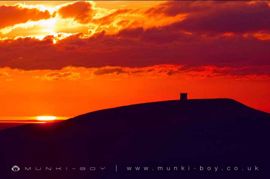
Written records of ‘Roun Pike’ stretch back to 1280, though it is entirely feasible the Pike became part of England’s integral beacon defence network over a century earlier under the instigation of the Earl of Chester after the Scottish raids of 1138. The beacon on the Pike was certainly fired in July, 1588, when the Spanish Armada had been sighted off English shores. Fifty years previously, Leland, a chronicler for Henry VIII, recorded he had passed the hill ‘Faierlokke’, though he astutely reported the local variation: “communley the people thereabout caullith it Rivenpike”.
Wood was gathered there in the early 18th century over ill-founded fears of a French invasion, and fires continued to be lit after the building of the Tower - most recently for the Coronation of King George V in 1910, then to mark the end of the First World War in 1918. It is possible to see that over many centuries Rivington Pike has rarely seen a period without human activity. Whilst the Tower has attracted visitors for nearly three hundred years and the Pike Fair for at least two hundred - with a cooling off period in the 1830s for drunken, riotous behaviour over the Easter weekend - flint chippings found on the summit suggest an earlier, prehistoric significance.
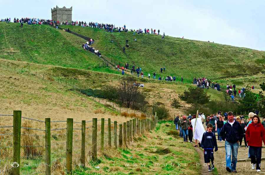
The Pike holds an annual fair every Good Friday where many brave the winds and scale the steep ascent to the summit, whilst their children roly-poly back down towards the burger vans and balloon sellers that have pitched themselves into the road around it’s base. Since 1892 the annual Pike Race has also been held on Easter Saturday, attracting over three hundred runners.
Rivington Pike Tower
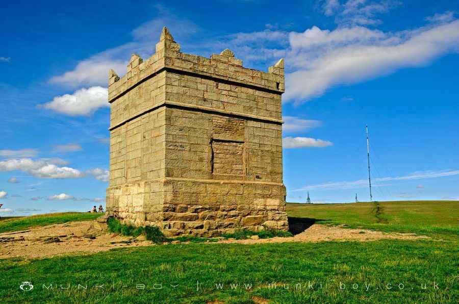
Built in 1733 from the remains of a beacon platform and pit and from local stone from the River Douglas and wood from the surrounding hills, Grade 2 listed Rivington Pike Tower was formerly used as a hunting lodge by Squire John Andrews, sheltering shooting parties out on a jolly from Rivington Hall. After decades of disrepair and vandalism the castellated top has been renovated, the roof and chimney replaced, and the door and windows bricked up. Inside, and now unable to be seen, are a fireplace and a small stone-flagged cellar. Due to erosion the doorway now stands a good forty inches above the soil rendering the Tower’s foundations clearly visible. Inside the Rivington Pike Tower
The roof of the Pike tower has been missing for many years, originally it had a sloping roof with a chimney. In its place is a rusted mesh that is meant to either stop litter falling into the tower or stop climbers falling in and getting stuck.
There is supposed to be a door in the floor of the Pike tower that leads to a small cellar but as can be seen from these photographs, the floor is covered with rubble and litter and is overgrown with plants.
Rivington Pike Easter Fair
A long standing local tradition is the Easter fair, starting on Good Friday each year at Rivington Pike. In the past the fair was held on the upper slopes of The Pike itself, erosion damage to the hill and modern health and safety rules and regulations have caused the fair to move to the rough road just below The Pike. Some readers may have found memories of precariously placed stalls and ‘bouncy castles’ perched at gravity defying angles on the hill, several decades ago.
In recent years, hot food stalls, confectionary and ice cream sellers, traditional fairground games such as the ever popular ‘Hook a Duck’ and several attractions for small children in the form of ‘bouncy castles’ and ‘roundabouts’ have been offered.
It is not advisable to attempt to drive to this location as the vehicles you will see in the above photo, the ‘road’ as you may loosely define it, is in fact an extremely rough broken cobbled surface and will wreck your car. Rivington Pike on Good Friday
On Good Friday literally thousands of people will ascending the pike from before dawn to after dusk. Many families choosing to spend the rest of the day strolling around the Terraced Gardens; and at this time you may see Lord Leverhulme’s gift to Bolton as he intended, with local people and vistiors enjoying the gardens, away from the industry and work of town and city.
Inclement Weather
Some years at Easter, The Pike is shrouded in rain and mist and terrible, biting winds but; you will still find many people at the top of the hill, sheltering around the Pike Tower. Rivington hall barn is a welcome stop on the way back down and is often full to the rafters with damp but merry people taking food and refreshment within its ancient wooden cruck frame, reminiscent of a medieval feast or as one might imagine Viking hoardes having returned from a great adventure.
The Hole in The Pike
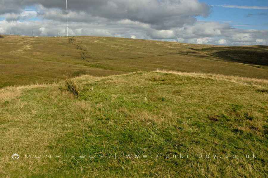
There’s a strange looking knobbly bit of ground on top of Rivington Pike and just to the north and slightly east of the Pike tower. It’s alluded to briefly in a number of sources, some vaguely and some with an air of authority, as an old Bell Pit, a prehistoric barrow, the original beacon platform and once to my knowledge as a wartime gun emplacement!
The shape of the structure on the ground is in the form of a seemingly circular bank with a hole in the middle. It does look a bit like a looted out cist burial or maybe the tiniest of bell pits. Today its circular form is exaggerated from some angles by the modern re-landscaping and ground stabilisation that was carried out in the 90’s on the surrounding slope below the structure.
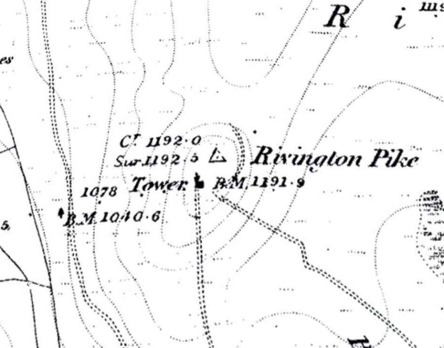
Now I’m not saying it isn’t in the same spot as an ancient burial mound or an old mine trial, in fact I’m certain there would have been some sort of prehistoric monument on this site because the hill is so prominent - who could resist? But, the current structure on the ground is the definitely the remains of an early OS Trig Point that was removed many years ago. I’m not sure when, it’s shown on the earliest OS maps but not on anything later. It’s not shown on any old photographs to my knowledge but then you’d be facing the other way, towards the Pike tower I guess.
Many of the old trig points have a built-up mound or stone plinth into the centre of which the triangulation pillar is cemented. Some even have substantial stone windbreaks around them - as to severl to the north of here from which the Winter Hill summit trig point is visible. Other places where triangulation pillars have been removed often have a similar hole in the centre, I believe a large chunk of cement or concrete comes out along with the pillar itself - leaving a characteristic hole.
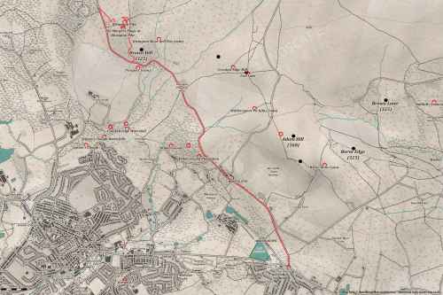
You can see the Trig Point marked as a triangle on this old OS map from around 1847, just in the right place - to the north and slightly east of the Pike tower.
I believe the early OS method required many more, closely spaced trig points than the later methods. In fact if you look at the old maps of the area you’ll find many that aren’t around today.
Created: 27 November 2016 Edited: 26 May 2024
Rivington Pike
Rivington Pike
Rivington Pike LiDAR Map
Contains public sector information licensed under the Open Government Licence v3.0
Walks in Rivington Pike
Local History around Rivington Pike
There are some historic monuments around including:
Round Loaf bowl barrow on Anglezarke MoorRound cairn on Winter HillRound cairn 280m west of Old Harpers FarmThe Moat House moated site 600m WNW of St David's ChurchBretters Farm moated site and two fishpondsPike Stones chambered long cairnRound cairn on Noon HillGidlow Hall moated site, Aspull, 560m NNE of Pennington HallHeadless Cross, Grimeford.


