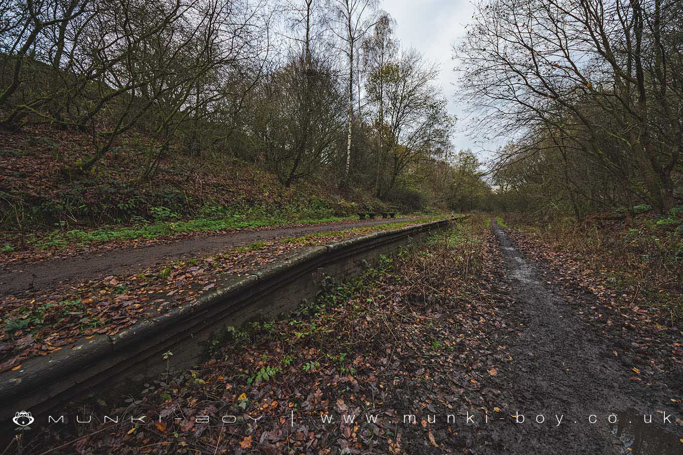
Ringley Road Station (ruin) by munki-boy
Ringley Road Station (ruin)
The remaining platform of the old Ringley Road Station beside the old track bed.
Created: 18 August 2019 Edited: 29 November 2023
Ringley Road Station (ruin)
Ringley Road Station (ruin) LiDAR Map
Loading LiDAR
please wait...
please wait...
Contains public sector information licensed under the Open Government Licence v3.0
Local History around Ringley Road Station (ruin)
There are some historic monuments around including:
Promontory fort called Castlesteads on the east bank of the Irwell 550m SSE of Banks FarmRadcliffe Tower and site of hall 100m south west of the parish church in RadcliffeLime kiln and associated culvert 50m north of Worsley Methodist ChurchRingley Old BridgeMedieval moated site and later fortified manor house known as Bury Castle 100m west of the parish churchCanal tunnel entrances and wharfWardley Hall moated site, Worsley.


