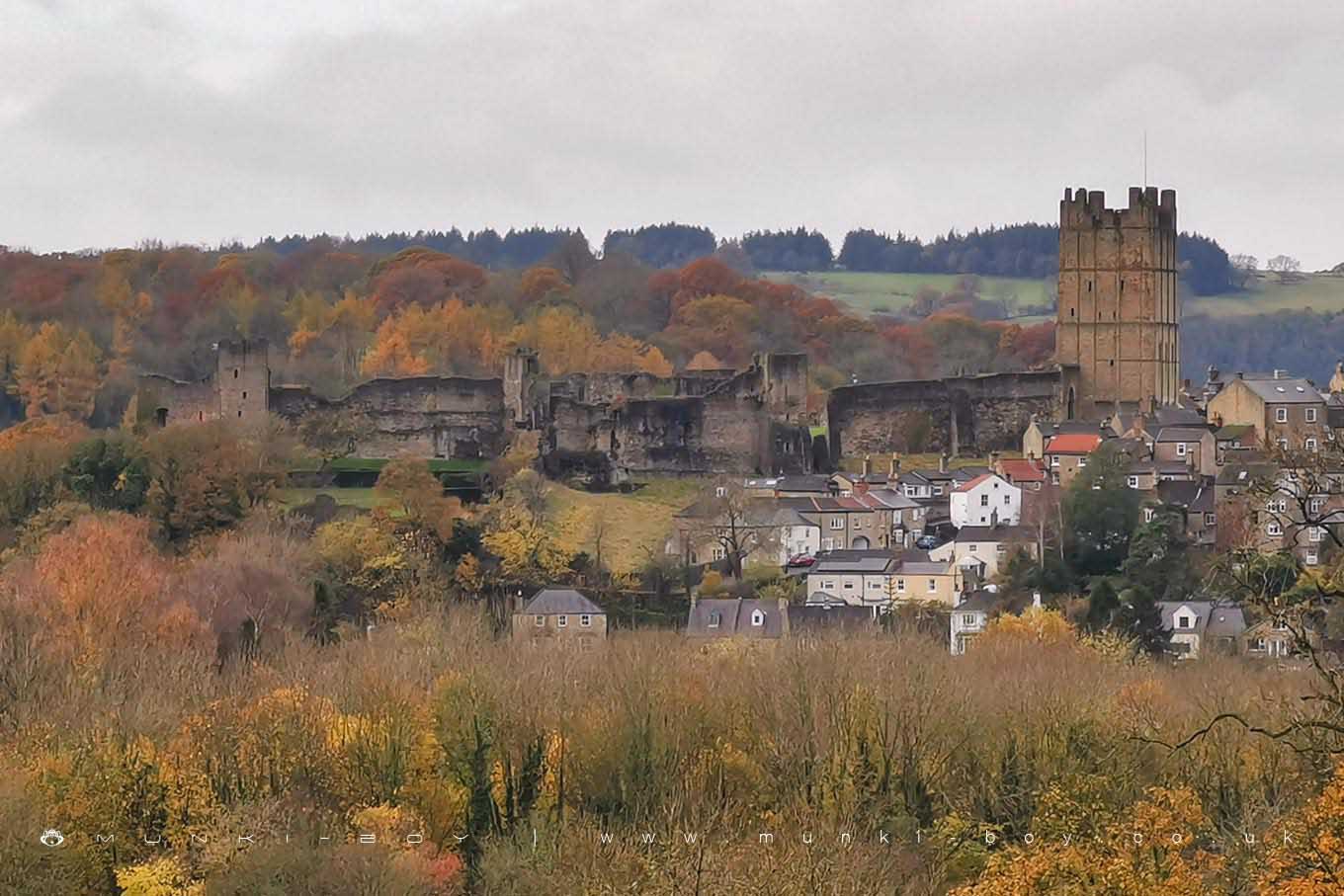
Richmond Castle by munki-boy
Richmond Castle
Richmond Castle is one of the finest and most complete 11th-century fortresses in the country.
Created: 15 November 2019 Edited: 29 November 2023
Richmond Castle Information
Richmond Castle Address
Tower Street, Richmond
DL10 4QW
Website: https://www.english-heritage.org.uk/visit/places/richmond-castle/
Get directionsRichmond Castle LiDAR Map

Contains public sector information licensed under the Open Government Licence v3.0
Local History around Richmond Castle
There are some historic monuments around including:
Richmond BridgeSt Martin's Benedictine Priory, RichmondSection of Scots Dyke linear boundary 75m south west of Sandford HouseSt Giles medieval hospital, post-medieval farmstead and Iron Age occupation site immediately north of St Giles FarmSection of Scots Dike linear boundary north west of High MerrybentThe Bargate, medieval gatewayEasby Abbey Premonstratensian monastery: monastic precinct, cultivation terraces, water-management features and ancillary buildingsSection of the Scots Dyke linear boundary 225m south of St Martin's PriorySection of Scots Dyke linear boundary 150m ENE of Olliver18th century copper mill 80m north west of Copper Mill BridgeSection of Scots Dyke linear boundary and portion of field system 100m east of Whitefields FarmSection of Scots Dike linear boundary north of Kirklands FarmRavensworth motte and bailey castle, water defence features, park pale and shrunken medieval villageFranciscan friarySection of the Scots Dyke linear boundary 250m south east of St Martin's PrioryRoman fort and prehistoric enclosed settlement 400m west of Carkin Moor FarmRichmond Castle: eleventh to fourteenth century enclosure castleRomano-British enclosed settlement 340m north east of East Applegarth at Whitcliffe ScarSection of Scots Dike linear boundary south of Kirklands FarmSection of Scots Dyke linear boundary running south from Olliver East for 550mMedieval cross base known as Plague Stone, 750m WSW of High Scales.