Raveden Plantation Waterfall by munki-boy
Raveden Plantation Waterfall
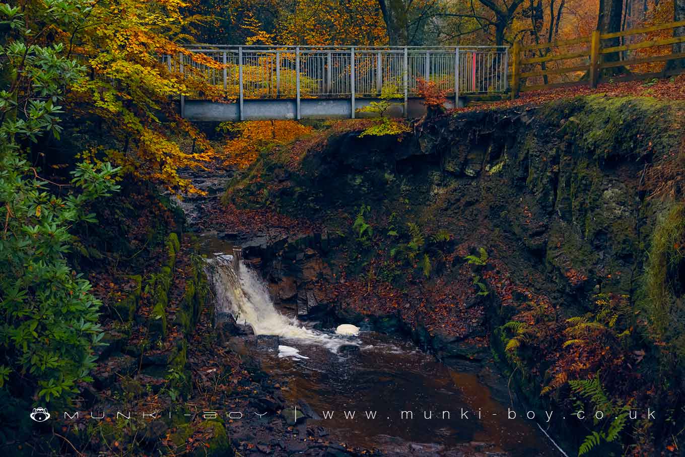
A small waterfall on the Raveden Brook where an old weir once dammed the river.
Variable from almost no water to quite violent and with a variable amount of ochre from a mine drain just upstream, this can stain much of the rock vibrant orange/red. The waterfall is probably caused by a geological fault as is locally common, but this has been further modified to construct a weir to form a small pond in the stream.
The modern bridge is an eyesore but useful walking route.
Created: 25 April 2021 Edited: 29 November 2023
Raveden Plantation Waterfall
Astley Brook (Irwell) Details
Astley Brook (Irwell)
Astley Brook (Irwell) is a river in Greater Manchester
Astley Brook (Irwell) takes in water from an area around 14.381 km2 in size and is part of the Croal Irwell catchment area.
Astley Brook (Irwell) is 7.829 km long and has been heavily modified by industry in the past.
Raveden Plantation Waterfall LiDAR Map
please wait...
Contains public sector information licensed under the Open Government Licence v3.0
Local History around Raveden Plantation Waterfall
There are some historic monuments around including:
Coking ovens and associated coal workings on Aushaw Moss 450m south west of Lower HouseRoman road at Bottom o' th' Knotts BrowRound cairn 280m west of Old Harpers FarmStone circle, ring cairn and two round cairns on Cheetham Close.


