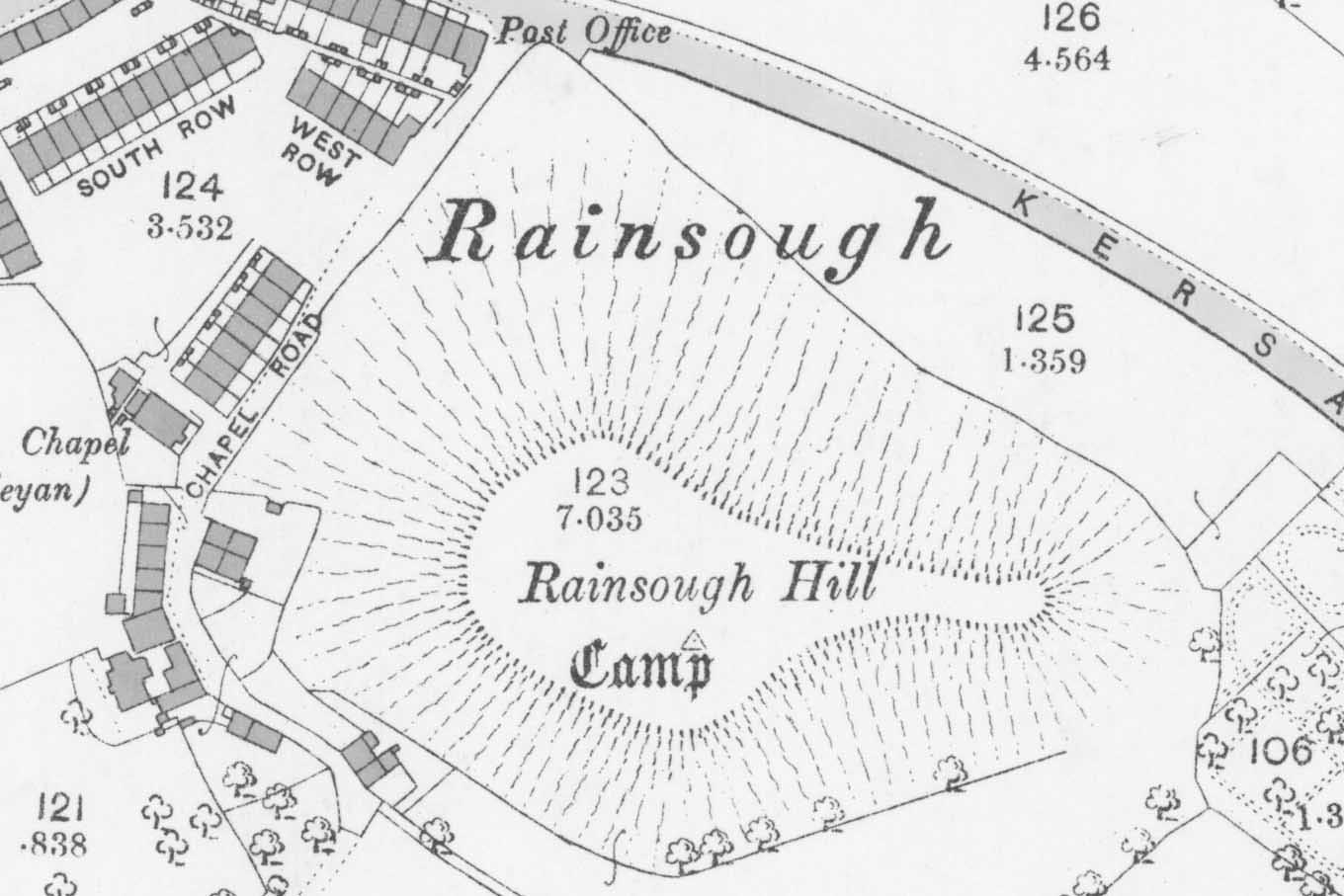
Old Map of Rainsough Hill Camp in 1893 by Ordnance Survey
Rainsough Hill Camp
A fort, having an area of one and a half acres, is supposed to have occupied the slight mound named Raineshaw. Whitaker says that ditches were visible all round it, halfway up its sides, and that they were from fifteen to twenty yards (sic) in depth, the hillock itself being only a hundred yards in height. Nothing is recorded as having been found on the site.
This camp no longer exists, completely built over.
A few Neolithic flint implements found at Rainsough Hill shown as a camp on the OS map, were exhibited at a meeting of the society in 1918 by J Wilfred Jackson of Manchester Museum.
Trial trenching by the Prestwich Archaeology Group of gardens on Rainsough Close revealed post holes of a strongly built stockade attached to the main hill settlement, possibly a livestock area. Some sherds belong to late Iron Age vessels, and were the only evidence for an Iron Age origin to the site. The size and shape of the site make it unlikely to be military in origin, though it undoubtedly evolved this aspect. It may have been a prosperous rural farm before the Roman invasion.
Cropmarks of buildings and probable signal tower exist on the 9th hole fairway of Prestwich Golf Course.
Created: 12 December 2019 Edited: 29 November 2023
Rainsough Hill Camp
Rainsough Hill Camp LiDAR Map

Contains public sector information licensed under the Open Government Licence v3.0
Local History around Rainsough Hill Camp
There are some historic monuments around including:
Bridgewater Canal's Barton Aqueduct embankment and retaining wallsSection of an early medieval boundary ditch known as the Nico Ditch in Platt Fields 480m SSE of Platt HallRadcliffe Tower and site of hall 100m south west of the parish church in RadcliffeRemains of eastern wall of the Roman fortThe Hanging Bridge immediately south of Manchester Cathedral.