Puzzle Woods by munki-boy
Puzzlewood
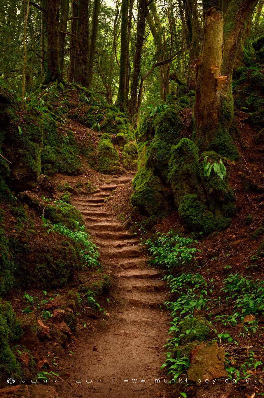
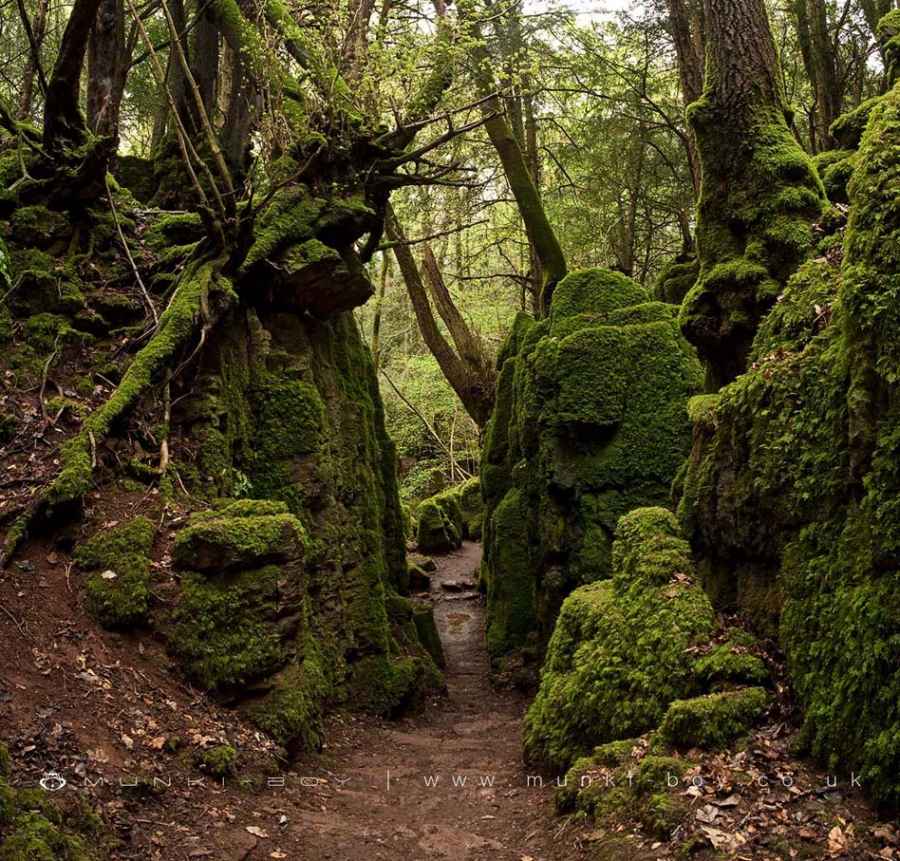
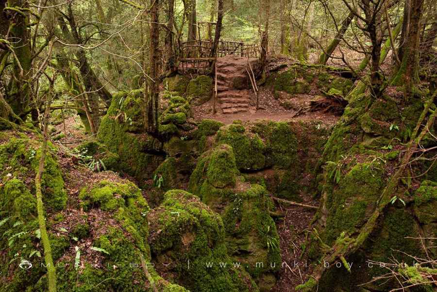
In Puzzlewood you will find strange rock formations, secret caves and ancient trees, which have kept locals guessing for centuries as to what could have created such a unique and eerie landscape, aptly named Puzzlewood.
Geologists have now started solving the mystery of how this unique natural landscape was formed. The geological feature here are known as Scowles. Scowles originate through the erosion of natural underground cave systems formed in the limestone many millions of years ago. Uplift and erosion caused the cave system to become exposed at the surface.
Puzzlewood was then used by Iron age settlers through to Roman times for the extraction of Iron Ore. Evidence of Roman occupation is supported by the discovery of over 3000 3rd Century AD Roman coins found in Puzzlewood. Once the Romans left, nature reclaimed the old workings with moss and trees, to create the unique landscape. The historical use soon became forgotten, and the folklore of Puzzlewood began.
Created: 31 July 2021 Edited: 29 November 2023
Puzzlewood Information
Puzzlewood Address
Perrygrove Rd, Coleford GL16 8QB, UK
GL16 8QB
Website: http://www.puzzlewood.net/
Get directionsLocal History around Puzzlewood
There are some historic monuments around including:
Offa's Dyke: section in Wyeseal Wood, 600m north of Gumbers Land BarnOffa's Dyke: section 65m north of Brook HouseOffa's Dyke: section on St Briavels Common, 230m north of Hudnalls FarmGanarew CrossOffa's Dyke: section in Highbury Plains, 370m west of Birt's BarnOffa's Dyke: section 650m south west of Stowfield FarmMerlin's Cave, Great DowardRedbrook Incline Overbridge Village cross at ClearwellOffa's Dyke: section on St Briavels Common, 100m south east of Hill FarmOffa's Dyke: section immediately north west of Coxbury FarmStaunton crossOffa's Dyke: section in Mocking Hazell Wood, 400m south of Lindors FarmKing Arthur's Cave, Great DowardSymonds Yat promontory fortSt Briavel's CastleOffa's Dyke: section in Highbury Wood, 460m west of Glyn FarmVillage cross at AylburtonLittle Hadnock Roman Villa, Dixton Newtown Offa's Dyke: section on St Briavels Common, immediately west of The FieldsTower keep castle on Little Camp HillOffa's Dyke: section on St Briavels Common, 90m north of The CherriesOffa's Dyke: section on St Briavels Common, 190m west of Hudnalls FarmCross in All Saints' churchyardOffa's Dyke: section 330m south west of Stowfield FarmTitanic Steel Works 230m south west of Yew Tree CottageScowles in Dingle Wood 560m north west of Scowles FarmMotte Castle 57m south-west of Church of St Mary MagdaleneOffa's Dyke: section in Highbury Plains, 770m south west of Glyn FarmOffa's Dyke: section on St Briavels Common, immediately south of SittingreenCamp NE of StoweOffa's Dyke: section on St Briavels Common, 400m east of Yewgreen FarmOffa's Dyke: section 470m west of Wyegate BarnOffa's Dyke: section at Birchfield CottageOffa's Dyke: section on St Briavels Common, 220m east of Upfield HouseOffa's Dyke: section in St Margaret's Grove, 170m north east of Gumbers Land BarnOffa's Dyke: section 340m south east of Coxbury FarmScowles in the north of Blake's Wood 620m south east of Church FarmWhitecliff Iron WorksCamp Hill promontory fort and Romano-British temple complexOffa's Dyke: section 800m south west of Stowfield FarmOffa's Dyke: section immediately south of Coxbury FarmDark Hill iron works and brickworks complex and Bear 220m south and 200m south east of Yew Tree CottageScowles in Blake's Wood 870m north west of Scowles FarmOffa's Dyke: section in Church Grove, 240m south west of Ferney LeazeMotte and bailey castle at English BicknorRoman Villa at Clearwell FarmOffa's Dyke: section in Victuals Grove, 230m north of Beaconsfield CottageLittle Doward Camp.